
Menu
Popular Walks
-
Mt Ngungun
(1151 ticks) -
Mount Coolum
(869 ticks) -
Mt Cordeaux
(665 ticks) -
Twin Falls Circuit
(635 ticks) -
Purling Brook Falls Circuit
(610 ticks)
Parent Regions
Sub-Regions
- Amamoor State Forest
- Bellthorpe National Park
- Brisbane City Council Local Walks
- Brisbane Forest park D'Aguilar National Park
- Brisbane Valley Rail Trail
- Coombabah Lakelands Conservation Area
- Daisy Hill Conservation Park
- Eumundi Conservation Park
- Glass House Mountains National Park
- Glen Rock Regional Park
- Gold Coast
- Ipswich
- Jimna State Forest
- Karawatha Forest
- Kondalilla National Park
- Lamington National Park
- Main Range National Park
- Mapleton National Park
- Moggill Conservation Park
- Moogerah Peaks National Park
- Moreton Island National Park
- Mt Barney National Park
- North Stradbroke Island - Minjeeribah
- Parklands Conservation Park
- Springbrook National Park
- Sunshine Coast
- Tamborine National Park
- White Rock - Spring Mountain Conservation Estate
Summary
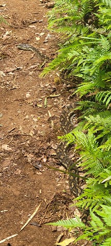
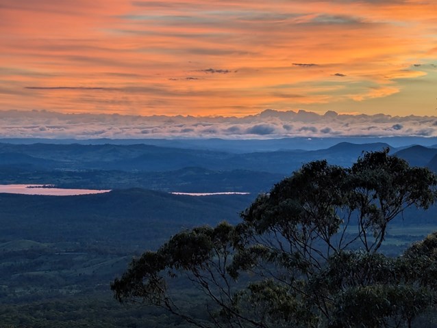
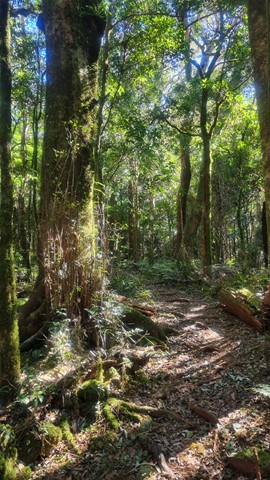
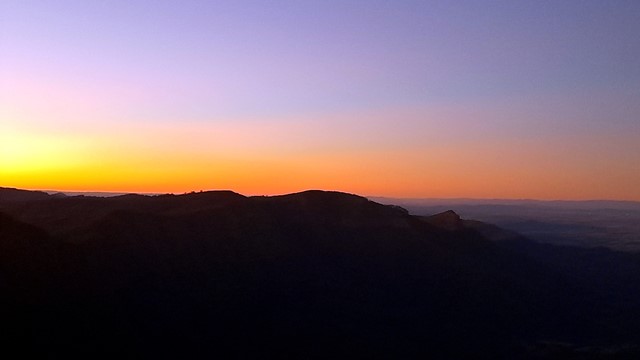
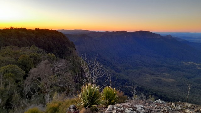
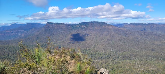
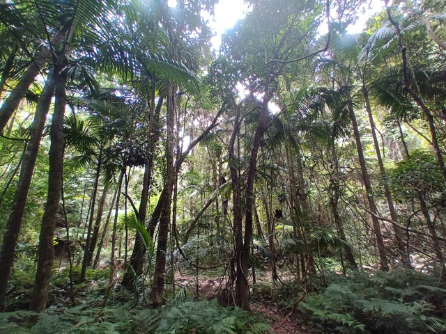
Boarding NSW and the pacific Ocean, it is not uncommon for hikes to have views of both worlds (ocean and hinterland). Hikes here are typically on the great dividing range.
Popular Walks
-
Mt Ngungun
(1151 ticks) -
Mount Coolum
(869 ticks) -
Mt Cordeaux
(665 ticks) -
Twin Falls Circuit
(635 ticks) -
Purling Brook Falls Circuit
(610 ticks)
Parent Regions
Sub-Regions
- Amamoor State Forest
- Bellthorpe National Park
- Brisbane City Council Local Walks
- Brisbane Forest park D'Aguilar National Park
- Brisbane Valley Rail Trail
- Coombabah Lakelands Conservation Area
- Daisy Hill Conservation Park
- Eumundi Conservation Park
- Glass House Mountains National Park
- Glen Rock Regional Park
- Gold Coast
- Ipswich
- Jimna State Forest
- Karawatha Forest
- Kondalilla National Park
- Lamington National Park
- Main Range National Park
- Mapleton National Park
- Moggill Conservation Park
- Moogerah Peaks National Park
- Moreton Island National Park
- Mt Barney National Park
- North Stradbroke Island - Minjeeribah
- Parklands Conservation Park
- Springbrook National Park
- Sunshine Coast
- Tamborine National Park
- White Rock - Spring Mountain Conservation Estate
History
Any interesting history for the region?
Features
What are the standout bushwalking features?
Access
How do you get there? Include all access points if there are many?
Maps
Which maps cover the region?
Accommodation
Where can I stay there? or near there?
Camping
Council Areas:
- Scenic Rim Regional
- Gold Coast City
- Logan City
- Redland City
- Ipswich City
- Lockyer Valley Regional
- Brisbane City
- Somerset Regional
- Moreton Bay Regional
- Sunshine Coast Regional
- Noosa Shire
Contact details
See Qld National parks website
Walks in Lamington National Park

 7.5
km
return
7.5
km
return
 3.5
hrs
3.5
hrs
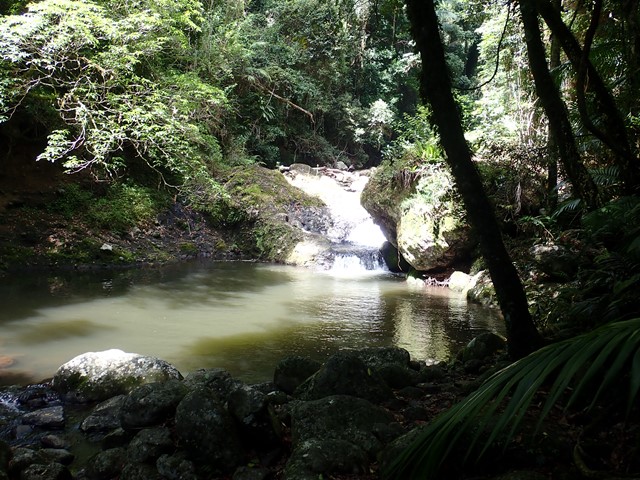
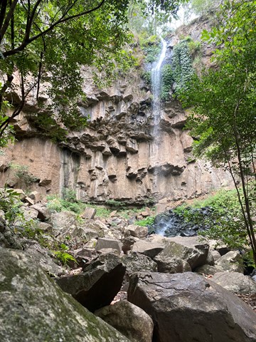
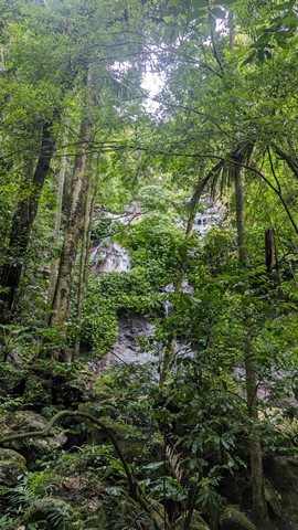
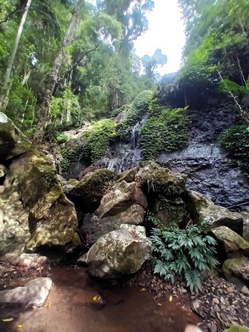
Westray's Grave from Christmas Creek
Hike from Christmas Creek to Westray's Grave along the South Branch of Christmas Creek. An enjoyable hike with obstacles to traverse to reach Westray's Grave. A chance for a swim on a hot day! Return trip is approximately 3-4 hours depending on conditions.
 2.4
km
return
75
mins
2.4
km
return
75
mins
Wishing Tree Track
The track passes large Brush Box and over a tree fern gully spanned by a suspension bridge down to the Wishing Tree, where you can turn left into Glow Worm Gully or ahead under the Wishing Tree to Morans Creek. This track is on private property at O’Reilly’s resort.
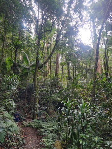
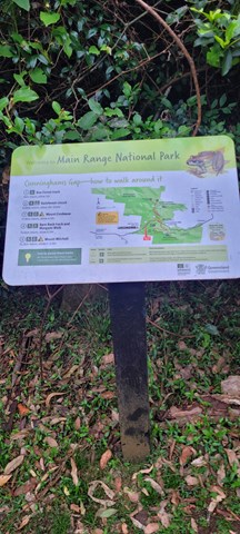
Walks in Main Range National Park
1
km
return
30
mins
Adjinbilly Cascades: Private Property
Adjinbilly Cascades are reached by a short 2 minute walk from the Ruby campfire area while staying at Adjinbilly Retreat. It is a beautiful place, deserving to be called the ‘heart’ of Adjinbilly. It is a ‘must’ to visit early in your stay, with the small cascading waterfalls and enveloping rainforest creating a unique, secluded setting. You can walk up to the falls (beware of slippery rocks), get wet or sit and enjoy the special feeling of just being there.
There is a table and chairs where you can share a meal (perhaps a candlelight dinner for a special occasion).
 2.5
km
return
1
hr
2.5
km
return
1
hr
Adjinbilly Circuit Track: Private property
This is an ungraded track mostly following old logging tracks along the creek. This beautiful walk has a myriad of highlights, from the many cascades and the beautiful views of the creek to the amazing strangler figs and the magnificent epiphytes high in the trees. It is accessed for guests staying at Adjinbilly Retreat
It is a walk with plenty of ‘ups and downs’, and you might get your feet wet as you cross the creek. There are seats at selected beauty spots – wonderful places where you can reflect and soak up the ambience or take special photographs.
 3.8
km
return
105
mins
3.8
km
return
105
mins
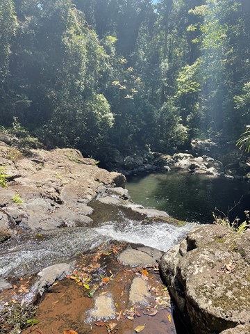
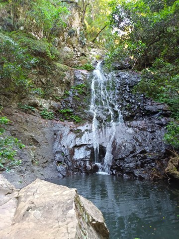
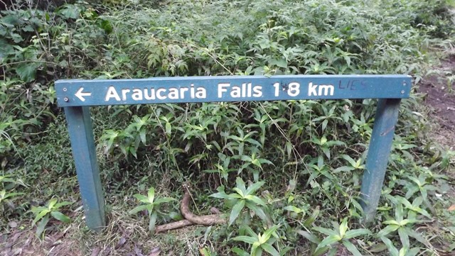
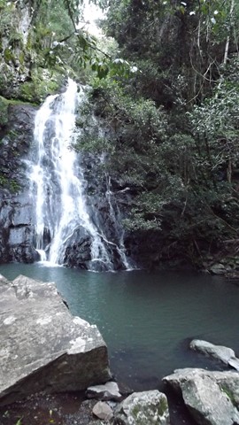
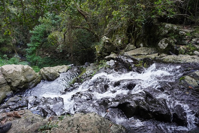
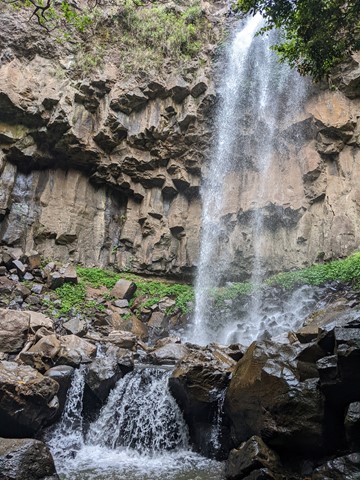
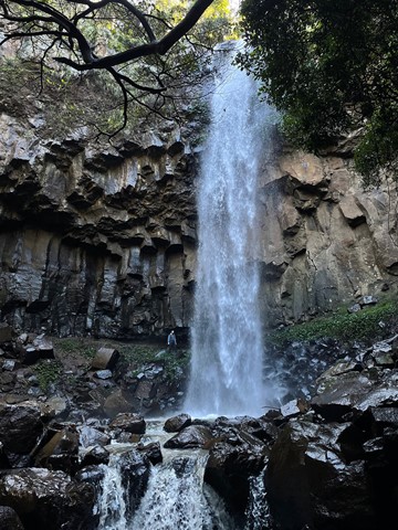
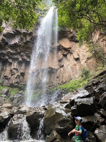
Araucaria Falls
Wind gracefully along a gully lined with brush box and gently climb to this small but spectacular waterfall. Cross the creek at the top before descending sharply to the deep pool below.
 13
km
4.5
hrs
13
km
4.5
hrs
Bare Rock track and Morgan's Walk
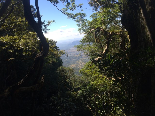
Bare Rock is a minor peak North of Cunningham's Gap with great views towards the Mistake Mountains.
 5
km
return
1
hr
5
km
return
1
hr
Box Forest Track
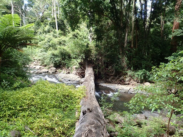
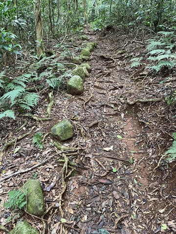
Rain forest walk from top car park to the bottom rest area at Cunningham's Gap. Includes 2 creek crossings and plenty of little waterfalls along the way.
 1.4
km
return
75
mins
1.4
km
return
75
mins
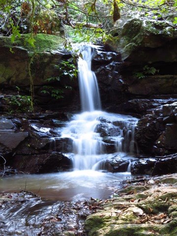
Browns Falls
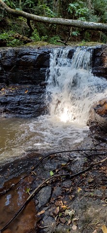
Located only 4.5 kms outside of Killarney in the Scenic Rim. The 15m waterfall requires a 700 metre walk along a rough track involving plenty of climbing over rocks and under fallen trees. It is definitely worth the trek.
 9
km
return
4
hrs
9
km
return
4
hrs
Cascades Circuit
THIS TRACK (SEPTEMBER 2025) IS CURRENTLY CLOSED DUE TO STORM DAMAGE.
A nice circuit starting off in a eucalypt forest and venturing deeper into the rainforest along the upper reaches of Dalrymple Creek.
Dalrymple is a level 3 track - medium
Cascades is a level 4 track - hard
Easiest way is to complete in clockwise direction and end up on the fire track heading back to the camp ground.
 20
km
return
7
hrs
20
km
return
7
hrs
Cunninghams Gap to Laidley Creek Falls
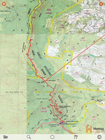
I've always loved the view of The Ramparts to the north of Cunninghams Gap when driving up Main Range, and have done the walk from the Gap to Bare Rock on a couple of occassions. This is only a short walk on a well-graded track, and not too much of a climb. The view at the end makes this a great short walk all by itself. However, I've always wondered what lay beyond. There's a map and a reasonable description of the route from Bare Rock to Laidley Creek Falls in "Take a Walk in South-east Queensland" (John and Lyn Daly) - refer page 257 Cunninghams Gap to Mount Castle. There's also a description in the out of print (but online) Bushpeople's Guide to Bushwalking in Southeast Queensland (Sylvesters Lookout to Mt Cordeaux)http://www.southee.com/Bushwalking/Ch15-MistakeMountains.html#label025. Several blogs indicate that it is a difficult walk with no views. I decided to investigate for myself (and without available walking buddies for the day - by myself) last weekend (14 May 2016). I never intended to walk through to Laidley Creek Falls, just investigate conditions beyond Bare Rock with a view to doing the walk through later in winter. Following are my observations.