
Cunninghams Gap to Laidley Creek Falls
Main Range National Park


Menu
GPS Tracks

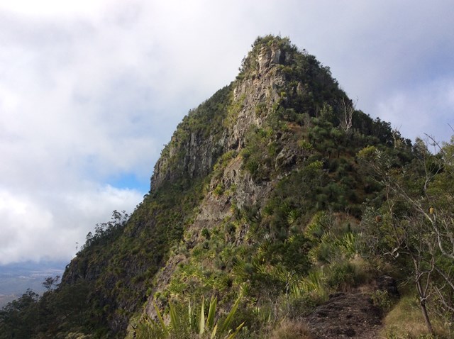

I've always loved the view of The Ramparts to the north of Cunninghams Gap when driving up Main Range, and have done the walk from the Gap to Bare Rock on a couple of occassions. This is only a short walk on a well-graded track, and not too much of a climb. The view at the end makes this a great short walk all by itself. However, I've always wondered what lay beyond. There's a map and a reasonable description of the route from Bare Rock to Laidley Creek Falls in "Take a Walk in South-east Queensland" (John and Lyn Daly) - refer page 257 Cunninghams Gap to Mount Castle. There's also a description in the out of print (but online) Bushpeople's Guide to Bushwalking in Southeast Queensland (Sylvesters Lookout to Mt Cordeaux)http://www.southee.com/Bushwalking/Ch15-MistakeMountains.html#label025. Several blogs indicate that it is a difficult walk with no views. I decided to investigate for myself (and without available walking buddies for the day - by myself) last weekend (14 May 2016). I never intended to walk through to Laidley Creek Falls, just investigate conditions beyond Bare Rock with a view to doing the walk through later in winter. Following are my observations.

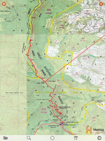
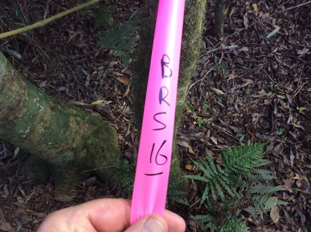
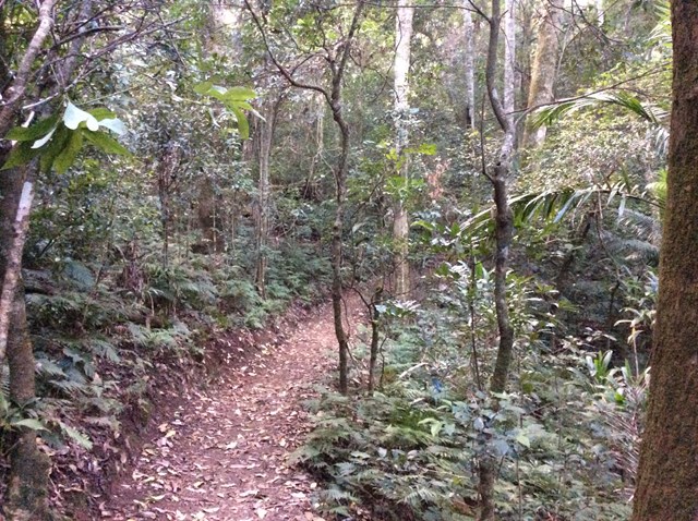
Start from Cunninghams Gap and walk out to Bare Rock. This 6km walk ascends 400m on a well-graded track, and isn't too taxing. However, if walking through to Laidley Creek Falls I'd recommend an early start. Bare Rock is a great spot for the first break, as the views are excellent. From here, descend off the northern side of the rock into the bush. There's no track, but you'll almost instantly see a trail of flagging tape heading north. I followed this and established a bread crumb trail with the Hema Maps app on my Ipad (GPS-enabled).
I managed to follow the flagging tape track out to what I presume is the rough bush camp described on Page 257 of Take a Walk in South-east Queensland (my position was 28.0030; 152.3773). There's not much here, it's a barely discernable scrape in the bush and there may be a need to clear away some growth to pitch a tent. It took about 2 hours to get to this point from Bare Rock. The trip back to Bare Rock was much quicker, as I could navigate across corners created by my bread crumb trail.
A few observations based on the extent of the walk I did - note things may be different beyong this point:
- For fit walkers (which I am not), I think the walk through to Laidley Creek Falls is certainly achievable in a day. I'd recommend an early start (particularly in winter) as the light drops off quickly after lunch;
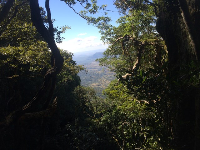
- There's not a lot of viewing points, and those which do occur offer only glimpses of the valley below;
- There's certainly challenges with vines and fallen logs, but these were not as bad as had been described in some of the blogs. With a day pack I had some ducking and weaving to do, but didn't encounter any large impenetrable thickets. Larger packs would be a bit more difficult, but there are significant areas where the walking is not a lot harder than on-track;
- It's been a dry summer, and there was no water in any of the gullies. I'd recommend taking all of your water in. I had three litres in a camelback, but ran out before I made it back to Bare Rock;
- Despite some blogs noting difficulty with GPS, I found my GPS-enabled IPad and Hema maps app to work well for the entire day. This was despite dense canopy, reasonably deep gullies and southern slopes. I think GPS capability of the Ipad could be further improved with a Bad Elf device. However, don't rely on GPS. Take a map and compass. I got World Wide Maps (Brisbane) (http://www.worldwidemaps.com.au/) to blow up and laminate the topo' map for this area, and as always had a compass. If you get lost, the simple message is head east toward The Ramparts and then north or south depending on your destination. However, be very careful near the edge, there is a sheer drop off;
- If walking through you'll need to organise a car shuffle at Goombera;
In summary, I think the walk through to Sylvesters Lookout or Laidley Creek falls could be a good one for people looking for a reasonably challenging day (but not ridiculously so). The distances a short (15km), but the walk seems likely to take the best part of 7 hours. In this regard I'd agree with Take a Walk in Southeast Queensland
Getting there
How do you get to the start of the walk?
Maps
Which maps cover the area?
Route/Trail notes
A detailed description of the walk!
Permits/Costs
None.
Other References
How can I find more info? Any guide books?
 Bare Rock out to Rough Bush Camp - Fixed (GPX)
 20
20 7
7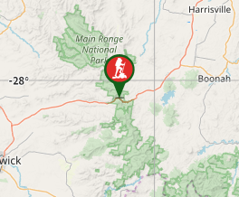
Comments
Nobody has commented on this walk yet. If you've done it then tick it off and add a comment.