
It's like Wikipedia... but for Bushwalkers!
Aussie Bushwalking is a user-supplied list of bushwalking and hiking tracks in Australia - made by bushwalkers, for bushwalkers. It helps bushwalkers find new walks, share walks and track conditions and remember their Australian bushwalking/hiking activities.


New Walks
-
Warwick Condamine River Walk
(South East Queensland - 2.9km return)A walk along the Condamine River through the parklands of Warwick.
-
Barangaroo Reserve
(Greater Sydney - 2km return)A short walk around the Barangaroo Reserve with options to extend around the foreshore or into the historic suburbs of Millers Point and up to the Observatory Hill Park or across to The Rocks.
-
Parramatta Explorer
(Greater Sydney - 6km return)A circuit around the sites & parklands of central Parramatta.
-
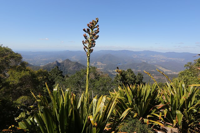
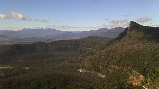
Bally Mountain Loop
(Gold Coast - 9.5km return)A loop walk to the peak of Bally Mountain, an alternative to the out an back of the standard route.
-
Manning Gorge Falls (Gibb River Road)
(Western Australia - 6km return)Manning Gorge is one of the most beautiful and best swimming spots in the Kimberley.
Located on Manning Creek in the grounds of the 283,280ha Mt Barnett Station, water remains at the base of the waterfalls…
Recent Articles
-
Bushwalking Clubs
(Queensland)A list of bushwalking and hiking clubs in Queensland, including Brisbane and South-East Queensland.
-
Getting started with hiking
How do you start hiking, bushwalking or tramping? This page will give you some tips for somebody who wants to get out and enjoy the Aussie bush.
-
Turtle Rock
(Girraween National Park)Find out what it takes to be a real Girraween photographer...
-
Racecourse Creek
(Girraween National Park)A lyrical reflection on a magical campsite in Girraween National Park.
-
Other Websites
Aussie Bushwalking doesn't contain all the world's bushwalking knowledge (yet) so here's some other sites to fill in your time when you're stuck at home.