
The Beehive to Cable Car via Te Ahumairangi Hill & Botanic Gardens
North Island NZ


Menu
From The Beehive & Parliament House make your way to Te Ahumairangi Hill and through the Botanic Gardens to the cable car.

Getting there
How do you get to the start of the walk?
Can start at The Beehive / Parliment House or do in reverse from the top of Cable Car.
Maps
Which maps cover the area?
Maps of Te Ahumairangi Hill & Botanic Gardens.
Route/Trail notes
A detailed description of the walk!
From The Beehive / Parliment House follow Bowen Street to Bolton Street Memorial Park then cross the highway on the over pass and continue through the cemetary on the far side and past a playing field to Glenmore Street. Then follow St Mary St to the Te Ahumairangi Reserve where you can gain elevation more slowly by aiming for the furthest North knoll near the Weld St enterance and then follow the ridgeline back to the Te Ahumairangi Hill Summit. From there you can wind down past the Glamorgan St enternace to the Te Ahumairangi Hill Lookout and then down to the James Stellin Memorial and then straight shoot it down to Patanga Cr which you follow back down to Glenmore Street & cross into the botanic gardens. From here head towards the duck pond and follow the stream up branching off and heading up hill following signs for the cable car. Make sure to detour to the top of the hill near the top of the cable car where their is a final viewpoint, battery & observatory.
Permits/Costs
Do you need any permits? What's the cost?
Free though if taking public transport to connect each end factor that in or extra walking.
Other References
How can I find more info? Any guide books?
GPS Tracks
- No GPS available for this walk yet.
 7.3
7.3 3
3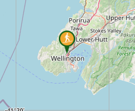
Comments
Nobody has commented on this walk yet. If you've done it then tick it off and add a comment.