
Menu

 3.6
km
return
3.6
km
return
 90
mins
90
mins
Mt Matheson Loop Walk (from Mt Nardi)
Starting at Mount Nardi picnic area, the Mount Matheson loop takes you on a short walk through rainforest. You can combine this hike with other tracks for a longer day walk.
 2.9
km
return
1
hr
2.9
km
return
1
hr
Warwick Condamine River Walk
A walk along the Condamine River through the parklands of Warwick.
 3.8
km
return
105
mins
3.8
km
return
105
mins
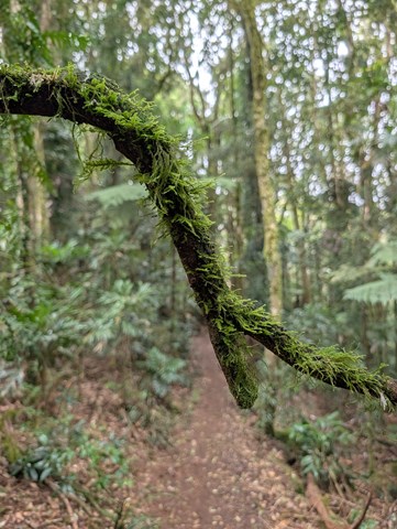
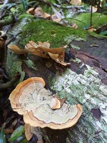
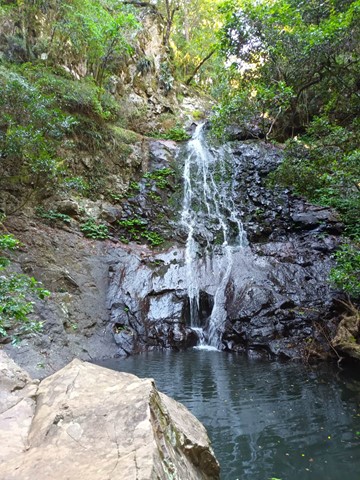
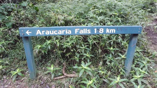
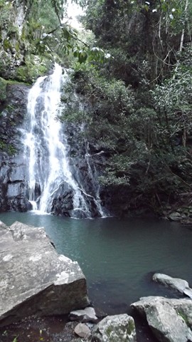
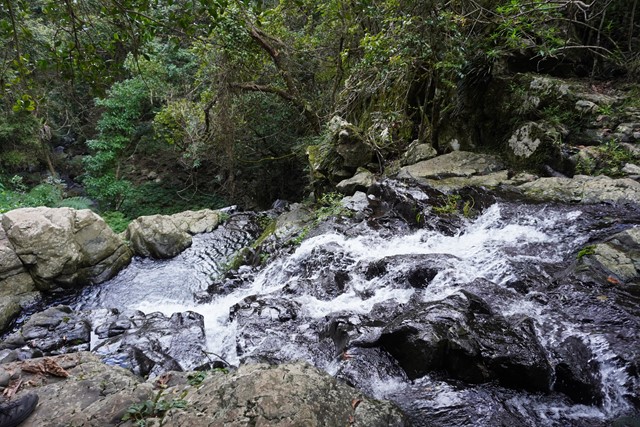
Araucaria Falls
Walk starts flat before gently descending along a gully lined with brush box. Cross the creek at the top of the falls and then descend sharply to the deep pool below to this small but spectacular waterfall.
 2
km
return
1
hr
2
km
return
1
hr
Barangaroo Reserve
A short walk around the Barangaroo Reserve with options to extend around the foreshore or into the historic suburbs of Millers Point and up to the Observatory Hill Park or across to The Rocks.
6
km
return
2
hrs
Parramatta Explorer
A circuit around the sites & parklands of central Parramatta.
 2.7
km
return
2
hrs
2.7
km
return
2
hrs
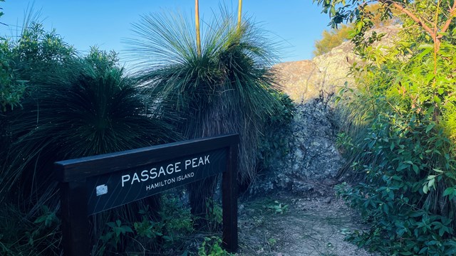
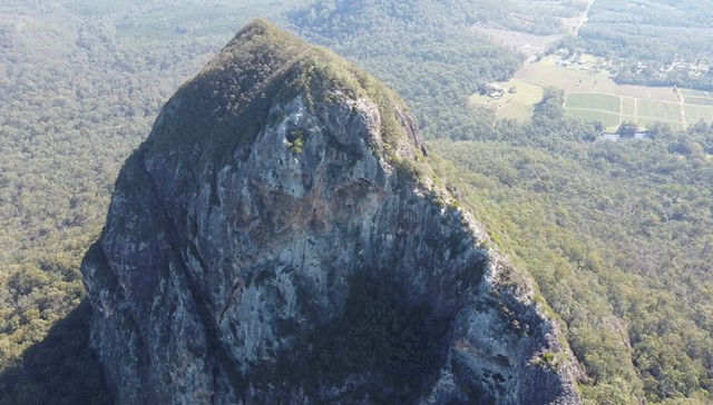
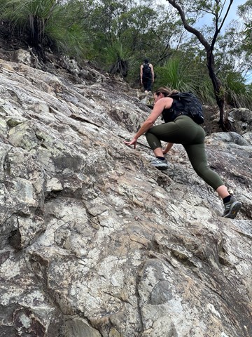
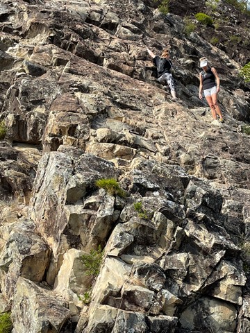
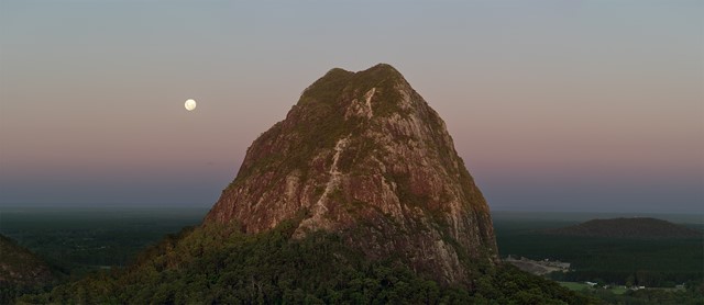
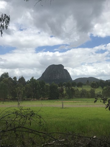
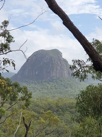
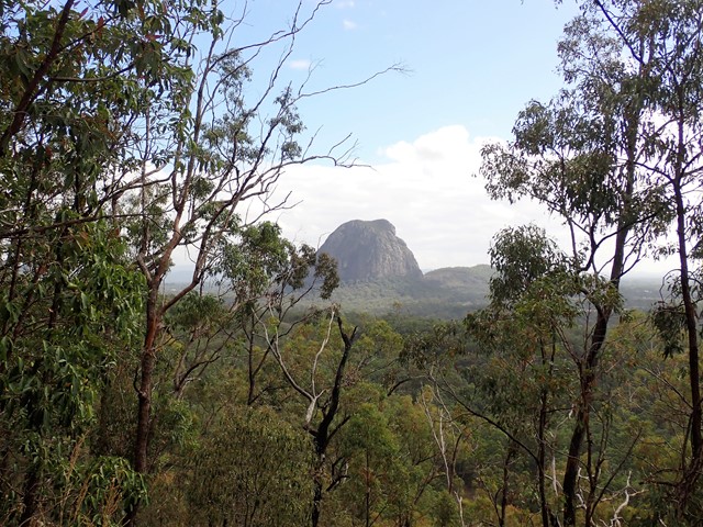
Mt Tibrogargan Summit
Almost a free climb instead of a hike.
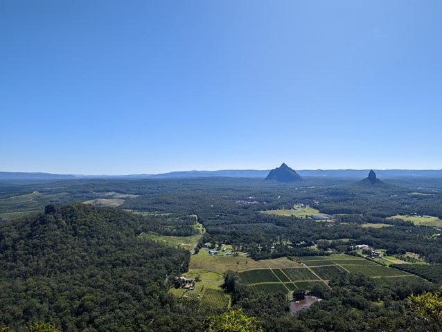
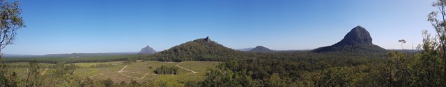
According to Jinibara people’s lore and custom, Beerwah is the ancestral, pregnant mother. Tibrogargan is seen as the father with Ngungun, his faithful dingo, lying at his feet. The mountains around them are their children. Coonowrin is the eldest. The others are Beerburrum, Coochin, Elimbah, Tibberoowuccum, Miketeebumulgrai, Tunbubudla and, the youngest is currently known as Wild Horse Mountain.
Aboriginal people do not climb these mountains out of spiritual respect to Jinibara and Kabi Kabi peoples. They ask that visitors refrain from climbing them for the same reason.
 3
km
return
3
hrs
3
km
return
3
hrs
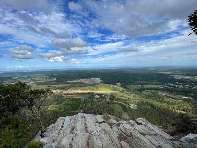
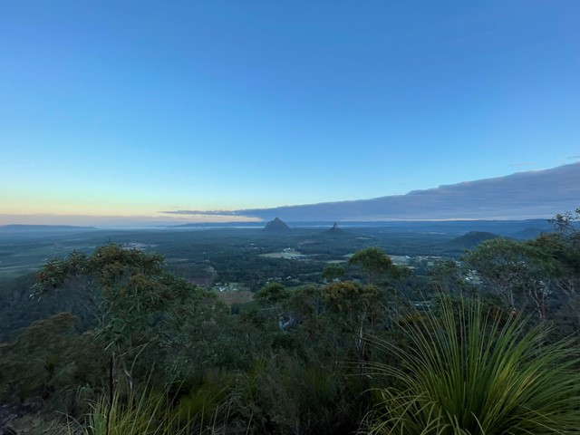
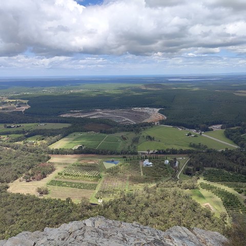
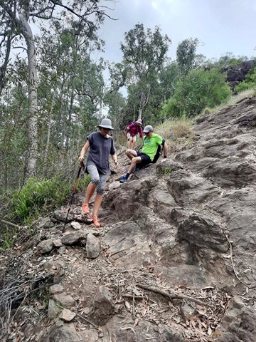
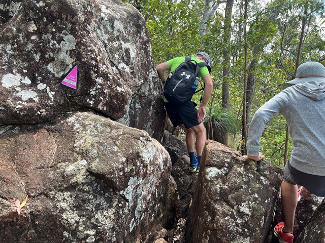
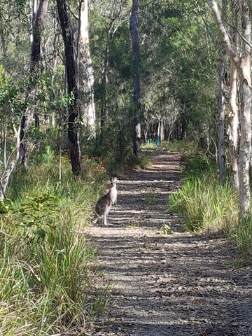
Mt Tibrogargan summit from car park trailhead
When someone asks me about doing this climb I describe it as “the perfect mountain” because it is a perfect amount of challenge and ease. For me there are only 2 very small sections that make my heart freeze abit but the rest is just perfect fun scrambling it’s actually quite easy but a good workout. Views are completely worth it. Beautiful mountain
 18
km
return
6
hrs
18
km
return
6
hrs
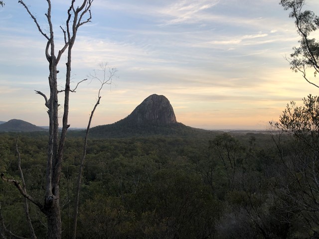
Beerburrum-Soldier Settlers Trail-Trachyte Circuit-Tibrogargan Circuit-Yul-yan-man Track-Beerburrum
This circuit will take you on all four trails between Beerburrum and Tibrogargan. It starts off easy but the last 5km is the hardest. The reward is an awesome hike!
 4
km
one-way
2
hrs
4
km
one-way
2
hrs
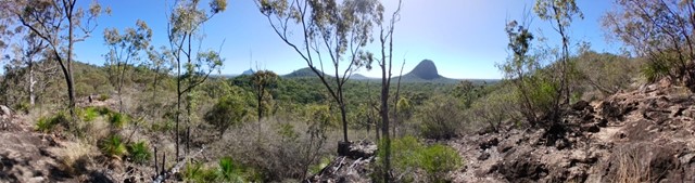
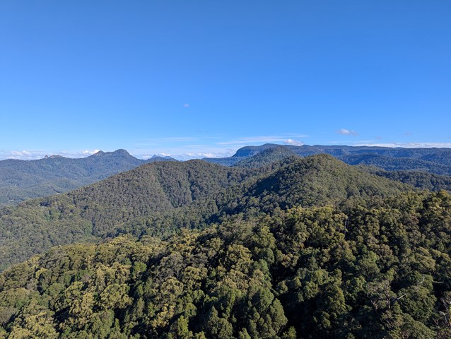
Yul-yan-man Track
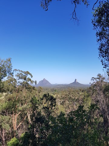
Breathtaking views of the surrounding mountains, rock scrambling challenges and diverse plant communities await you are you skirt Mt Beerburrum and then transverse the Trachyte Ridge, before reaching a heath covered bluff and descending into the open eucalypt forest below.
 14
km
return
4
hrs
14
km
return
4
hrs
Beerburrum to Tibrogargan Circuit and return
Walk from Beerburrum to the Soldiers Settlers Track to Trachyte Circuit to Tibrogargan Circuit to Matthew Flinders Park to Steve Irwin Way to Beerburrum
 15
km
return
5
hrs
15
km
return
5
hrs
Yul-yan-man Track, Tibrogargan Circuit, Trachyte Circuit, Soldiers Settlers Trail
Simply a stitched together circuit of four existing tracks that together, provide a lot of good views, a good variety of landscape and plants and lots of birdsong and flowers. The Yul-yan-man track part includes some rock scrambling, the other three parts are mostly flat and easy.
 9.5
km
return
4
hrs
9.5
km
return
4
hrs
Bally Mountain Loop
A loop walk to the peak of Bally Mountain, an alternative to the out an back of the standard route.
 6
km
return
6
km
return
Manning Gorge Falls (Gibb River Road)
Manning Gorge is one of the most beautiful and best swimming spots in the Kimberley.
Located on Manning Creek in the grounds of the 283,280ha Mt Barnett Station, water remains at the base of the waterfalls and in several pools along the creek year round, ideal for a refreshing dip.
The waterfalls are seasonal and fed by the rains during wet season, so they may be dry the mid to late dry season.
When exploring, you may also come across some examples of Bradshaw and Wandjina rock art.
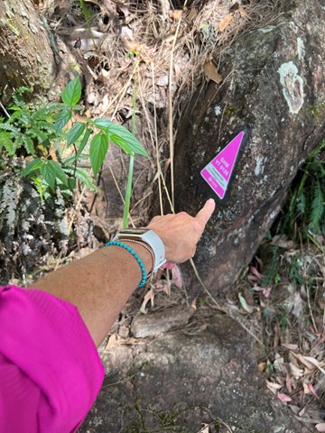
Visiting the gorge involves an adventurous walk of approximately 3 kilometres to the top of the gorge, following the informal trail markers made up of rock cairns, red discs and arrows. The trail begins at the campground, where visitors must first cross Manning Creek to re-join the trail path on the other side. Visitors may swim the 100 metres across, or use the rope guide with floats to ferry belongings.
The trail follows a route overland rather than along the creek with views over the ranges and savannah woodlands along the way. The terrain is uneven, with some rock scrambling and an incline towards the end. The trail is mostly unshaded, so it is important to bring drinking water and to wear a hat.
2
km
return
Dalmanyi (Bell Gorge)
Dalmanyi (Bell Gorge) Trail starts from the parking area and ends just above the stunning waterfall with spectacular views of the gorge. Dalmanyi Falls Trail is an extension of the Dalmanyi (Bell Gorge) Trail which crosses over the top of the falls and down to the deep pool below.
2
km
return
Tunnel walk, Dimalurru (Tunnel Creek) National Park
Tunnel Creek is a very popular walk with a bit of adventure thrown in for good measure. The 2 kilometre return walk goes through a naturally formed tunnel carved over millions of years by fast flowing wet-season water.
1.9
km
return
Gorge Walk, Bandiln͟gan (Windjana Gorge) National Park
Gorge Trail is a spectacular 1.9km (return) bushwalk through Bandiln͟gan (Windjana Gorge). Discover the Devonian reef system which is unlike any other in the Kimberley. As you move through the gorge keep an eye out for freshwater crocodiles and cheeky bower birds collecting white objects for their nest.
1.2
km
return
Savannah Walk Trail, Bandiln͟gan (Windjana Gorge) National Park
The Savannah Walk is an easy well-marked 1.2km loop starting from either the campground or day use visitor carpark area. The trail takes you through savannah habitat and highlights key features with interpretive signage.
10
km
return
Whip Snake Gorge Trail (Purnulul National Park)
Whip Snake Gorge Trail starts at the Piccaninny carpark and follows Piccaninny Creek before turning to the left to veer into the gorge. This difficult 10km return trail takes you into a natural ampitheatre which is full of vegetation.