
Menu

 2.8
km
return
2.8
km
return

Piccaninny Creek Lookout Trail (Purnulul National Park)
The Creek Lookout Trail within Piccaninny Gorge, is a 2.8km return trail. The lookout provides you with impressive views over Piccaninny Creek winding its way south towards the Ord River and the distant beehive domes. The trail is a moderate walk negotiating an uneven and deeply eroded creek bed.
1.4
km
return
The Domes (Purnulul National Park)
The Domes walk is 1.4km and packed with the famous ‘beehive’ domes. The trail is ideal for people who are not into hiking but want to get an insight into this unique landscape. The Bungle Bungle Range is around 360 million years old.
2
km
return
Cathedral Gorge (Purnulul National Park)
Cathedral Gorge's astonishing natural amphitheatre of red rock hidden within the unusual bee hive striped formations is just one of the many fascinating geological landmarks within the Bungle Bungle range that made Purnululu National Park become a World Heritage site. This moderately difficult 2km return trail is not one to be missed.

Osmand Lookout Trail (Purnulul National Park)
A short walk with a moderate slope takes you to an elevated ridge with panoramic views of the ancient and rugged Osmand Range.
Echidna Chasm (Purnulul National Park)
The Echidna Chasm walk trail is 2 kilometres return from the carpark and has steep-sided gorge walls up to 200 metres high and barely a metre wide in places. It features prehistoric Livistona palms and gorge walls exhibiting extraordinary colours.
 7.2
km
return
7.2
km
return
Escarpment Trail (Purnulul National Park)
The Escarpment Trail is a 7.2km return trail which runs along the the range through open woodlands, linking all the trails together from Echidna carpark to the Bloodwoods carpark.
4.4
km
return
Mini Palms (Purnulul National Park)
The Mini Palms Trail is a challenging 4.4km return trail from the Bloodwoods carpark which follows the Escarpment Trail for 1km before turning off to follow a dry, stony creek bed. The trail continues with steep slopes, narrow edges and large boulders to climb over, under or squeeze between before reaching two viewing platforms surrounded by Livistona palms, looking into an amphitheatre filled with tiny palms.
4.4
km
return
Homestead Valley Trail (Purnulul National Park)
The Homestead Valley Trail cuts deep into the range, through open woodlands and an uneven, dry creek bed ending in a shaded rest area with views overlooking Homestead Valley.
200
m
return
Bloodwoods Lookout Trail (Purnulul National Park)
Bloodwoods Lookout is a short 200m return trail to views of the northern escarpment of the Bungle Bungle Range and surrounding woodland.
 530
m
return
530
m
return
Stonehenge Trail (Purnululu National Park)
This is a short, easy walk through open woodland with trailside signs introducing the traditional Aboriginal use of trees, shrubs and grasses.
1.1
km
return
Kurrajong Trail (Purnululu National Park)
This marked walk trail starts from the Kurrajong campground at the northern end of the park. This short 1.1km return trail gives you an idea of the different vegetation types in the Park.
7.5
km
return
4.5
hrs
Jagududgu Loop Walk (Caranbirini Conservation Reserve)
Jagududgu Loop Walk - this walk traverses the different habitats of Caranbirini, revealing changes within each habitat and offers many spectacular views. Alternatively, you can walk up to the first lookout and back (about 1 km return).
Distance: 7.5 km loop (approx)
Time: 4 - 5 hours
Grade: 3 - moderate
2
km
return
1
hr
Barrawulla Loop Walk (Caranbirini Conservation Reserve)
Barrawulla Loop Walk - a short walk that takes you into another world exploring the impressive sandstone spires of the ‘lost city’ formation.
Distance: 2 km loop
Time: 1 - 2 hours
Grade: 2 - easy
200
m
return
10
mins
Caranbirini Waterhole (Caranbirini Conservation Reserve)
this walk leads to a birdhide overlooking a semi-permanentwaterhole. A bird-watcher’s delight, particularly late in the dry season when surface water in the region becomes scarce.
Distance: 200 m return
Time: 10 mins
Grade: 2 - easy
2.1
km
return
1
hr
Lewis Thomas Historic Trail - Castle Hill Blackstone Reserve
A short walk around the Castle Hill Blackstone Reserve with informational signage on the interesting history of the area (coal mining & Welsh mansion "castle"). A detour can be made up to the summit of the hill (add an extra kilometre and a bit return).
2.6
km
return
2
hrs
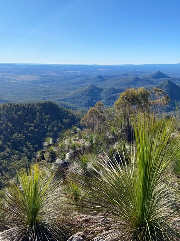
The Leap
2.5km return walk taking you to The Leap Lookout with spectacular views over Mackay to the ocean. It's a short but intense out and back walk starting in rainforest along a creek line before transitioning to a unique grass-tree ecosystem as you arrive at the summit. It contains some very steep sections and requires a bit of rock scrambling, and can be quite slippery after rain. Plenty of markers to guide you to your destination.
Parking is minimal at the base - you may have to park down the street a little bit, or, alternatively, park at the pub and walk from there, and have a relaxing meal and drink when you finish.
500
m
return
15
mins
Peters Creek Walk
A short tadpole loop trail that has views over the creek and nice rainforest.
3
km
return
1
hr
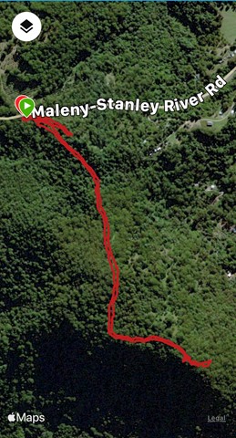
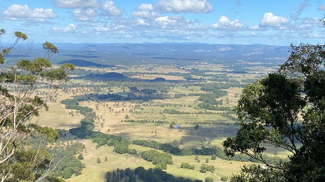
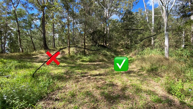
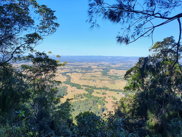
Mt Peachester
A short potentially overgrown trail (unless you time it for after the forestry trails slashing) to the top of Mt Peachester. There you can peer through the bushes to get some views over the surrounding countryside.
 6.5
km
return
3.5
hrs
6.5
km
return
3.5
hrs
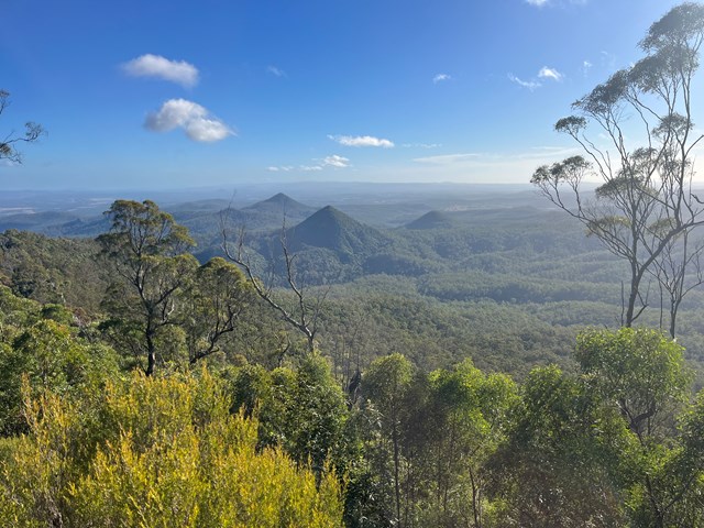
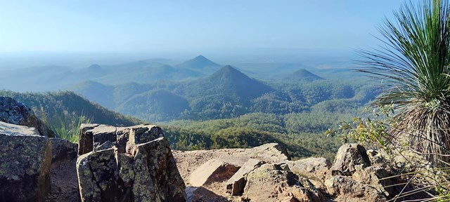
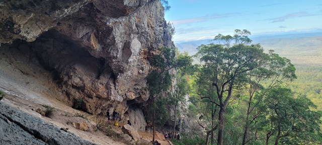
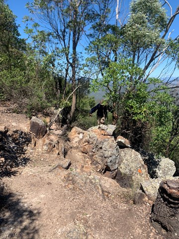
Flinders Peak & Caves
Short but steep hike to summit and side trip to caves. Approximately 5.5 klms.