
Mt Machar Ridge Summit Circuit
Glen Rock Regional Park


Menu

A challenging ridge walk incorporating the Mt Machar summit with some great views

Getting there
The Glen Rock camping area is on the East Haldon Road. The last few kilometres of road are unsealed but 2WD cars can use it unless the creek is up. Park at the Casuarina Day Use area, where you will find an abundance of parking. Mt Philp and Glen Rock are on one side of the valley and Mt Machar is on the other (Western) side.
Route/Trail notes
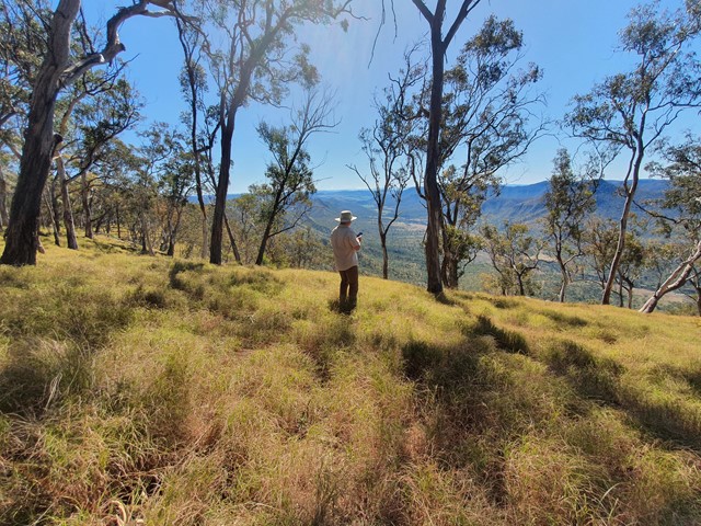
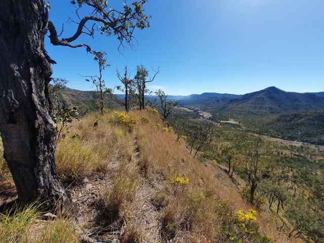
This track is probably best done anticlockwise, in order to get the steepest section out of the way first. There is little shade for much of the track, so start early and take plenty of water. To find the start of the circuit, after parking, walk back the way you drove in along East Haldon Road a few hundred metres and after a big shed on your left you'll see a prominent sign showing the start of the Christie's Loop track. Follow this track and you will immediately need to cross the creek (they're aren't stepping stones, so consider taking a pair of runners or reef shoes to cross). Once past the creek, follow the Christie's Loop track (a farm road) for a couple of kilometres heading roughly west. It starts out as a gentle gradient then becomes steeper approaching the ridge. Nearing the ridgeline, the track turns roughly northwest, then on the ridge itself, you reach a gate, and a sign directs you to turn right to continue the Christie's Loop track. Here's where you leave the circuit and turn left, following the ridge south. Navigation isn't too difficult because the ridge quickly narrows and there is a barbed wire fence all the way along the ridgeline. Follow the faint footpad (unless it's been overgrown). It quickly becomes quite steep, with a bit of scrambling, but exposure is minimal. Once on top of the ridge, the gradient reduces, but you keep gradually gaining elevation in undulating terrain. At times, you'll see a road adjacent to the fence on the western side; it makes walking a little easier. There are some great views to both east and west. Eventually, the ridgeline broadens and the landscape becomes more forested. Then you'll reach a 4WD track/firetrail that will take you all the way to the summit of Mt Machar (it's difficult to find without a GPS app - about 30 metres west of the road on the opposite side of the fence; there are no views to speak of but there's a small cairn). From the summit, it's all downhill following the road. About a kilometre past the highest point (about 7km in) you'll come across a weather station and signal repeater, where there are great views along the valley, including Glen Rock and Point Pure. From here, the road doubles back heading northeast. At times the road is quite steep, so watch your footing. After another four or five kilometres it gradually levels out and brings you back to the creek. After crossing the creek you'll reach a couple of farm gates, a paddock and the old shed mentioned earlier. It's a short walk back to the road, emerging about 50 metres south of where the you started on the Christie's Loop track.
Permits/Costs
No cost
Other References
https://www.wikiloc.A/hiking-trails/mt-macha-up-razorback-down-firetrail-loop-106412794#wp-106412797
All Trails: "Mt Machar" (though the start and finish are a bit different to what's described above)
QTopo also shows the roads: "Christie's Loop Section", "Mt Machar Christies" (though part of this is off the ridgeline) and "Mt Machar Track"
GPS Tracks
- No GPS available for this walk yet.
 13
13 5
5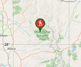
Comments