
Menu
Popular Walks
-
Mt Ngungun
(1151 ticks) -
Mount Coolum
(869 ticks) -
Mt Cordeaux
(665 ticks) -
Twin Falls Circuit
(635 ticks) -
Purling Brook Falls Circuit
(610 ticks)
Parent Regions
Sub-Regions
- Amamoor State Forest
- Bellthorpe National Park
- Brisbane City Council Local Walks
- Brisbane Forest park D'Aguilar National Park
- Brisbane Valley Rail Trail
- Coombabah Lakelands Conservation Area
- Daisy Hill Conservation Park
- Eumundi Conservation Park
- Glass House Mountains National Park
- Glen Rock Regional Park
- Gold Coast
- Ipswich
- Jimna State Forest
- Karawatha Forest
- Kondalilla National Park
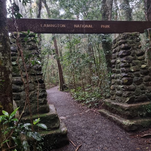
- Lamington National Park
- Main Range National Park
- Mapleton National Park
- Moggill Conservation Park
- Moogerah Peaks National Park
- Moreton Island National Park
- Mt Barney National Park
- North Stradbroke Island - Minjeeribah
- Parklands Conservation Park
- Springbrook National Park
- Sunshine Coast
- Tamborine National Park
- White Rock - Spring Mountain Conservation Estate
Summary
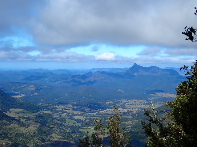
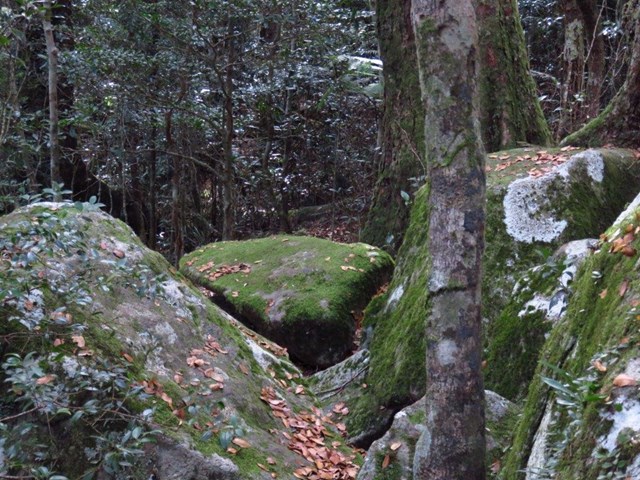
Boarding NSW and the pacific Ocean, it is not uncommon for hikes to have views of both worlds (ocean and hinterland). Hikes here are typically on the great dividing range.
Popular Walks
-
Mt Ngungun
(1151 ticks) -
Mount Coolum
(869 ticks) -
Mt Cordeaux
(665 ticks) -
Twin Falls Circuit
(635 ticks) -
Purling Brook Falls Circuit
(610 ticks)
Parent Regions
Sub-Regions
- Amamoor State Forest
- Bellthorpe National Park
- Brisbane City Council Local Walks
- Brisbane Forest park D'Aguilar National Park
- Brisbane Valley Rail Trail
- Coombabah Lakelands Conservation Area
- Daisy Hill Conservation Park
- Eumundi Conservation Park
- Glass House Mountains National Park
- Glen Rock Regional Park
- Gold Coast
- Ipswich
- Jimna State Forest
- Karawatha Forest
- Kondalilla National Park
- Lamington National Park
- Main Range National Park
- Mapleton National Park
- Moggill Conservation Park
- Moogerah Peaks National Park
- Moreton Island National Park
- Mt Barney National Park
- North Stradbroke Island - Minjeeribah
- Parklands Conservation Park
- Springbrook National Park
- Sunshine Coast
- Tamborine National Park
- White Rock - Spring Mountain Conservation Estate
History
Any interesting history for the region?
Features
What are the standout bushwalking features?
Access
How do you get there? Include all access points if there are many?
Maps
Which maps cover the region?
Accommodation
Where can I stay there? or near there?
Camping
Council Areas:
- Scenic Rim Regional
- Gold Coast City
- Logan City
- Redland City
- Ipswich City
- Lockyer Valley Regional
- Brisbane City
- Somerset Regional
- Moreton Bay Regional
- Sunshine Coast Regional
- Noosa Shire
Contact details
See Qld National parks website
Walks in Lamington National Park

 1.2
km
return
1.2
km
return
 30
mins
30
mins
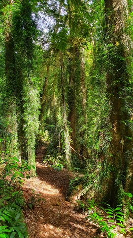
Rainforest Circuit
For a quick introduction to the rainforest, follow the Border Track for 500m, then branch right and return to the picnic area. A self-guiding brochure, produced by the Lamington Natural History Association is available at the Information Centre, the Lamington Teahouse and at Binna Burra Lodge.
 37.5
km
return
2
days
37.5
km
return
2
days
Running Creek Falls Via Stinson Track
Running Creek Falls Campsite via Stretcher Track
Christmas creek road..
-to Westrays Grave
-to Stinson Remote Bush Camp
-to Point Lookout Bush Camp
-to Running Creek Bush Camp
-to Falls
-to car at Gap Creek Road
 21
km
7
hrs
21
km
7
hrs
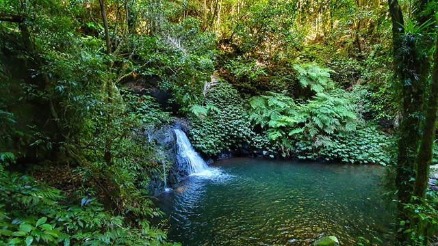
Ships Stern Circuit
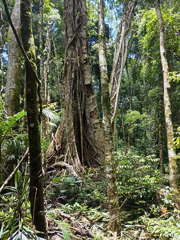
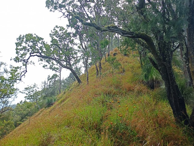
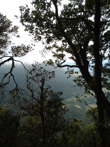
Combines rainforest, palm groves and open eucalypt forest, wildflower vegetation and excellent lookouts over the Numinbah Valley. A short side trip takes in the Lower Ballanjui Falls. The Ship's Stern Walk is one of the most magnificent walks in the Park. It is particularly excellent in winter and spring, especially the latter when wildflowers are often abundant. The Binna Burra lodge offers convenient accommodation for an early start or an overnighter, and also has a cafe with a view that's a great way to finish this track.
 14
km
return
7
hrs
14
km
return
7
hrs
Stairway Falls
Great, but long and difficult walk from O'Reily's, following a path down to Blue Pool, then a run down path that's hard to find in some sections down to stairway falls. Goes though a lot of great scenery and you should definitely be prepared for your feet to get wet as you need to continually cross the creek to keep on path.
 15
km
return
8
hrs
15
km
return
8
hrs
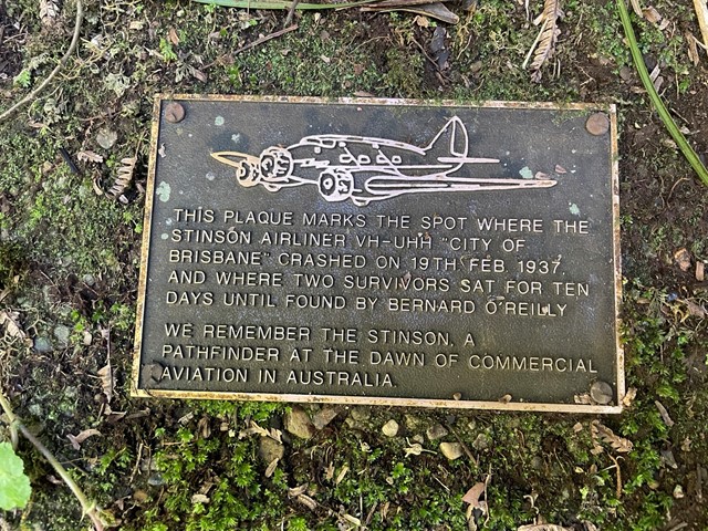
Stinson Crash Site from Christmas Creek
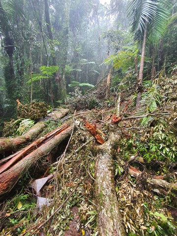
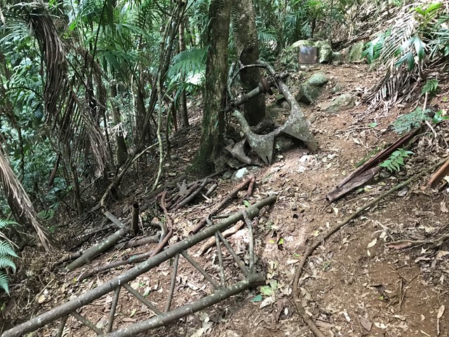
This walk takes you to the Stinson memorial crash site and the close-by Stinson remote bush camping site (no bush camping is allowed anywhere along the track, only with a permit in designated area). There is not much of the Stinson wreck left so I'd recommend doing this one sooner rather than later before it all goes under, there has been some serious treefall and landslide in the area in late 2020 and early 2021 due to heavy rains. The memorial area contains some plaques dedicated to those who lost their lives in the crash.
Aside from the wreck it is a lovely hike with diverse forest, land features and some easy unexposed rock scrambling/climbing although this could probably be avoided. There's even a bit of vine swinging to be done on the way back down if you're game.
It is a hard walk in rough terrain. The initial climb is very steep and fitness is key to completing the track in a decent time. It diverges off Westray's Grave track, just before reaching the grave, seeing the grave on the same walk is recommended (https://www.aussiebushwalking.com/qld/se-qld/lamington-np/westray-s-grave-from-christmas-creek).
 20.5
km
one-way
2
days
20.5
km
one-way
2
days
Stretcher Track
Long considered a "classic" walk in South East Queensland this walk retraces the route taken by the rescue party for the survivors of the Stinson plane crash. It is not maintained by QPWS and is extremely overgrown once the main plateau is reached. A compass and a topographical map is essential as visibility is extremely limited in the rainforest even if you are not walking through low cloud and the track is to all intensive purposes non existent on the plateau.
 20
km
7
hrs
20
km
7
hrs
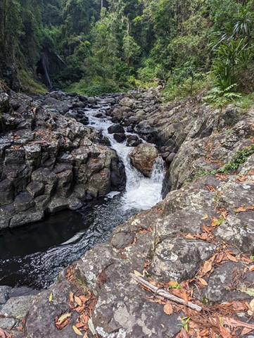
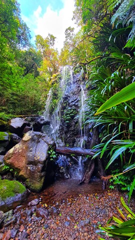
Toolona Creek and Mount Wanungra Lookout
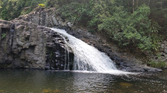
A full day walk that follows Toolona Creek in which over 8 waterfalls will be seen, also reaching Mt Wanungara lookout to provide views to Byron Bay.
 19.8
km
return
7
hrs
19.8
km
return
7
hrs
Toolona Creek Circuit
A beautiful walk along Toolona Creek and an endless number of waterfalls! Many creek crossings and beautiful, lush areas deep in the valley.
 5
km
return
90
mins
5
km
return
90
mins
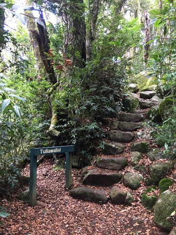
Tullawallal Circuit
This track leads through the rainforest to the summit of Tullawallal at over 950m. Also this track leads to the closest stand of Antarctic beech trees to Binna Burra. The rock formation at the end is a natural wonder that will have you guessing! Can be completed as a loop with the Border Track.
 18
km
6
hrs
18
km
6
hrs
West Canungra Creek Circuit
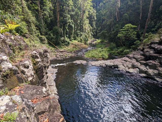
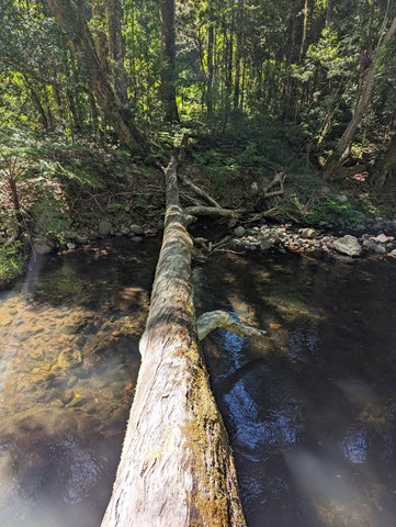
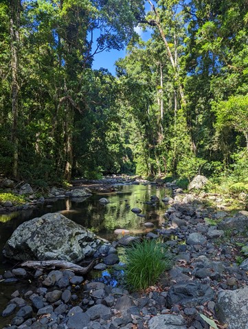
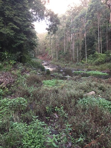
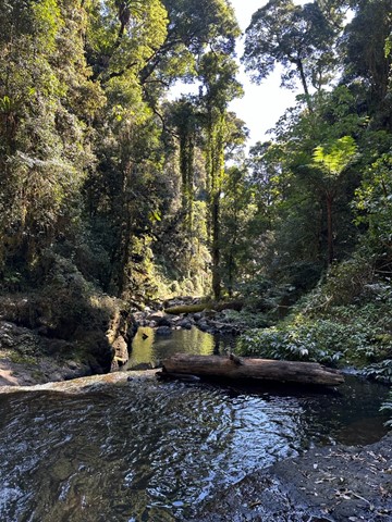
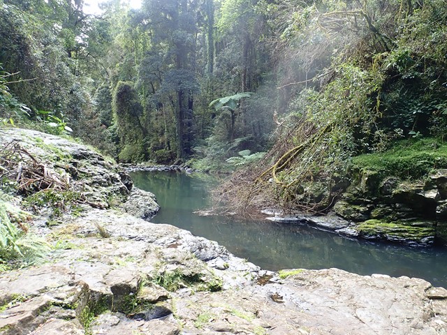
The circuit descends to 'Yerralahla' (blue pool) passing by some large rainforest trees including red cedar Toona ciliata, and then follows the creek for most of its length, crossing it several times. Eels inhabit the West Canungra Creek. They bite when threatened and injuries have occurred. Creek crossings may be difficult to navigate and the circuit might not be obvious in places. Take particular care at creek crossings, especially after rain. Check track conditions with a ranger before you leave. The circuit exits via the Box Forest circuit.