
Menu
Popular Walks
-
Coomera Circuit
(234 ticks) -
Daves Creek Circuit
(225 ticks) -
Box Forest
(223 ticks) -
Morans Falls
(222 ticks) -
Caves Track
(206 ticks)
Summary
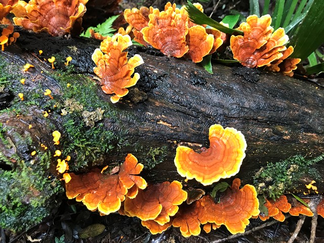
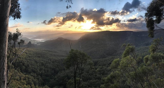
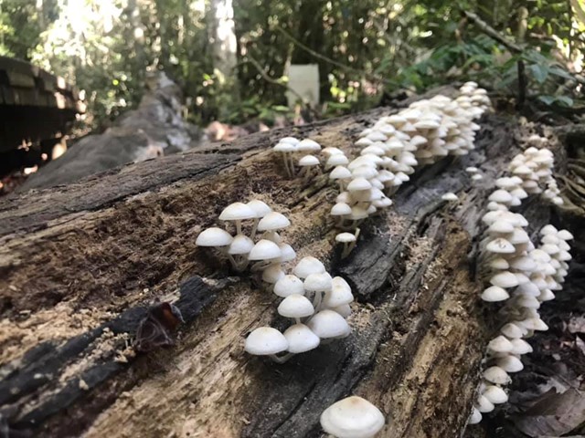
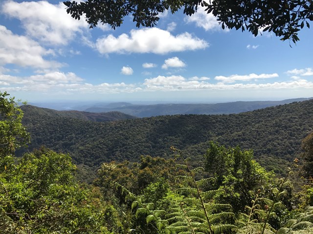
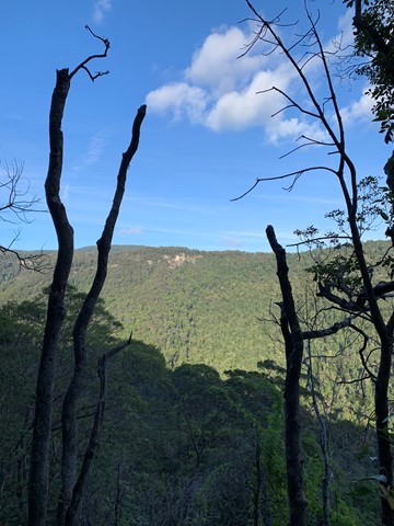
Lamington National Park is a 206 square kilometre park on the McPherson Range on the Queensland-New South Wales border. The park features beautiful rainforest waterfalls, amazing views and a comprehensive series of clearly marked tracks.
Popular Walks
-
Coomera Circuit
(234 ticks) -
Daves Creek Circuit
(225 ticks) -
Box Forest
(223 ticks) -
Morans Falls
(222 ticks) -
Caves Track
(206 ticks)
History
Any interesting history for the region?
Features
What are the standout bushwalking features?
Access
Green Mountains (O'Reilly's)
Exit the M1 at Nerang and follow signs to Canungra (signs also indicate Lamington National Park or O'Reilly's). Turn left into Kidston Street and follow this road up the mountain (don't miss the great views along the way!) to the carpark adjacent to the QPWS Information Centre, campground and O'Reilly's Guesthouse.
Note that the road, although sealed, is narrow and winding and has many blind corners. Take care!
Binna Burra
Exit the M1 at Nerang and follow signs to Beechmont. Follow the signs from the roundabout at Beechmont to Binna Burra.
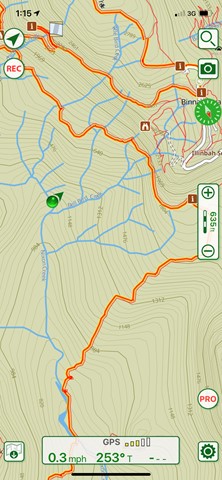
Maps
A number of SUNMAP 1:25000 topographic maps cover Lamington National Park including Lamington (South-West of the park), Tyalgum (South-East) Hillview (North-West) and Beechmont (North-East).
Hema maps also provides a comprehensive 1:35000 map of the park.
Accommodation
Camping
A National Park campground is available in the Green Mountains section. Sites must be pre-booked on weekends and holidays, but you may self-register at other times.
Remote, walk-in camping is allowed at designated sites between February and November. These sites must be pre-booked through the QPWS (see website below).
A private campground is available at Binna Burra
Other
Resort accommodation is available at O'Reilly's Rainforest Guesthouse and Binna Burra Mountain Lodge as well as various other options around the surrounding area.
Contact details
EPA Website - http://www.epa.qld.gov.au/projects/park/index.cgi?parkid=97
Walks in Lamington National Park

 21.8
km
return
21.8
km
return
 7
hrs
7
hrs
Albert River Circuit
A lesser used walk starting at O'Reillys and spawning from the Border track.
 17.8
km
return
6
hrs
17.8
km
return
6
hrs
Araucaria Lookout
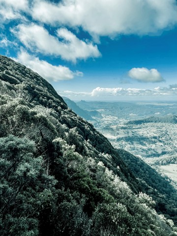
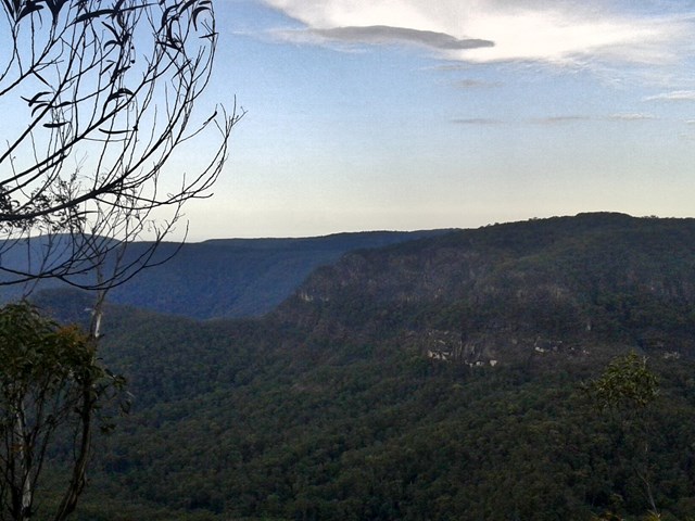
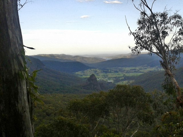
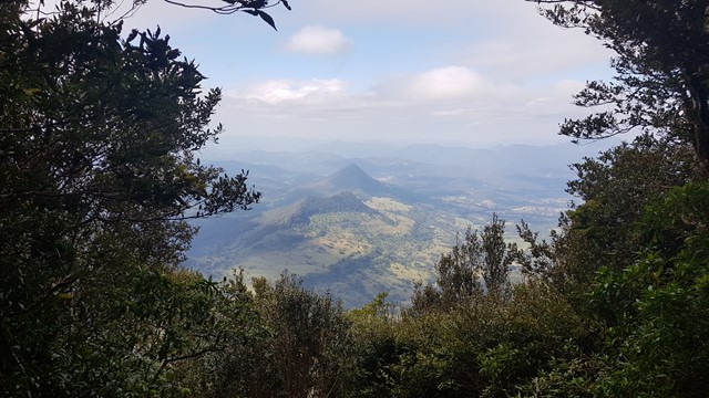
An awesome but seldom visited lookout offering near 360 degree views along the Numinbah Valley.
Araucaria Lookout is named after the hoop pines Araucaria cunninghamii, which can be viewed from the lookout. These hoop pine communities are a living representative of the Jurassic Age (the age of the conifers) of about 180 million years ago.
At 18km return it's a long walk but on graded tracks so there are no navigational issues or bush bashing to worry about. There are a few ups and downs to contend with but nothing really steep or nasty. Allow 5-6 hours at a steady pace including time to enjoy the views.
 2
km
return
1
hr
2
km
return
1
hr
Bellbird Lookout
THIS TRACK NO LONGER EXISTS
This track branches off the Ships Stern circuit and descends through rainforest and open forest before emerging suddenly at Bellbird lookout—a natural lookout (with no handrails) above a very high, sheer cliff. Please keep children under close supervision and keep well away from the cliff edge.
The land around this lookout and most of the track is not part of the national park—it belongs to Binna Burra Mountain Lodge. For enquiries, please contact Binna Burra Mountain Lodge on (07) 5533 3622.
From here you get an excellent view of Ships Stern, Turtle Rock, Egg Rock (Kurraragin) and Numinbah Valley—all remnants of what millions of years of erosion, landslides and weathering have created.
Hoop pines Araucaria cunninghamii can be seen from the lookout, growing on the exposed northern slopes. Harvesting of hoop pine and red cedar Toona ciliata led to the initial European settlement and ultimately the clearing of Numinbah Valley for agriculture.
 10
km
return
4
hrs
10
km
return
4
hrs
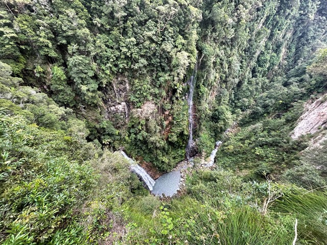
Bohgaban Falls
Follows the Gold Coast Hinterland Great Walk before off trail rock hopping up Nixon Creek to Bohgaban Falls.
 800
m
return
30
mins
800
m
return
30
mins
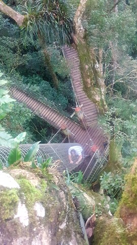
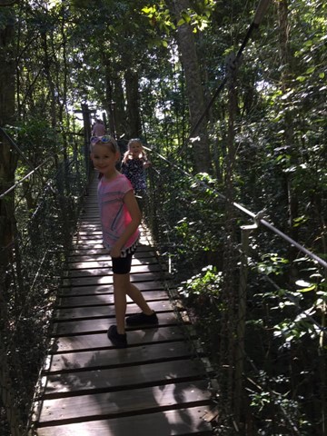
Booyong Walk (Treetop Walk)
The Tree Top Walk consists of 9 suspension bridges up to 16 metres above ground. Enjoy a bird’s eye view from a deck 30 metres above ground in a fig tree over the walkway.
 21.8
km
7
hrs
21.8
km
7
hrs
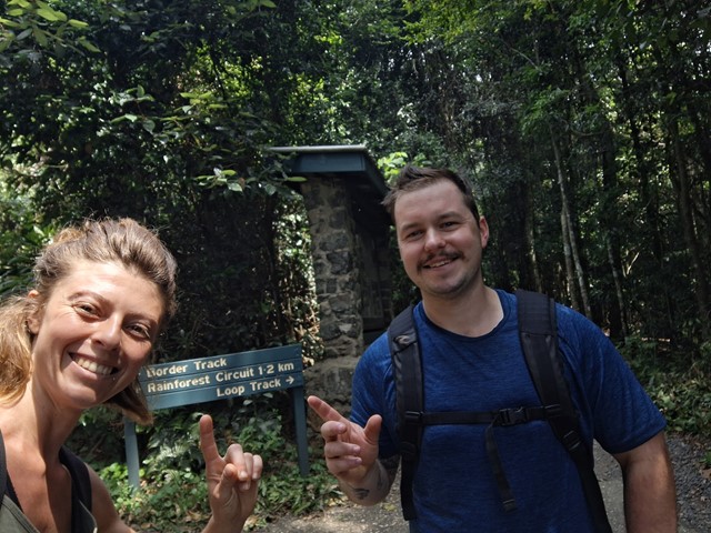
Border Track
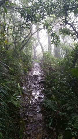
Direct connection between Binna Burra and O'Reillys. Graded & well used, with very muddy sections after rain. Gentle inclines but many uneven surfaces due to rocks and roots and tree falls. Includes several side-tracks to lookouts (may be no views if the cloud is low).
(Officially graded as Grade 4/Hard, but feels like Grade 3 most of the way.)
 10.6
km
4
hrs
10.6
km
4
hrs
Box Forest
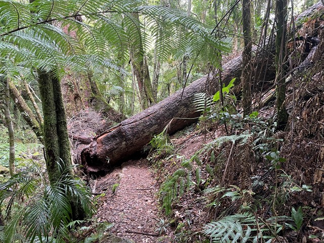
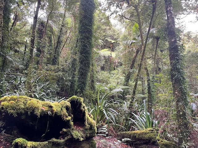
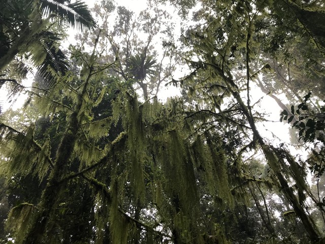
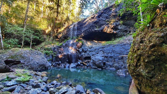
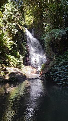
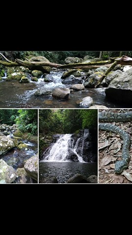
The Box Forest Track leaves the Picnic Rock track 2.7 km from the entrance and is a most rewarding circuit walk. The track winds down through stands of Brush Box and Piccabeen Palms, to the lush sub-tropical rainforest along Canungra Creek. Pepper Vines cling to tall trees that often support spectacular tree gardens.
Turn right at the next track junction. During wet times, you will have to wade through the water when crossing above Wajinya Falls. The track continues near the top of the falls on the other side. Darragumai Falls and Picnic Rock are considered good lunch spots. Don't miss Box Log and Elabana Falls on the way home.
 5
km
return
90
mins
5
km
return
90
mins
Castle Crag
The walk continues on from Balancing Rock and has some very steep drop offs, don't do it you are scared of heights.
5.2
km
return
90
mins
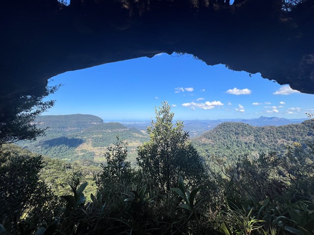
Caves Track
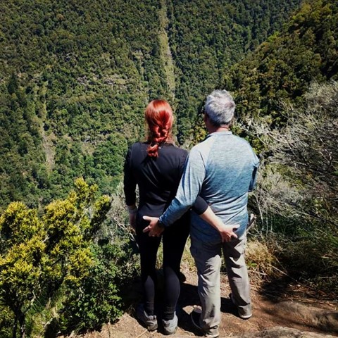
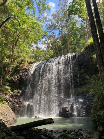
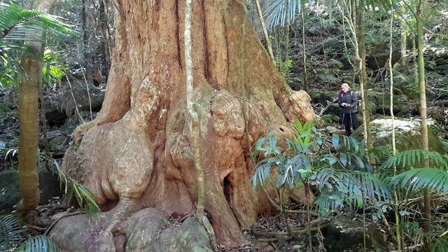
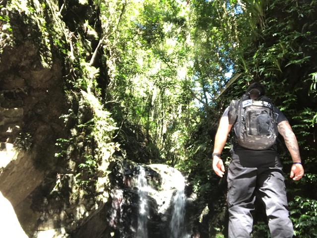
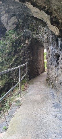
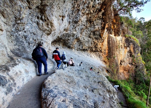
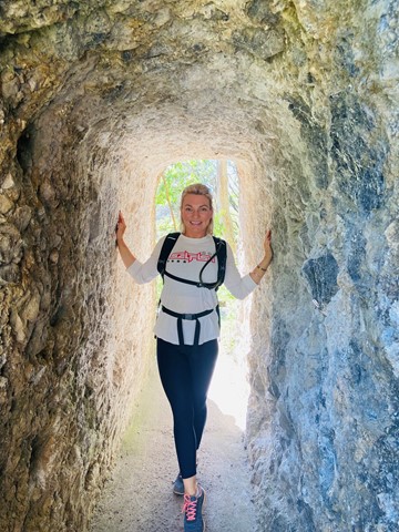
From the information centre, this interesting track winds up through open forest and rainforest to emerge on the road opposite the ship's Stern track entrance. It provides excellent views into the Coomera Valley and passes a large red cedar and fine specimens of other rainforest tree species. A range of volcanic rock types and formations can be observed. Koalas are often seen in open forest area along the walk. Take care when walking down the bitumen road to return to the start of the circuit, especially on weeekends when traffic is heavy. A self guiding brochure for this circuit is available at the information centre, Lamington Teahouse and at Binna Burra Lodge.
 17.4
km
7
hrs
17.4
km
7
hrs
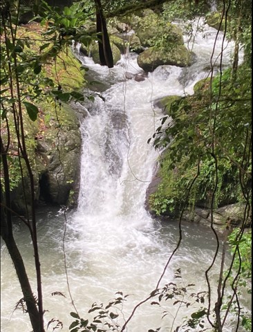
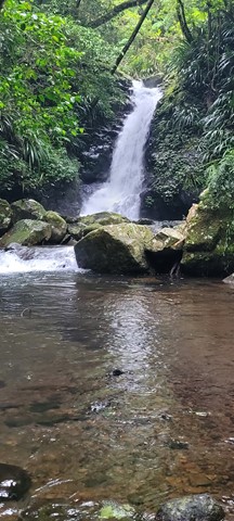
Coomera Circuit
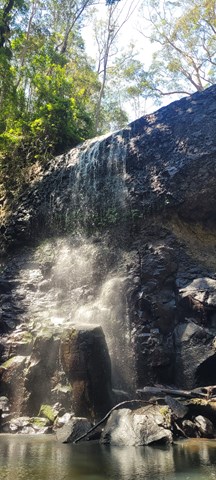
This track showsoff some of Binna Burra's best assets and is one of the prettiest walks in this section of the park. The waterfalls are at their best after rain. The track does cross over the Coomera River several times and crossings can become tricky if water levels are high.