
Menu
Popular Walks
-
Mt Ngungun
(1151 ticks) -
Mount Coolum
(869 ticks) -
Mt Cordeaux
(665 ticks) -
Twin Falls Circuit
(635 ticks) -
Purling Brook Falls Circuit
(610 ticks)
Parent Regions
Sub-Regions
- Amamoor State Forest
- Bellthorpe National Park
- Brisbane City Council Local Walks
- Brisbane Forest park D'Aguilar National Park
- Brisbane Valley Rail Trail
- Coombabah Lakelands Conservation Area
- Daisy Hill Conservation Park
- Eumundi Conservation Park
- Glass House Mountains National Park
- Glen Rock Regional Park
- Gold Coast
- Ipswich
- Jimna State Forest
- Karawatha Forest
- Kondalilla National Park
- Lamington National Park
- Main Range National Park
- Mapleton National Park
- Moggill Conservation Park
- Moogerah Peaks National Park
- Moreton Island National Park
- Mt Barney National Park
- North Stradbroke Island - Minjeeribah
- Parklands Conservation Park
- Springbrook National Park
- Sunshine Coast
- Tamborine National Park
- White Rock - Spring Mountain Conservation Estate
Summary
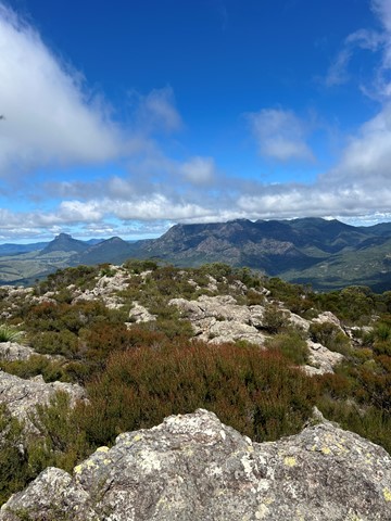
Boarding NSW and the pacific Ocean, it is not uncommon for hikes to have views of both worlds (ocean and hinterland). Hikes here are typically on the great dividing range.
Popular Walks
-
Mt Ngungun
(1151 ticks) -
Mount Coolum
(869 ticks) -
Mt Cordeaux
(665 ticks) -
Twin Falls Circuit
(635 ticks) -
Purling Brook Falls Circuit
(610 ticks)
Parent Regions
Sub-Regions
- Amamoor State Forest
- Bellthorpe National Park
- Brisbane City Council Local Walks
- Brisbane Forest park D'Aguilar National Park
- Brisbane Valley Rail Trail
- Coombabah Lakelands Conservation Area
- Daisy Hill Conservation Park
- Eumundi Conservation Park
- Glass House Mountains National Park
- Glen Rock Regional Park
- Gold Coast
- Ipswich
- Jimna State Forest
- Karawatha Forest
- Kondalilla National Park
- Lamington National Park
- Main Range National Park
- Mapleton National Park
- Moggill Conservation Park
- Moogerah Peaks National Park
- Moreton Island National Park
- Mt Barney National Park
- North Stradbroke Island - Minjeeribah
- Parklands Conservation Park
- Springbrook National Park
- Sunshine Coast
- Tamborine National Park
- White Rock - Spring Mountain Conservation Estate
History
Any interesting history for the region?
Features
What are the standout bushwalking features?
Access
How do you get there? Include all access points if there are many?
Maps
Which maps cover the region?
Accommodation
Where can I stay there? or near there?
Camping
Council Areas:
- Scenic Rim Regional
- Gold Coast City
- Logan City
- Redland City
- Ipswich City
- Lockyer Valley Regional
- Brisbane City
- Somerset Regional
- Moreton Bay Regional
- Sunshine Coast Regional
- Noosa Shire
Contact details
See Qld National parks website
Walks in Mt Barney National Park

 15
km
return
15
km
return
 10
hrs
10
hrs
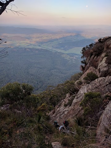
Mt Barney East Peak - South-East Ridge up and South Ridge down
Very tough. Be prepared for plenty of rock scrambling at height and no trail markers on the summit. Long walk back to the car park from South ridge track.
 9
km
return
8
hrs
9
km
return
8
hrs
Mt Barney East peak south east ridge
This seems to be a duplicate of part of another walk. The information shown here is incorrect. Please refer to the Mt Barney - East Peak - Up South-East - Down South walk instead: https://www.aussiebushwalking.com/qld/mt-barney/mt-barney-summit/mt-barney-south-east-ridge-ascent-peasants-ridge-descent
Starting from yellow Pinch assend the as per the signage the south east ridge track to the summit
 16
km
one-way
1
days
16
km
one-way
1
days
Mt Barney East Peak via SE Ridge, traverse North Pinnacle to Leaning Peak, descend to Barney Gorge and Lower Portals
We did this as a day walk, starting at Yellow Pinch carpark around 7AM and arriving at Lower Portals about 4PM. We were told by a professional guide we bumped into at Yellow Pinch carpark that we wouldn't be able to complete our planned route in 1 day. We completed it easily in about 9 hours and taking plenty of stops, but we're experienced hikers and you need to hold a good pace. Most people would probably prefer to break it up into a 2-day walk.
A couple things you need to know first up:
1. This route starts at Yellow Pinch Carpark but finishes at Lower Portals Carpark, so you either need to pre-arrange a way to get back to your car or you have an extra walk at the end from Lower Portals back to Yellow Pinch.
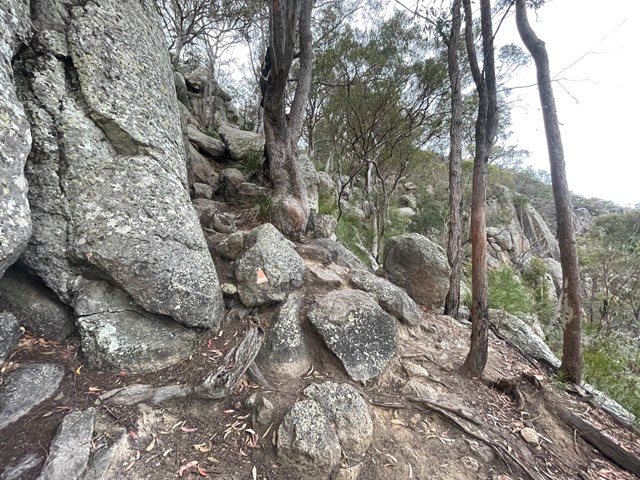
2. A rope is needed to descend a couple short sections of the couloir on the western side of Leaning Peak. This is a very steep scramble through thick grass and over a few small cliffs, so only attempt if you are comfortable with doing this, as once you pass the first cliff you're pretty much committed to continuing the descent because it's difficult to get back up.
 10.7
km
return
6
hrs
10.7
km
return
6
hrs
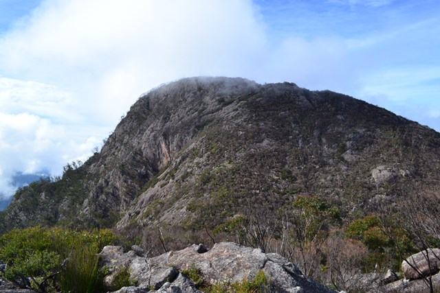
Mt Barney North Peak
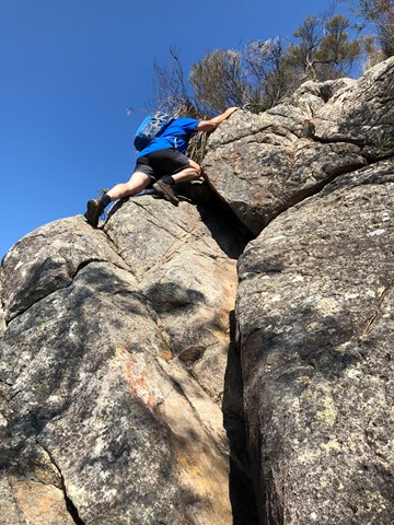
This challenging route offers all the views normally associated with a climb up Logan's Ridge without the extremely precipitous sections. There are a few exposed sections where a rope may be handy, particularly if the rock is wet.
 18.5
km
return
12
hrs
18.5
km
return
12
hrs
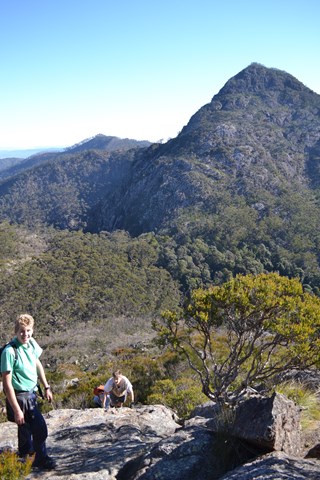
Mt Barney via Gorge and down Peasants Ridge
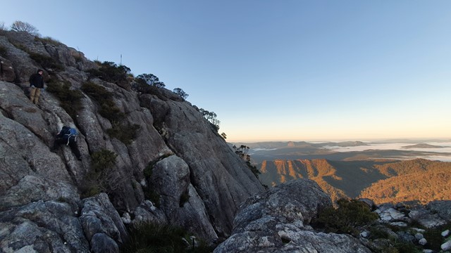
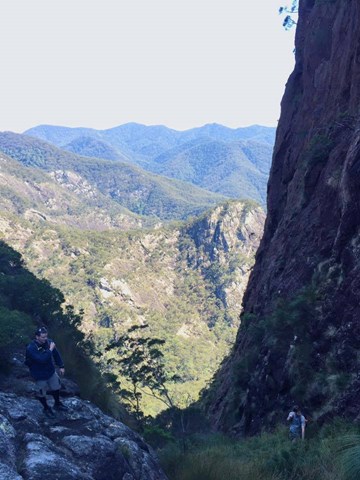
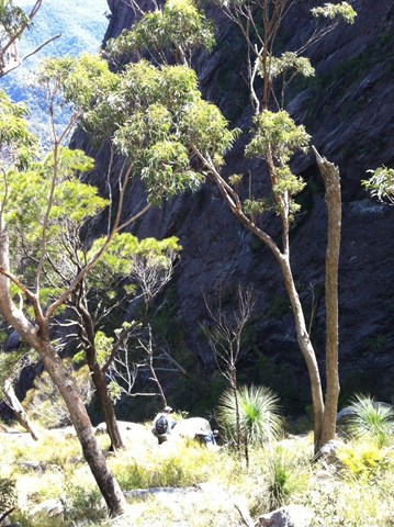
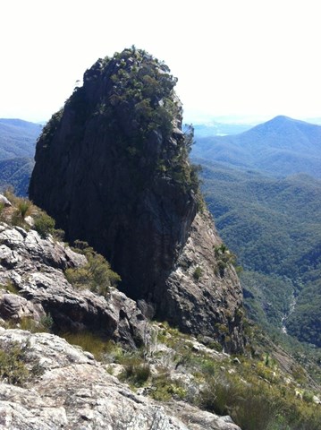
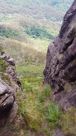
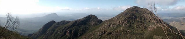
A tough hike in up the Gorge mostly off track with some challenging rock scrambling. Upon reaching Barney Saddle the trek up West Peak is reasonably challenging and shouldn't be attempted unless you have a head for heights as it is quite steep and exposed in places. After returning to the saddle if time allows the return trip up East Peak is well worth tackling as the views from the summit are unbeatable on a clear day. The trip down via Peasants Ridge is relatively straight forward but does offer a couple of interesting sections. After reaching the car park at Yellow Pinch it is about 6km to the start point by road at Lower Portals Carpark. It is preferable to have organised a car shuffle so as to avoid this at the end of a long day.
 15
km
return
9
hrs
15
km
return
9
hrs
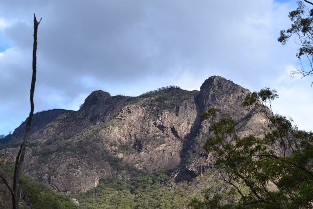
Mt Barney via Logans Ridge and return via Gorge
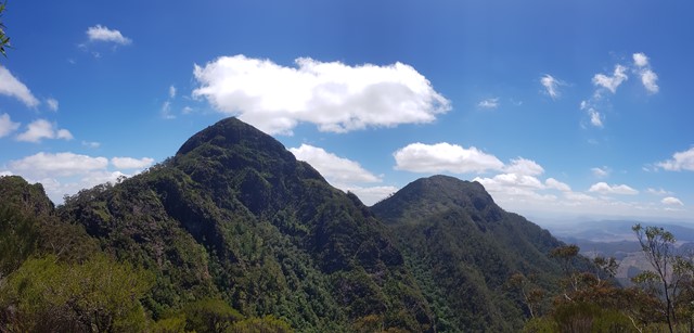
The climb up Logan's Ridge is challenging but offers superb views on a clear day. The first recorded climb was undertaken by Captain Patrick Logan, Charles Fraser and Allan Cunningham in 1828. The climb became too difficult for Fraser and Cunningham who turned back leaving Logan to climb on alone. This ascent should not be attempted unless you are an experienced rock scrambler and have a head for heights. Any climb too difficult for Allan Cunningham deserves respect.
 17
km
return
8
hrs
17
km
return
8
hrs
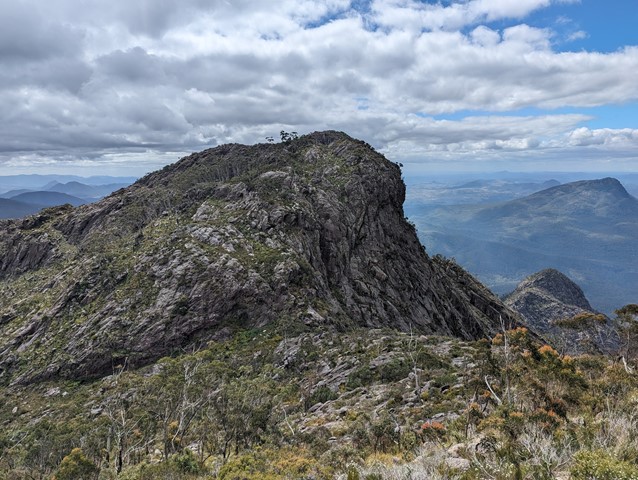
Mt Barney West Peak
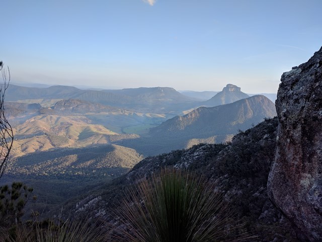
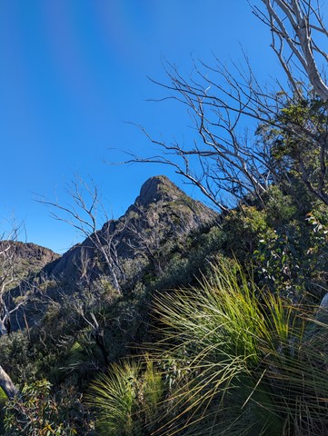
Straight up the west peak. The track is a goat track at best. There is the occasional piece of tape in a tree. You probably will get lost. But its not that hard to find your way. One tip is at the big rock face, aim towards the left end (south but not to south as there is a very big cliff). Also a good idea to take a compass bearing on the way up, as white outs are common up here.
The summit is scrubby, with a pile of rocks to mark the highest spot on Mt Barney (its higher than east peak). Head to the the northern end of the peak for amazing views to the north and west.
Even if you dont intend on climbing the whole way up. Do yourself a favour and go a little way, as the veiw up East peak is amazing. Totally different aspect of this incredible mountain.
 10.1
km
return
5
hrs
10.1
km
return
5
hrs
Mt Clunie
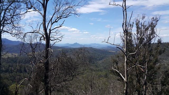
This is one for the "peak-baggers" and those who want to test there fitness. Mt Clunie is one of the high mountains (1158m) on the Qld/NSW border and the walk involves one of the tougher ascents in South-East Qld (described as "incredibly steep" in the Bushpeople's Guide, and they aren't joking). The walk begins at the border gate on the Carneys Creek Rd (this becomes White Swamp Rd once it crosses into NSW) and follows the border fence all the way up to the summit. The first few kilometres of the walk, in a roughly Southerly direction, is through undulating terrain in open eucalypt forest, and although there are some steep sections, it isn't too difficult. However, about an hour into the walk, a steel fence is crossed, the vegetation begins to change to rainforest, and the very steep section commences. At this point is is very handy to wear tough gloves, in order to drag yourself up the fence, and wear long sleeves and pants/gators, to battle through some areas of blackberry. A few hundred metres from the summit, the track levels, and there are some picturesque rock formations on the Qld side of the fence. In some sections, it is best to climb over the fence for easier travel. The summit is marked by a cairn, but there are no views to speak of, apart from occasional glimpses of Wilson's Peak to the North-West. You will make up some time on the return trip, but in parts, it's almost necessary to slide back down!
 6
km
4
hrs
6
km
4
hrs
Mt Lindesay
I've revised the description and left the original below.
From the border gate the route follows the western ridge before traversing the mountain's southern slopes. Once you reach the eastern ridge, look for the ascent point for the lower cliff-line, very close to the ridge crest. The climb starts with a steep chimney to a tree, which can be used as an anchor for this lower pitch if needed, then briefly traverses right before climbing straight up a very shallow gully to a ramp trending leftwards. Casuarina needles make this section slippery. The route is easy to follow from here but the upper cliff-line, while short, contains a slightly overhanging move and some climbers will require aid to ascend. It is far easier to abseil down the upper cliff-line, and safer to use a rope for all exposed sections. Rope doubled-over slings around trees, with separate sling retrieval line should work OK for descent, though the lead climber would need to be able to ascend without protection and the lower cliffs would be 2 pitches long. There were no views from the summit when I climbed this in early 2000s
ORIGINAL DESCRIPTION
This walk starts near the border gate and eventually becomes very steep on a relatively poorly defined path. It's possible to go nearly all the way to the top without a rope.
6
km
return
4
hrs
Mt Maroon
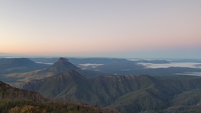
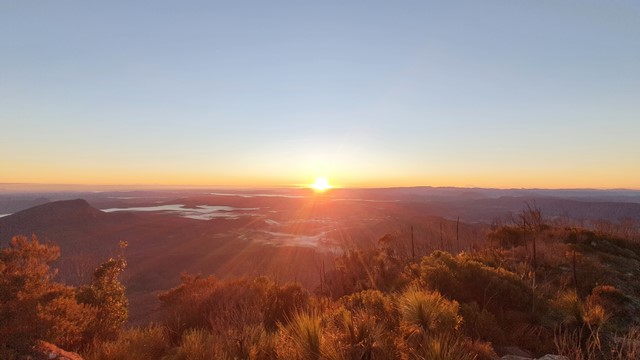
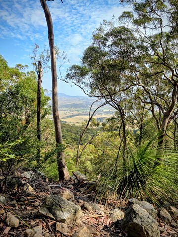
Mt Maroon provides some of the best views in South-East Queensland, with a 360 degree views ranging from Lamington NP through Mt Barney, the length of Main Range and the Moogerah Peaks.
No facilties on site, be sure to bring toilet paper etc.
Bring plenty of water and food/snacks.