


 8.4
8.4 2.5
2.5- Mount Bippo Penbean (North Stradbroke Island - Minjeeribah)
- Mount Vane (Jarlo Beetle Track) (North Stradbroke Island - Minjeeribah)
- Blue Lake (Kaboora Track) (North Stradbroke Island - Minjeeribah)
- Point Lookout to Keyholes (North Stradbroke Island - Minjeeribah)
- North Stradbroke Island Sand Cliffs (North Stradbroke Island - Minjeeribah)
Dunwich to Brown Lake
North Stradbroke Island - Minjeeribah
Menu
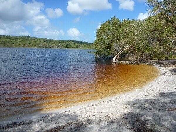
A walk from the Dunwich to the Brown Lake that mostly follows the road.
Picnic Facilities
BBQ
Toilets
No Public Transport
Cycling Permitted
Coastal
95m
Maximum Elevation
95m
Total Climb
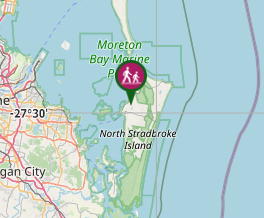
Getting there
From where Stradbroke Flyer's drop you off plug into Google Maps, 'Brown Lake.' Click on the public toilets and set that as your course. Head up Alfred Martin way following signs to the Brown Lake. You can follow along the road until you get there or alternatively take a nicer track on a sandy 4WD road on the left of the road which will take you to the Brown Lake also.
Route/Trail notes
A relatively easy walk along a road. Not much in terms of actual trails. Nothing really to note. Road isn't busy so don't worry about getting run over.
GPS Tracks
- No GPS available for this walk yet.
Where
Click here to load this map.
Comments
Nobody has commented on this walk yet. If you've done it then tick it off and add a comment.