
Menu
Popular Walks
-
Mt Ngungun
(1151 ticks) -
Mount Coolum
(869 ticks) -
Mt Cordeaux
(665 ticks) -
Twin Falls Circuit
(635 ticks) -
Purling Brook Falls Circuit
(610 ticks)
Parent Regions
Sub-Regions
- Amamoor State Forest
- Bellthorpe National Park
- Brisbane City Council Local Walks
- Brisbane Forest park D'Aguilar National Park
- Brisbane Valley Rail Trail
- Coombabah Lakelands Conservation Area
- Daisy Hill Conservation Park
- Eumundi Conservation Park
- Glass House Mountains National Park
- Glen Rock Regional Park
- Gold Coast
- Ipswich
- Jimna State Forest
- Karawatha Forest
- Kondalilla National Park
- Lamington National Park
- Main Range National Park
- Mapleton National Park
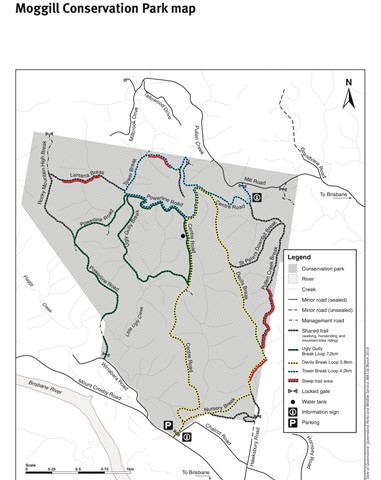
- Moggill Conservation Park
- Moogerah Peaks National Park
- Moreton Island National Park
- Mt Barney National Park
- North Stradbroke Island - Minjeeribah
- Parklands Conservation Park
- Springbrook National Park
- Sunshine Coast
- Tamborine National Park
- White Rock - Spring Mountain Conservation Estate
Summary
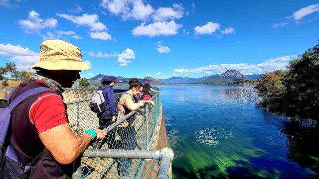
Boarding NSW and the pacific Ocean, it is not uncommon for hikes to have views of both worlds (ocean and hinterland). Hikes here are typically on the great dividing range.
Popular Walks
-
Mt Ngungun
(1151 ticks) -
Mount Coolum
(869 ticks) -
Mt Cordeaux
(665 ticks) -
Twin Falls Circuit
(635 ticks) -
Purling Brook Falls Circuit
(610 ticks)
Parent Regions
Sub-Regions
- Amamoor State Forest
- Bellthorpe National Park
- Brisbane City Council Local Walks
- Brisbane Forest park D'Aguilar National Park
- Brisbane Valley Rail Trail
- Coombabah Lakelands Conservation Area
- Daisy Hill Conservation Park
- Eumundi Conservation Park
- Glass House Mountains National Park
- Glen Rock Regional Park
- Gold Coast
- Ipswich
- Jimna State Forest
- Karawatha Forest
- Kondalilla National Park
- Lamington National Park
- Main Range National Park
- Mapleton National Park
- Moggill Conservation Park
- Moogerah Peaks National Park
- Moreton Island National Park
- Mt Barney National Park
- North Stradbroke Island - Minjeeribah
- Parklands Conservation Park
- Springbrook National Park
- Sunshine Coast
- Tamborine National Park
- White Rock - Spring Mountain Conservation Estate
History
Any interesting history for the region?
Features
What are the standout bushwalking features?
Access
How do you get there? Include all access points if there are many?
Maps
Which maps cover the region?
Accommodation
Where can I stay there? or near there?
Camping
Council Areas:
- Scenic Rim Regional
- Gold Coast City
- Logan City
- Redland City
- Ipswich City
- Lockyer Valley Regional
- Brisbane City
- Somerset Regional
- Moreton Bay Regional
- Sunshine Coast Regional
- Noosa Shire
Contact details
See Qld National parks website
Walks in Mapleton National Park

 37.5
km
one-way
37.5
km
one-way
 3
days
3
days
Sunshine Coast Great Walk - North to South - Gheerulla Camping Area to Baroon Pocket Dam
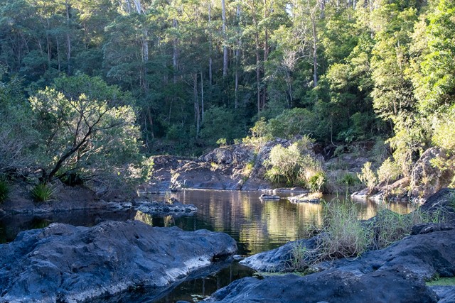
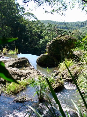
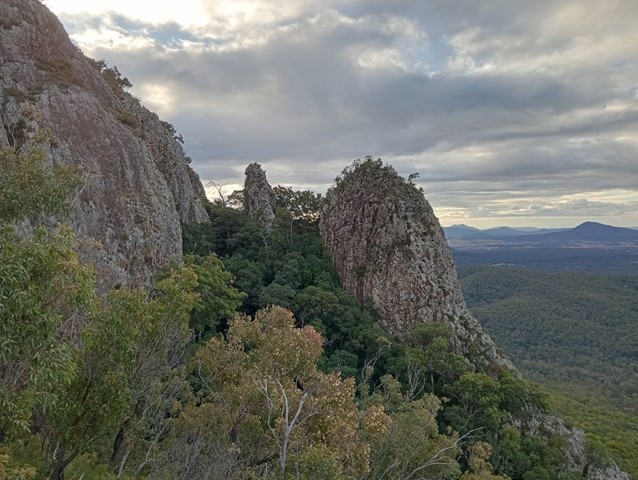
You'll enjoy walking past waterfalls, peering into gorges and resting near rock pools. There's some stunning views and wonderful lookouts along the way. Notice the plant communities around you and how they change from warm subtropical rainforest to tall open eucalypt forest; all protected in three beautiful national parks—Kondalilla, Mapleton Falls and Mapleton.
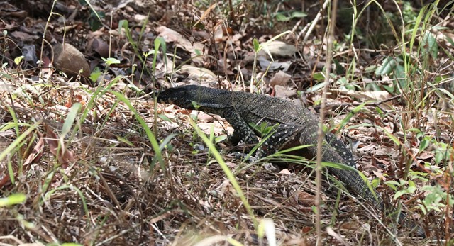
There are more than 100 species of birds, about 70 reptile species and more than 30 frog species, so you'll have lots of wildlife around you.
The Sunshine Coast Hinterland Great Walk's many access points offer different walking options.
58.8km long-distance walking with overnighting in the three remote, walkers' camps
full-day walks with some comfortable holiday house accommodation nearby
shorter half-day walks.
 200
m
return
15
mins
200
m
return
15
mins
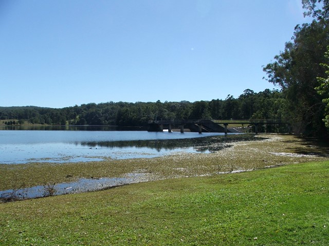
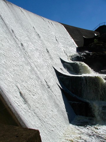
Wappa Falls
Only a very short walk from the car park and a bit of rock hopping if you want some good pictures, with the option to walk up to the dam and Jack Harrison Park.
Walks in Moggill Conservation Park
 8.2
km
return
2
hrs
8.2
km
return
2
hrs
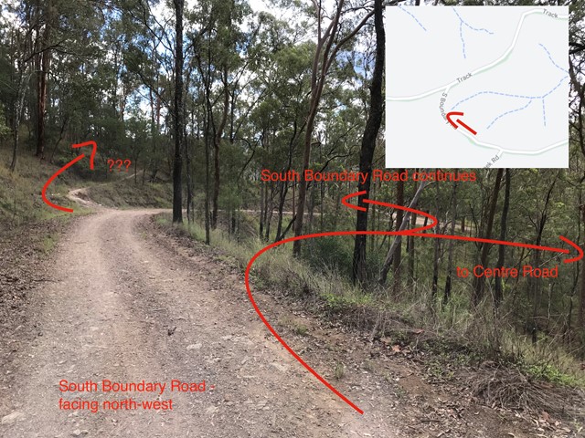
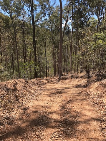
Centre Road and Tower Break Loop
The walk begins in the riparian rainforest and winds its way up into the dry eucalypt expanse of the Brisbane Forest. Note, there a quite a few steep sections (both up and down) which may be covered in loose shale.
 5.8
km
return
90
mins
5.8
km
return
90
mins
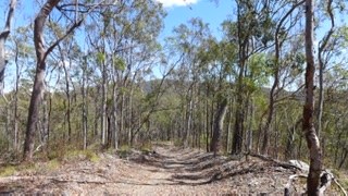
Devils Break Loop
Great short to medium length bush walk with not too many many people. There is a very steep section on the southern end of Devils Break which can be covered in shale so appropriate walking shoes are a must here.
 5
km
return
2
hrs
5
km
return
2
hrs
Lantana Break
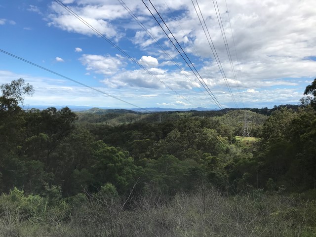
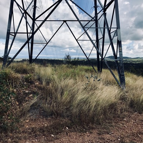
A nice 5k walk from Wirrabarra road. I would recommend heading along powerline break first, then up lantana break and coming back down Rocky Mountain High. Lantana break is heading directly up from the gullly to the top of the ridge, quite a challenging walk, but well signposted and takes about two hours all up. I'd recommend heading there after a little bit of rain so that the ground is softer and not at slippery.
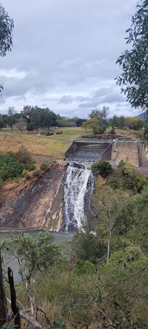
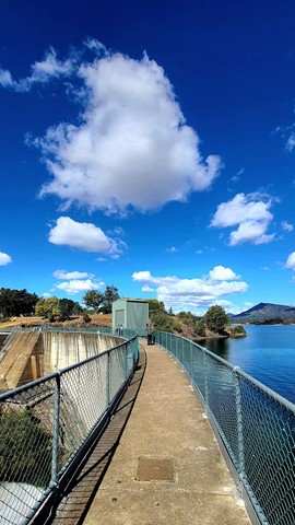
Walks in Moogerah Peaks National Park
840
m
return
20
mins
Mee-bor-rum Circuit
This circuit track passes through heathland and features a lookout with views of Tamborine Mountain, Lamington Plateau and Mount Barney. Care must be taken at the lookout; it is a natural texture and has no handrails. Further along the track a circular viewing platform provides views of the heathland and southern section of Mount French.
 6
km
return
3
hrs
6
km
return
3
hrs
Mount Edwards
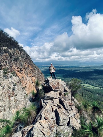
This hiking track takes you to the summit of Mt Edwards, the taller, conical-shaped peak beside Moogerah Dam. This trail crosses the dam wall then leads to the top the mountain with an elevation gain of almost 500m to really get your heart pumping. There is a lookout part-way up the track with views of Little Mt Edwards/Reynolds Creek below the dam wall, while the lookout at the summit faces north-east towards Brisbane and the Fassifern Valley.
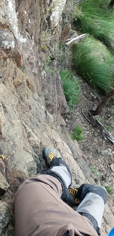
Officially listed as Grade 5/Very Hard difficulty (unsigned trail, loose/rocky surface, some tree falls/overgrown sections + steep incline), this trail is suitable for walkers with a moderate-high fitness level who are confident and well prepared (wear appropriate shoes, take plenty of water etc.).
 6
km
return
3
hrs
6
km
return
3
hrs
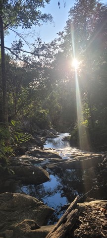
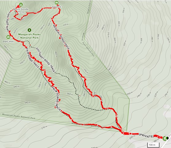
Mt Greville
A walk up to the top of Mt Greville circa 770m. Up the waterfall gorge, then visit viewing platform rock slab near top of waterfall gorge. Alternatively, ascend via SE Ridge. Continue to summit then return via Palm Gorge.
 7
km
return
5
hrs
7
km
return
5
hrs
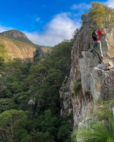
Mt Greville via Razor back ridge, waterfall Gorge, Bare rock, the ladder, the peak
Starting from the car park assend to the folk and then drop across waterfall gorge and assend the northern wall and traverse along a narrow ridge before descending a gully back down into waterfall gorge and assend back up to Bare rock and the down into the northern gorge before taking the 2nd gully back up to a viewing rock and a bolted ladder before the last assend to the peak and desend south east ridge
 5.5
km
return
2.5
hrs
5.5
km
return
2.5
hrs
Mt Greville waterfall gorge, Northern face
Starting from the car park ascend to the viewing rock and then head along the faint track towards south east ridge. Once at the cliff line peel of to the right and traverse along until you get to the first gully entrance seen from the viewing rock once there rock scramble up the north western ridge line to the summit. Beware there is a degree of exposure here and no marked route. The bare rock is cliff like and the gullies are extremely unstable beware of shifting rocks. Descend down south east ridge.