
Menu
Popular Walks
-
Mt Ngungun
(1151 ticks) -
Mount Coolum
(869 ticks) -
Mt Cordeaux
(665 ticks) -
Twin Falls Circuit
(635 ticks) -
Purling Brook Falls Circuit
(610 ticks)
Parent Regions
Sub-Regions
- Amamoor State Forest
- Bellthorpe National Park
- Brisbane City Council Local Walks
- Brisbane Forest park D'Aguilar National Park
- Brisbane Valley Rail Trail
- Coombabah Lakelands Conservation Area
- Daisy Hill Conservation Park
- Eumundi Conservation Park
- Glass House Mountains National Park
- Glen Rock Regional Park
- Gold Coast
- Ipswich
- Jimna State Forest
- Karawatha Forest
- Kondalilla National Park
- Lamington National Park
- Main Range National Park
- Mapleton National Park
- Moggill Conservation Park
- Moogerah Peaks National Park
- Moreton Island National Park
- Mt Barney National Park
- North Stradbroke Island - Minjeeribah
- Parklands Conservation Park
- Springbrook National Park
- Sunshine Coast
- Tamborine National Park
- White Rock - Spring Mountain Conservation Estate
Summary
Boarding NSW and the pacific Ocean, it is not uncommon for hikes to have views of both worlds (ocean and hinterland). Hikes here are typically on the great dividing range.
Popular Walks
-
Mt Ngungun
(1151 ticks) -
Mount Coolum
(869 ticks) -
Mt Cordeaux
(665 ticks) -
Twin Falls Circuit
(635 ticks) -
Purling Brook Falls Circuit
(610 ticks)
Parent Regions
Sub-Regions
- Amamoor State Forest
- Bellthorpe National Park
- Brisbane City Council Local Walks
- Brisbane Forest park D'Aguilar National Park
- Brisbane Valley Rail Trail
- Coombabah Lakelands Conservation Area
- Daisy Hill Conservation Park
- Eumundi Conservation Park
- Glass House Mountains National Park
- Glen Rock Regional Park
- Gold Coast
- Ipswich
- Jimna State Forest
- Karawatha Forest
- Kondalilla National Park
- Lamington National Park
- Main Range National Park
- Mapleton National Park
- Moggill Conservation Park
- Moogerah Peaks National Park
- Moreton Island National Park
- Mt Barney National Park
- North Stradbroke Island - Minjeeribah
- Parklands Conservation Park
- Springbrook National Park
- Sunshine Coast
- Tamborine National Park
- White Rock - Spring Mountain Conservation Estate
History
Any interesting history for the region?
Features
What are the standout bushwalking features?
Access
How do you get there? Include all access points if there are many?
Maps
Which maps cover the region?
Accommodation
Where can I stay there? or near there?
Camping
Council Areas:
- Scenic Rim Regional
- Gold Coast City
- Logan City
- Redland City
- Ipswich City
- Lockyer Valley Regional
- Brisbane City
- Somerset Regional
- Moreton Bay Regional
- Sunshine Coast Regional
- Noosa Shire
Contact details
See Qld National parks website
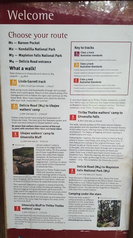
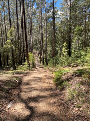
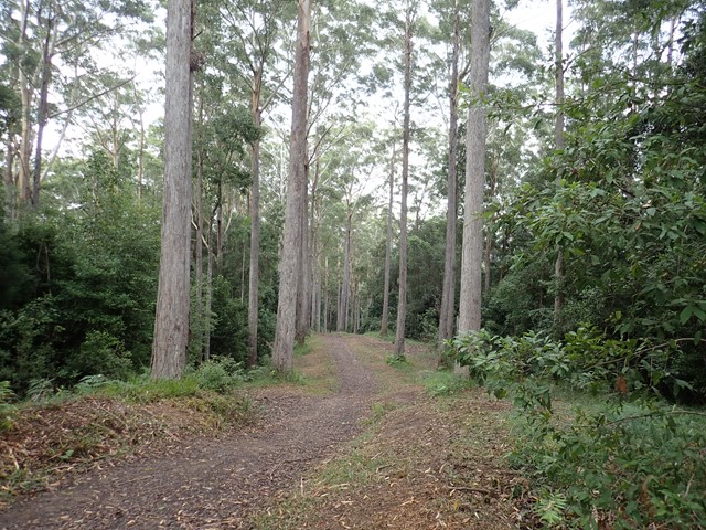
Walks in Mapleton National Park

 2.5
km
return
2.5
km
return
 1
hr
1
hr
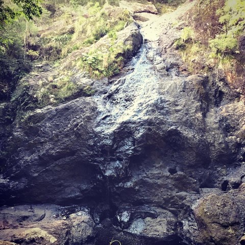
Kureelpa Falls
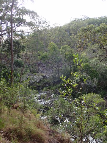
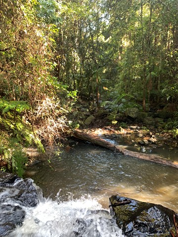
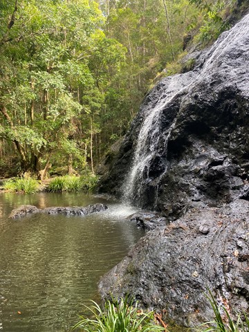
A hidden gem in the Mapleton National Park, with water from the South Maroochy River cascading over boulders before falling 30m into a hidden gorge.
700
m
return
15
mins
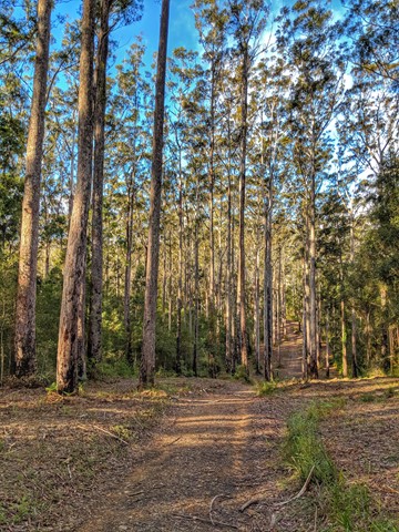
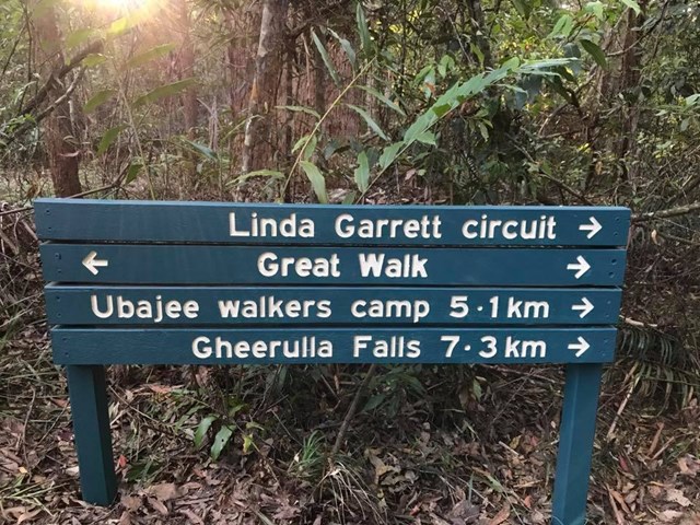
Linda Garrett Circuit
A very short walk dedicated to Linda Garrett, who donated lands for the benefit of the community.
 14
km
4
hrs
14
km
4
hrs
M4 parking/Ubajee walkers camp/Gheerulla falls loop
This is pleasant walk which is part of the Sunshine Coast Great walk. To get there turn down Delicia road and proceed to the M4 parking area. From there take the Great walk trail that leads to the Ubajee Walkers camp. From the camp follow the trail down to the Gheerulla falls and then from there its simply a matter of following the track back up to Delicia road (appr 2 km) and back to the carpark via the dirt road.
1.8
km
return
1
hr
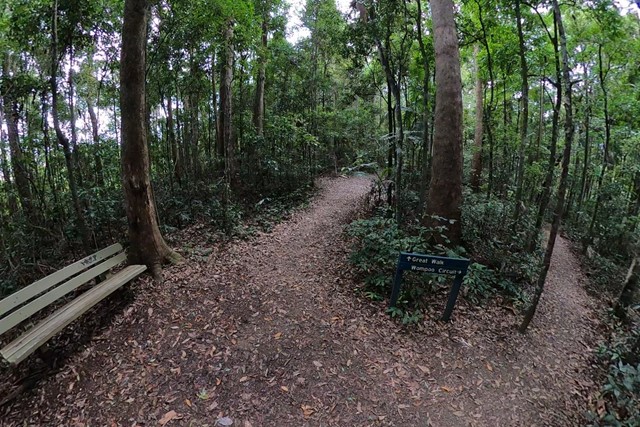
Mapleton Falls & Wompoo Circuit
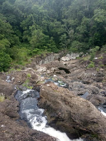
This walk winds through rainforest and eucalypt forest, whilst providing views of the 120m falls tumbling down the escarpment from Pencil Creek into Obi Obi Valley.

 9.2
km
return
3
hrs
9.2
km
return
3
hrs
Mt Thilba Thalba via Gheerulla Creek
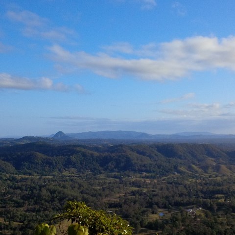
A section of the Gheerulla Valley circuit. A moderate climb on a well maintained track leading to a lookout on Mt Thilba Thalba 1.2 km before the Thilba Thalba walkers camp. A 200 metre side track on the left of the main track leads to a rocky outcrop looking out over the valley.
 6.9
km
return
2
hrs
6.9
km
return
2
hrs
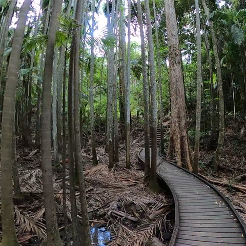
Piccabeen Circuit
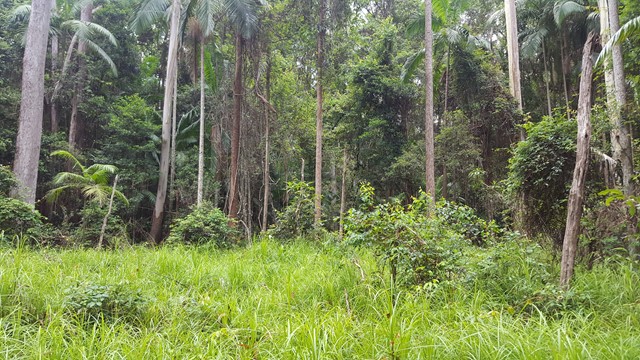
Piccabeen Circuit provides a pleasant walk through piccabeen groves, tall blackbutt forest and rainforest communities and across various creeks.
 6.7
km
return
105
mins
6.7
km
return
105
mins
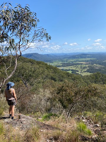
Point Glorious
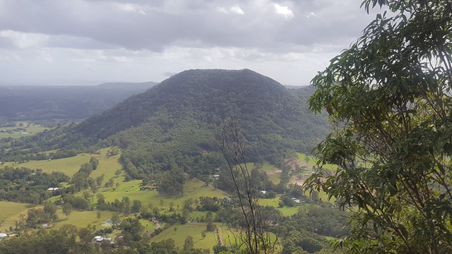
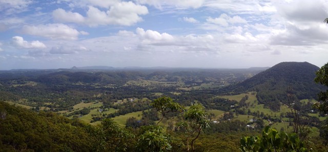
A walk in along a forest road, with the reward of wonderful views of the surroundings from the lookout, including Mt Eewah, which at 422m is just 2km in front of you.
 16
km
return
4
hrs
16
km
return
4
hrs
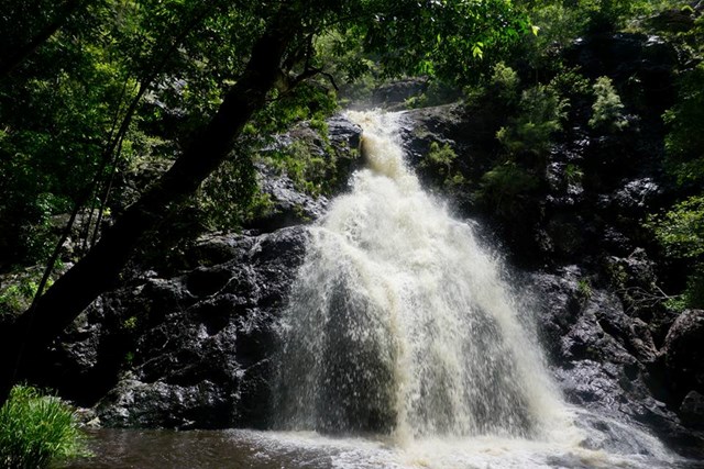
Sam Kelly Road to Gheerulla Falls
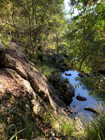
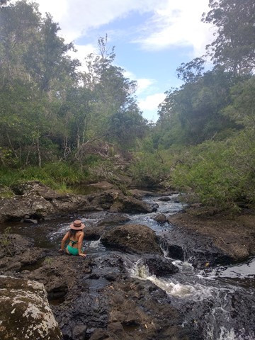
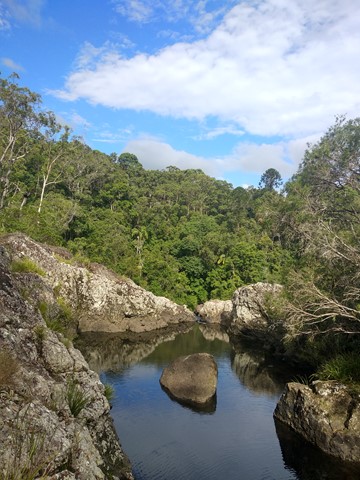
A easy to moderate hike which roughly follows the course of Gheerulla Creek to Gheerulla Falls. Experience changing habitats as you leave the cool, valley floor to skirt the hills, pass through eucalypt forest and then return to rain forest. You will pass deviations to Thilba Thalba walkers’ camp and later to Ubajee walkers’ camp, but keep going straight ahead, following the signs to the waterfall. Return by the same route. There are several water holes which may provide swimming opportunities.