
Menu
Popular Walks
-
Mt Ngungun
(1151 ticks) -
Mount Coolum
(869 ticks) -
Mt Cordeaux
(665 ticks) -
Twin Falls Circuit
(635 ticks) -
Purling Brook Falls Circuit
(610 ticks)
Parent Regions
Sub-Regions
- Amamoor State Forest
- Bellthorpe National Park
- Brisbane City Council Local Walks
- Brisbane Forest park D'Aguilar National Park
- Brisbane Valley Rail Trail
- Coombabah Lakelands Conservation Area
- Daisy Hill Conservation Park
- Eumundi Conservation Park
- Glass House Mountains National Park
- Glen Rock Regional Park
- Gold Coast
- Ipswich
- Jimna State Forest
- Karawatha Forest
- Kondalilla National Park
- Lamington National Park
- Main Range National Park
- Mapleton National Park
- Moggill Conservation Park
- Moogerah Peaks National Park
- Moreton Island National Park
- Mt Barney National Park
- North Stradbroke Island - Minjeeribah
- Parklands Conservation Park
- Springbrook National Park
- Sunshine Coast
- Tamborine National Park
- White Rock - Spring Mountain Conservation Estate
Summary
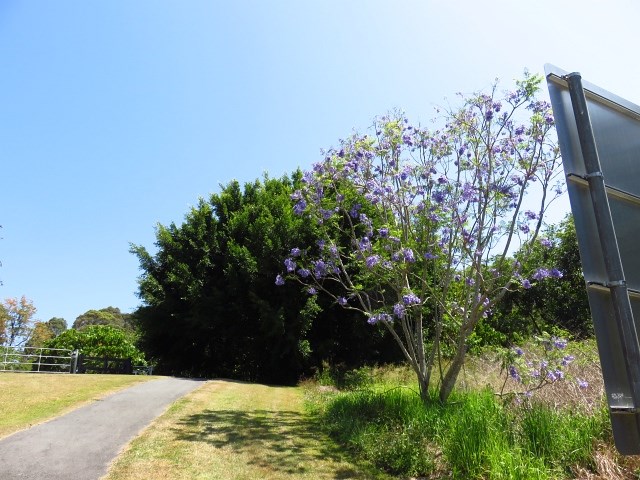
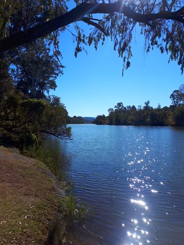
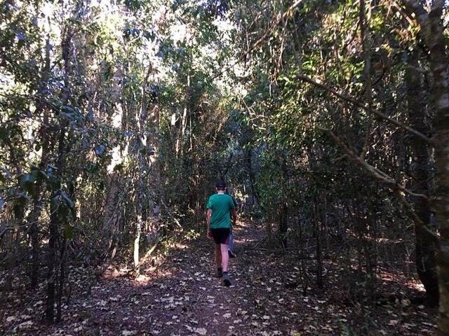
Boarding NSW and the pacific Ocean, it is not uncommon for hikes to have views of both worlds (ocean and hinterland). Hikes here are typically on the great dividing range.
Popular Walks
-
Mt Ngungun
(1151 ticks) -
Mount Coolum
(869 ticks) -
Mt Cordeaux
(665 ticks) -
Twin Falls Circuit
(635 ticks) -
Purling Brook Falls Circuit
(610 ticks)
Parent Regions
Sub-Regions
- Amamoor State Forest
- Bellthorpe National Park
- Brisbane City Council Local Walks
- Brisbane Forest park D'Aguilar National Park
- Brisbane Valley Rail Trail
- Coombabah Lakelands Conservation Area
- Daisy Hill Conservation Park
- Eumundi Conservation Park
- Glass House Mountains National Park
- Glen Rock Regional Park
- Gold Coast
- Ipswich
- Jimna State Forest
- Karawatha Forest
- Kondalilla National Park
- Lamington National Park
- Main Range National Park
- Mapleton National Park
- Moggill Conservation Park
- Moogerah Peaks National Park
- Moreton Island National Park
- Mt Barney National Park
- North Stradbroke Island - Minjeeribah
- Parklands Conservation Park
- Springbrook National Park
- Sunshine Coast
- Tamborine National Park
- White Rock - Spring Mountain Conservation Estate
History
Any interesting history for the region?
Features
What are the standout bushwalking features?
Access
How do you get there? Include all access points if there are many?
Maps
Which maps cover the region?
Accommodation
Where can I stay there? or near there?
Camping
Council Areas:
- Scenic Rim Regional
- Gold Coast City
- Logan City
- Redland City
- Ipswich City
- Lockyer Valley Regional
- Brisbane City
- Somerset Regional
- Moreton Bay Regional
- Sunshine Coast Regional
- Noosa Shire
Contact details
See Qld National parks website
Walks in Gold Coast

 3.5
km
return
3.5
km
return
 45
mins
45
mins
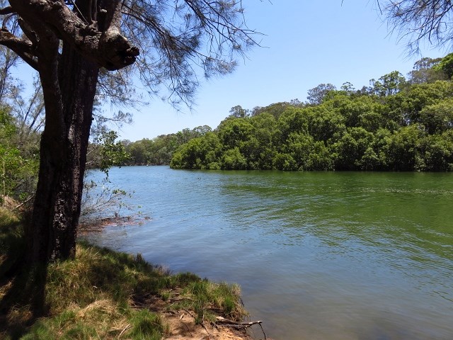
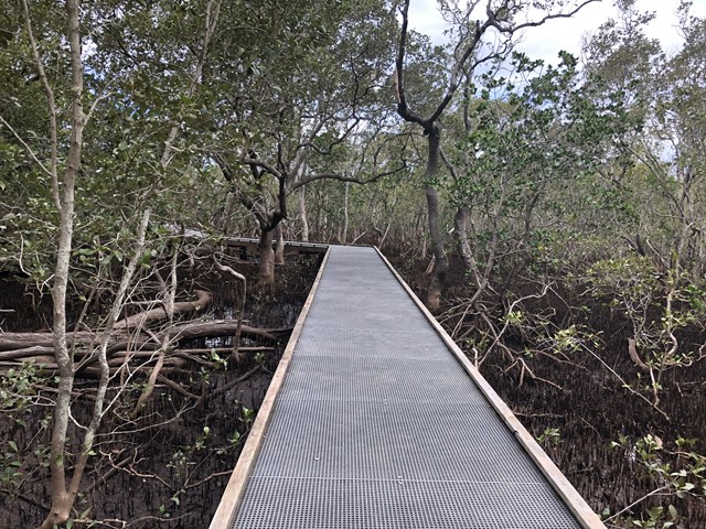
Schuster Park
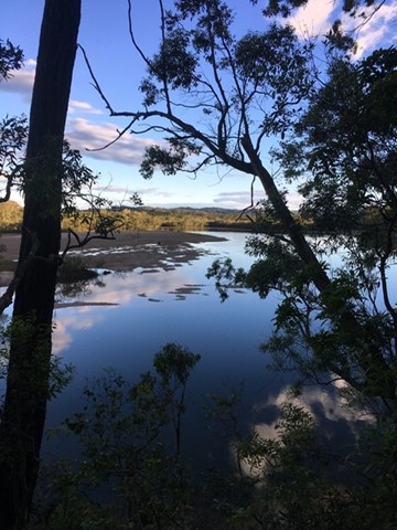
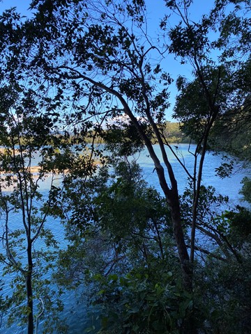
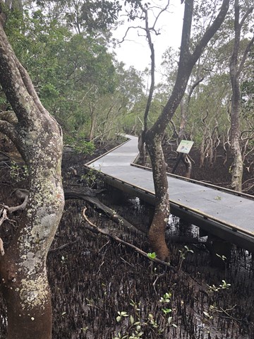
Schusters Park is a great spot to take the kids for a quick walk or stay the day for a picnic by the creek. There is lots of room to run around, and a sandy beach to launch kayaks from. Put on some mozzie repellent before exploring the flat trail through the mangroves along the northern peninsula of the park.
 800
m
return
40
mins
800
m
return
40
mins
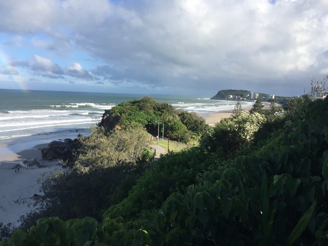
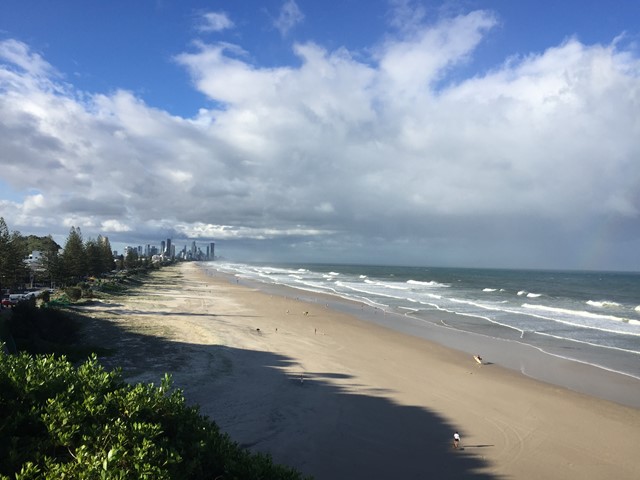
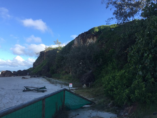
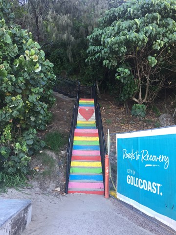
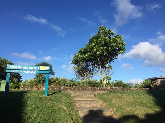
South Nobby Headland
A walk on South Nobby Headland also referred to as Little Burleigh or North Burleigh Headland which is within Mick Schamburg Park . The walk links to Miami Beach via Don Macsween Park and North Burleigh Beach via Ed Hardy Park while enjoying many lookout points with views North to Surfers, East to the Pacific Ocean, South to Burleigh Heads and West to the Gold Coast Hinterland. As well as traversing the Miami Rainbow Stairs.
 8
km
return
2
hrs
8
km
return
2
hrs
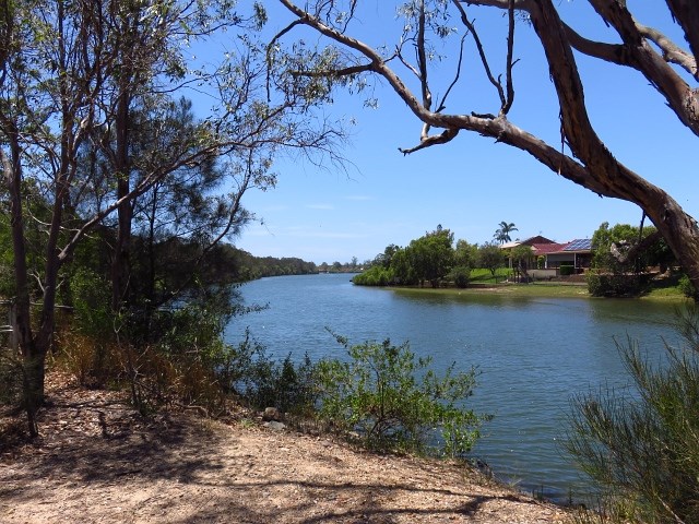
Tallebudgera Creek Circuit
This is a pristine waterway, one of the ‘must do walking tracks’ on the Gold Coast
 2.5
km
return
45
mins
2.5
km
return
45
mins
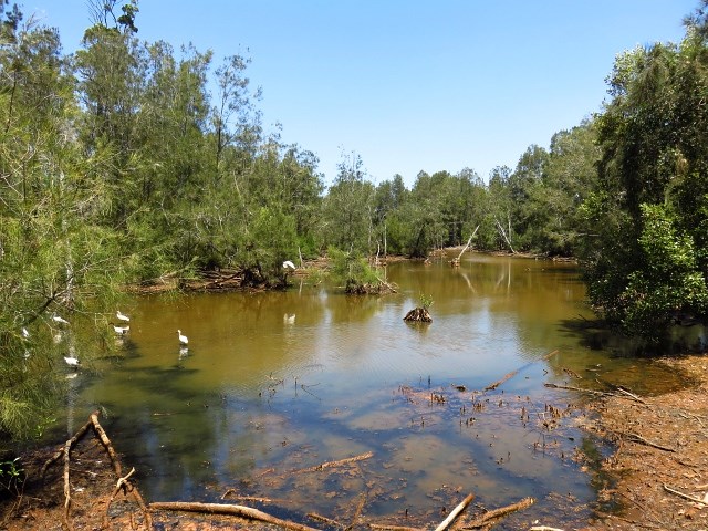
Tugun Hill Conservation Area
The Tugun Hill Conservation Area is approximately 16 hectares and is managed for conservation purposes.
Walks in Ipswich
2
km
return
1
hr
Kholo Gardens (Multiple Tracks)
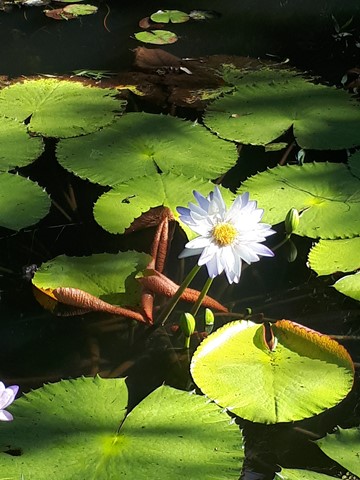
A picturesque retreat into nature seven kilometres from the Ipswich Central Business District is the peaceful Kholo Gardens at Pine Mountain. It’s an unexpected delight to explore with its lush gardens, crystal clear lily pond, bush walks and open spaces. Giant Kauri trees and Hoop Pines planted by early settlers, rare birds and plants, and the nearby Brisbane River all make this a special place to spend some time. It’s also a sacred site for the indigenous Jagera, Yuggera and Ugarapul People.
At this subtropical haven, you can enjoy the peace and quiet of the 400 metre walk through Tree Fern Lane under a natural rainforest canopy. The more energetic can try the steeper 800 metre Coal Creek Walk – aptly named seeing as the earliest recordings of coal in the area were made here in 1825.
Formerly the site of a water pumping station, Kholo Gardens has an historic well onsite as well as a charming little old church, relocated here in 1990 from Redbank. With that and a stunningly restored Queenslander nearby, you can see why this is a popular venue for weddings and other functions. There are also barbecues, picnic tables and public toilets.
 2.1
km
return
1
hr
2.1
km
return
1
hr
Lewis Thomas Historic Trail - Castle Hill Blackstone Reserve
A short walk around the Castle Hill Blackstone Reserve with informational signage on the interesting history of the area (coal mining & Welsh mansion "castle"). A detour can be made up to the summit of the hill (add an extra kilometre and a bit return).
Walks in Jimna State Forest
3.2
km
return
1
hr
Araucaria Circuit
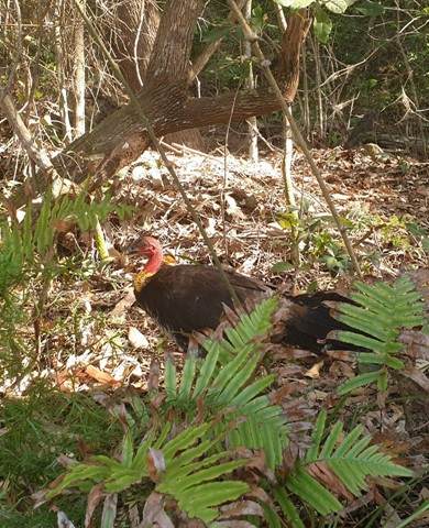
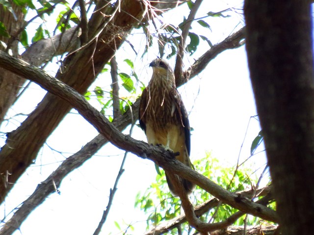
The Araucaria walk, the longest of the the two walks in the Jimna State Forest, begins with a short walk across a suspension bridge at the end of the camping ground. The 3.2km walk takes about an hour and takes you through open bushland at the start into a hoop pine/dry rain forest. As it winds through the forest, you ascend gently and walk around a dry river gorge. There's plenty of bird watching in the early morning and late afternoon. Look for (and hear) bell miners (bellbirds), finches, sulphur crested cockatoos, Australian wood ducks and wood swallows and many more species. Staghorns and elkhorns can be seen in part of the rainforest. Move back into grassland before reaching the suspension bridge.
**Updated Oct 2024: This walk has been closed and suspension bridge removed
 700
m
return
20
mins
700
m
return
20
mins
Yabba Creek Circuit
A short easy walk along the banks of Yabba Creek at Jimna State Forest camping area. Loads of birds to see and hear.