
Menu
Popular Walks
-
Mt Ngungun
(1151 ticks) -
Mount Coolum
(869 ticks) -
Mt Cordeaux
(665 ticks) -
Twin Falls Circuit
(635 ticks) -
Purling Brook Falls Circuit
(610 ticks)
Parent Regions
Sub-Regions
- Amamoor State Forest
- Bellthorpe National Park
- Brisbane City Council Local Walks
- Brisbane Forest park D'Aguilar National Park
- Brisbane Valley Rail Trail
- Coombabah Lakelands Conservation Area
- Daisy Hill Conservation Park
- Eumundi Conservation Park
- Glass House Mountains National Park
- Glen Rock Regional Park
- Gold Coast
- Ipswich
- Jimna State Forest
- Karawatha Forest
- Kondalilla National Park
- Lamington National Park
- Main Range National Park
- Mapleton National Park
- Moggill Conservation Park
- Moogerah Peaks National Park
- Moreton Island National Park
- Mt Barney National Park
- North Stradbroke Island - Minjeeribah
- Parklands Conservation Park
- Springbrook National Park
- Sunshine Coast
- Tamborine National Park
- White Rock - Spring Mountain Conservation Estate
Summary
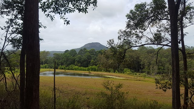
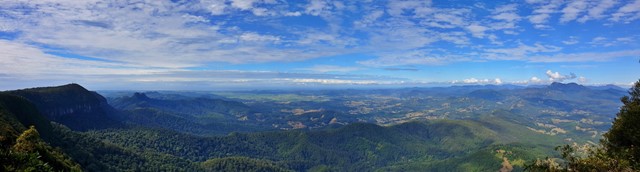
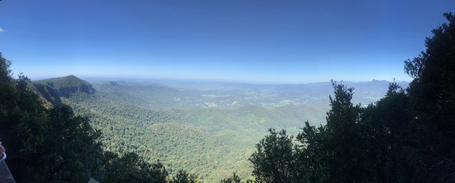
Boarding NSW and the pacific Ocean, it is not uncommon for hikes to have views of both worlds (ocean and hinterland). Hikes here are typically on the great dividing range.
Popular Walks
-
Mt Ngungun
(1151 ticks) -
Mount Coolum
(869 ticks) -
Mt Cordeaux
(665 ticks) -
Twin Falls Circuit
(635 ticks) -
Purling Brook Falls Circuit
(610 ticks)
Parent Regions
Sub-Regions
- Amamoor State Forest
- Bellthorpe National Park
- Brisbane City Council Local Walks
- Brisbane Forest park D'Aguilar National Park
- Brisbane Valley Rail Trail
- Coombabah Lakelands Conservation Area
- Daisy Hill Conservation Park
- Eumundi Conservation Park
- Glass House Mountains National Park
- Glen Rock Regional Park
- Gold Coast
- Ipswich
- Jimna State Forest
- Karawatha Forest
- Kondalilla National Park
- Lamington National Park
- Main Range National Park
- Mapleton National Park
- Moggill Conservation Park
- Moogerah Peaks National Park
- Moreton Island National Park
- Mt Barney National Park
- North Stradbroke Island - Minjeeribah
- Parklands Conservation Park
- Springbrook National Park
- Sunshine Coast
- Tamborine National Park
- White Rock - Spring Mountain Conservation Estate
History
Any interesting history for the region?
Features
What are the standout bushwalking features?
Access
How do you get there? Include all access points if there are many?
Maps
Which maps cover the region?
Accommodation
Where can I stay there? or near there?
Camping
Council Areas:
- Scenic Rim Regional
- Gold Coast City
- Logan City
- Redland City
- Ipswich City
- Lockyer Valley Regional
- Brisbane City
- Somerset Regional
- Moreton Bay Regional
- Sunshine Coast Regional
- Noosa Shire
Contact details
See Qld National parks website

 400
m
return
400
m
return
 40
mins
40
mins
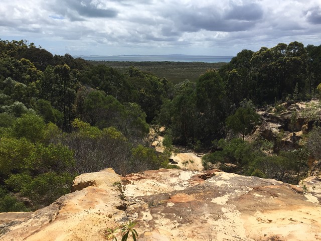
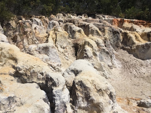
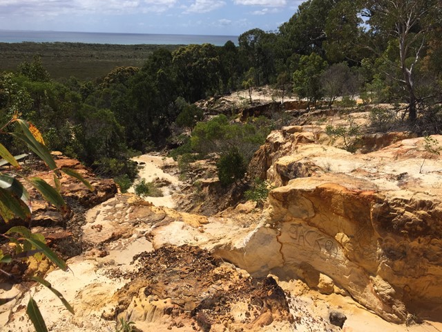
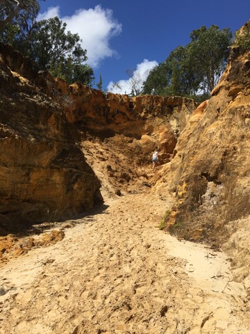
North Stradbroke Island Sand Cliffs
A short walk through some interesting coloured sand cliffs. Follow the path and then go up the gorge on the left hand side up to the maze like area which has views out to the water.
 10
km
return
2.5
hrs
10
km
return
2.5
hrs
Point Lookout to Keyholes
Start from Point Lookout and walk southward down the beach till a sign in the dunes where you head in land for about 100m to the keyholes. Then head back to Point Lookout same way.
Look out for 4WDs
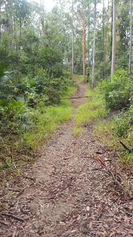
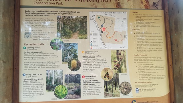
Walks in Parklands Conservation Park
5.3
km
return
90
mins
Coobong Circuit
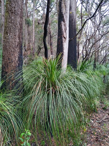
Travel through open eucalypt forest where bloodwood and tallowwood trees are common and banksias, wattles, grass trees and hopbush grow in the forest understory.
In more protected, wetter areas, the forest features flooded gum, turpentine, cabbage tree palm, piccabeen palm, stinging tree and some rainforest plants. You will cross two small creeks and pass bee hives on this circuit.
 11
km
return
2.5
hrs
11
km
return
2.5
hrs
Komine Circuit
Cooler winter months are the best time to explore this circuit. It winds through open scribbly gum forest and includes large sections of track with little shade.
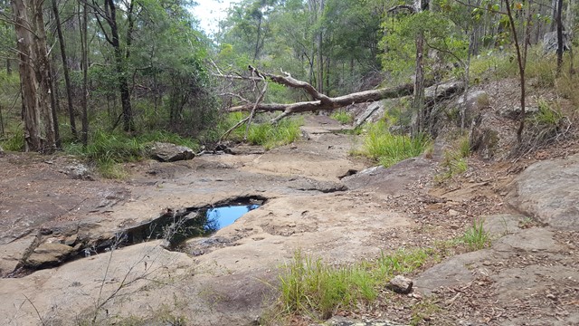
A number of creeks lead to rock pools and cascades, which flow after heavy rainfall.
 7.8
km
return
2
hrs
7.8
km
return
2
hrs
Lemon Tree Circuit
Similar to the Rocky Creek circuit, this track includes dry, rocky ridges. Some sections are more exposed, making the dry open forest a hotter area through which to travel, especially during the warmer summer months.
 5.4
km
return
90
mins
5.4
km
return
90
mins
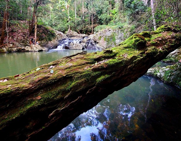
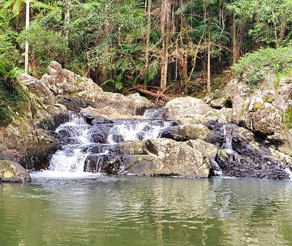
Rocky Creek Circuit
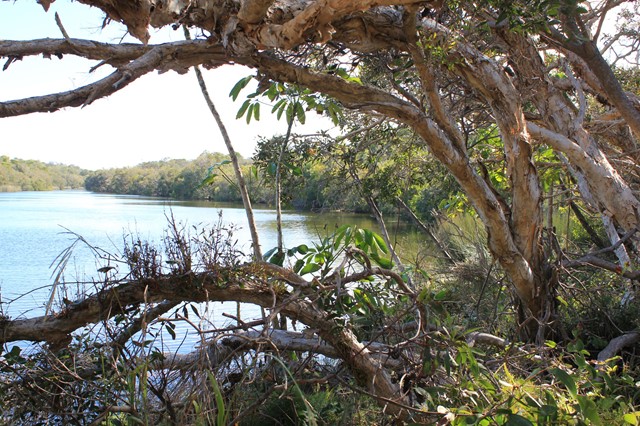
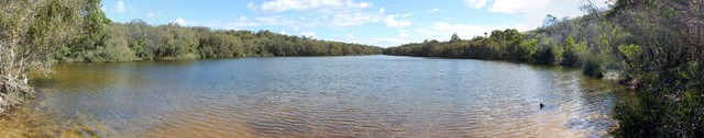
Parklands Regional Park is a valuable wildlife habitat with vegetation ranging from eucalypt forests of bloodwood and tallowwood trees (with banksia, wattle and grass tree understorey) to rainforest gullies with flooded gum, turpentine and, in protected wetter areas, groves of palms.
A number of creeks lead to rock pools and cascades, which flow after heavy rainfall.
Walks in Springbrook National Park
2.9
km
return
1
hr
Apple Tree Park North and South Trails
A short walk in the forest from Apple Tree Park with views through the trees to Numinbah Valley.
 6
km
return
3
hrs
6
km
return
3
hrs
Apple Tree Park to Little Nerang Creek Falls
Start from the car park at Apple Tree Park. Cross the road and decend down the fire trail until you find the NP TRAIL entrance on your left. Decend down to Creek crossing, waterfall and swimming holes. Climb back up the way you came, climbing the equivalent of a 61 story building.
This walk eventually links to the Warringa Pool Track which leads onto the Purling Brook Falls Circuit and is the route taken by the Gold Coast Hinterland Great Walk.
 700
m
return
30
mins
700
m
return
30
mins
Best Of All Lookout
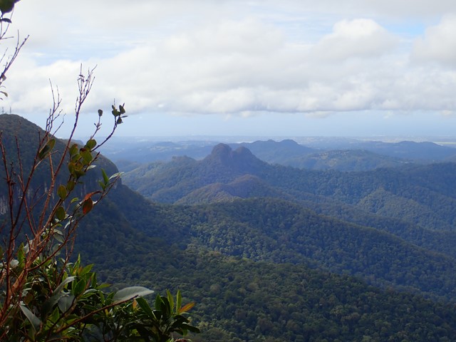
It makes lofty claims... and meets them! This short walk is well worth the effort with excellent views of the Tweed Valley including Mt Warning, Byron Bay and The Cougals. Plus, it includes one of the most accessible stands of Antarctic Beech Forest (Nothofagus Moorei) in Queensland. If you haven't been there, make sure to stop off next time you're on the plateau.
 6
km
return
3.5
hrs
6
km
return
3.5
hrs
Boyds Butte - from Cougal Cascade
A relatively short walk, but challenging, rainforest walk, with great views as a reward. You'll need a GPS app, or good off-track navigational skills in places.