
Menu
Popular Walks
-
Mt Ngungun
(1151 ticks) -
Mount Coolum
(869 ticks) -
Mt Cordeaux
(665 ticks) -
Twin Falls Circuit
(635 ticks) -
Purling Brook Falls Circuit
(610 ticks)
Parent Regions
Sub-Regions
- Amamoor State Forest
- Bellthorpe National Park
- Brisbane City Council Local Walks
- Brisbane Forest park D'Aguilar National Park
- Brisbane Valley Rail Trail
- Coombabah Lakelands Conservation Area
- Daisy Hill Conservation Park
- Eumundi Conservation Park
- Glass House Mountains National Park
- Glen Rock Regional Park
- Gold Coast
- Ipswich
- Jimna State Forest
- Karawatha Forest
- Kondalilla National Park
- Lamington National Park
- Main Range National Park
- Mapleton National Park
- Moggill Conservation Park
- Moogerah Peaks National Park
- Moreton Island National Park
- Mt Barney National Park
- North Stradbroke Island - Minjeeribah
- Parklands Conservation Park
- Springbrook National Park
- Sunshine Coast
- Tamborine National Park
- White Rock - Spring Mountain Conservation Estate
Summary
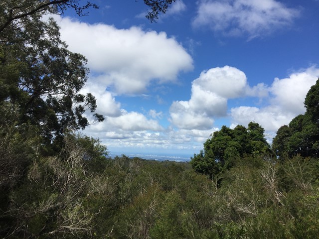
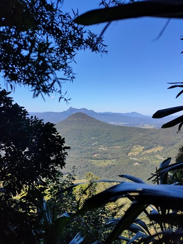
Boarding NSW and the pacific Ocean, it is not uncommon for hikes to have views of both worlds (ocean and hinterland). Hikes here are typically on the great dividing range.
Popular Walks
-
Mt Ngungun
(1151 ticks) -
Mount Coolum
(869 ticks) -
Mt Cordeaux
(665 ticks) -
Twin Falls Circuit
(635 ticks) -
Purling Brook Falls Circuit
(610 ticks)
Parent Regions
Sub-Regions
- Amamoor State Forest
- Bellthorpe National Park
- Brisbane City Council Local Walks
- Brisbane Forest park D'Aguilar National Park
- Brisbane Valley Rail Trail
- Coombabah Lakelands Conservation Area
- Daisy Hill Conservation Park
- Eumundi Conservation Park
- Glass House Mountains National Park
- Glen Rock Regional Park
- Gold Coast
- Ipswich
- Jimna State Forest
- Karawatha Forest
- Kondalilla National Park
- Lamington National Park
- Main Range National Park
- Mapleton National Park
- Moggill Conservation Park
- Moogerah Peaks National Park
- Moreton Island National Park
- Mt Barney National Park
- North Stradbroke Island - Minjeeribah
- Parklands Conservation Park
- Springbrook National Park
- Sunshine Coast
- Tamborine National Park
- White Rock - Spring Mountain Conservation Estate
History
Any interesting history for the region?
Features
What are the standout bushwalking features?
Access
How do you get there? Include all access points if there are many?
Maps
Which maps cover the region?
Accommodation
Where can I stay there? or near there?
Camping
Council Areas:
- Scenic Rim Regional
- Gold Coast City
- Logan City
- Redland City
- Ipswich City
- Lockyer Valley Regional
- Brisbane City
- Somerset Regional
- Moreton Bay Regional
- Sunshine Coast Regional
- Noosa Shire
Contact details
See Qld National parks website
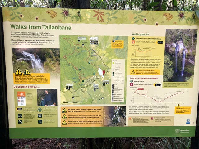
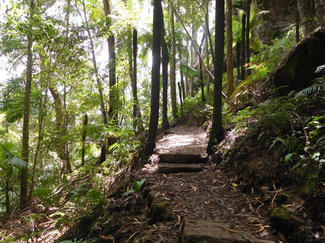
Walks in Springbrook National Park

 100
m
return
100
m
return
 5
mins
5
mins
Buliya-Buliya Jagun Boardwalk
Visit Gauriemabah - place of stories, at the old schoolhouse, and discover the many tales of Springbrook. Take a short walk along Buliya-Buliya Jagun Boardwalk look and listen for the many little birds along your way to the lookout.
 4.2
km
return
2
hrs
4.2
km
return
2
hrs
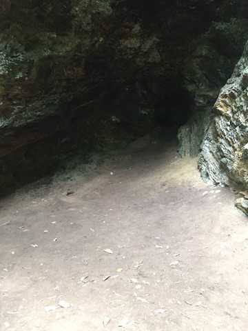
Bushrangers Cave
An off-track walk from the border gate to Bushrangers Caves, which used to be an aboriginal camp. The adventurous can head on up Mt Wagawn to join up with the main Lamington track system.
 1.6
km
return
1
hr
1.6
km
return
1
hr
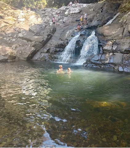
Cougal Cascades
A short walk next to Currumbin Creek. Great for a short walk not too far from the Gold Coast or for cooling off on a hot day (without the sand and salt of the sea).
There are plenty of fantastic swimming holes further up the cascades if you don't mind a 20min walk upstream .
 14.5
km
return
6
hrs
14.5
km
return
6
hrs
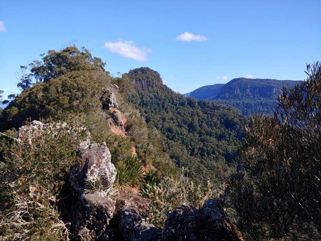
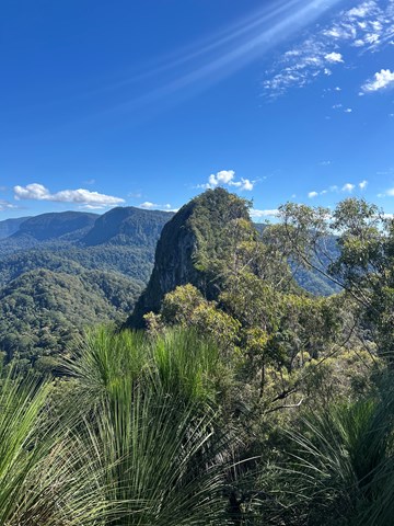
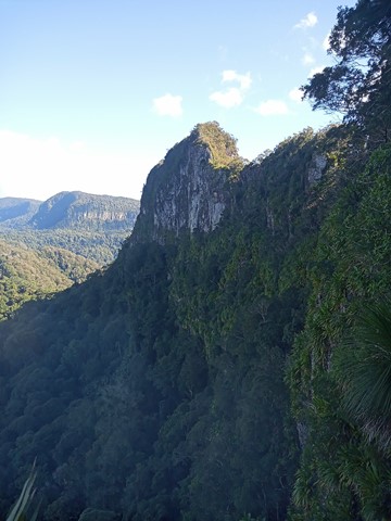
Cougal Cascades to Boyd’s Butte and Mt Cougal East Peak
A circuit walk from Cougal Cascades to Boyd's Butte and Mt Cougal. Includes views from both peaks.
 4.4
km
return
90
mins
4.4
km
return
90
mins
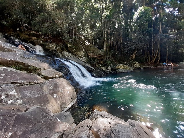
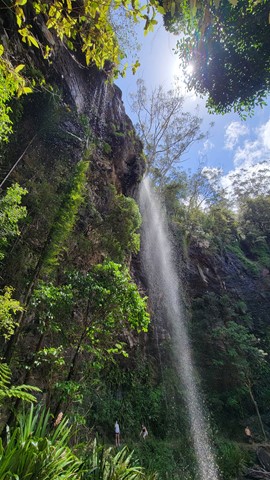
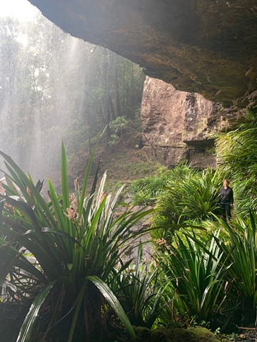
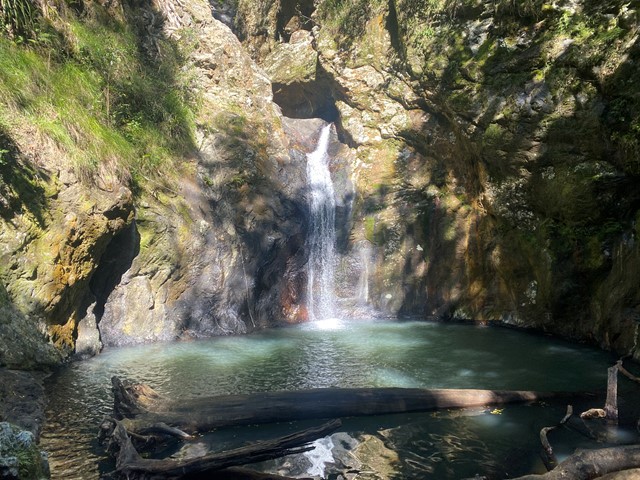
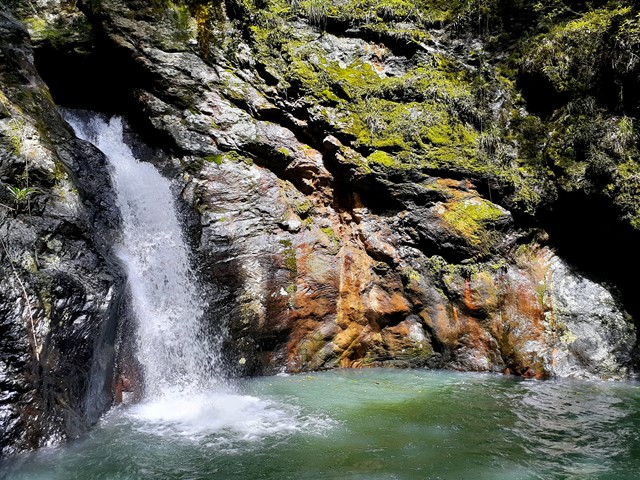
Goomoolahra Falls and Rainbow Falls
No need to complete the full 14 kilometre Warrie circuit, but instead walk 3 kilometres (of the 17 km track) and see at least 3 waterfalls. You are walking along the side of the cliff with sheer drops below and rock faces above.
Very picturesque and one of the nicest walks in Springbrook National Park. Not to be confused with the view of the Goomoolahra Falls from above.
 600
m
return
10
mins
600
m
return
10
mins
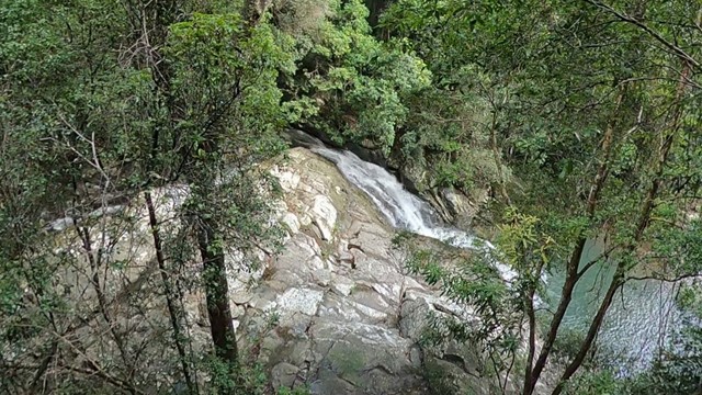
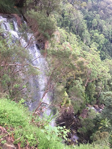
Goomoolahra Falls Lookout Track
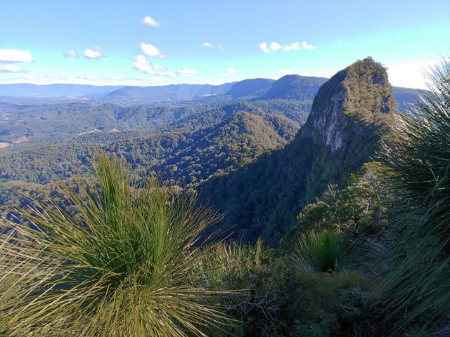
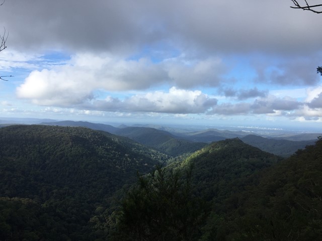
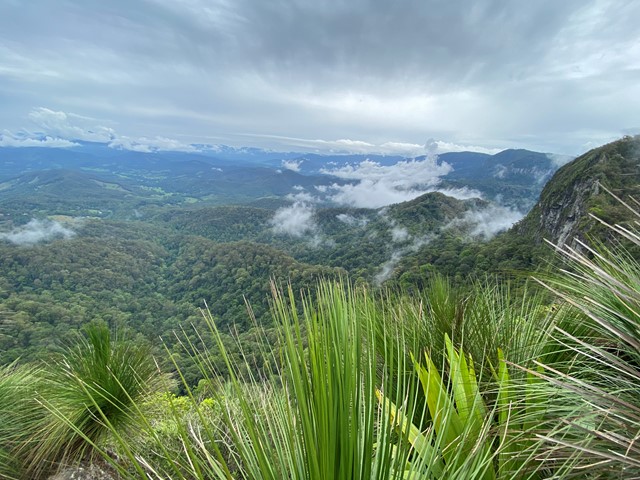
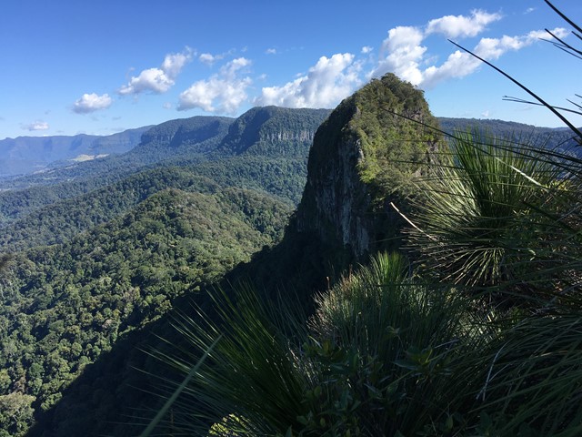
Picnic area with a view. Wheelchair friendly track to a stunning view of the top of Goomoolahra Falls with the warrie circuit track below and views of the Springbrook Pinnacle and out to the coast and the general hinterland.
 4
km
return
2
hrs
4
km
return
2
hrs
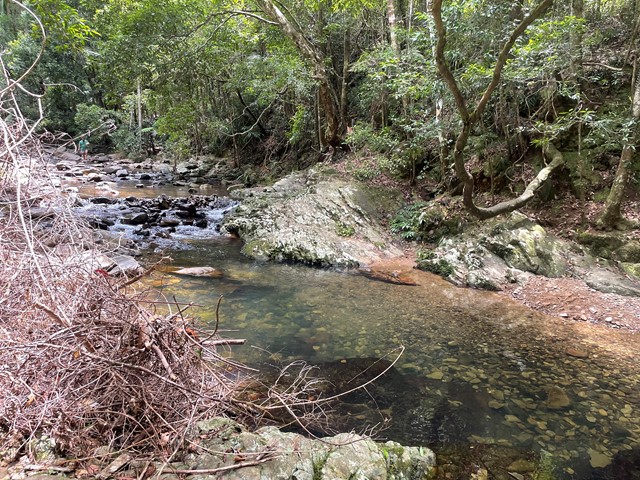
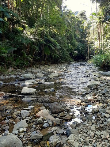
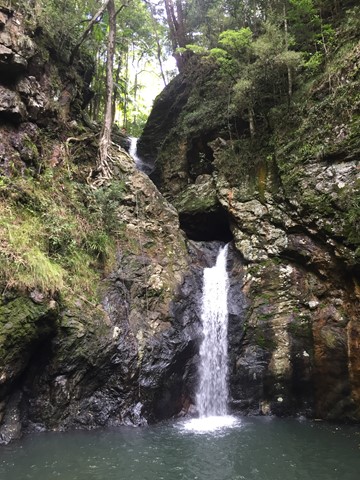
Gorge Falls
Gorge Falls is a 5.6km return walk along the Cream Track, beginning at the end of Tallebudgera Creek Road.
When you reach the cream track signpost that takes you up some man made steps bear left and follow the path to the left to get to the falls. The track seems to disappear a few times but just continue along the edge of the creek and you keep finding it.
 10.5
km
return
4
hrs
10.5
km
return
4
hrs
Little Nerang Creek, Purlingbrook Falls, Road return
This walk incorporates parts of the Gold Coast Hinterland Great Walk and the Purlingbrook Falls circuit to see spectacular waterfalls and beautiful rainforest, and it has some great waterholes if it's a hot day!
 2
km
return
1
hr
2
km
return
1
hr
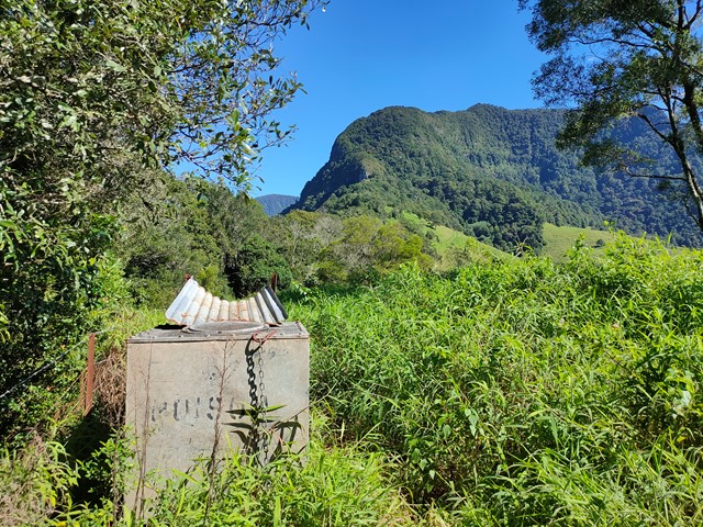
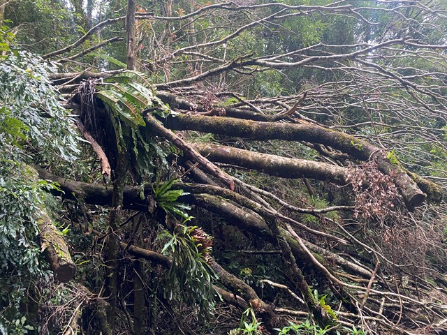
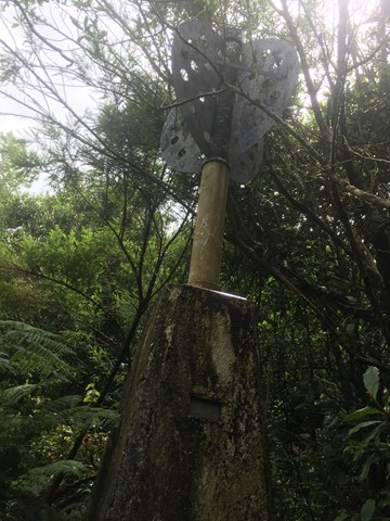
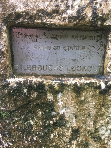
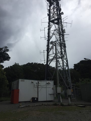
Mount Thillinmam (Bilbroughs Lookout)
A 4wd track through rainforest to Mount Thillinmam (958m). Mount Thillinmam has multiple repeater towers and limited views.
 10
km
5
hrs
10
km
5
hrs
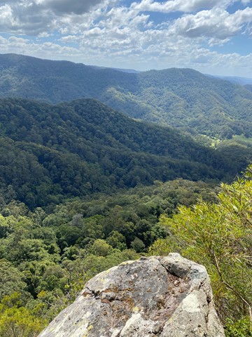
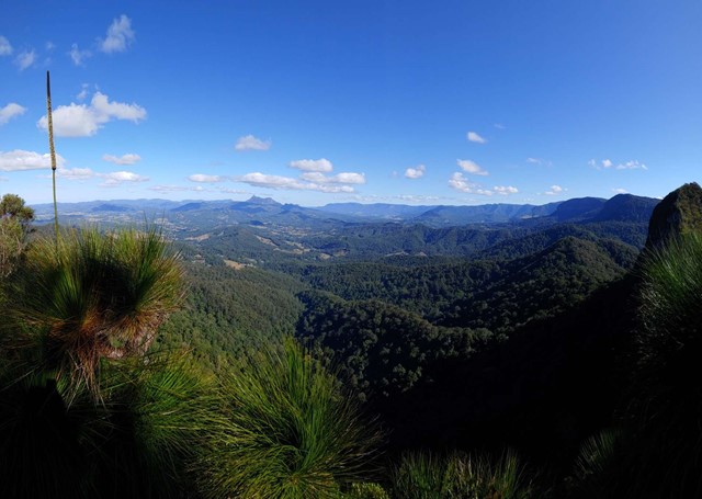
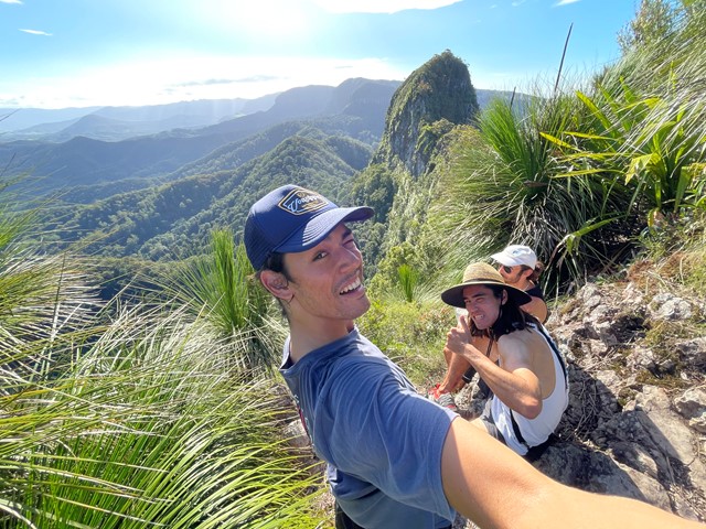
Mt Cougal
A walk along the border fence line to the twin summits of Mt Cougal. There are excellent views from the top!
It is hard for beginners. Make sure you check weather. Finding location is a little hard. When arrive see steel gate that states ‘please keep gate clear ta’ On side of gate you can enter, when pass the gate look to your left and see sign with with instructions. Don’t be discouraged when you start, it is a little scary, but it gets easier, but still lots of hill. Follow the barbed wired fence on your left the whole way. The track will go from very narrow to comfortable in some places. Once you reach the last 700 metres or so... it becomes much harder. You will see a thin rope to guide you - do not use this to pull you up as it will break!! You will come to a spot where the track will seem to end. Look for a tree that has arrows etched into it to guide you where to go. There’s also a small pink ribbon tied to a tree branch Up further. You have to go up! It’s hard but worth it.