
Menu
Popular Walks
-
Mt Ngungun
(1138 ticks) -
Mount Coolum
(858 ticks) -
Mt Warning Summit Trail
(758 ticks) -
Mt Cordeaux
(655 ticks) -
Twin Falls Circuit
(625 ticks)
Popular Walks
-
Mt Ngungun
(1138 ticks) -
Mount Coolum
(858 ticks) -
Mt Warning Summit Trail
(758 ticks) -
Mt Cordeaux
(655 ticks) -
Twin Falls Circuit
(625 ticks)
Sub-Regions
Walks in Cania Gorge National Park
(Wide Bay Burnett, Queensland)
 8
km
return
8
km
return
 6
hrs
6
hrs
Shamrock Mine to Castle Mountain Lookout
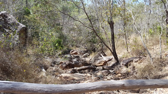
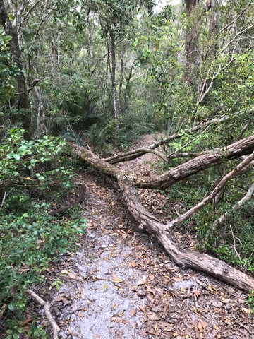
This walk follows a creek bed to the rock face, where you need to climb a dry waterfall, before using navigational skills to reach the fire trail that takes you to the lookout that provides stunning views of the dam, lake and gorge.
 3
km
return
2
mins
3
km
return
2
mins
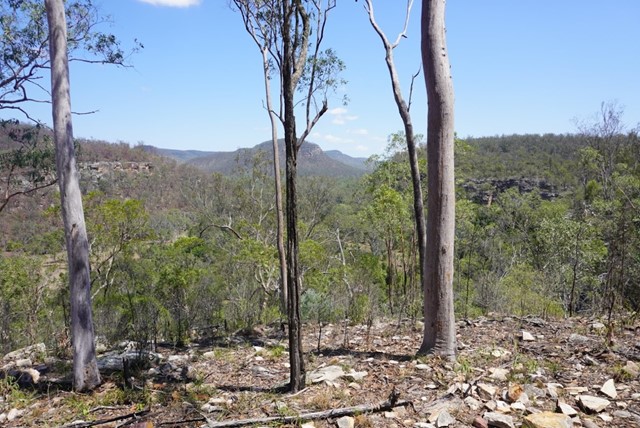
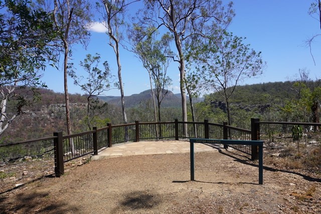
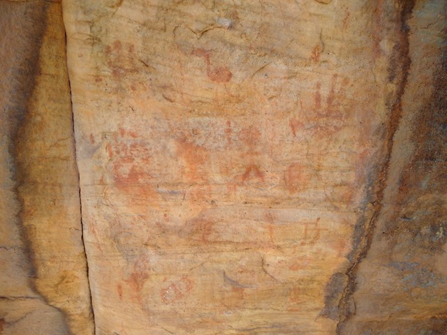
The Gorge Lookout
This lookout is off the Dragon Cave and Bloodwood Cave Walk (Approx 240 meters up from half way along the walk)
 1.5
km
return
1
hr
1.5
km
return
1
hr
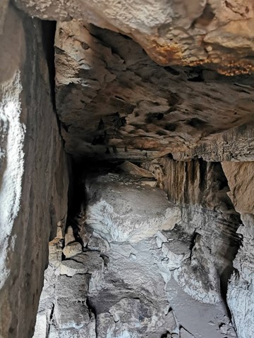
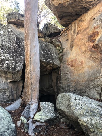
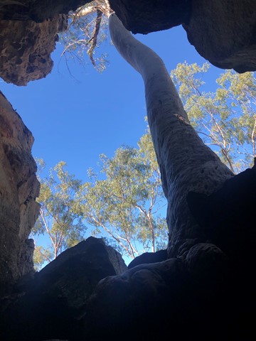
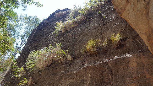
Two Storey Caves Circuit
An easy loop walk that takes in King Orchid Crevice and the Two Storey Caves.
Walks in Great Sandy National Park
(Wide Bay Burnett, Queensland)
5.6
km
return
2
hrs
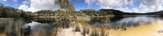
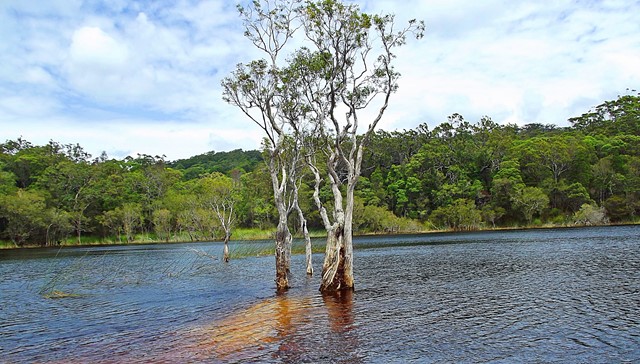
Basin Lake
Walk through lush rainforest and woodlands to what is regarded by many as the island’s most beautiful lake.
21
km
return
6
hrs
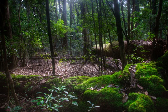
Bymien Day Use Area to Freshwater Campground
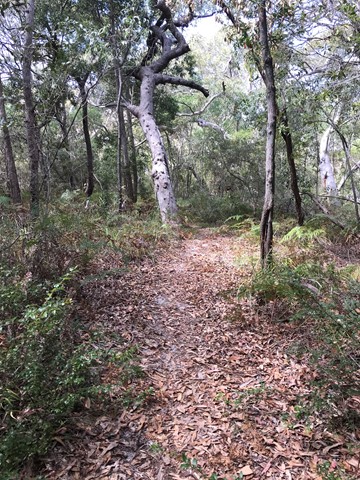
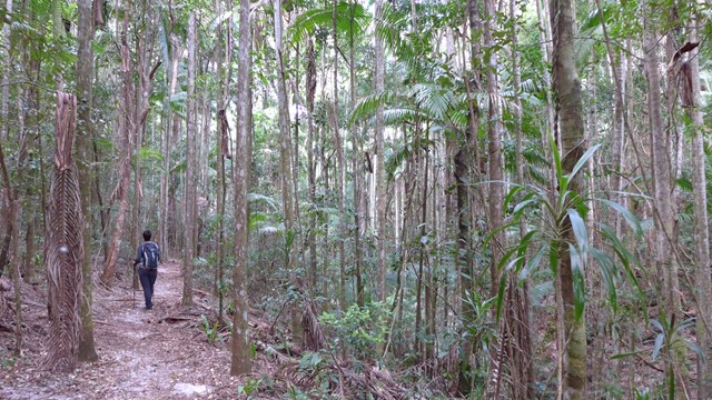
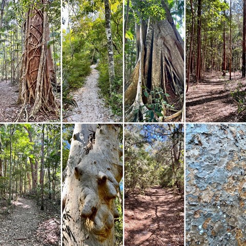
A wonderful walk through rainforest, kauri and hoop pines, Piccabeen and strangler figs. The walk is pretty straightforward with gentle inclines and descents over a mostly sandy base. Stop at Poona Lake for a swim and then continue on to Freshwater Lake then Freshwater campground before returning via the same track... Or leave Bymien Day Use area and head straight to Freshwater Campground for lunch then visit Freshwater Lake on your way back to Bymien. The track is well signed the entire way.
 12
km
return
4
hrs
12
km
return
4
hrs
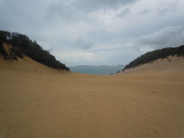
Camp site 3 to Cooloola sandpatch
Trail ap the hill through mostly banksia bush. Loose sand, quite hot in summer.
20
km
return
7
hrs
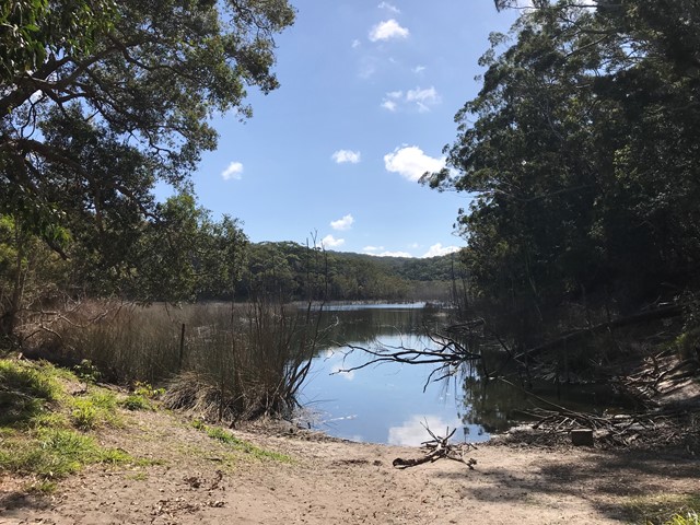
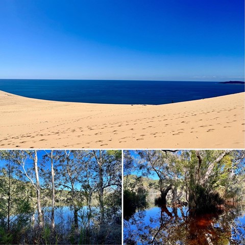
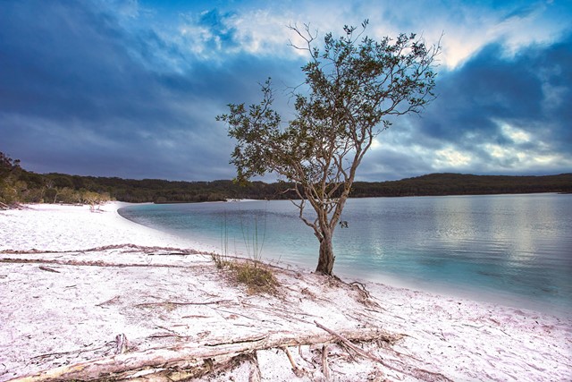
Carlo Sand Blow to Poona Lake
This walk is part of the Cooloola Great Walk. Starting from the Carlo Sand Blow car park at Rainbow Beach, its a short 10 min walk to the Carlo Sand Blow. From there cross the sand blow to the other side and continue along the track. It is well sign posted. At the 5km mark the track parts into 2. Follow the path to Poona lake which is another 5km. This track is a much smaller track, but is well defined. Take a swim and have lunch at the lake and then return via the same way.
 3.2
km
return
90
mins
3.2
km
return
90
mins
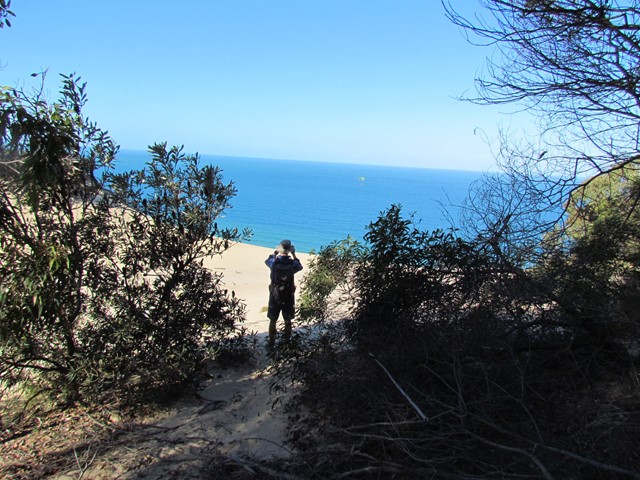
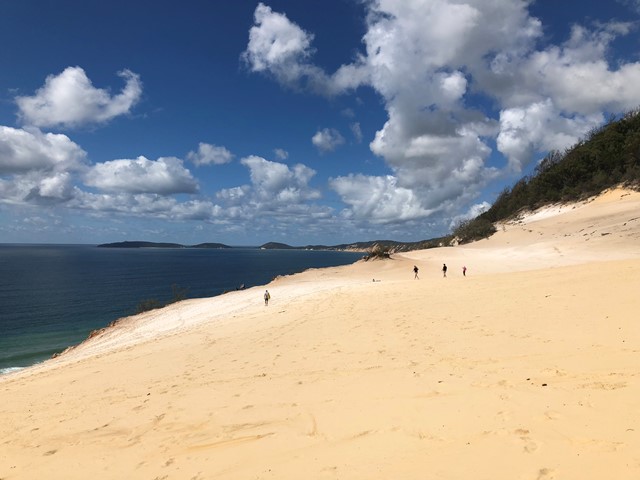
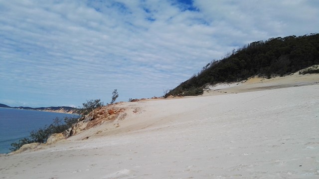
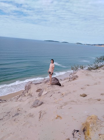
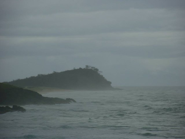
Carlo Sandblow
Named after one of Captain Cook's crew (Carlo), Carlo Sandblow provides magnificent 360° views. To the north is Fraser Island and Inskip Point and to the south the length of Rainbow Beach all the way to Double Island Point. Informative signs on the Sandblow are provided.
 14
km
one-way
5
hrs
14
km
one-way
5
hrs
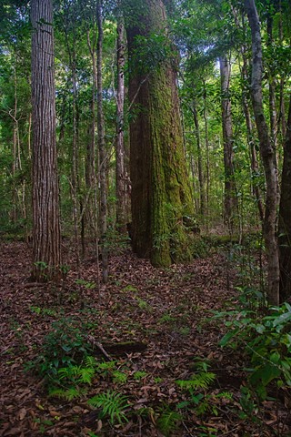
Central Station to Lake Mckenzie via Pile Valley
A walk from Central Station to Lake McKenzie via the rain forest at Pile Valley
 1.6
km
return
1
hr
1.6
km
return
1
hr
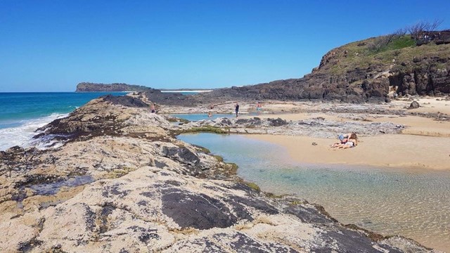
Champagne Pools Boardwalk
An nice boardwalk that leads from the car park to the Champagne Pools with a a viewing platform along the way. Located at the Northern tip of Fraser Island along 75 mile beach north of Indian Head. needless to say 4wd access only !