
Menu
Popular Walks
-
Bluff Knoll Summit
(10 ticks) -
Bibbulum Track
(5 ticks) -
Mount Bruce
(5 ticks) -
Mt Meharry
(3 ticks) -
Castle Rock and the Granite Skywalk
(3 ticks)
Sub-Regions
Summary
The biggest state in Australia sure has something to offer.
Popular Walks
-
Bluff Knoll Summit
(10 ticks) -
Bibbulum Track
(5 ticks) -
Mount Bruce
(5 ticks) -
Mt Meharry
(3 ticks) -
Castle Rock and the Granite Skywalk
(3 ticks)
Sub-Regions
Other Information
Contact details
Western Australia Parks and Wildlife Service:
https://parks.dpaw.wa.gov.au/
Regions
Walks in Western Australia

 15
km
return
15
km
return
 4
hrs
4
hrs
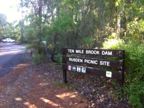
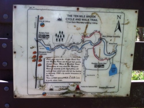
10 Mile Brook Trail
10 Mile Brook Trail is a pleasant walk or cycle out to 10 Mile Brook Dam, named after the tiny brook that was dammed in the mid-1990s to create a new supply of water for the quickly growing Margaret River and other townships.
 1000
km
77
days
1000
km
77
days
Bibbulum Track
This is a walk in planning for mid 2012 and I am looking for up to 3 walking partners. The pace will be gentle (I will be 57yo by then)and I have walked only 120km of the Alpine Track (Main Range and Jagungal)as experience. I am cautious in my expectations and will be well prepared. I am not, however, trying to break any records. I prefer people who are flexible in their attitudes, easy going, able to laugh at themselves and also able to leave any gung-ho male bravado at home!
200
m
return
Bloodwoods Lookout Trail (Purnulul National Park)
Bloodwoods Lookout is a short 200m return trail to views of the northern escarpment of the Bungle Bungle Range and surrounding woodland.
 135
km
one-way
6
days
135
km
one-way
6
days
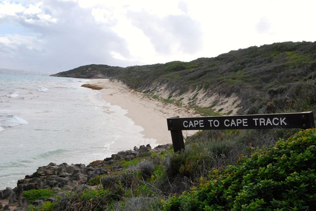
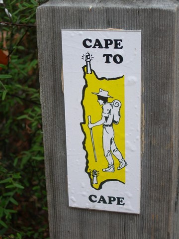
Cape to Cape Track
The track runs between the lighthouses of Cape Naturaliste and Cape Leeuwin. 135km. End to End 5-7 days. Hike all year round. Best time to hike Spring.
 4.4
km
return
2
hrs
4.4
km
return
2
hrs
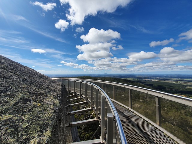
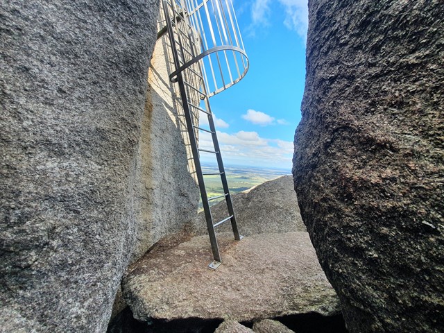
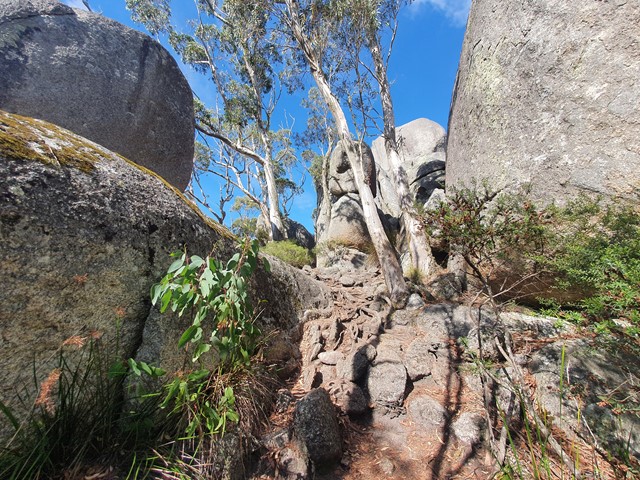
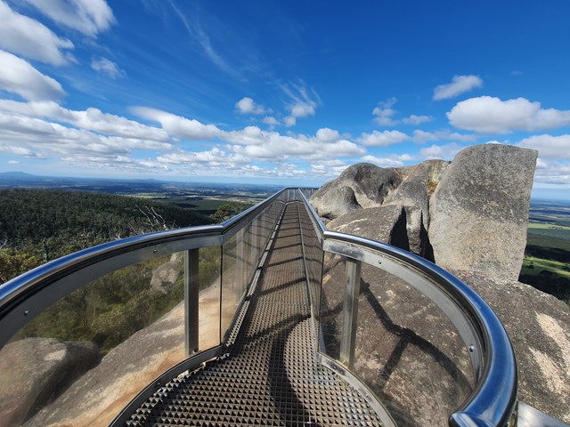
Castle Rock and the Granite Skywalk
A nice steady ascent to Castle Rock followed by a scramble up to the skywalk perched high on the top of the rock formation.
 2
km
return
2
km
return
Cathedral Gorge (Purnulul National Park)
Cathedral Gorge's astonishing natural amphitheatre of red rock hidden within the unusual bee hive striped formations is just one of the many fascinating geological landmarks within the Bungle Bungle range that made Purnululu National Park become a World Heritage site. This moderately difficult 2km return trail is not one to be missed.
2
km
return
Dalmanyi (Bell Gorge)
Dalmanyi (Bell Gorge) Trail starts from the parking area and ends just above the stunning waterfall with spectacular views of the gorge. Dalmanyi Falls Trail is an extension of the Dalmanyi (Bell Gorge) Trail which crosses over the top of the falls and down to the deep pool below.
Echidna Chasm (Purnulul National Park)
The Echidna Chasm walk trail is 2 kilometres return from the carpark and has steep-sided gorge walls up to 200 metres high and barely a metre wide in places. It features prehistoric Livistona palms and gorge walls exhibiting extraordinary colours.
7.2
km
return
Escarpment Trail (Purnulul National Park)
The Escarpment Trail is a 7.2km return trail which runs along the the range through open woodlands, linking all the trails together from Echidna carpark to the Bloodwoods carpark.