


 40
40 9
9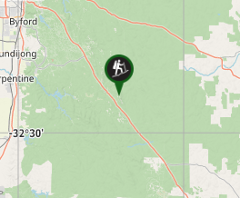
Aussie Bushwalking can keep track of your bushwalks.
Login/signup to tick this walk off.Monadnocks & Mt Cooke loop
Western Australia
Menu
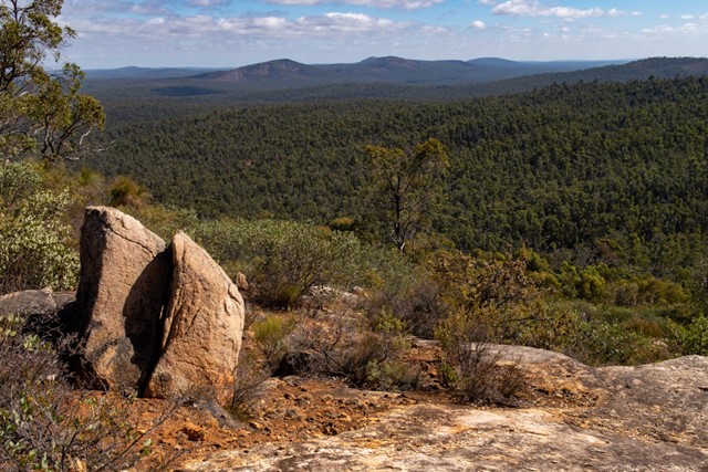
A long day walk along the Darling Ranges section of the Bibbulman Track, the route combines Mount Cuthbert and Mount Vincent (Sullivans Rock to Monadnocks) as well as Mount Cooke, the highest point of the Darling Scarp. It avoids backtracking by utilising the Bibbulman Track and surrounding 4WD roads.
Lookouts
Picnic Facilities
Camping Permitted
Eucalypt Forest
582m
Maximum Elevation
1230m
Total Climb
Getting there
Start/finish at Bubbulman trackhead on the south side of Albany Hwy, 9.5km past the junction with Jarrahdale Rd
Maps
2133-2S Yaganing South (1:25K)
2133-2N Yaganing North (1:25K)
2133-3N Jarrahdale North (1:25L)
Also Bibbulmun Track map (Map 1 – the Darling Range)
Interactive topographical map with GPX download
Route/Trail notes
A very long day walk, which could also be a 2-day walk, the route follows sections of the Bibbulmun Track, but returns using service trails to form a loop - see track notes below.
Permits/Costs
Nil
Other References
https://hikingtheworld.blog/2019/04/11/monadnocks-mt-cooke-loop-bibbulman-track/
GPS Tracks
- No GPS available for this walk yet.
Comments