
Shamrock Mine to Castle Mountain Lookout
Cania Gorge National Park


Menu
GPS Tracks

This walk follows a creek bed to the rock face, where you need to climb a dry waterfall, before using navigational skills to reach the fire trail that takes you to the lookout that provides stunning views of the dam, lake and gorge.

Getting there:
From Monto, head north on the Burnett Highway and after 11.5km turn right into Cania Road (signposted Cania Gorge). Follow this for 24km and park by the Shamrock Mine information board on the right, about 11km beyond the Cania Gorge Tourist Retreat.
Maps:
Route/Trail notes:
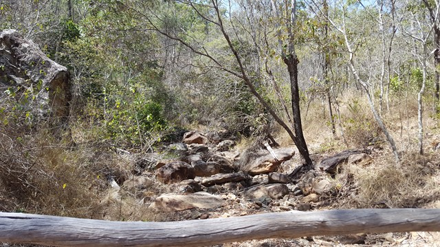
From the Shamrock Mine car park, walk along the road towards the dam and then down Hatchery Road to the right. As the road turns left to the base of the dam, drop down to the right into the creek bed and start your scramble along it: over boulders and under fallen trees to the waterfall rock face. This part will take you about 1.5hr to cover the 2.4km, due to the obstacles and the need to take care with every footstep.
At the waterfall face, on the true left of the creek is a red rope to help scale the steep sandstone face and then carefully continue walking up the face to the top. Once at the top, head North East for 450m to cut the fire trail, turning left to Castle Mountain Lookout.
Return carefully by the same route.
Permits/Costs:
None.
Other References/Comments:
This walk is recommended only to be done in the cooler months when snakes are hibernating, if not, make lots of noise and watch where you put your hands. Additionally, long pants or gaiters are highly recommended due to thick scrub and large spikes and take a PLB, plenty of water and a snack.
Basing yourself at Cania Gorge Tourist Retreat for a few days, is a great way to provide easy access to these walks.
 195 Shamrock to Castle Mt (GPX)
 8
8 6
6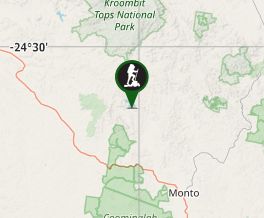
Comments