
Menu
Popular Walks
-
Mt Ngungun
(1138 ticks) -
Mount Coolum
(858 ticks) -
Mt Warning Summit Trail
(758 ticks) -
Mt Cordeaux
(655 ticks) -
Twin Falls Circuit
(625 ticks)
Popular Walks
-
Mt Ngungun
(1138 ticks) -
Mount Coolum
(858 ticks) -
Mt Warning Summit Trail
(758 ticks) -
Mt Cordeaux
(655 ticks) -
Twin Falls Circuit
(625 ticks)
Sub-Regions

 5.2
km
return
5.2
km
return
 90
mins
90
mins
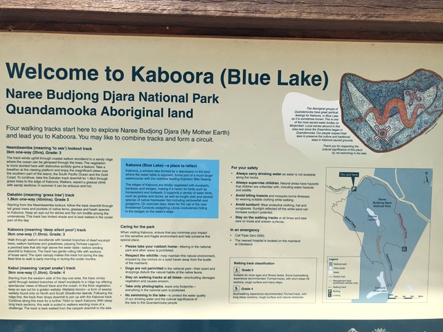
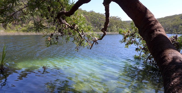
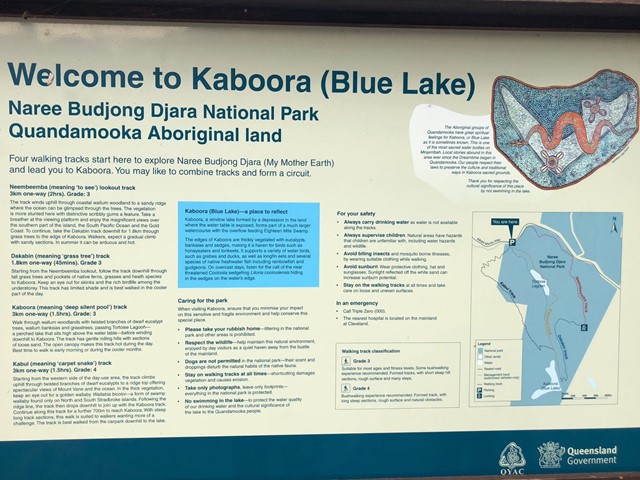
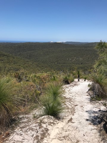
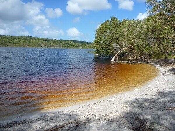
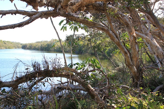
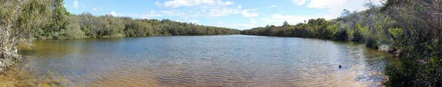
Blue Lake (Kaboora Track)
Walk through banksias, grasstrees and eucalypt on your way to Kaboora/Blue Lake. Pass Tortoise Lagoon on the way to this jewel of the island.
 8.4
km
return
2.5
hrs
8.4
km
return
2.5
hrs
Dunwich to Brown Lake
A walk from the Dunwich to the Brown Lake that mostly follows the road.
 8
km
return
3
hrs
8
km
return
3
hrs
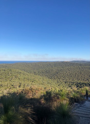
Mount Vane (Jarlo Beetle Track)
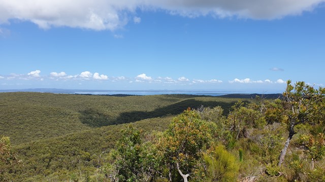
The Mount Vane walking track on Minjerribah is Straddie’s latest visitor attraction. Recent completion of the track has allowed keen bush walkers to enjoy 360-degree views of Moreton Bay and Quandamooka Country from a lookout atop one of Minjerribah’s highest peaks.
Constructed by Minjerribah’s Traditional Owners, the Quandamooka People, the new walk joins two existing walks within Naree Budjong Djara (My Mother Earth) National Park to create a 10 kilometre network of trails. This offers walkers a half day of trekking to special sights like Karboora (Deep Silent Pool, also known as Blue Lake) and a number of peaks with sweeping views over 18 Mile Swamp to the Gold Coast.
 1.5
km
return
45
mins
1.5
km
return
45
mins
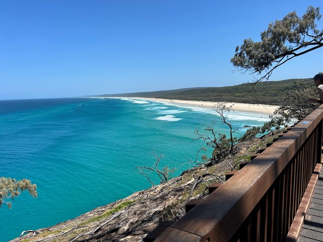
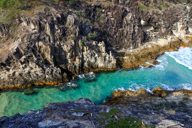
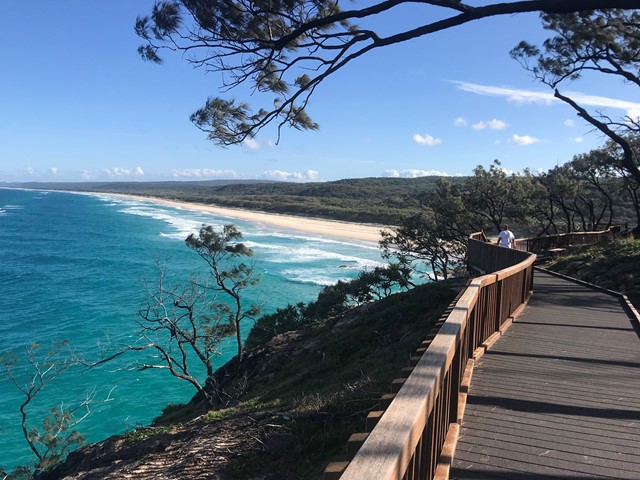
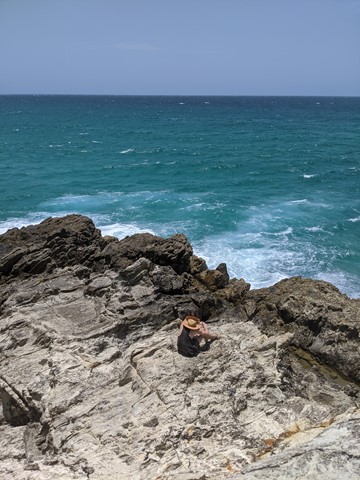
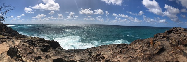
North Gorge Walk (Point Lookout)
Straddie’s impressive headland walk called the North Gorge walk is located at the north western end of Point Lookout and is the best vantage point on the island to watch the whales and marine life pass right before your eyes.
The walk encompasses the best of both worlds, with its raw and jagged headland to one side, and natural bushland on the other. Known for its best viewing experience of migrating humpback whales, the Gorge Walk also has a unique rock formation called the ‘Blow Hole’, similar to that of a humpback whale. The Gorge Walk is a North Stradbroke Island icon and reveals just how pristine and unspoiled the island truly is.
Access to the Gorge Walk is on Moloomba Road at Point Lookout, opposite Fishes Cafe and the Oceanic Gelati Shop.
 400
m
return
40
mins
400
m
return
40
mins
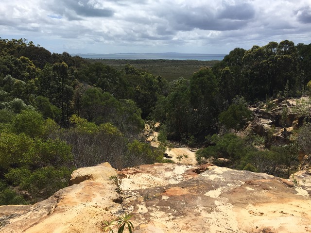
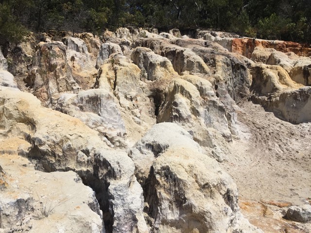
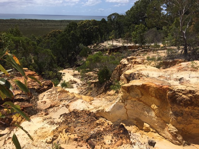
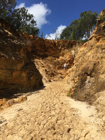
North Stradbroke Island Sand Cliffs
A short walk through some interesting coloured sand cliffs. Follow the path and then go up the gorge on the left hand side up to the maze like area which has views out to the water.
 10
km
return
2.5
hrs
10
km
return
2.5
hrs
Point Lookout to Keyholes
Start from Point Lookout and walk southward down the beach till a sign in the dunes where you head in land for about 100m to the keyholes. Then head back to Point Lookout same way.
Look out for 4WDs
 5.3
km
return
90
mins
5.3
km
return
90
mins
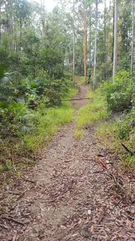
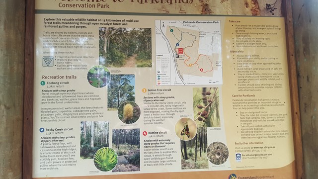
Coobong Circuit
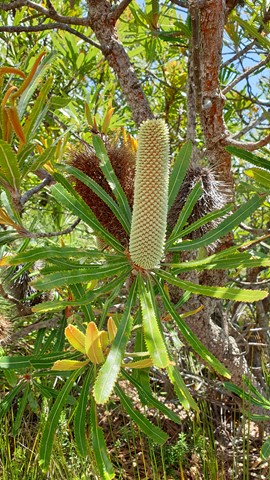
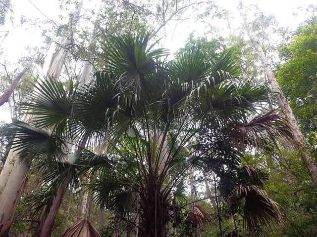
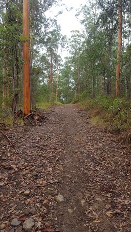
Travel through open eucalypt forest where bloodwood and tallowwood trees are common and banksias, wattles, grass trees and hopbush grow in the forest understory.
In more protected, wetter areas, the forest features flooded gum, turpentine, cabbage tree palm, piccabeen palm, stinging tree and some rainforest plants. You will cross two small creeks and pass bee hives on this circuit.
 11
km
return
2.5
hrs
11
km
return
2.5
hrs
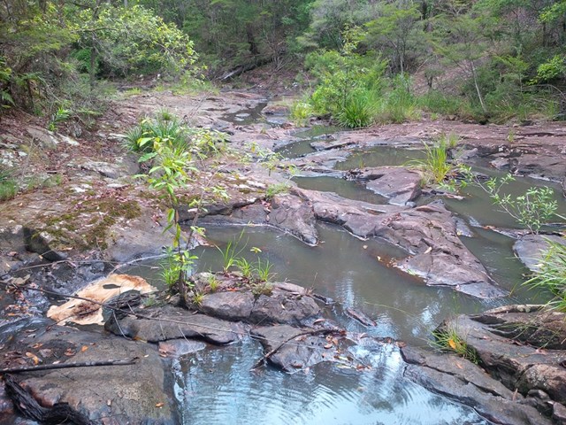
Komine Circuit
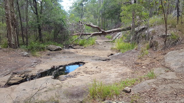
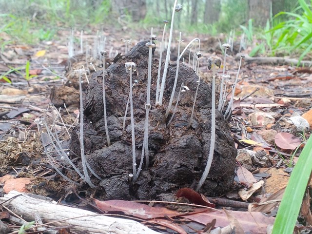
Cooler winter months are the best time to explore this circuit. It winds through open scribbly gum forest and includes large sections of track with little shade.
A number of creeks lead to rock pools and cascades, which flow after heavy rainfall.
 7.8
km
return
2
hrs
7.8
km
return
2
hrs
Lemon Tree Circuit
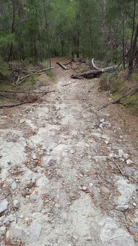
Similar to the Rocky Creek circuit, this track includes dry, rocky ridges. Some sections are more exposed, making the dry open forest a hotter area through which to travel, especially during the warmer summer months.
 5.4
km
return
90
mins
5.4
km
return
90
mins
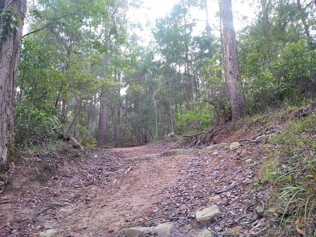
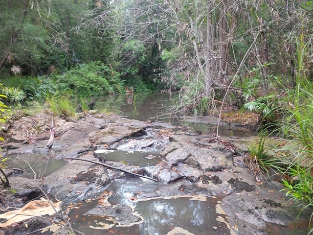
Rocky Creek Circuit
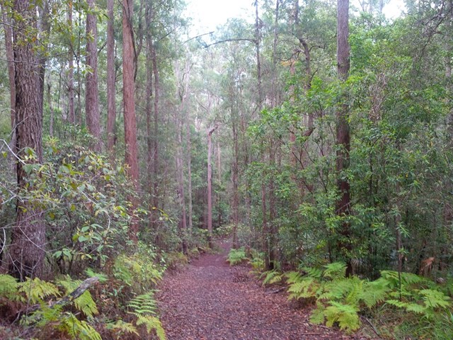
Parklands Regional Park is a valuable wildlife habitat with vegetation ranging from eucalypt forests of bloodwood and tallowwood trees (with banksia, wattle and grass tree understorey) to rainforest gullies with flooded gum, turpentine and, in protected wetter areas, groves of palms.
A number of creeks lead to rock pools and cascades, which flow after heavy rainfall.