Mt. Mathieson Circuit

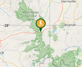
Main Range National Park

This track was built by volunteers in 1986 from the National Parks Assoc of Qld. The mountain is named after the chief commissioner of railways from 1880s to 1912

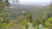
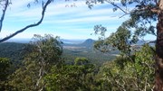
Lookouts
Scrambling or Climbing
No Dogs Permitted
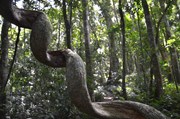
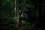
Rainforest
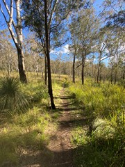
Eucalypt Forest
836m
Maximum Elevation
489m
Total Climb

Getting there

From Brisbane follow the Cunningham Highway through Aratula towards Cunninghams Gap. 5.4km after Aratula turn left onto Lake Moogerah Rd (signposted Lake Moogerah and Spicers Peak). 5.8km later turn right onto Spicers Gap Rd. Follow this road another 6.5km into the National Park and park on the left at the Pioneer Graves Picnic Area, just past the campground.

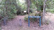
From the Pioneer graves carpark go towards the Mango orchard and where the Spicers gravel road starts to go up. there are signs on the right to the beginning of the track.

Maps

Main Range

Route/Trail notes

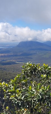
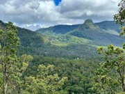
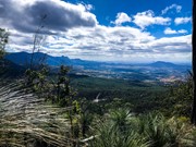
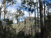
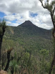
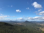
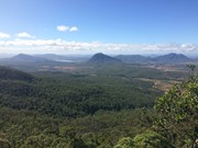
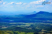
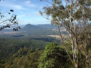
This is a must-do walk, fantastic views of Mt. Cordeaux and Mitchell and when at the governors chair the views are endless. The track is well marked and starts next to the orchard on the opposite side of the road to the car park.

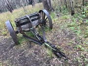
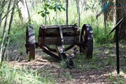
I would start from the track entrance then walk to the top of Mt. Mathieson. While walking across the top towards Spicers gap be careful of several large rock falls then traverse an break in the canopy across

 to an old timber jinker. From here keep following the track to the carpark then turn left and follow the historic road to the Governors Chair. Make sure to make the short detour to the amazing Governors Chair lookout.

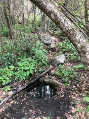
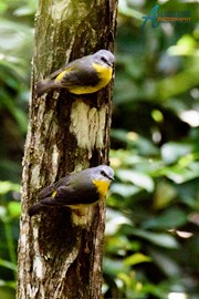
After finishing at the lookout return to the road and follow it for the final leg downhill through bell birds and whip birds to Moss's Well (a 60m side track) and then continuing back to the campgrounds.

The gravel road is extremely difficult after rain so wait a few days after rain before driving on this gravel road. 4 wheel drive vehicles will have no problem on this road.

There are toilets and non-potable water there. If you have some type of water filtration you could have an extended stay at the campgrounds.

Permits/Costs

Only if you are camping there is a self registration site.

Other References

Call local NPWS Main Range

GPS Tracks

Comments

This is a really nice walk for those that are building up to challenge the grade 5 difficulty walks. The walk is well worn and its hard to miss the track. The birdlife as others have said is abundant and a joy to the senses. Read the other comments - its all there. Enjoy!

Mark Whitford on 25 Jul, 2020

This was a nice walk. not very challenging, but some fun views of mountains. Governers chair lookout was very beautiful

Emmalea on 8 Jul, 2020

This is a great little half-day walk, with fantastic views along the ridge line over to Mt Mitchell and Cordeaux. Also goes through a number of different vegetation areas to keep things interesting on the relatively flat part back from the ridge line to Governor's Chair. Some small sections of steep scrambling, but there are plenty of rocks and trees to hang onto so most people should manage fine. I would recommend parking at the lookout and doing the walk down the road section first, as it's the least interesting part of the walk.

Sophie P on 20 Jun, 2020

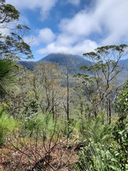
This is an interesting walk. Abundant bird life from the start. Stunning views. A number of prominent vegetation changes. Some clambering over boulders and steep ascents. Colonial relics/points of interest. We checked out Governor's Chair and Moss's Well on the return leg. Both very worthwhile. If you sat at Moss's Well for a period you would be treated with a variety of birds. It is obvious where bushfires ravaged sections in 2019 but this doesn't detract from the beauty of the walk.

BalticAussie on 18 May, 2020

This was a pleasant walk although not challenging/exciting. The historical aspect was interesting. At times the path split off and was overgrown but we managed to stay on track.

Whicheverway on 17 May, 2020

Fantastic walk that has a little bit of everything.
Whilst the track is easy to find, there are a few sections where the weeds have overgrown the track a bit.
Loved the ridge walk and rock scrambling involved.
This track will become a favourite that we come back to

Wandering Brauns on 16 May, 2020

I concur with mjorn's comments. Fires had affected large areas, but there were encouraging signs of forest regrowth. However, the grasses and shrubs growing back meant I spent half an hour picking seeds out of my (and my children's) socks when we got back to Brisbane! They also made finding the track difficult as we approached the summit of Mt Mathieson. Overall, enjoyable with some nice variety. We particularly enjoyed walking along the ridge south from Mt Mathieson.

Michael D on 15 Apr, 2020

I did this one for the first time yesterday since the November/ December bushfires in 2019. It’s still a beautiful walk, but the track is a little hard to follow in areas due to the undergrowth being burned. If you haven’t done this walk before, I’d recommend taking someone who knows the track, or following along on an app like Wikiloc.

Walking this track after/during heavy rain is incredible. Tiny streams and waterfalls everywhere.

mjorn_ on 9 Feb, 2020

Some rock scrambling required. Some areas have been burnt from the recent fires. Loved the section through the Gondwana rainforest. Lots of views along the way.

Mittens83 on Feb, 2020

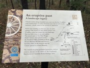
Lovely Hike and not too difficult at all with beautiful views towards Cunningham's Gap and Lake Moogerah. Recommend driving all the way up (along the dirt road can be done in a 2WD as long as it hasn't rained otherwise 4WD is recommended) and then walking all the way back to the start of the hike at the lower car park (which is clearly signposted) that way you can cover off the pioneer graves and moss'es well) Lots of history to read about on the way things to see. Views from the Governors chair lookout are amazing .

Ashwin on 17 Aug, 2019

Did the walk from Pioneer Graves Camping Area. Up to Mathieson's lookout, the track is clear and easy to follow. There's a view at the lookout, but it's obstructed by trees and branches. Keep following the track for a bit past the lookout and you'll get some better open views of Mitchell and Cordeaux. There's a section beyond this in which some navigational care is required:
1) There's a narrow gap between a large rock and a tree. Go through the gap, not around.
2) Soon after you'll come across a bunch of boulders. The track is visible beyond, so go over the boulders. If you try navigating a patch which looks like the track around the boulders, it'll send you steeply off the track and down into the bush between Mathieson and Mitchell.
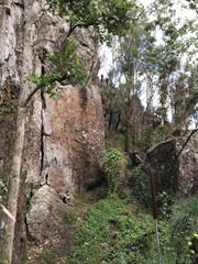
Afterwards you'll be generally alright up to a large rockwall. If you find it, you are going the right way. Go up and around, and just follow the ridgeline the rest of the way till you pass an orange arrow indicating the path direction. Everything beyond that point should be quite easy. There's some obstacles (from fallen trees mainly) which you'll either clamber over or navigate around, but otherwise you're in the clear.

Himalayan Pack Yak on 8 Aug, 2019

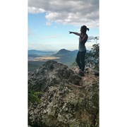
Did the entire loop, including Heritage Walk and Gov's Armchair. Loved the views through trees atop Mt Mathieson and did not get leeched despite comments below. Plenty of rocky outcrops to take in surrounds and pix from between 1.7 - 2 kilometres in. Few minor obstacles on track but easy to circumnavigate.

Bing Vandergraaf on 13 Jun, 2019

Followed the circuit from Pioneers graves in an anticlockwise direction towards Governor's Chair. Fairly easy walk with some views of Cunningham's gap area, Mt Mitchell and Mt Cordeaux on the way. Definitely recommend a 4 wheel drive to get up to the parking area as the dirt road was not too kind on my little Mazda.

JayWalker on 5 May, 2019

Excellent circuit!! Loved it, will go back with the kids :)

Sally on 24 Feb, 2019

The track this time of year was perfect, if a little too dry, making it hard to 'stalk' up close to the wildlife for some pics.
Heading Southwest from the peak of Mt Mathieson, the track is somewhat challenging with a couple of steep sections, but well worth the views!

Lachlan on 4 Aug, 2018

Good 4 hour walk with mountain views, plus take binoculars to enjoy a variety of birds.

Philip Burrill on 11 Jul, 2018

Nice walk. No leeches for us today - maybe we were lucky? Came across 2 snakes - one enormous brown sunning himself on the trail and a carpet python resting beside the road. Track was freshly trimmed in most parts, except for a small section in the middle - long pants still recommended if only for this portion. Views from Governors Chair are awesome. Walking in the sounds of the bell birds was most enjoyable.

BGS3 on 13 Apr, 2018

Good view points. Track at parts is quite overgrown. Recommend wearing long pants to avoid cuts and leeches. Great way to spend a morning.

Jaimi on 4 Mar, 2018

The walk is beautiful but quite overgrown. The leeches are prolific. Highly recommend long pants and walking poles and any other kind of leech protection

Rosh on 3 Mar, 2018

The first walk of the year for our little group. Beautiful scenery. The time & difficulty info provided on the Aussie Bushwalking site was about right for us. The track did not appear to have been used much though as the grasses were growing over the track etc. There were lots of leeches in places & we had not been prepared for that. We accessed the site in a 2WD car (following a day or so of rain) but I would recommend getting there with an AWD or 4WD. Overall the walk was a beautiful mix of varied terrain, fantastic views & historic sites. Oh, & the cuppa at Aratula on the way home was perfect too.

Just Jan on 3 Mar, 2018

Where

Click here to load this map.

Nearby Walks

Done this walk?

This walk has been ticked 109 times

Aussie Bushwalking can keep track of your bushwalks.

Login/signup to tick this walk off.

Tick walks to keep track of where you've been. You must Login to tick walks. Accounts are 100% free so sign up if you don't have one.