
Mt. Mathieson Circuit
Main Range National Park


Menu
GPS Tracks


This track was built by volunteers in 1986 from the National Parks Assoc of Qld. The mountain is named after the chief commissioner of railways from 1880s to 1912


Getting there
From Brisbane follow the Cunningham Highway through Aratula towards Cunninghams Gap. 5.4km after Aratula turn left onto Lake Moogerah Rd (signposted Lake Moogerah and Spicers Peak). 5.8km later turn right onto Spicers Gap Rd. Follow this road another 6.5km into the National Park and park on the left at the Pioneer Graves Picnic Area, just past the campground.
From the Pioneer graves carpark go towards the Mango orchard and where the Spicers gravel road starts to go up. there are signs on the right to the beginning of the track.
Maps
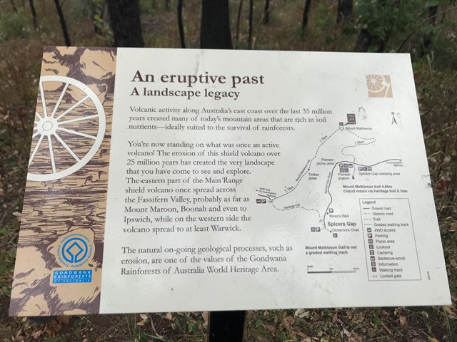
Main Range
Route/Trail notes
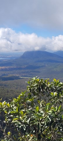
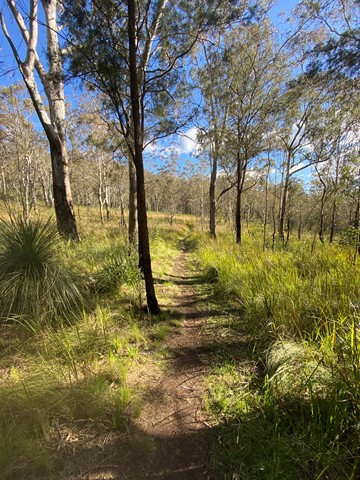
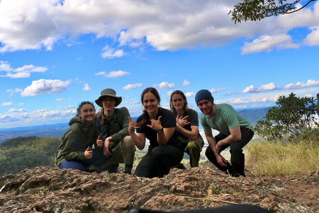
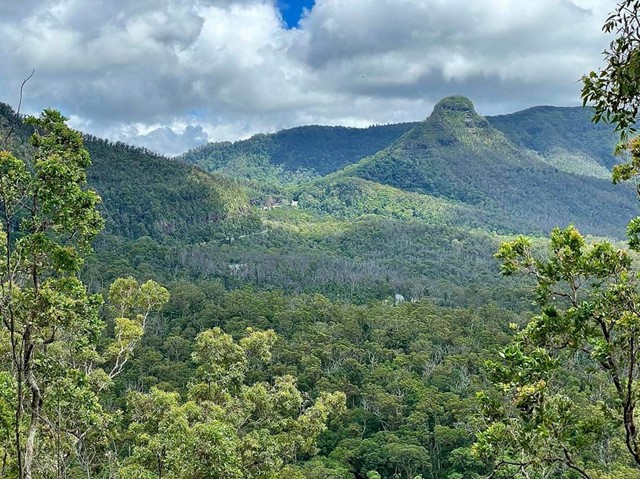
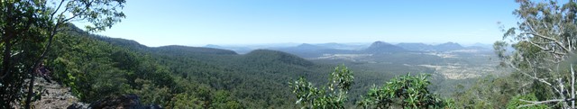
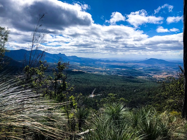
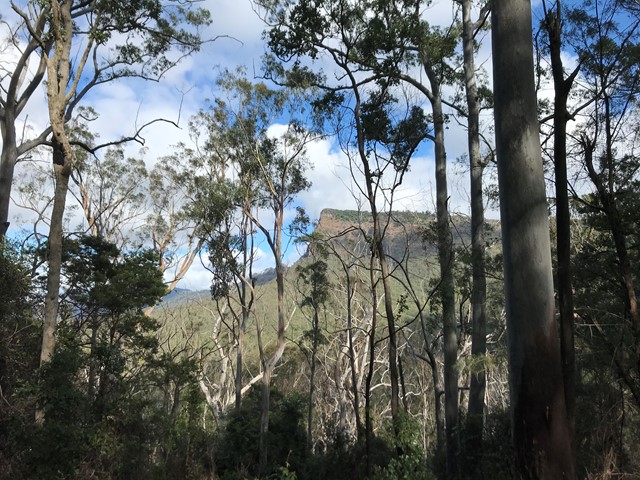
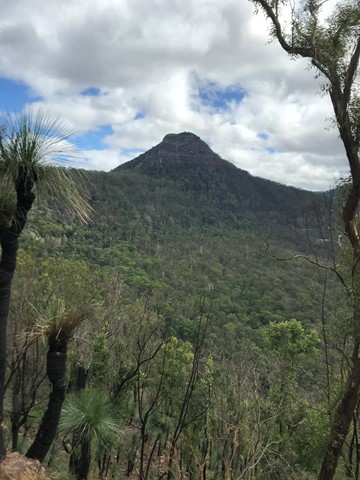
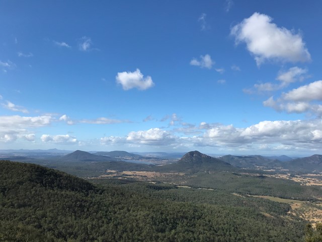
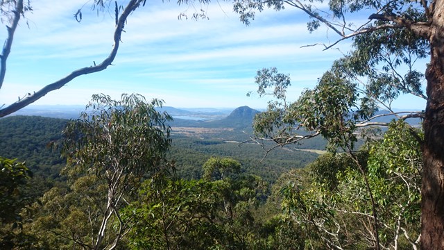
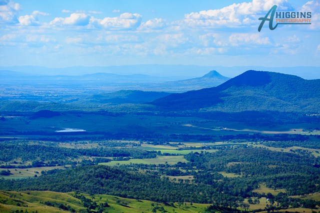
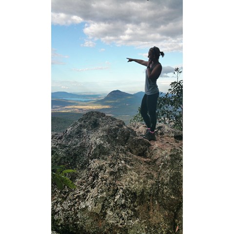
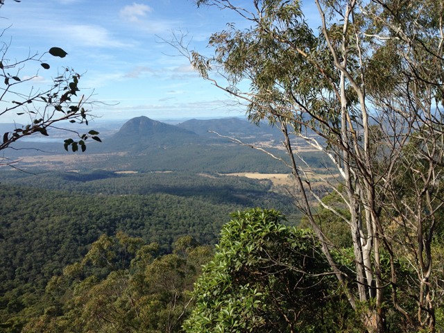
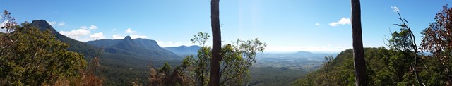
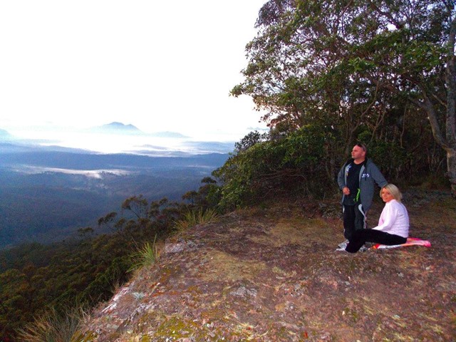
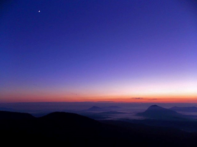
This is a must-do walk, fantastic views of Mt. Cordeaux and Mitchell and when at the governors chair the views are endless. The track is well marked and starts next to the orchard on the opposite side of the road to the car park.

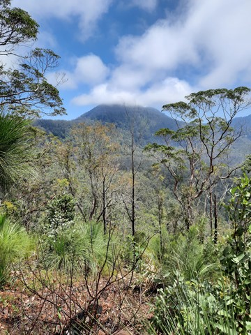
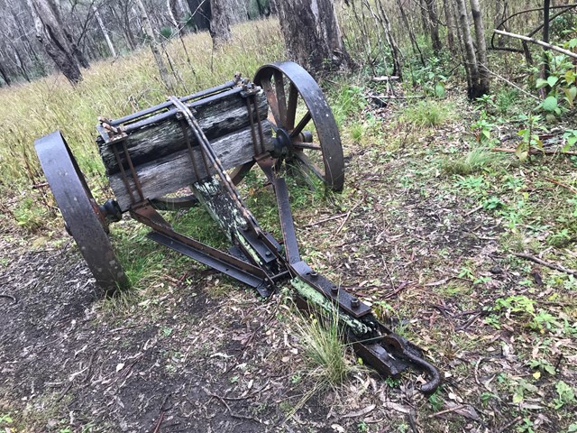
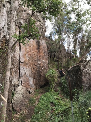
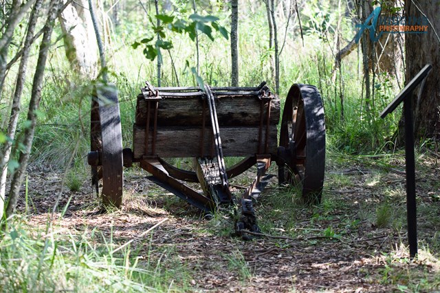
I would start from the track entrance then walk to the top of Mt. Mathieson. While walking across the top towards Spicers gap be careful of several large rock falls then traverse an break in the canopy across
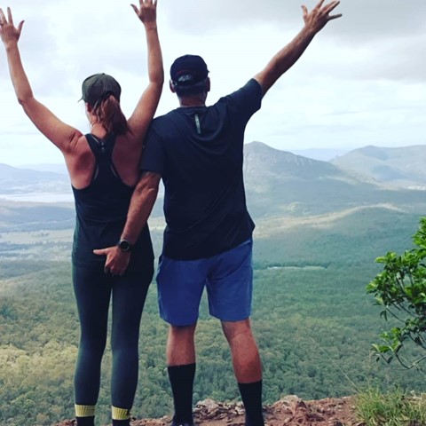
to an old timber jinker. From here keep following the track to the carpark then turn left and follow the historic road to the Governors Chair. Make sure to make the short detour to the amazing Governors Chair lookout.
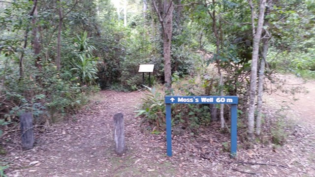
 After finishing at the lookout return to the road and follow it for the final leg downhill through bell birds and whip birds to Moss's Well (a 60m side track) and then continuing back to the campgrounds.
The gravel road is extremely difficult after rain so wait a few days after rain before driving on this gravel road. 4 wheel drive vehicles will have no problem on this road.
There are toilets and non-potable water there. If you have some type of water filtration you could have an extended stay at the campgrounds.
Permits/Costs
Only if you are camping there is a self registration site.
Other References
Call local NPWS Main Range
 Mt Mathieson (GPX)
 10.5
10.5 3
3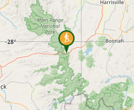
Comments