
Menu
Popular Walks
-
Mt Ngungun
(1151 ticks) -
Mount Coolum
(869 ticks) -
Mt Cordeaux
(665 ticks) -
Twin Falls Circuit
(635 ticks) -
Purling Brook Falls Circuit
(610 ticks)
Parent Regions
Sub-Regions
- Amamoor State Forest
- Bellthorpe National Park
- Brisbane City Council Local Walks
- Brisbane Forest park D'Aguilar National Park
- Brisbane Valley Rail Trail
- Coombabah Lakelands Conservation Area
- Daisy Hill Conservation Park
- Eumundi Conservation Park
- Glass House Mountains National Park
- Glen Rock Regional Park
- Gold Coast
- Ipswich
- Jimna State Forest
- Karawatha Forest
- Kondalilla National Park
- Lamington National Park
- Main Range National Park
- Mapleton National Park
- Moggill Conservation Park
- Moogerah Peaks National Park
- Moreton Island National Park
- Mt Barney National Park
- North Stradbroke Island - Minjeeribah
- Parklands Conservation Park
- Springbrook National Park
- Sunshine Coast
- Tamborine National Park
- White Rock - Spring Mountain Conservation Estate
Summary
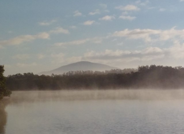
Boarding NSW and the pacific Ocean, it is not uncommon for hikes to have views of both worlds (ocean and hinterland). Hikes here are typically on the great dividing range.
Popular Walks
-
Mt Ngungun
(1151 ticks) -
Mount Coolum
(869 ticks) -
Mt Cordeaux
(665 ticks) -
Twin Falls Circuit
(635 ticks) -
Purling Brook Falls Circuit
(610 ticks)
Parent Regions
Sub-Regions
- Amamoor State Forest
- Bellthorpe National Park
- Brisbane City Council Local Walks
- Brisbane Forest park D'Aguilar National Park
- Brisbane Valley Rail Trail
- Coombabah Lakelands Conservation Area
- Daisy Hill Conservation Park
- Eumundi Conservation Park
- Glass House Mountains National Park
- Glen Rock Regional Park
- Gold Coast
- Ipswich
- Jimna State Forest
- Karawatha Forest
- Kondalilla National Park
- Lamington National Park
- Main Range National Park
- Mapleton National Park
- Moggill Conservation Park
- Moogerah Peaks National Park
- Moreton Island National Park
- Mt Barney National Park
- North Stradbroke Island - Minjeeribah
- Parklands Conservation Park
- Springbrook National Park
- Sunshine Coast
- Tamborine National Park
- White Rock - Spring Mountain Conservation Estate
History
Any interesting history for the region?
Features
What are the standout bushwalking features?
Access
How do you get there? Include all access points if there are many?
Maps
Which maps cover the region?
Accommodation
Where can I stay there? or near there?
Camping
Council Areas:
- Scenic Rim Regional
- Gold Coast City
- Logan City
- Redland City
- Ipswich City
- Lockyer Valley Regional
- Brisbane City
- Somerset Regional
- Moreton Bay Regional
- Sunshine Coast Regional
- Noosa Shire
Contact details
See Qld National parks website
Walks in Sunshine Coast

 30
km
return
30
km
return
 5
hrs
5
hrs
Mac N Back
Trail 7 of the Noosa Trail Network; a relatively flat picturesque trail that crosses Six Mile Creek and traverses the Yurol State Forest from Lake MacDonald to Pomona.
 5.5
km
return
2
hrs
5.5
km
return
2
hrs
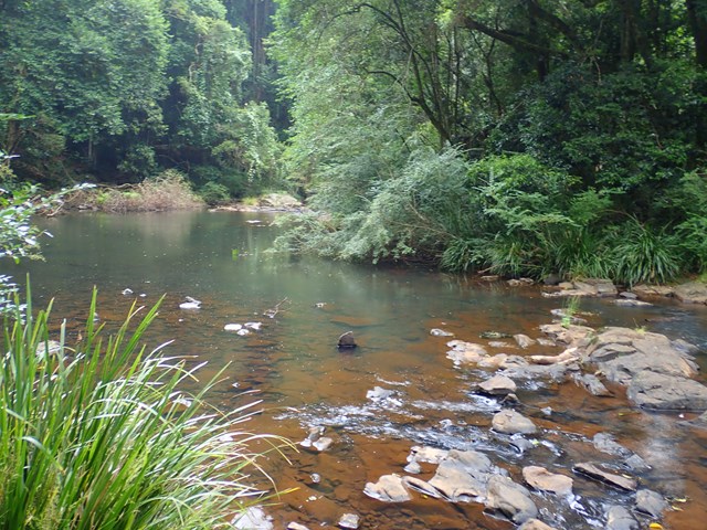
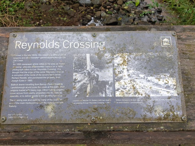
Maleny Trail (Peace in the Trees Circuit)
A leisurely walk along Obi Obi Creek from the boardwalk in town to the Golf Club and back, that passes the sculptured 'Peace in the Trees', '5th Light Horse Regiment Beersheba Museum', 'Platypus Viewing Area', 'Southern Wetlands' and historical buildings of the once 'Fairview Dairy Farm'.
 2
km
return
1
hr
2
km
return
1
hr
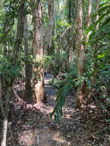
Maroochy Wetland Conservation Park
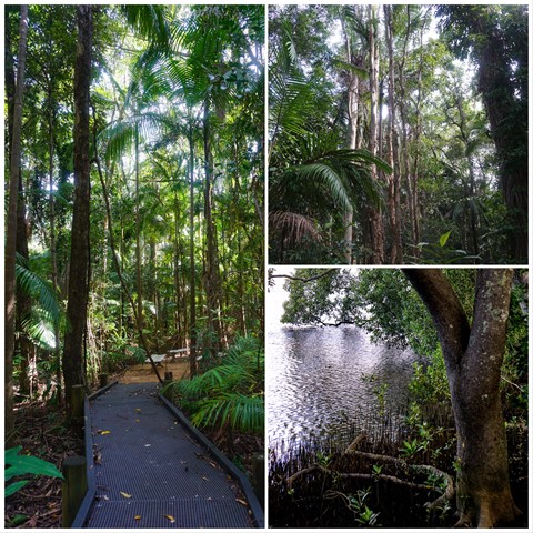
The Maroochy Wetlands Sanctuary boardwalk passes through eucalypt, rain and mangrove forest down to the river. Native fauna including River Mangrove, Orange Mangrove, Swamp Oak, Milky Mangrove, Grey Mangrove, Native Wisteria, Flooded Gum, Bungwall Fern, Paperbarked Tea-Tree and Mangrove Fern. There is abundant bird life, as well as crabs, butterflies, reptiles, fish and other wildlife species that frequent the wetlands.
 12
km
one-way
3
hrs
12
km
one-way
3
hrs
Maroochydore (Picnic Point) to Mudjimba (SCCP 8)
Coastal walk that is part of Sunshine Coast Coastal Walk.
 3
km
return
1
hr
3
km
return
1
hr
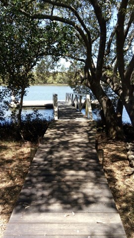
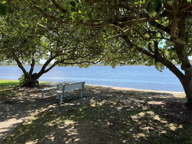
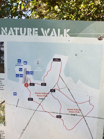
Martin Williams Walk
Lovely walk at Lake Baroon, near Maleny Qld
Two loops. Total approximately 3 km's
 2
km
return
1
hr
2
km
return
1
hr
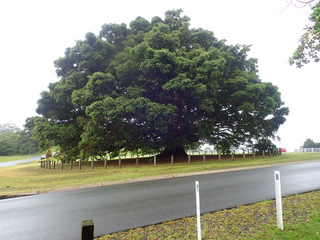
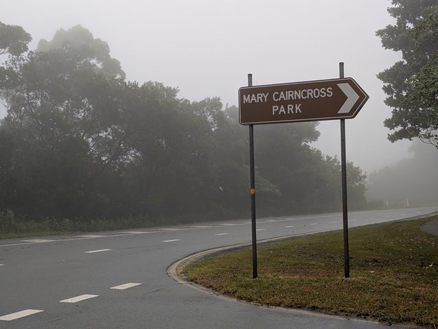
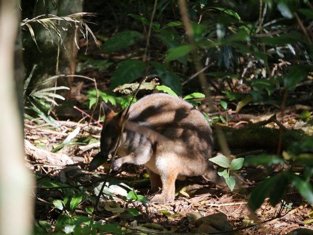
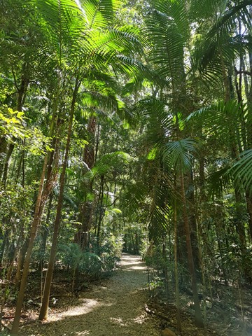
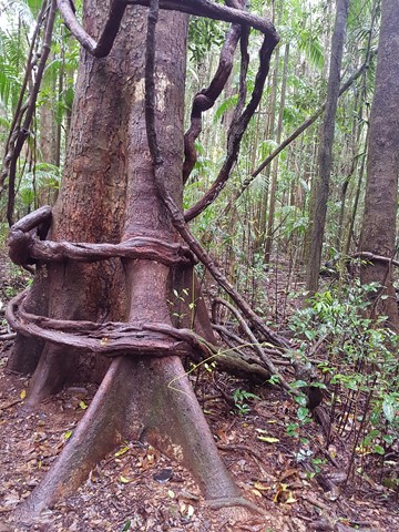
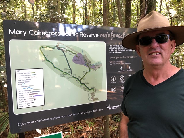
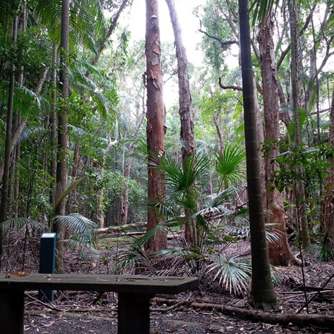
Mary Cairncross Reserve
This walk never fails to please. At a very leisurely stroll you can stop and enjoy the rainforest and spot the pademelons hidden in the bush. Best time to do the walk is early in the morning to get the pademelons and birds and to avoid the tourist buses.
Views across the road overlooking the Glass House Mountains on a clear day are spectacular.
 1.3
km
return
40
mins
1.3
km
return
40
mins
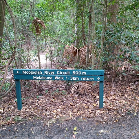
Melaleuca Trail, Jowarra Section
This is part of the Jowarra Section of the Mooloolah River a separate section of this park to be accessed via the Steve Irwin Way off the Bruce Hwy ( caloundra off ramp ) turn right at traffic lights into the Information Centre Car park ( there's also Daisy's Restaurant ) in the middle of the car park you will find the entrance of park leading to both walks.
 1
km
return
30
mins
1
km
return
30
mins
Merdian Hill, Mooloolah River National Park
This walk up Merdian Hill is moderately steep but very short so whoever graded it easy is correct. The view from the top is nice but not spectacular, glimpses of Ewen Maddock through the trees. It's hardly worth making a special trip just for this walk, but combined with a few other walks in the area makes a nice day out. For starters, in the same location but on the other side of Old Caloundra Rd there are several short walks through wet woodland type vegetation, eg lots of candlestick banksia. Take the walking trails further down Old Caloundra Rd to get away from the traffic noise on Steve Irwin Way. Add a walk around Jowarra Section of Mooloolah River NP and/or Dularcha NP, both an easy drive from Meridan Hill. That makes a really nice day out.
 8
km
return
2
hrs
8
km
return
2
hrs
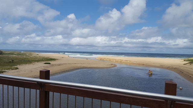
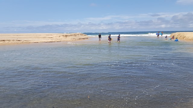
Moffat Beach to Currimundi Lake (SCCP 4)
Time to get your feet wet on this one, as you cross Swamp Creek and head up the sand to Dicky Beach and on along the coastal wetlands boardwalks to beautiful Currimundi Lake.
 8
km
one-way
2
hrs
8
km
one-way
2
hrs
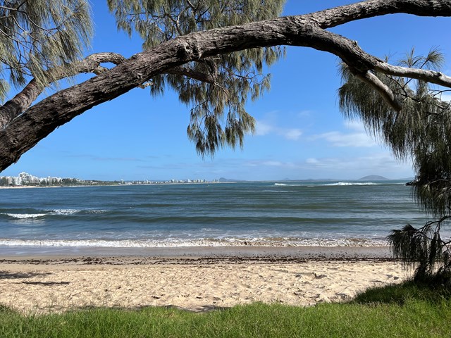
Mooloolaba Beach to Maroochydore (Picnic Point) (SCCP 7)
Coastal walk that is part of the Sunshine Coast Coastal Walk.