
Menu
Popular Walks
-
Mt Ngungun
(1151 ticks) -
Mount Coolum
(869 ticks) -
Mt Cordeaux
(665 ticks) -
Twin Falls Circuit
(635 ticks) -
Purling Brook Falls Circuit
(610 ticks)
Parent Regions
Sub-Regions
- Amamoor State Forest
- Bellthorpe National Park
- Brisbane City Council Local Walks
- Brisbane Forest park D'Aguilar National Park
- Brisbane Valley Rail Trail
- Coombabah Lakelands Conservation Area
- Daisy Hill Conservation Park
- Eumundi Conservation Park
- Glass House Mountains National Park
- Glen Rock Regional Park
- Gold Coast
- Ipswich
- Jimna State Forest
- Karawatha Forest
- Kondalilla National Park
- Lamington National Park
- Main Range National Park
- Mapleton National Park
- Moggill Conservation Park
- Moogerah Peaks National Park
- Moreton Island National Park
- Mt Barney National Park
- North Stradbroke Island - Minjeeribah
- Parklands Conservation Park
- Springbrook National Park
- Sunshine Coast
- Tamborine National Park
- White Rock - Spring Mountain Conservation Estate
Summary
Boarding NSW and the pacific Ocean, it is not uncommon for hikes to have views of both worlds (ocean and hinterland). Hikes here are typically on the great dividing range.
Popular Walks
-
Mt Ngungun
(1151 ticks) -
Mount Coolum
(869 ticks) -
Mt Cordeaux
(665 ticks) -
Twin Falls Circuit
(635 ticks) -
Purling Brook Falls Circuit
(610 ticks)
Parent Regions
Sub-Regions
- Amamoor State Forest
- Bellthorpe National Park
- Brisbane City Council Local Walks
- Brisbane Forest park D'Aguilar National Park
- Brisbane Valley Rail Trail
- Coombabah Lakelands Conservation Area
- Daisy Hill Conservation Park
- Eumundi Conservation Park
- Glass House Mountains National Park
- Glen Rock Regional Park
- Gold Coast
- Ipswich
- Jimna State Forest
- Karawatha Forest
- Kondalilla National Park
- Lamington National Park
- Main Range National Park
- Mapleton National Park
- Moggill Conservation Park
- Moogerah Peaks National Park
- Moreton Island National Park
- Mt Barney National Park
- North Stradbroke Island - Minjeeribah
- Parklands Conservation Park
- Springbrook National Park
- Sunshine Coast
- Tamborine National Park
- White Rock - Spring Mountain Conservation Estate
History
Any interesting history for the region?
Features
What are the standout bushwalking features?
Access
How do you get there? Include all access points if there are many?
Maps
Which maps cover the region?
Accommodation
Where can I stay there? or near there?
Camping
Council Areas:
- Scenic Rim Regional
- Gold Coast City
- Logan City
- Redland City
- Ipswich City
- Lockyer Valley Regional
- Brisbane City
- Somerset Regional
- Moreton Bay Regional
- Sunshine Coast Regional
- Noosa Shire
Contact details
See Qld National parks website
Walks in Glass House Mountains National Park

 18
km
return
18
km
return
 6
hrs
6
hrs
Beerburrum to Tibrogargan circuit via Soldier Settlers, Trachyte, Tibrogargan loop and Yul-yan-man track
This circuit will take you on all four trails between Beerburrum and Tibrogargan. It starts off easy but the last 5km is the hardest. The reward is an awesome hike!
 13.22
km
return
3.75
hrs
13.22
km
return
3.75
hrs
Beerburrum to Trachyte and Tibrogragan Circuits
Walk from Beerburrum to the Returned Servicemans memorial Track to Trachyte Circuit to Tibrogargan Circuit to Steve Irwin Way
 12
km
2.25
hrs
12
km
2.25
hrs
Coonowrin Circut (almost)
This track ALMOST makes it around the entire Coonowrin Circut, infact it is only a matter of 385mts that is blocked off by a gate and heaps of Private Property signs.
 800
m
return
30
mins
800
m
return
30
mins
Glass House Mountain Lookout
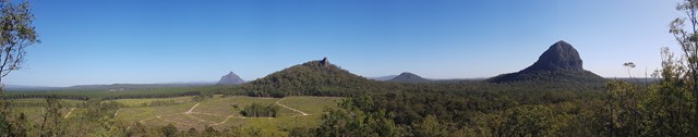
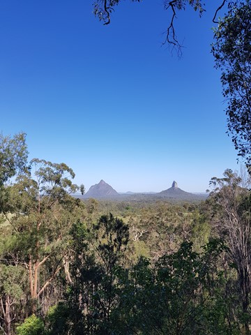
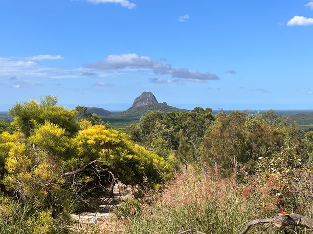
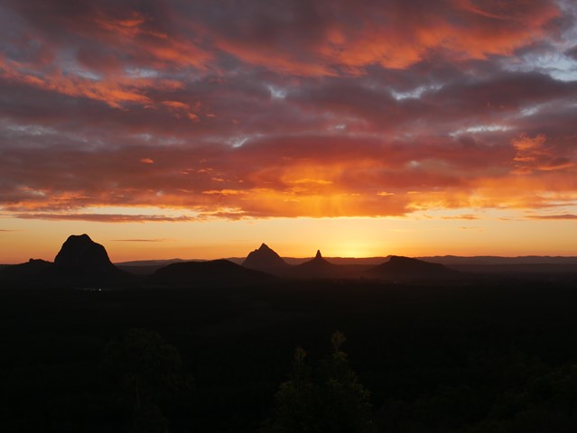
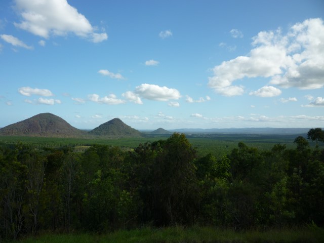
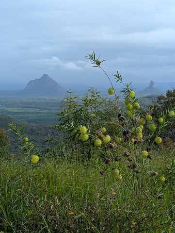
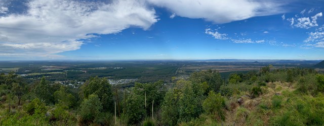
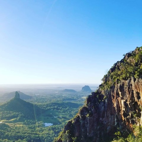
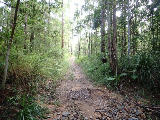
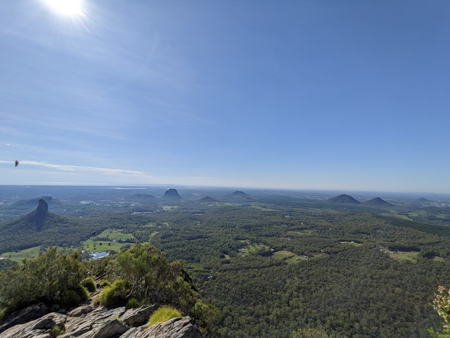
The lookout is about 10km from the Glass House Mountains township, in Beerburrum West State Forest. It offers panoramic views of the mountain peaks, Caloundra, Maroochydore, Brisbane and Moreton Island. A short walking track starting at the lookout leads you through open scribbly gum forest, down through a wet eucalypt forest gully and returns back to the lookout.
 3.5
km
return
90
mins
3.5
km
return
90
mins
Mount Beerburrum
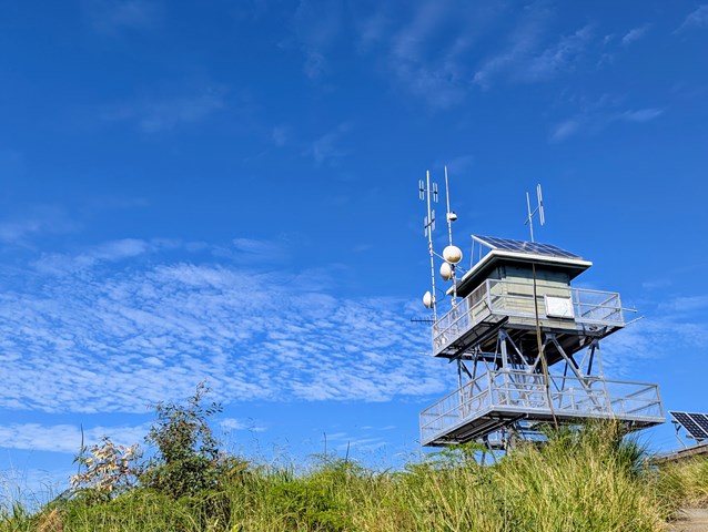
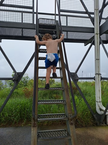
A paved but very steep walk leads 700 metres uphill through a small area of rainforest, then winds up through eucalyptus woodland to a fire tower. There is a 360 degree view of the Glass House Mountains and other parts of South East Queensland from the summit. On a clear day, Brisbane CBD is visible too. When descending the fire tower, go down backwards as you would with any ladder, several people have tried to go down forward and had very nasty accidents.
 3.6
km
return
3
hrs
3.6
km
return
3
hrs
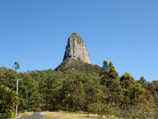
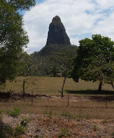
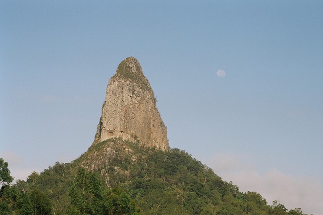
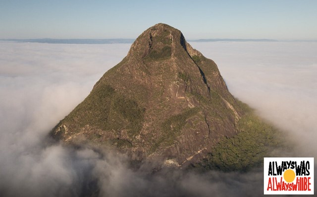
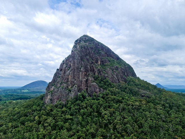
Mount Beerwah
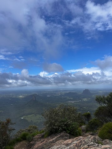
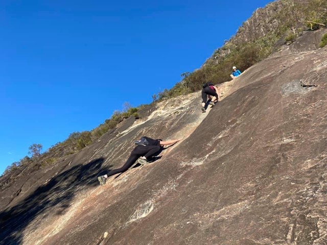
Best to do this walk early before the heat of the day. From the base it's a steep rock climb/scramble up that seems to go on forever. Once past this initial climb, you reach the Organ Pipes. From here it's a moderate walk/scramble to the top. Views are amazing from the summit. Take your time coming down, use your feet and hands to control your descent as it's steep. If you're willing to sacrifice your pants to the rock, a crab walk/butt scoot down is effective for grip and won't make you slide Take water and some energy food as you'll be tired and need to get some energy, especially in the warmer months. Approx 3hrs. Great if you like a challenge.
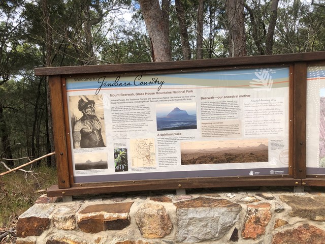
Take care with this walk/climb, but go soon. A small group of Australians calling themselves the "Jinibara" have Non-Exclusive native title to the national park and want to prevent others paying homage to this wonderful mountain by climbing it. Be proud of your achievement if you reach the summit, but only if you feel confident on the steep rock.
 9.5
km
one-way
3
hrs
9.5
km
one-way
3
hrs
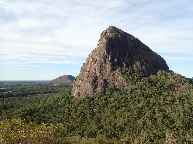
Mount Beerwah Base
This walk travels along tracks and roads that link to circumnavigate the base of Mour Beerwah. It gives great views of the mountain from different angles and its many faces.
 2.9
km
return
3
hrs
2.9
km
return
3
hrs
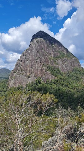
Mount Beerwah Summit
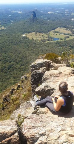
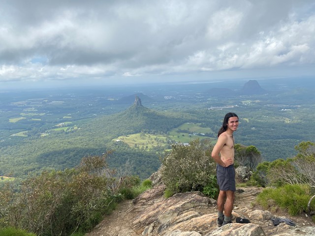
The highest of the Glasshouse Mountains, the Mt Beerwah summit walk is slightly easier than Mt Tibrogargan but still quite challenging. It has extensive views of the Sunshine Coast Hinterland and Glasshouse Mountains.
 1.3
km
30
mins
1.3
km
30
mins
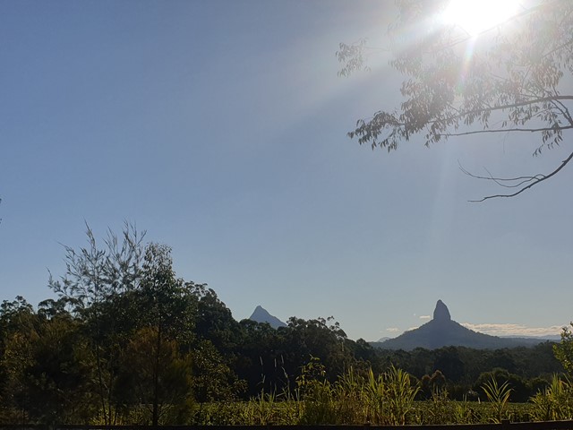
Mount Beerwah Western Boundary
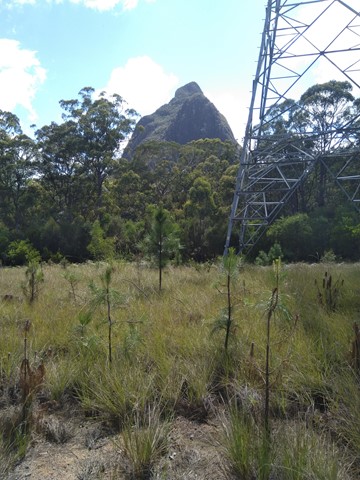
Just a short stroll with glimpses of Mount Beerwah on your left. this track ended with no signage although we continued walking along the fire trail until we came out at a main fire trail near the power lines possibly called Connection Road. The extra walk would be aprox 1.5-2km each way which made the total walk about 1hr.
 4
km
return
2.5
hrs
4
km
return
2.5
hrs
Mount Cooee
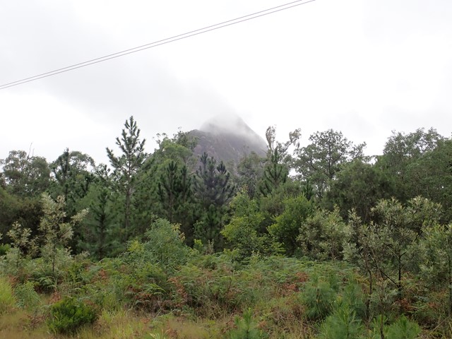
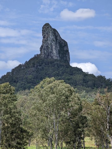
At just 167m, this is probably the least climbed and one of the least known mountains in the area, especially as it is overshadowed by Mount Tibrogargan immediately to the west.