
Menu
Popular Walks
-
Mt Ngungun
(1151 ticks) -
Mount Coolum
(869 ticks) -
Mt Cordeaux
(665 ticks) -
Twin Falls Circuit
(635 ticks) -
Purling Brook Falls Circuit
(610 ticks)
Parent Regions
Sub-Regions
- Amamoor State Forest
- Bellthorpe National Park
- Brisbane City Council Local Walks
- Brisbane Forest park D'Aguilar National Park
- Brisbane Valley Rail Trail
- Coombabah Lakelands Conservation Area
- Daisy Hill Conservation Park
- Eumundi Conservation Park
- Glass House Mountains National Park
- Glen Rock Regional Park
- Gold Coast
- Ipswich
- Jimna State Forest
- Karawatha Forest
- Kondalilla National Park
- Lamington National Park
- Main Range National Park
- Mapleton National Park
- Moggill Conservation Park
- Moogerah Peaks National Park
- Moreton Island National Park
- Mt Barney National Park
- North Stradbroke Island - Minjeeribah
- Parklands Conservation Park
- Springbrook National Park
- Sunshine Coast
- Tamborine National Park
- White Rock - Spring Mountain Conservation Estate
Summary
Boarding NSW and the pacific Ocean, it is not uncommon for hikes to have views of both worlds (ocean and hinterland). Hikes here are typically on the great dividing range.
Popular Walks
-
Mt Ngungun
(1151 ticks) -
Mount Coolum
(869 ticks) -
Mt Cordeaux
(665 ticks) -
Twin Falls Circuit
(635 ticks) -
Purling Brook Falls Circuit
(610 ticks)
Parent Regions
Sub-Regions
- Amamoor State Forest
- Bellthorpe National Park
- Brisbane City Council Local Walks
- Brisbane Forest park D'Aguilar National Park
- Brisbane Valley Rail Trail
- Coombabah Lakelands Conservation Area
- Daisy Hill Conservation Park
- Eumundi Conservation Park
- Glass House Mountains National Park
- Glen Rock Regional Park
- Gold Coast
- Ipswich
- Jimna State Forest
- Karawatha Forest
- Kondalilla National Park
- Lamington National Park
- Main Range National Park
- Mapleton National Park
- Moggill Conservation Park
- Moogerah Peaks National Park
- Moreton Island National Park
- Mt Barney National Park
- North Stradbroke Island - Minjeeribah
- Parklands Conservation Park
- Springbrook National Park
- Sunshine Coast
- Tamborine National Park
- White Rock - Spring Mountain Conservation Estate
History
Any interesting history for the region?
Features
What are the standout bushwalking features?
Access
How do you get there? Include all access points if there are many?
Maps
Which maps cover the region?
Accommodation
Where can I stay there? or near there?
Camping
Council Areas:
- Scenic Rim Regional
- Gold Coast City
- Logan City
- Redland City
- Ipswich City
- Lockyer Valley Regional
- Brisbane City
- Somerset Regional
- Moreton Bay Regional
- Sunshine Coast Regional
- Noosa Shire
Contact details
See Qld National parks website
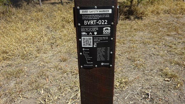
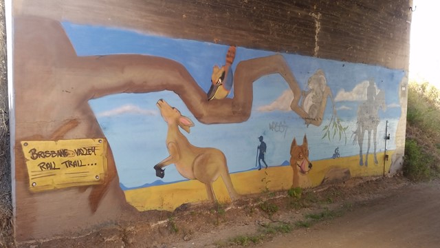
Walks in Brisbane Valley Rail Trail

 14
km
one-way
14
km
one-way
 4.5
hrs
4.5
hrs
BVRT - Coominya to Mt Hallen
Part of the Brisbane Valley Rail Trail. A great section for bird watching.
 24.5
km
one-way
6
hrs
24.5
km
one-way
6
hrs
Coominya to Esk - Part of BVRT
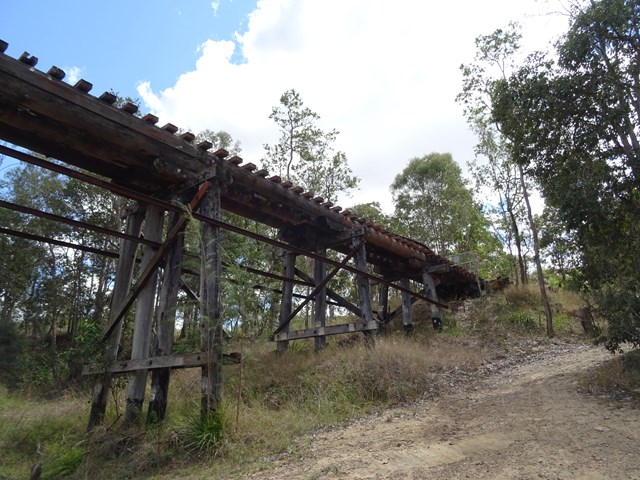
This walk is part of the Brisbane Valley Rail Trail, starts and finishes at the railway station. Coominya and Esk are small towns but have all services. Several large and impressive rail bridges along the track but not accessible, a lower river crossing. The walk passes through farm lands but mainly bush walking so plenty of gates to open and shut but not a walk to complete in Summer months. The trail is well marked so maps are not required. Coominya is accessible after a turnoff on the Brisbane Valley Highway. Public amenities and car parking at both ends of the walk but no public amenities on the track. No permits or costs for the walk.
 9
km
one-way
2.5
hrs
9
km
one-way
2.5
hrs
Diamantina Boulevard to Borallon Station Road - Part of BVRT
10kms easy walking along the old Brisbane Valley Rail Trail. Passing old stations (or where they used to be, signs have been erected) of Muirlea, Pine Mountain and Borallon. Great for birdwatching. I would recommend for a winter walk - dappled shade, but would get very hot very quickly in summer.
11
km
one-way
3
hrs
Esk to Ottaba - Part of BVRT
Approximately 11kms along the Brisbane Valley Rail Trail. Very exposed, but pleasant walking.
19
km
one-way
5
hrs
Esk to Toogoolawah - Part of BVRT
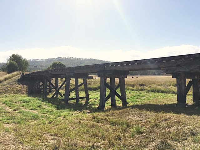
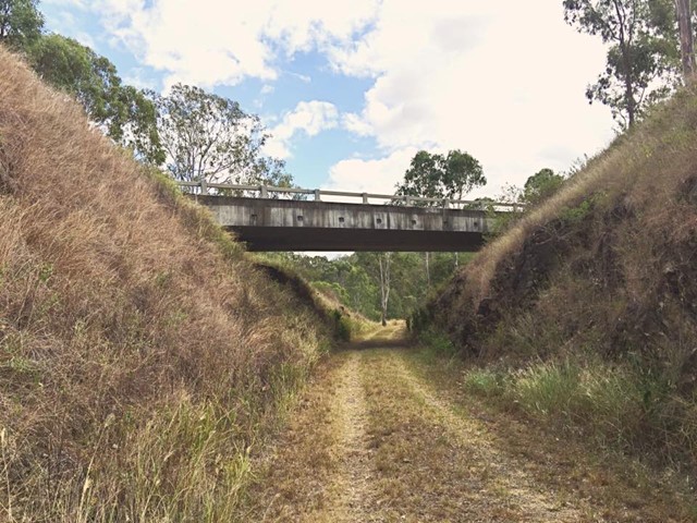
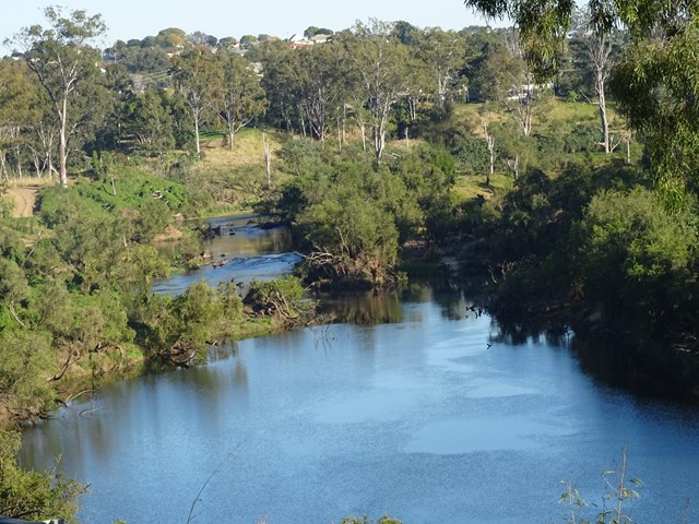
The 19 kilometre Esk to Toogoolawah section of the Brisbane Valley Rail Trail is northwest of Brisbane along the Warrego and Brisbane Valley Highways. This section of the trail travels adjacent to Camp Creek and crosses Cressbrook Creek, a tributary of the Brisbane River, at Toogoolawah. The trail extends through farmland including lucerne, other pasture and small crops that are important to the local economy.
On trail signage indicates classifications between Esk and Toogoolawah. The distance and lack of trail facilities make this section suitable for people with a moderate to high fitness level. There are no drinking water or toilet facilities between Esk and Toogoolawah. Sufficient water must be carried.
 8
km
one-way
2
hrs
8
km
one-way
2
hrs
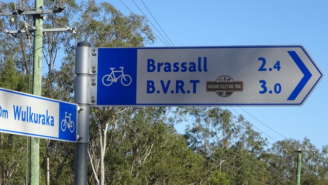
Fernvale to Lowood - Part of BVRT
For the most part this section of the walk follows beside the Brisbane Valley Highway ie it gets noisy and there really isn't much in the way of shade at all. However, the views are nice looking out towards to the mountains and onto Lowood. Heading in to Lowood you'll meet up with a bend in the Brisbane river with some lovely views downstream, and a large colony of bats making home in the trees. Arriving into Lowood, you'll be rewarded with the first section of actual railway for the trail; Lowood was the original terminus for the BVRT. Lowood has a pub, bakery and nice cafes for refreshments.
 23
km
one-way
6
hrs
23
km
one-way
6
hrs
Wulkaraka to Fernvale - Part of BVRT
I rode this but you are certainly allowed to walk it. A fun and enjoyable ride from Wulkaraka station to Fernvale. Look forward to a delicious thick shake and a pie at the renowned Fernvale bakery! The track is mostly flat and easy to follow. A couple of road crossings.
 4
km
one-way
1
hr
4
km
one-way
1
hr
Wulkuraka Station to Diamantina Boulevard - Part of BVRT
This first part of the BVRT (Brisbane Valley Rail Trail) is only 3.8kms of very easy walking along paved pathways between residential and bushland. As the name suggests this is along the old Brisbane Valley Railway, the whole trail is approximately 161kms finishing in Yarraman.
5
km
return
1
hr
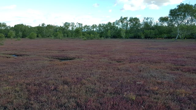
Coombabah Lakelands Conservation Area
There is no direct track, just a heap of different paths, where you can wonder through the conservation area spotting all sorts of wildlife. Especially kangaroos, that are slowly becoming more used to humans, so you can get some really nice photos of some semi wild kangaroos. Otherwise there are koalas and bird life also to enjoy.
 1
km
return
15
mins
1
km
return
15
mins
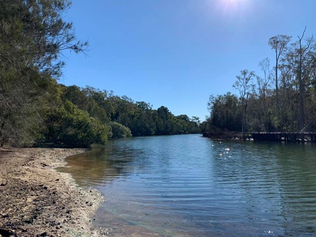
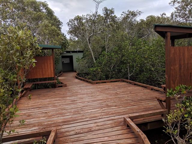
Mangrove Boardwalk
A short walk through the mangroves. At the end there is a bird tower that overviews the Coombabah lake.