
Menu
Popular Walks
-
Mt Ngungun
(1151 ticks) -
Mount Coolum
(869 ticks) -
Mt Cordeaux
(665 ticks) -
Twin Falls Circuit
(635 ticks) -
Purling Brook Falls Circuit
(610 ticks)
Parent Regions
Sub-Regions
- Amamoor State Forest
- Bellthorpe National Park
- Brisbane City Council Local Walks
- Brisbane Forest park D'Aguilar National Park
- Brisbane Valley Rail Trail
- Coombabah Lakelands Conservation Area
- Daisy Hill Conservation Park
- Eumundi Conservation Park
- Glass House Mountains National Park
- Glen Rock Regional Park
- Gold Coast
- Ipswich
- Jimna State Forest
- Karawatha Forest
- Kondalilla National Park
- Lamington National Park
- Main Range National Park
- Mapleton National Park
- Moggill Conservation Park
- Moogerah Peaks National Park
- Moreton Island National Park
- Mt Barney National Park
- North Stradbroke Island - Minjeeribah
- Parklands Conservation Park
- Springbrook National Park
- Sunshine Coast
- Tamborine National Park
- White Rock - Spring Mountain Conservation Estate
Summary
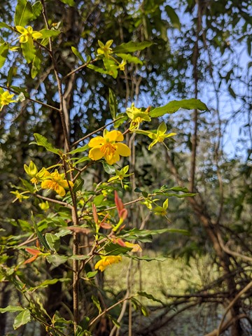
Boarding NSW and the pacific Ocean, it is not uncommon for hikes to have views of both worlds (ocean and hinterland). Hikes here are typically on the great dividing range.
Popular Walks
-
Mt Ngungun
(1151 ticks) -
Mount Coolum
(869 ticks) -
Mt Cordeaux
(665 ticks) -
Twin Falls Circuit
(635 ticks) -
Purling Brook Falls Circuit
(610 ticks)
Parent Regions
Sub-Regions
- Amamoor State Forest
- Bellthorpe National Park
- Brisbane City Council Local Walks
- Brisbane Forest park D'Aguilar National Park
- Brisbane Valley Rail Trail
- Coombabah Lakelands Conservation Area
- Daisy Hill Conservation Park
- Eumundi Conservation Park
- Glass House Mountains National Park
- Glen Rock Regional Park
- Gold Coast
- Ipswich
- Jimna State Forest
- Karawatha Forest
- Kondalilla National Park
- Lamington National Park
- Main Range National Park
- Mapleton National Park
- Moggill Conservation Park
- Moogerah Peaks National Park
- Moreton Island National Park
- Mt Barney National Park
- North Stradbroke Island - Minjeeribah
- Parklands Conservation Park
- Springbrook National Park
- Sunshine Coast
- Tamborine National Park
- White Rock - Spring Mountain Conservation Estate
History
Any interesting history for the region?
Features
What are the standout bushwalking features?
Access
How do you get there? Include all access points if there are many?
Maps
Which maps cover the region?
Accommodation
Where can I stay there? or near there?
Camping
Council Areas:
- Scenic Rim Regional
- Gold Coast City
- Logan City
- Redland City
- Ipswich City
- Lockyer Valley Regional
- Brisbane City
- Somerset Regional
- Moreton Bay Regional
- Sunshine Coast Regional
- Noosa Shire
Contact details
See Qld National parks website
Walks in Brisbane City Council Local Walks

 3
km
return
3
km
return
 45
mins
45
mins
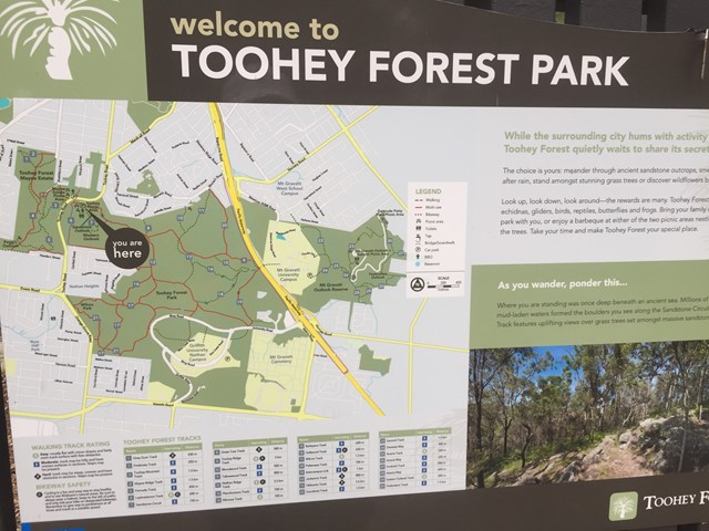
Toohey Mountain Track & Mayne Ridge Track
A short walk in Toohey Forest Park from the Mayne Estate Picnic Area to the top of Toohey Mountain and to Pegg's Outlook.
 2
km
40
mins
2
km
40
mins
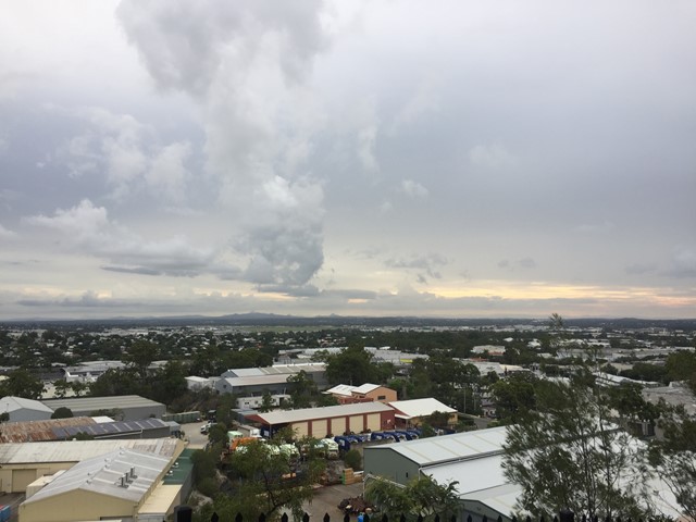
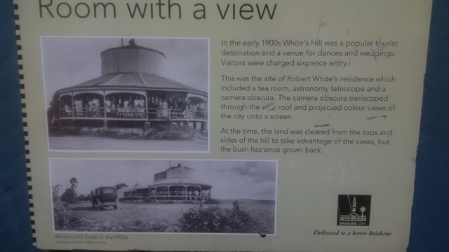
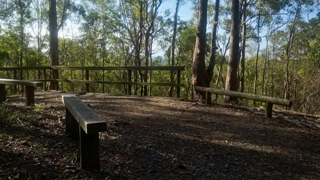
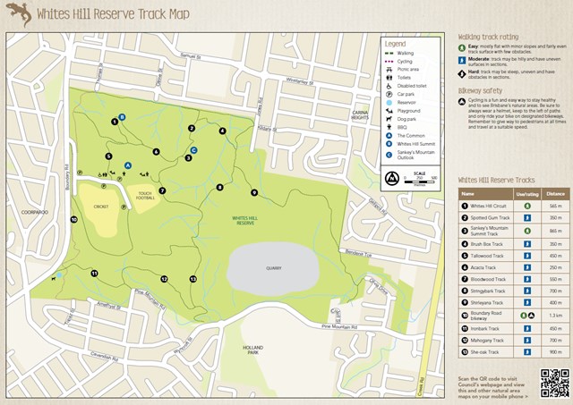
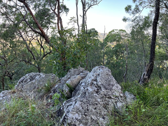
Whites Hill Circuit
A nice urban bushland walk to a peak and lookout to Brisbane's CBD. A few tracks that can be combined to a loop.
 500
m
return
30
mins
500
m
return
30
mins
Windaroo Mountian
Short walk, one route is steep the other isn't not the best views on top but not bad. There are a number of trails and tracks. Nothing marked.
 1.5
km
return
40
mins
1.5
km
return
40
mins
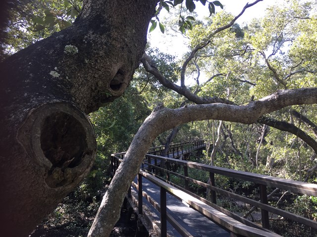
Wynnum Mangrove Boardwalk
Walkway and boardwalk circuit that pass through the mangroves.
 1.5
km
27
mins
1.5
km
27
mins
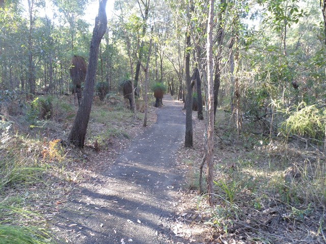
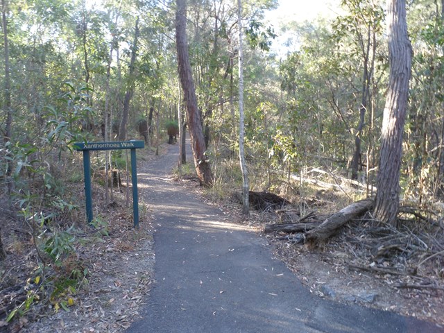
Xanthorrhoea Track
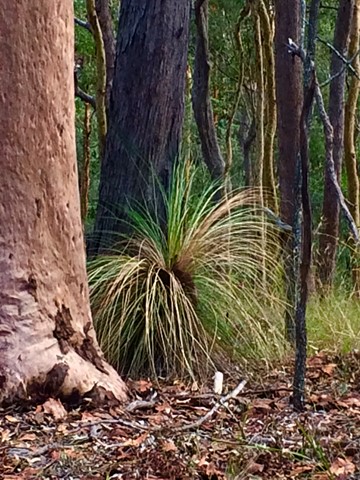
This track passes through mixed heath and woodland species including banksias, grass trees and heath peas. You are likely to see kookaburras, forest kingfishers, red-backed wrens, dollarbirds, lizards and geckoes.
Picnic area available at entrance.
Grade: easy, but it’s hilly
Suited to: birdwatching and flora walks
Habitat: heathland
Must: walk this track in September or at dusk
Recommendation: combine this track with the Banksia Track for a two hour circuit walk, Pomax Track for another two hour walk or all three for a three hour walk
 5
km
90
mins
5
km
90
mins
Araucaria Track
This walk begins off downhill, soon there are some views of the reservoir then the track begins to wind its way along the edge of the reservoir keep an eye out for different water birds.
I would advise taking you camera equipment as well as a pair of binoculars for some good bird watching. After approx 1.7km you come to a Y junction go straight ahead and some more views of the Enoggera weir come into sight. There seems to be alot of bellbirds and a few whipbirds around here.
From here the track winds into some bush some small reminent of rainforest. And from here it gets a bit "are we there, yet" but keep on going up and over the ridge and back down again and you rejoin back at the Y junction.
Now the return route can be a little problem if you leave it late to do this walk because on your return from the Y junction. You will meet alot of people along the way.
Some signs have been errected "brown snakes" in the area. So watch your step when walking around the exposed hot ridge areas.
Also this track can be combined with the Corymbia Circuit to add a bit of distance for you walk.
 5.2
km
return
90
mins
5.2
km
return
90
mins
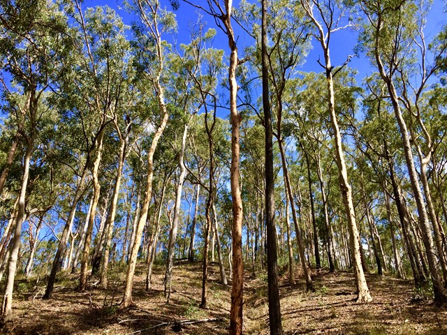
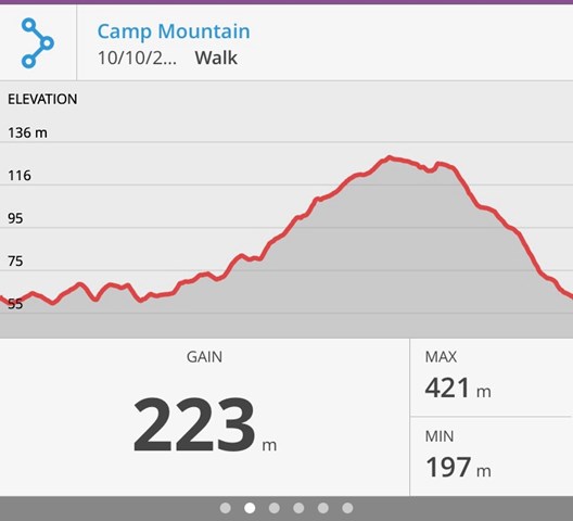
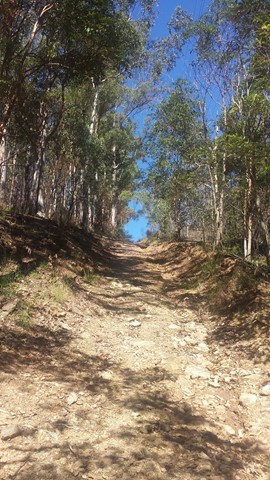
Camp Mountain Lookout
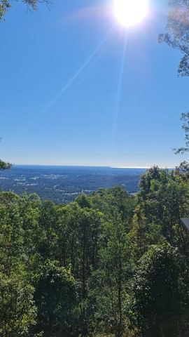
Beautiful walk through eucalypt forest along a well maintained fire trail. We parked at the junction of Suttons Road & Suttons Court, Camp Mountain, parked the car at the horse step through and headed up the hill. It's a steep walk up to the lookout where you will find spectacular views of Brisbane City and Moreton Bay. Wander a little further and you can see the beautiful Samford Valley and Glass House Mountains in the distance. You can also drive into the lookout from Mt Nebo Road.
If you are feeling energetic and want to add an extra hour to your walk, head down the hill towards Bellbird Grove - the trail splits just after the water tank, instead of going left to do the circuit, go straight ahead. Follow the trail and you will come into the back of Bellbird Grove - have a toilet stop, a little rest and then turn around and head back the same way to join back onto the circuit.
 18
km
7
hrs
18
km
7
hrs
Cedar Creek to White Cedar Picnic Ground
A Walk over the D'Aguilar Range via Maiala Picnic Ground.
1.5
km
30
mins
Corymbia Circuit
A small walk in a cool area before going on to the Araucaria Track
 10
km
return
3
hrs
10
km
return
3
hrs
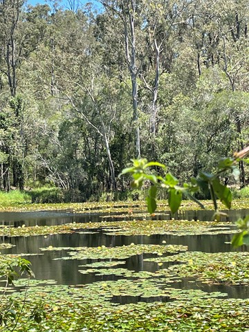
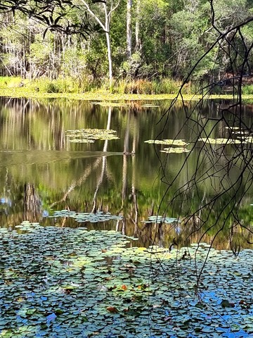
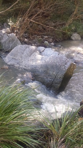
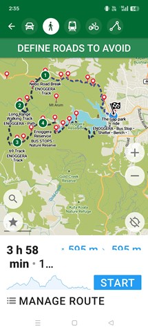
Enoggera Reservoir Circuit
This is a great walk through mostly canopied forest that skirts around Enoggera Reservoir. There are some quite steep hills which will be a challenge if you are not very fit, but most of the walk is easy. Glimpses of the reservoir, lots of beautiful trees, the odd encounter with wildlife make for a very enjoyable couple of hours.
It is best to call into the Information Centre at Walk About Creek before starting this walk as they have detailed instructions on navigating the bit of suburb walking required to complete the circuit. It's also useful to have the topographical map as the hike isn't on marked trails - it would be difficult to get lost - but it's possible! If you are doing a circuit then just keep taking Left hand turns if going anti clockwise! After reaching the dam wall keep on the left until you reach the transport hub (The Gap), The parking area has an exit that leads to the Walkabout Creek area with proper walkways.