
Menu
Popular Walks
-
Mt Ngungun
(1156 ticks) -
Mount Coolum
(872 ticks) -
Mt Warning Summit Trail
(760 ticks) -
Mt Cordeaux
(668 ticks) -
Twin Falls Circuit
(636 ticks)
Popular Walks
-
Mt Ngungun
(1156 ticks) -
Mount Coolum
(872 ticks) -
Mt Warning Summit Trail
(760 ticks) -
Mt Cordeaux
(668 ticks) -
Twin Falls Circuit
(636 ticks)
Sub-Regions
Walks in Warrumbungle National Park
(New South Wales)
 4
km
return
4
km
return
 90
mins
90
mins
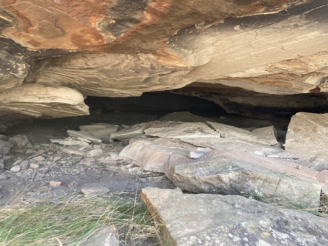
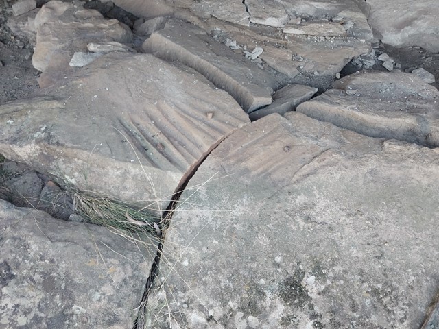
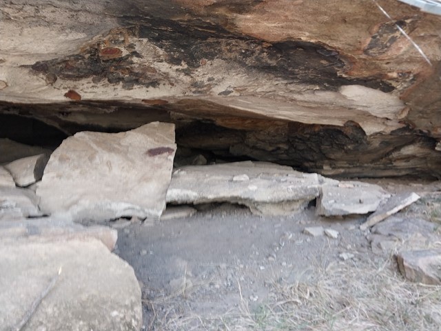
Tara Cave
Tara Cave walking track is ideal for bushwalkers interested in the area’s Aboriginal culture. The track leads to Tara Cave, which has evidence of Aboriginal occupation and along the way there are interpretive displays about the local Aboriginal people’s connection with the land.
Until recently, Aboriginal people used caves in the area for shelter. Tara Cave was also used for manufacturing stone tools, and you can see a stone slab with ‘grinding grooves’ at the cave entrance.
 1.3
km
return
45
mins
1.3
km
return
45
mins
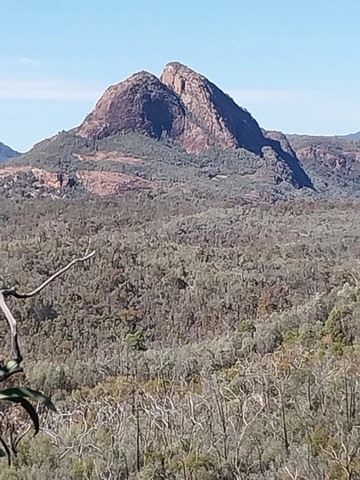
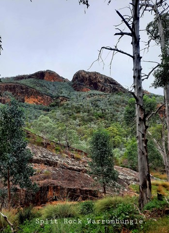
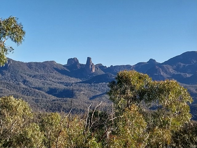
Wambelong Nature Track
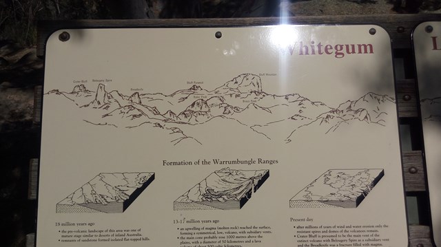
Short and easy, Wambelong Nature Track is big on rewards and ideal for wildlife and bird watching. The track rises steeply with an awe-inspiring vista of the valley and Split Rock, where you’ll gaze across unique rock outcrops and dramatic spires shaped by volcanic activity 13-17 millions of years ago and then through a small, sheltered gorge.
 1.25
km
return
30
mins
1.25
km
return
30
mins
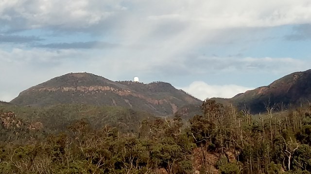
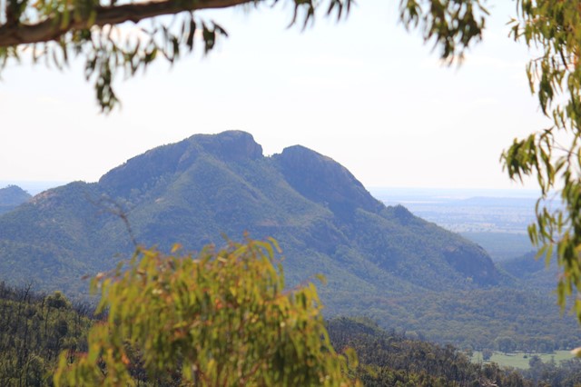
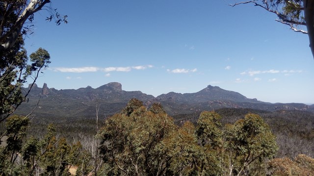
Whitegum Lookout
Spectacular views of the volcanic landscape of Warrumbungle National Park await you at Whitegum Lookout. It provides you with a perspective of the many other walks and climbs that the National Park has to offer.
Walks in Wollumbin National Park
(New South Wales) 8.5
km
return
3
hrs
8.5
km
return
3
hrs
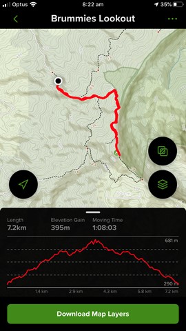
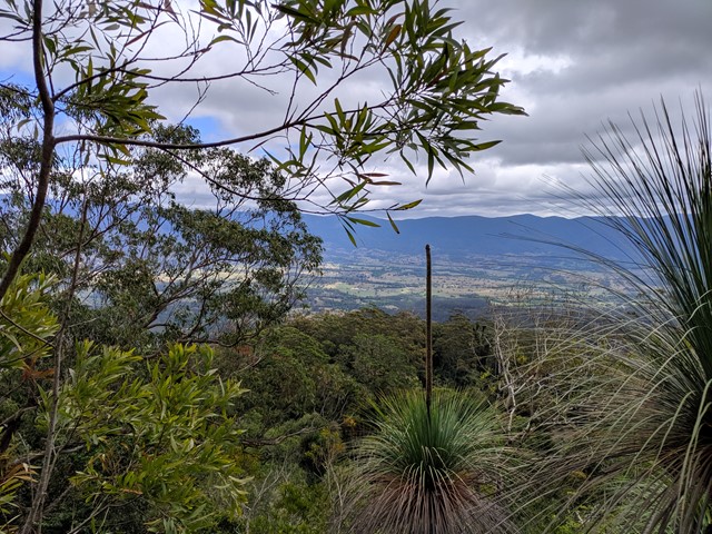
Brummies Lookout
A nice return walk along a rising forestry trail through tall forest and rainforest, then on to a foot trail ending at a small peak with great views towards nearby Mt Warning and the Border Ranges.
 8.3
km
return
5
hrs
8.3
km
return
5
hrs
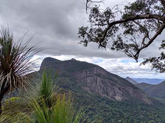
Mt Warning Summit Trail
MOUNT WARNING SUMMIT TRAIL HAS BEEN CLOSED SINCE COVID, BUT IT IS NOW PROPOSED TO REOPEN THE TRACK IN JULY 2026.
A trail to the summit of Mt Warning offers beautiful 360 degree views of the Great Dividing Range from the peak. Lots of steps, can be slippery. A steep climb to the summit using chains, but the views from the top are worth it!
Walks in Northern Territory
2
km
return
1
hr
Barrawulla Loop Walk (Caranbirini Conservation Reserve)
Barrawulla Loop Walk - a short walk that takes you into another world exploring the impressive sandstone spires of the ‘lost city’ formation.
Distance: 2 km loop
Time: 1 - 2 hours
Grade: 2 - easy
200
m
return
10
mins
Caranbirini Waterhole (Caranbirini Conservation Reserve)
this walk leads to a birdhide overlooking a semi-permanentwaterhole. A bird-watcher’s delight, particularly late in the dry season when surface water in the region becomes scarce.
Distance: 200 m return
Time: 10 mins
Grade: 2 - easy
2.1
km
return
1
hr
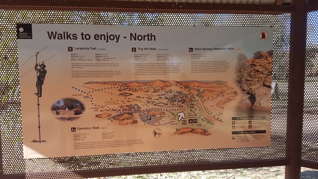
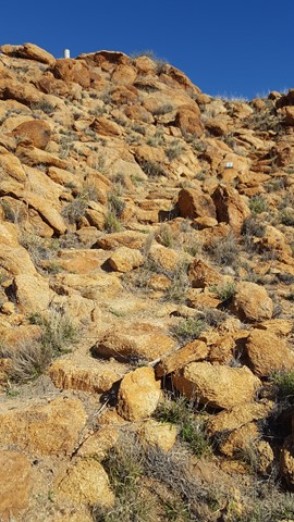
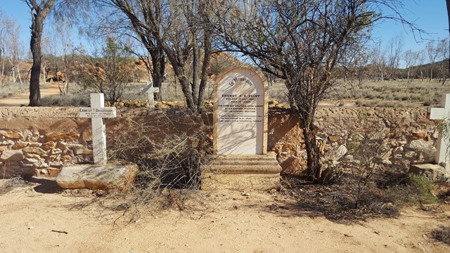
Cemetery & Trig Hill Loop
This is a hugely historic area and this walk, with its interpretive signs, takes you out to the cemetery and around the immediate area, up Trig Hill and back to the Telegraph Station.
 1.6
km
return
1
hr
1.6
km
return
1
hr
Claypan Walk (Rainbow Valley Conservation Reserve)
The Claypan Walk is 1.6 km return and meanders along the edge of the mostly dry claypans that transform into reflective pools for short periods after rain. There are several viewing platforms
along the way that provide the best views of Rainbow Valley.
1
km
return
30
mins
Corroboree Rock Walk (East Macdonell Ranges)
Corroboree Rock is a dark grey column of dolomite an hour's drive east of Alice Springs.
It’s one of many sites in the MacDonnell Ranges that’s of great importance to the Eastern Arrernte people.
Take a short walk around the base of the rock to survey the area and have a closer look at the ancient sedimentary, fine-grained rock. At the base you can see dark grey and light grey streaky blobs of dolostone rock. A ring of low ground surrounding it makes it look like an obelisk.
The real significance of the rocky outcrop to the Eastern Arrernte people is not well known. Corroboree Rock was probably not a corroboree site due to the lack of water in the area, but was probably used as an important storage site for ceremonial objects.
The rock itself is an outcrop of dolomite from the Bitter Springs Formation originally laid down in salty lakes 800 million years ago.
Corroboree Rock Conservation Reserve is an easy stopover on your way to other East MacDonnell landmarks such as Trephina Gorge and Arltunga. The reserve is easily reached along the sealed road by two-wheel drive vehicles.