
Menu
Popular Walks
-
Breadknife and Grand High Tops Circuit
(13 ticks) -
Whitegum Lookout
(10 ticks) -
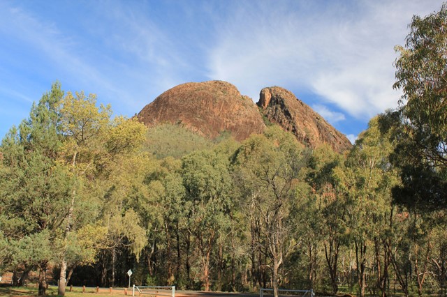
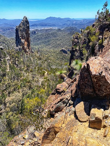
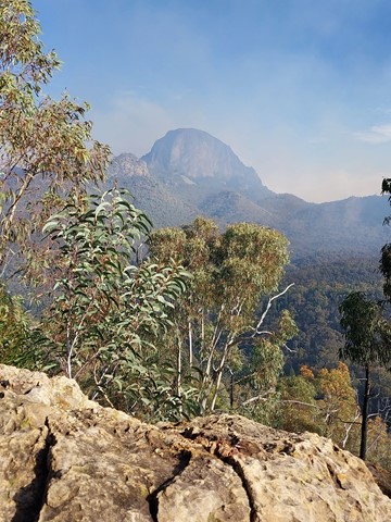
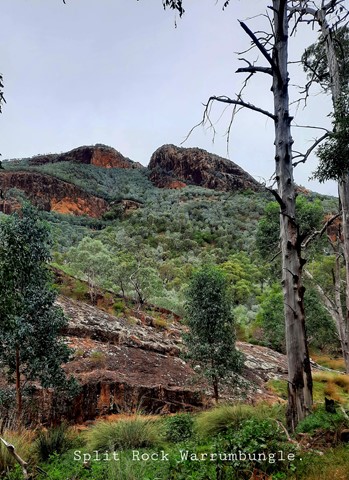
Belougery Split Rock
(9 ticks) -
Wambelong Nature Track
(6 ticks) -
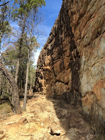
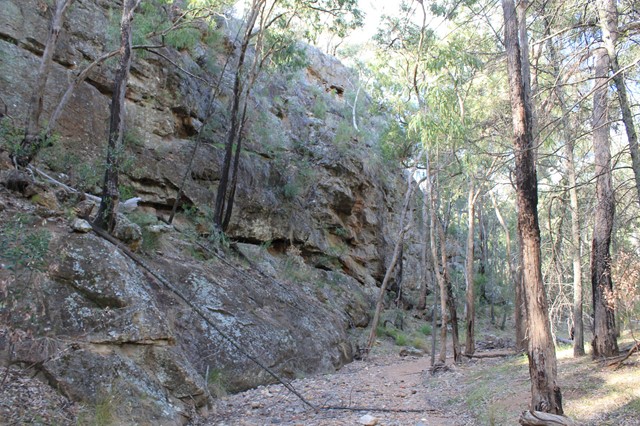
Burbie Canyon
(6 ticks)
Parent Regions
Summary
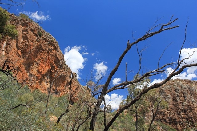
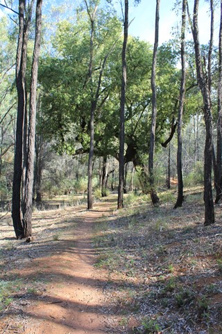
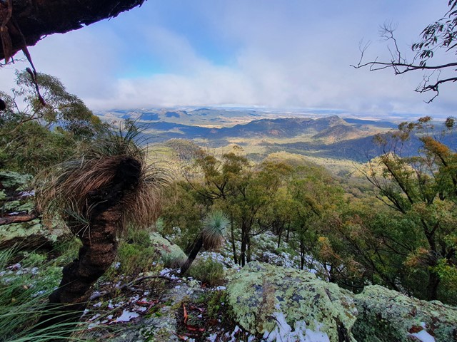
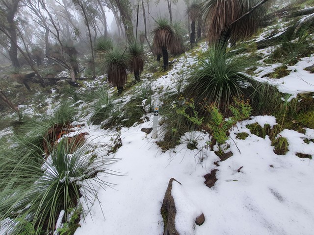
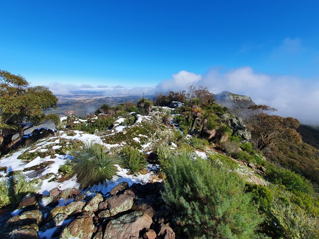
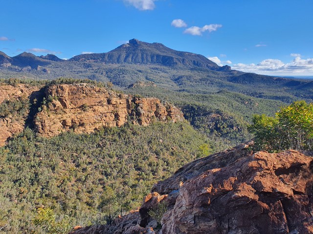
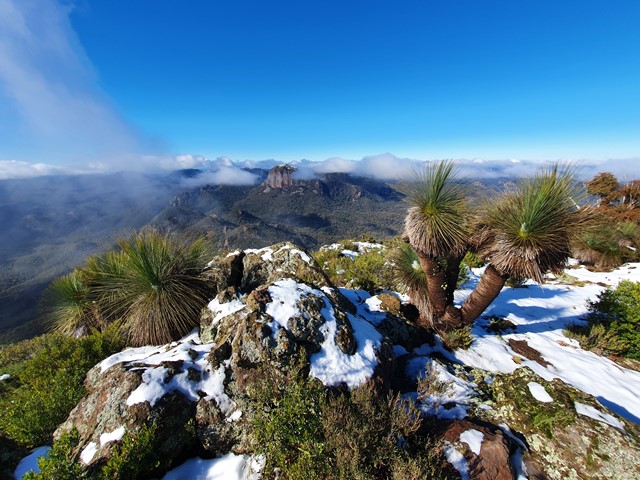
Warrumbungle National park is an area of former volcanic activity. Its landscape includes forested ridges, barren spires and deep gorges. the park was added to the National Heritage List in 2006. It is an ideal destination for the bushwalker, pack camper, photographer, birdwatcher or those who simply enjoy watching sunlight change the colours on a cliff face.
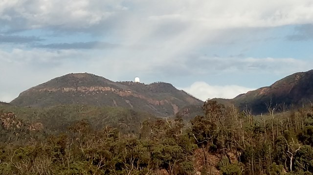
The park is also Australia's only Dark Sky Park. Nearby Siding Spring Observatory is a worthwhile stop and stargazing is fantastic from the park or one of the nearby public observatories.
Popular Walks
-
Breadknife and Grand High Tops Circuit
(13 ticks) -
Whitegum Lookout
(10 ticks) -
Belougery Split Rock
(9 ticks) -
Wambelong Nature Track
(6 ticks) -
Burbie Canyon
(6 ticks)
Parent Regions
History
John Oxley was the first European to explore the area in 1818. Oxley named the range the Arbuthnot Range but the Gamilaroi name, Warrumbungles meaning "crooked mountains" became the most common name.
In 2013 the park was ravaged by a massive bushfire. The Visitor Centre has details on the fire and explanations of the research and regeneration afterwards.
Features
The Siding Springs Observatory is adjacent to the park but only open during the day (at night it's busy doing research!) There are a number of public observatories nearby which offer nighttime shows.
The park is popular with rock climbers. Climbing routes can be found at the crag.
Access
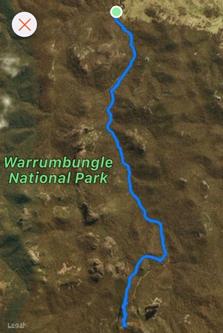
Access to the park is along John Renshaw Parkway from Coonababran on the east or Tooraweenah on the west. The route is signposted from Coonababran.
As you drive in from the east, entertain the children as you follow the 'Virtual Solar System' that leads to Siding Spring Observatory at the Park entrance - Virtual Solar System Drive.
Accommodation
The park has 8 campgrounds, many of which are walk in. Camp Blackman provides vehicular camping and is a popular base for walkers with barbecues, picnic tables and hot showers.
Contact details
https://www.nationalparks.nsw.gov.au/visit-a-park/parks/warrumbungle-national-park
Walks in Warrumbungle National Park

 4.6
km
return
4.6
km
return
 3.5
hrs
3.5
hrs
Belougery Split Rock
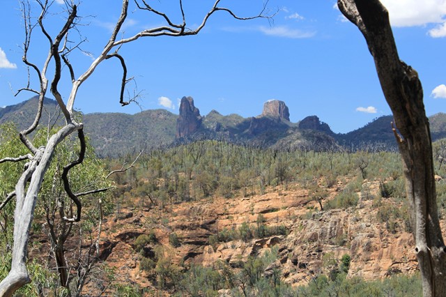
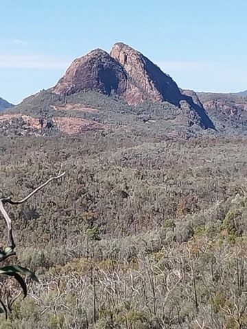
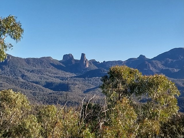
A medium length tracks with some fun scrambling and fantastic views across to the Warrumbungles major features including the Breadknife, Grand High Tops, Belougery Spire and Siding Spring Observatory. The rock is a lava dome formed by viscous lava. This is a great half-day walk as an introduction to the Warrumbungles or if you have limited time.
 17
km
return
7
hrs
17
km
return
7
hrs
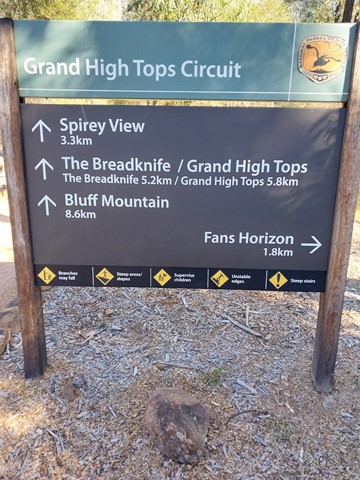
Bluff Mountain
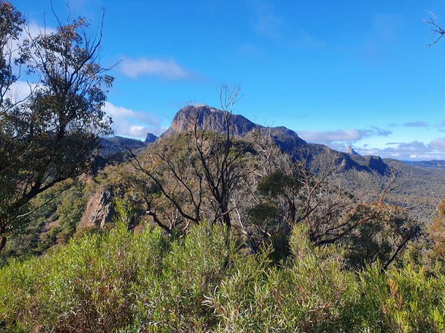
A must for adventurous bushwalkers, Bluff Mountain walking track follows the same route as Breadknife and Grand High Tops walk but this hike takes you to the top of Bluff Mountain. It offers unrivalled views of the Warrumbungles’ ancient volcanic landscape as you climb from remnant ancient rainforest to windswept mountain heath.
 13
km
return
6
hrs
13
km
return
6
hrs
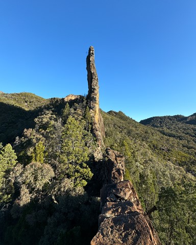
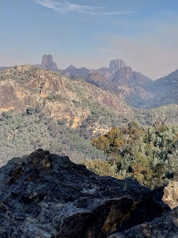
Breadknife and Grand High Tops Circuit
Breadknife and Grand High Tops Circuit in Warrumbungle National Park is regarded as one of the best walks in New South Wales, offering close up views of the park’s iconic rock formations.
 2.4
km
return
1
hr
2.4
km
return
1
hr
Burbie Canyon
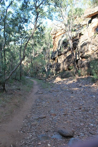
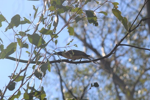
Avid birdwatchers will love Burbie Canyon walking track, which offers a gentle stroll along the creek and through a narrow sandstone gorge. Indeed, the birdlife is so varied here, you can’t help but go bird watching. This is a terrific track for families, the kids will love it.
 3.8
km
return
105
mins
3.8
km
return
105
mins
Fans Horizon
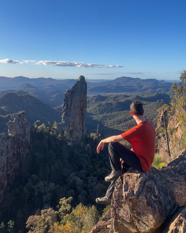
Perched atop the cliffs of Balgatan Mountain, Fans Horizon lookout is well worth the short but challenging hike. It’s perfect for bushwalkers who are pressed for time but keen to see the Warrumbungles' famous volcanic rock formations.
Take the time to catch your breath as you enjoy some of the park’s most rewarding sights. You’ll have magnificent views of the iconic Breadknife, Belougery Spire and Crater Bluff.
 24.9
km
3
days
24.9
km
3
days
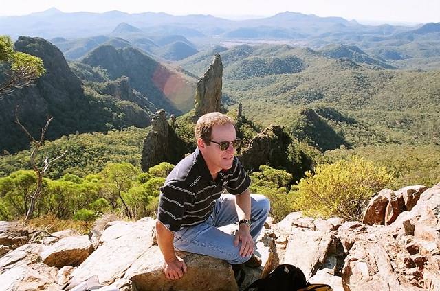
Grand High Tops
A spectacular mountain walk through the remnants of an ancient volcanic landscape of Warrumbungle National Park in outback NSW.
 17
km
return
6
hrs
17
km
return
6
hrs
Mt Exmouth
At 1,206 meters, Mt Exmouth is the tallest mountain in the Warrumbungles. Follow a well marked trail to the summit for excellent 360 degree views.
 4
km
return
90
mins
4
km
return
90
mins
Tara Cave
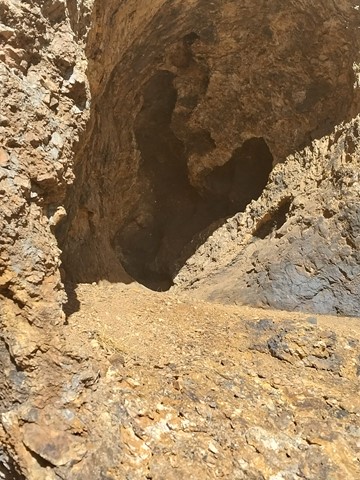
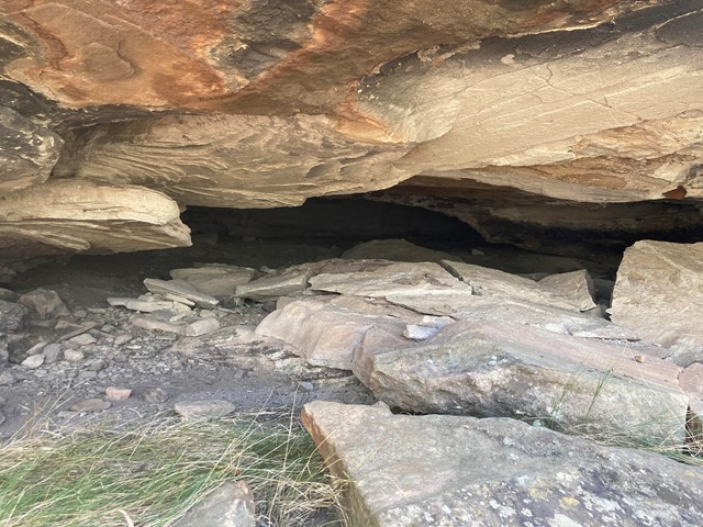
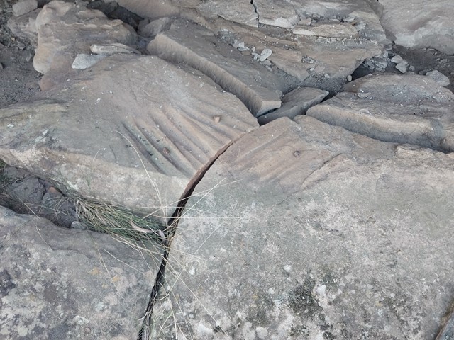
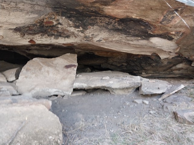
Tara Cave walking track is ideal for bushwalkers interested in the area’s Aboriginal culture. The track leads to Tara Cave, which has evidence of Aboriginal occupation and along the way there are interpretive displays about the local Aboriginal people’s connection with the land.
Until recently, Aboriginal people used caves in the area for shelter. Tara Cave was also used for manufacturing stone tools, and you can see a stone slab with ‘grinding grooves’ at the cave entrance.
 1.3
km
return
45
mins
1.3
km
return
45
mins
Wambelong Nature Track
Short and easy, Wambelong Nature Track is big on rewards and ideal for wildlife and bird watching. The track rises steeply with an awe-inspiring vista of the valley and Split Rock, where you’ll gaze across unique rock outcrops and dramatic spires shaped by volcanic activity 13-17 millions of years ago and then through a small, sheltered gorge.
 1.25
km
return
30
mins
1.25
km
return
30
mins
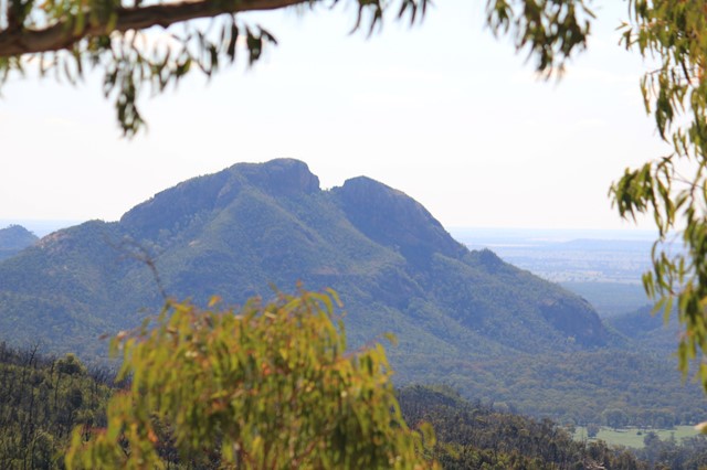
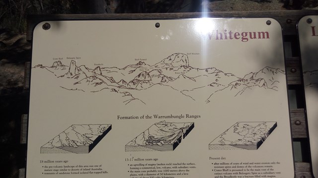
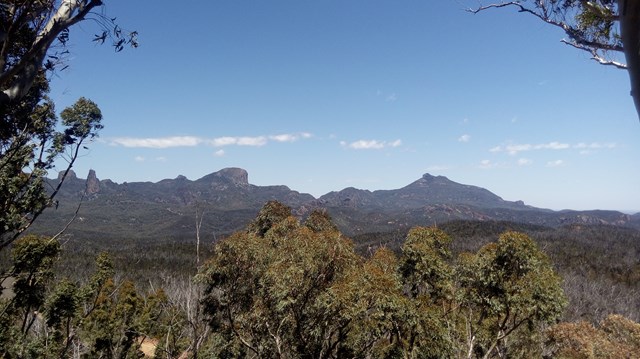
Whitegum Lookout
Spectacular views of the volcanic landscape of Warrumbungle National Park await you at Whitegum Lookout. It provides you with a perspective of the many other walks and climbs that the National Park has to offer.