
Menu
Popular Walks
-
Mt Ngungun
(1145 ticks) -
Mount Coolum
(864 ticks) -
Mt Warning Summit Trail
(759 ticks) -
Mt Cordeaux
(659 ticks) -
Twin Falls Circuit
(630 ticks)
Popular Walks
-
Mt Ngungun
(1145 ticks) -
Mount Coolum
(864 ticks) -
Mt Warning Summit Trail
(759 ticks) -
Mt Cordeaux
(659 ticks) -
Twin Falls Circuit
(630 ticks)
Sub-Regions
Walks in Far North Queensland
(Queensland)
 10.6
km
return
10.6
km
return
 8
hrs
8
hrs
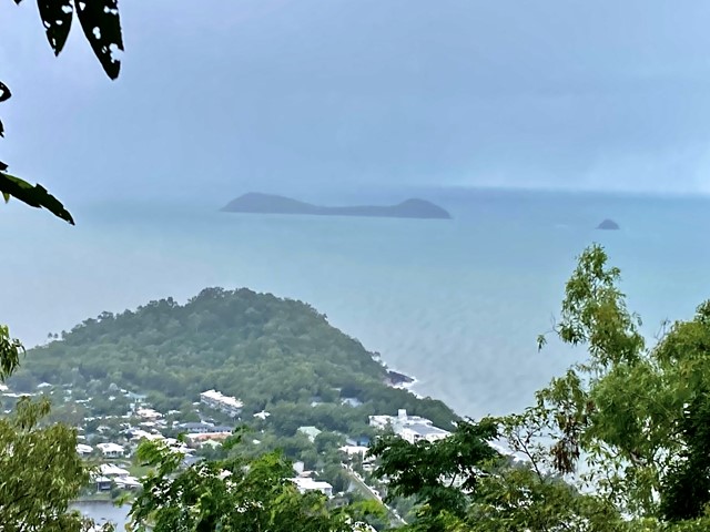
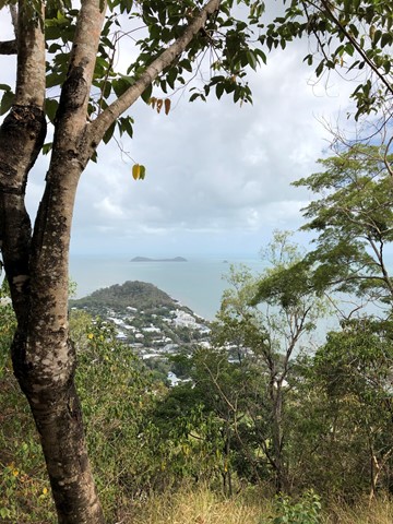
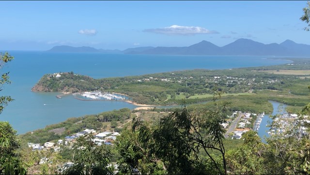
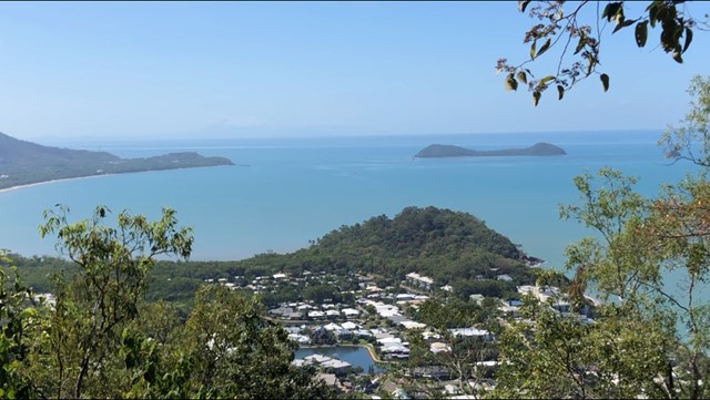
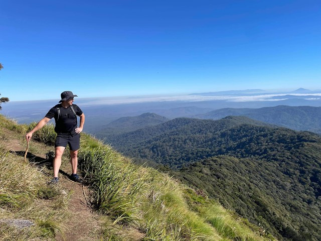
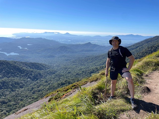
Devils Thumb
A long, steep and tiring ascent up and over a mountain to get to the enormous granite rock feature that overlooks Port Douglas and beyond. Quite possibly the best lookout in North Queensland!!
 4
km
return
90
mins
4
km
return
90
mins
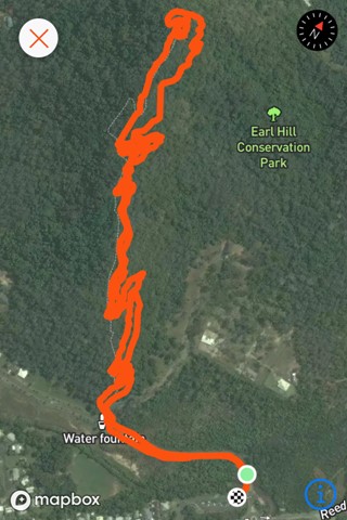
Earl Hill Summit Track
Earl Hill is a 2.9 kilometre moderately trafficked out and back trail located at Trinity Beach north of Cairns, Queensland, Australia that features a great forest setting and is good for all skill levels. The trail is primarily used for hiking, walking, and nature trips and is accessible year-round.
 400
m
return
15
mins
400
m
return
15
mins
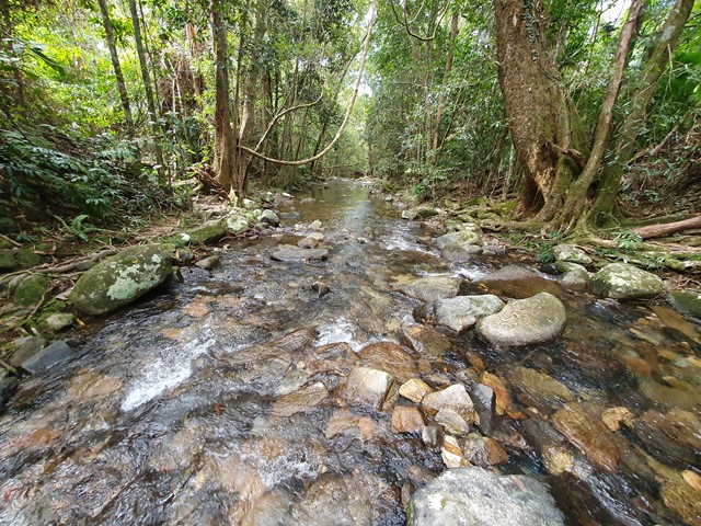
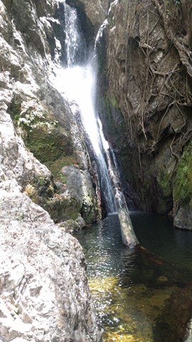
Ellinjaa Falls
Ellinjaa Falls are picturesque falls that are part of the Waterfalls Circuit along with Millaa Millaa and Zillie Falls. Enjoy the sound of the water rushing over a series of lava columns and watch for turtles and platypus. The falls are a great spot for swimming with a little ledge hidden behind the falls that you can sit on and take in the rainforest scenery.
 2
km
return
1
hr
2
km
return
1
hr
Emerald Creek Falls walking track
Emerald Creek rushes out of the rainforests of the Lamb Range. The waters of the creek tumble over granite boulders, forming the picturesque falls that plunge into placid pools.
800
m
return
1
hr
Fairy Falls - Cairns
An isolated bushwalk through the rainforest, ending in a waterfall and small swimming hole.
 7.5
km
return
87
mins
7.5
km
return
87
mins
Hartleys Creek Falls
A 7.5 km out and back hike with some undulations .
10.8
km
5
hrs
Island Circuit
A lovely scenic walk around Dunk Island - not too strenuous, lots of wildlife!
 17.5
km
return
7
hrs
17.5
km
return
7
hrs
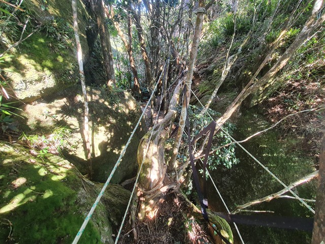
Kahlpahlim Rock Circuit,
Dinden national Park, Cairns
Steep climb to top of rock
Very challenging
Also hard walk down
1.5
km
return
45
mins
Lacey’s Creek Walk
Easy going walk through tropical rainforest with the chance to see a cassowary.
12.6
km
return
5
hrs
Lamb's Head and Kahlpahlim Rock
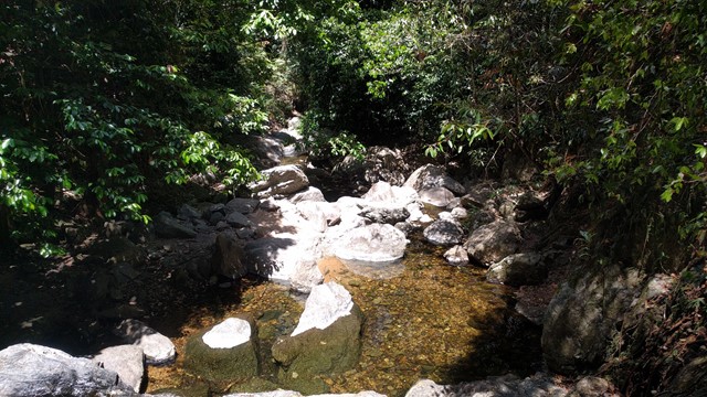
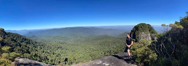
This a a fantastic and varied hike to the summit of Lamb's Head. Walk would range between 4-6hrs depending on fitness levels and stoppages. I recommend taking a few litres of water and some snacks. It is best during the dry winter season. The views at the top are absolutely amazing and there are several viewing points if you follow the 'sometimes hard' to see small pink ribbons. One view faces north/north-east over Cairns and the other is west/north-west. It truely is the one of the best hikes in the region. Afterwards you can find many beautiful rock pools at Davies Creek to swim in.