
Menu
Popular Walks
-
Mt Walsh
(108 ticks) -
Barker Creek Circuit
(77 ticks) -
Carlo Sandblow
(68 ticks) -
Scenic Circuit
(64 ticks) -
Mount Kiangarow
(59 ticks)
Summary
From Gympie to Bundaberg. This region is known for...
Popular Walks
-
Mt Walsh
(108 ticks) -
Barker Creek Circuit
(77 ticks) -
Carlo Sandblow
(68 ticks) -
Scenic Circuit
(64 ticks) -
Mount Kiangarow
(59 ticks)
Parent Regions
Sub-Regions
History
Any interesting history for the region?
Features
What are the standout bushwalking features?
Access
How do you get there? Include all access points if there are many?
Maps
Which maps cover the region?
Accommodation
Where can I stay there? or near there?
Camping
Council Areas
- Gympie Regional
- South Burnett Regional
- North Burnett Regional
- Fraser Coast Regional
- Bundaberg Regional
Contact details
See QLD National Parks Website: ..
Walks in Wide Bay Burnett

 1.1
km
return
1.1
km
return
 15
mins
15
mins
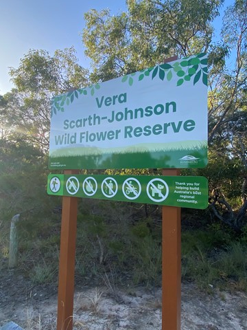
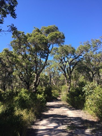
Vera Scarth-Johnson Wild Flower Reserve
A short walk through Banksia trees and alongside salt flats. The walking track splits in two not far from the car park and if you follow that in a loop you get this walk. There is another one way walking track that heads towards the salt flats of the Elliott River.
 5.86
km
return
84
mins
5.86
km
return
84
mins
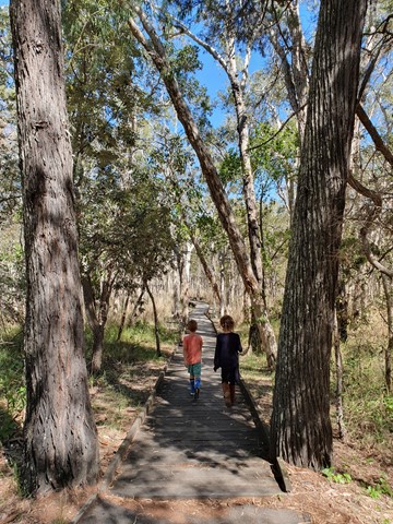
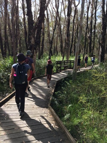
Woodgate Banksia Walking Track
A 200m paved surface leads from the entrance of the park to the boardwalk. The boardwalk is 400m in distance making a round trip from the park entrance and back about 1.4 km. The walking track varied from hard pressed dirt and grass, to quite soft sandy soil but in general was very well maintained and flat. Prams with pump-up tyres and bikes would both cope well on this track. The full circuit is 5.2km and takes about 2 hours to complete. The scenery was varied from large cabbage palms and ferns to forests of eucalypts and banksias.
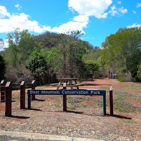
Walks in Boat Mountain Conservation Park
 432
m
return
30
mins
432
m
return
30
mins
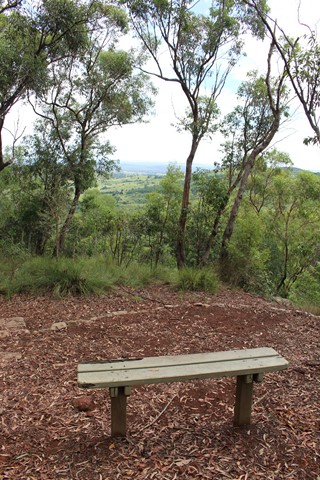
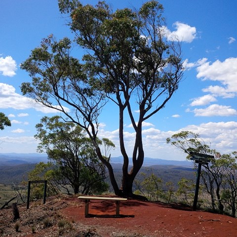
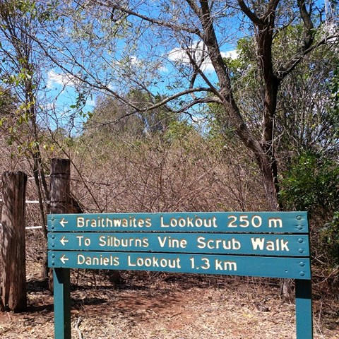
Braithwaites Lookout
A walk up to Boat Mountain's first lookout with views towards Murgon, through healthy, partly-shaded bushland.
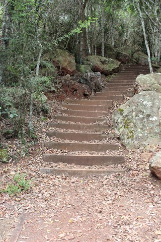
While this is a short and easy to follow track, the walk begins with a long staircase of 180 steps.
 2.6
km
return
1
hr
2.6
km
return
1
hr
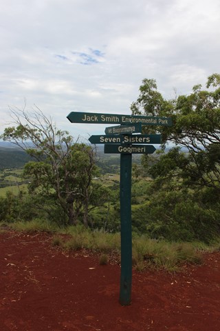
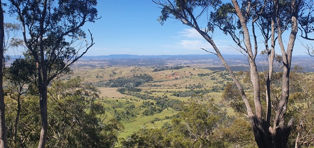
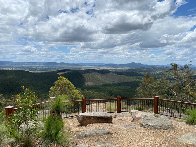
Daniels Lookout
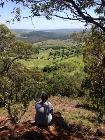
This track winds up Boat Mountain then follows along the ridge at the top to offer sweeping views to the north.
There is a long man-made staircase of 180 steps at the beginning of this walk, but the upper section of the track is mostly flat and very easy to follow, with views that are well worth the effort.
 1.9
km
return
1
hr
1.9
km
return
1
hr
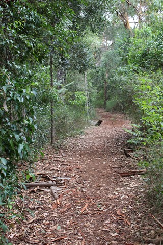
Silburns Vine Scrub Walk
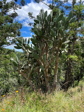
Boat Mountain is named for it's shape, which looks like an overturned Viking ship. Silburns Vine Scrub Walk is a side track off the main trail. It winds through a shady section of dry rainforest that contains many interesting vines and plants and the odd Padymelon if you are lucky.
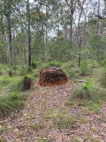
Walks in Brooyar State Forest
 100
m
return
15
mins
100
m
return
15
mins
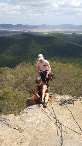
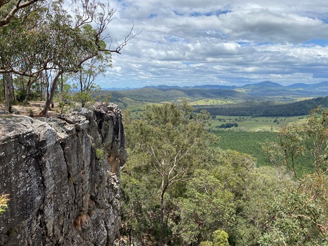
Eagles Nest
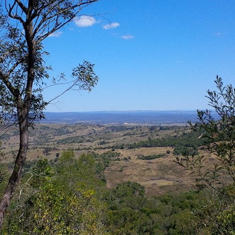
A short walk to a similar lookout to Point Pure, with its sandstone cliffs and views over hoop pine plantations and mature rainforest with emergent hoop pines.
Also a good place for some rock climbing and abseiling, if you're into that, or just watch the fun.
 2.2
km
return
1
hr
2.2
km
return
1
hr
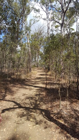
Glastonbury Creek Loop
A looping walk up to the top of the ridge above the camp site, through the eucalypt forest and abundant grass trees, before returning downhill to Glastonbury Creek.
 8.6
km
return
2.5
hrs
8.6
km
return
2.5
hrs
Glastonbury Creek to Point Pure
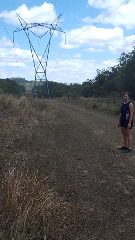
A 4.3km(one way) walk along the road to point pure lookout from the camp ground. Very uphill on the way to the lookout.
It travels along the 4WD track so the path is quite smooth to walk, although a bit steep. It is a bit exposed in places so sun protection is a must.
410
m
return
15
mins
Point Pure
A short walk leads to the lookout at the top of sandstone cliffs. The lookout offers views over hoop pine plantations and mature rainforest with emergent hoop pines. Beyond the plantations, Glastonbury Creek can be seen winding through grazing country.
Also a good place for some rock climbing and abseiling, if you're into that, or just watch the fun.
Walks in Bunya Mountains
10
km
return
3
hrs
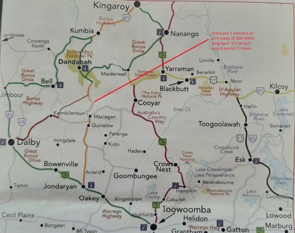
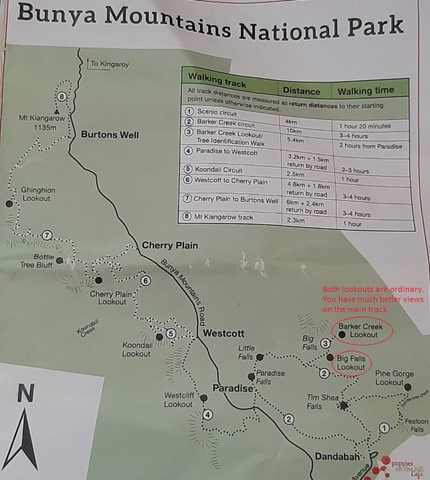
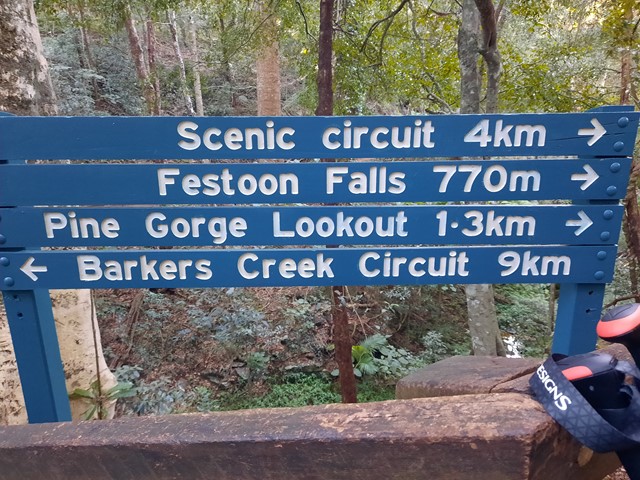
Barker Creek Circuit
A very scenic walk leaving from the Dandabah Camping area, Bunya Avenue. The walk joins up with the shorter Tim Shea Falls walk. Best walked in an anti-clockwise direction for the views and less incline. A couple of side tracks to lookout points. Rainforest, grassy knoll and woodlands