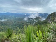
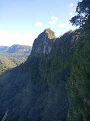
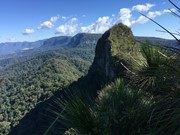
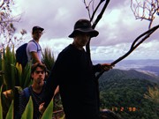
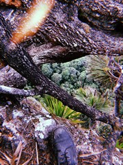
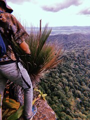
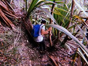
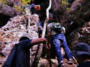
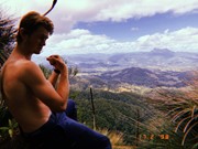
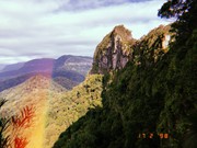
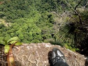
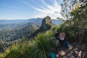
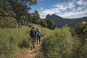
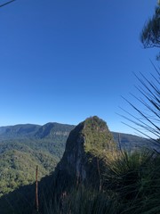
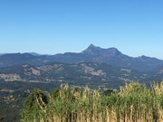
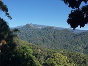
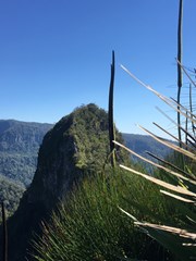
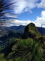
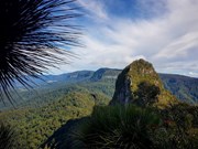
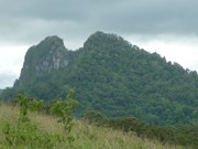
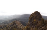
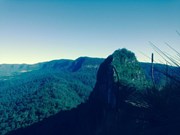
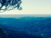
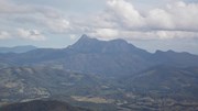
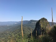
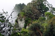
A walk along the border fence line to the twin summits of Mt Cougal. There are excellent views from the top!
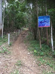
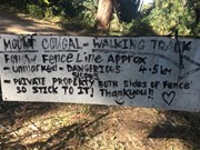
It is hard for beginners. Make sure you check weather. Finding location is a little hard. When arrive see steel gate that states ‘please keep gate clear ta’ On side of gate you can enter, when pass the gate look to your left and see sign with with instructions. Don’t be discouraged when you start, it is a little scary, but it gets easier, but still lots of hill. Follow the barbed wired fence on your left the whole way. The track will go from very narrow to comfortable in some places. Once you reach the last 700 metres or so... it becomes much harder. You will see a thin rope to guide you - do not use this to pull you up as it will break!! You will come to a spot where the track will seem to end. Look for a tree that has arrows etched into it to guide you where to go. There’s also a small pink ribbon tied to a tree branch Up further. You have to go up! It’s hard but worth it.

Scrambling or Climbing

Getting there

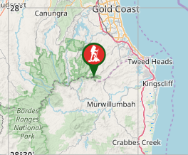
Turn into Stewart Road, exit 95 from the M1. Turn left into Currumbin Creek Rd after about 1km. After about another 7km turn left into Tomewin Mountain Rd. after about another 10km pass through the Border Gate. Turn right into Garden of Eden Rd, about 1km from gate. Drive for about 4km to a gate with a few carspaces. Park Here. 

Maps

Sunmaps Springbrook 25000 

Route/Trail notes

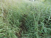
Hop the locked gate (actually, you can walk around it) and follow the path immediately on the left uphill. The barbed wire fence commences here on your left, lantana on your right and sugarcane on your left in patches further up. Do not follow the obvious track straight ahead of the gate! If you see a bunch of abandoned shacks you have gone the wrong way!! After fighting through some serious folage (the path is majorly overgrown for the first hour) at the top of this hill you are rewarded with views of the Tweed Valley and the coast. In fact, garters, long pants and ideally a machette should take care of the basic requirements to continue on this walk. :) The high folage is wet in the mornings requiring hiking boots to avoid soaked feet. On the return (if you choose that option), once the sun hits it, it becomes sticky with a billion small pricles finding every piece of exposed skin! Nonetheless, if you can get past the folage, after the first hour, the track becomes well worn, shady without the high grass. You will be walking on a relatively easy rainforset track for a while.

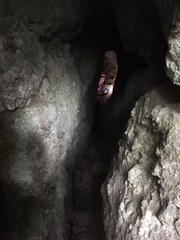
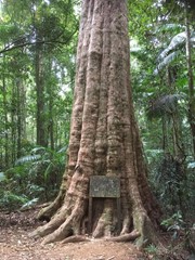
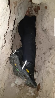
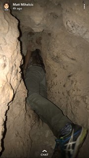
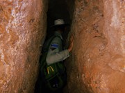
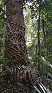
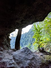
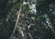
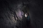
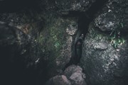
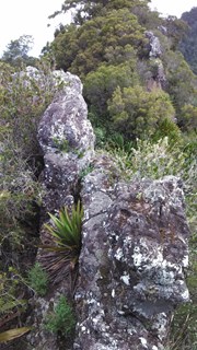
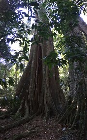
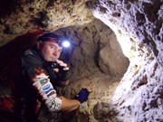
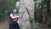
The track winds its way through the rainforest, heading up and downhill along the border fence. You will enter a cleared area with a large tree in it this which was marked by the surveyor Roberts in the 1860's. Keep following the fenceline which will eventually start to become a relatively steep uphill scramble. Walking poles (or some stray sticks) to assist with both the up and decend would be great here if you don't have the fancy onces, pick up a stick early on in the rainforest path before it gets steep (they are usually gone when you start looking on the steep bit). The track is marked in some places with pink ribbons and arrows carved into the timber where it gets a little confusing. After a long uphil climb (notably without further head high grass) veer right and look for a path to a narrow cave. You can Squeeze through the Cave and there is a book to sign on the other side in the opening in the cliff-face - but note that you have to return through the Cave.  Keep veering right after a visit to the cave untill you find a steep rocky gully where you need to scramble up the cliff. If you look closely, someone has been kind enough to carve an arrow into a tree trunk to point out where to start climbing. The very first few steps are the hardest. After that it's pretty easy going for the final 5 minutes to the peak / lookout. At the top, on the left of the track is a lookout twoard the west. To the right goes to Boyd's Butt and finally to the sawmill at Cougal Cascades. Turn left and walk to the Summit of East Cougal.

To climb West Cougal locate the track that heads downhill steeply, descend a 3m cliff  to the right and a tree to the left. When you reach the saddle. Follow a narrow ridge take the track to the RIGHT. As you climb uphill steeply locate a track that goes to the left. I marked this point for the return. Follow this track uphill to the small clearing at the top. There is a lot of vegetation to push through. there are limited views here.

To return simply retrace your steps.  

Permits/Costs

Spring brook Camping $5 in National Parks.

Other References

Rankin: Secrets of the Scenic Rim, Daly:Take a walk in South east Queenslnd. 

Comments

Did this a week ago. Once you park your car, there are two dirt roads that split. one through a fence, one non-fenced, dont walk up either... there is a sign that says 'Walk' with an arrow, but that means to follow the very hidden track hidden right of the fence, not the new freshly graded road on the left.. You need to pop yourself over (or around) that fence and hug the barbed wire fence.
The Barbed wire fence should be within a few metres to your left the entire walk up, going through a sugar cane mess that is kind of like a tunnel, some standard rainforest tail and a steep uphill with fallen trees, until you hit a rocky face (thats where the cave is, scramble up the rocks, its a bit hidden but its obvious when you see it- definetley worth a look if your not caustrophophic or afraid of spiders) to continue to the summit, follow the pink ribbon tied to trees and then you will come to a slight right but very upwards scramble. Summit is only 3-4min from here. great views of Mt Warning and West Cougal Peak.
Beware the fence coming back down, dont grab onto and protect your gear as its tight and can puncture, scratch your gear.
Fun, lots to see, different terrain and the cave is interesting. A one day mission.
I highly recommend

Simon Hutchen on 15 May, 2018

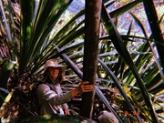
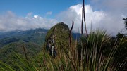
Enjoyable hike. Instructions easy to follow - did both East and West peak. As mentioned, East has better views but I enjoyed the track to West more - especially the giant spear lily tunnel you crawl/climb through. Still very overgrown at the start - lots of ticks - check yourself. Lots of lawyer vine/wait a while which are quite aggressive and can rip your hair out as I found. We found it hard to find start of track as we were first to start and drove past the gate to find a large ditch in the road - don’t go that far! On return about 20 cars parked. Keen to head back at some point to check out Boyd’s Butte
Juiced Pixels on 6 May, 2018

Walked it on 13th April 2018 with Jade, to check it out before taking the hike group there. Track was good, just that long grass section at the start was tall, but track was very easy to find and follow the whole way up.. From start point at gate, up to East Pk and back to gate 3.5 hours.. Love it, great walk
Barry White on 13 Apr, 2018

Did this one today..went a group called the fit, fast and furious.. did it in 3 hours all up, however no breaks other than the occasional one to catch your breath and spent 15 minutes at the top....Amazing walk very overgrown in a lot of places and it is a continous ascent from the get go. Flattens out a bit when your crossing the ridge before climbing again.. you pretty much keep the barbed fence(which is the border of QLD/NSW) to your left and go all the way up at times u gotta go across the fence which has been damaged due to fallen trees .. all in all quite exhausting but a great workout..Views absolutely worth it.. Recommend wearing long pants, ankle support boots and a full sleeve shirt to avoid leeches and cuts.. bit of scrambling to get to the top of the first peak...Would not recommend taking kids on this one.. and watch out for the occasional snake..

Ashwin on 23 Dec, 2017

We had the whole track to ourselves and took it in turns in breaking the spider webs with our faces!

The first 30 minutes was very overgrown. Some of the rocks and earth from the new road which is being constructed on the left hand side of the track have been pushed on to the path, so we had to climb over these mounds to find the track. Looks like walkers may be using the new road as an alternative route to avoid the overgrown section as it does follow the track for a while.

If you keep the border fence on your left the whole way up you can't go wrong. A fabulous day walk that has it all. 5 hours was spot on for us including a 30 minute break.

Helen Winter on 18 Dec, 2017

EAST SUMMIT
• Initial steep dozer track - muddy and boggy from recent rain
• Path along the rabbit fence - fairly clear with some lawyer vines here and there. It is very tempting to keep reaching out to grab the barbed wire fence for support but it is a tetanus shot waiting to happen.
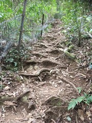
• Jungle, and tree root staircase - wet and slippery
• Ascent of the East summit - no real dramas. Some thick foliage.

Views obscured by low clouds settling in. When we arrived at the peak we could see the West peak above the clouds clearly. Five minutes later it was hidden.

WEST SUMMIT
• Razorback - dense foliage
• Ascent - I found it fairly easy to get lost despite the regular pink tape. There were one or two false (perhaps alternate) tracks that can lead you away and areas of very thick foliage.
• Two or three scrambles up small rock faces, which were made awkward by being wet
• No great viewing opportunities at the top, which is covered in bush and small trees
• On the descent, we got lost and descended a much harder rock face and spent 30 minutes wandering around till we found the pink tape again.
• Started to rain and everything was very wet, slippery and muddy, making it more arduous.

TIPS
• Highly recommend at least long pants and gloves, and possibly long-sleeved shirt and gaiters, due to lawyer vines, sharp grass, the possibility of snakes, and the track running next to the rusty old rabbit fence.
There were many instances on the descent where the wet rock offered no grip for shoes or hands. In these cases I often ended up grabbing handfuls of the thick, sharp-edged grass to lower myself down - because I had gloves on.
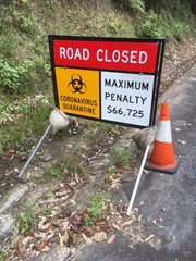
• Road to the parking area was narrow, unsealed and a few spots were taped off due to erosion or slippage. In the wet it was muddy and rutted.
• Parking area is not very big and a bit tricky to maneuver if there are other cars there.

Overall I'm glad to have done it, but it felt like a slog on this particular day - wet, humid, hot and muddy.
One guy who had done it before said that on a fine winter day it's a doddle, so perhaps that's the best time to give it a go.

We were the only people there and the track didn't seem heavily used.

Left about 7:30am and were back at the car park by 1:30pm. Someone said that was an hour or so quicker than the last time they did it.

Rey Leon on 2 Dec, 2017

Awesome hike. Some fun scrambling/climbing sections, a cave to explore and good views from the first point. Just make sure to keep a close watch on the pink tape so you don't get lost on the second section!

Lia Skye on 23 Sep, 2017

Apparently the track up to Cougal has been clearer as of august 23.Thats amazing! Years ago it was always slashed up until the start of the rainforest.but has in recent years been a winding , confusing head high tangle of grass. I Think national parks must have forgotton it existed. So its good to hear tha its clearer as of aug.2017.will think about a day trip soon! For those who havent gone,go! Its a gret walk.the cave is almost straight upslope once you reach east Cougal and kind of hidden down behind some boulders. Beware of a false trail off to the right.the track has been changing alot due to tree false . Traverse to the right after the cave and find the scuffle marks on the rocks and tree roots where people climb the cliff break. Great views at the top of eaxtern peak!A steep track goes straight down to the saddle where there is room for one small tent if youre interested. The route along the cliff face to western peak is rough and you must take great care scrambling up through the foliage and spear lillies.Make sure you have reasonable experience or are with someone who has!Its quite rough but well worth the effort,the top has spectacular views over to mt Warning and its a beautiful campsite;but make sure you bring water! If going to Boyds Butte ,watch the plentiful lawyer vine.There is a wide saddle between Cougal andthe route to Boyds,but if returning thhe same way stick close to the central ridge to regain the Cougal track.Be careful climbi g around the pinnacles near the butte (but do it!).A rough usually taped route leads south from here steeply down to a flat stony area and then down a side spur to Currumbin ck.The spur has a taped route but is easy enough to follow and is well worthwhile checking out!At the bottom, just turn left to the car park at the rockpools .If you still have energy,turn right instead for some fabulous rockpools to cool off in! TREKK ON BABE!!

Geoff Smith on 28 Aug, 2017

Track was quite clear, maybe recently cleared, so no machete needed. I've walked Springrook and Mt Warning a few times recently and always Mt Cougal is in the view, so great to finally get here - views on a clear winter day were superb! Thanks for the track description, no navigational issues to report as a result of your clarity.

glenn mead on 20 Aug, 2017

Great walk, don't think I could fit through the last bit of the cave.

Got a few ticks in the long grass.

samkramer on 15 Jul, 2017

Great walk, still quite overgrown at the start going through the sugar cane area, but really nice once you enter the rainforest. Plenty of markers to follow once you've left the rainforest and start the steeper scramble section. Great views towards Mt Warning at the top. Definitely wear long clothing, or you'll definitely be getting scratched.

B_razzle on 3 Jun, 2017

Such a little adventure this hike, winding through sugar cane, up a calf killer hill to reach the summit. Bush bashed to the other peak, but there was limited views. Great climb!

courtlalala on 26 Apr, 2017

As of early/mid January 2017 some of the track is still majorly overgrown, so if you want to avoid small scratches wear long pants

Brodie R on 11 Jan, 2017

Beautiful walk, unlike any other, but I won't attempt this one again without almost complete body covering. Got shredded to pieces by the foliage (of which there is a LOT). Lots of sugarcane near the start of the track, and a fair few wait-a-while vines in the rainforest sections that are at head height.

Cover up, bring lots of water, and leave this one for a cooler day. You'll love it.

mjorn_ on 1 Jan, 2017

We got lost quite a few times on this track as the trail was very overgrown and it criss-crossed into private property a lot which became a little confusing. It also took us through sugar cane, and we were there right when there were a lot of snakes out and about so don't do this hike if you have any issues with snakes.

Caitlyn Worland on 13 Nov, 2016

Completed this track in about 4hrs, I didn't go to both peaks as I left a little late. But wow, it is a toigh track, basically vertical towards the end and you're touching foliage about 80% of the trek. The summit views are stunning, however I didn't find the cave? I'll have to go back for another look. Well worth the bush bashing but it is a tough climb.

Chantelle on 7 Oct, 2016

Interesting scenery. Loved the sugar cane! Hated the barb rusted wire but thankfully no-one touched it. Ground can be quite unstable so a walking pole is useful. Went to both peaks (about 6 hours) but I couldn't find the cave :(

agms on 2 Aug, 2016

The 29/05/2016 was my rookie trek for The Bushwalkers Club Official.
It was beyond an honor to get the call up from the prestigious group and trek with the best!
We summited both peaks and returned within a short few hours on the lovely Sunday afternoon, and was an awesome way to finish the weekend. Beautiful views back over the Tweed valley and over the southern Gold Coast.
Jokes a side this walk has sparked a new hobbie and passion. Would recommend and defiantly gets the Ranger McFriendly tick of approval!
Enjoy :)

Ranger McFriendly on 29 May, 2016

I really enjoyed this trek i loved the rainforest and the cave and the tracks on both peaks! The last part with the rope to the top of the summit was fun! Few parts were thin and on the edge of the cliff but amazing still!

Julie on 14 May, 2016

Good fun despite being drenched for almost the entire walk, and being engulfed by cloud up the top (no views). Gorgeous rainforest and some fun bush bashing all the same. Definitely wear long trousers and some sensible footwear.

GackJibs on Feb, 2016

Where

Click here to load this map.

Nearby Walks

Done this walk?

This walk has been ticked 183 times

Aussie Bushwalking can keep track of your bushwalks.

Login/signup to tick this walk off.

Tick walks to keep track of where you've been. You must Login to tick walks. Accounts are 100% free so sign up if you don't have one.