
Menu
Popular Walks
-
Mt Ngungun
(1156 ticks) -
Mount Coolum
(872 ticks) -
Mt Cordeaux
(668 ticks) -
Twin Falls Circuit
(636 ticks) -
Purling Brook Falls Circuit
(611 ticks)
Summary
The Sunshine State
Queensland has a wealth of bushwalking opportunities including multiple World Heritage Listed rainforests such as the Daintree and Lamington National Park, great coastal and island parks like Fraser Island and Hinchinbrook Island.
Popular Walks
-
Mt Ngungun
(1156 ticks) -
Mount Coolum
(872 ticks) -
Mt Cordeaux
(668 ticks) -
Twin Falls Circuit
(636 ticks) -
Purling Brook Falls Circuit
(611 ticks)
Sub-Regions
Other Information
World Heritage Areas
- Fraser Island
- Gondwana Rainforests of Australia (Lamington NP, Springbrook NP, Mount Chinghee NP, Mount Barney NP, Main Range NP)
- Great Barrier Reef
- Riversleigh
- Wet Tropics (Daintree NP, Barron Gorge NP, Cedar Bay NP, Girringun NP, Wooroonooran NP)
Contact details
Queensland Parks and Forest:
https://parks.des.qld.gov.au/
Regions
The link below provides a region map of QLD as a reference to what council zones are included in the 7 geographic regions of QLD.
https://en.wikipedia.org/wiki/Regions_of_Queensland#/media/File:Qld-regions-map.gif
- Far North Queensland
- North Queesnland
- Central Queensland
- Mackay, Isaac and Whitsunday
- Wide Bay Burnett
- Darling Downs South West
- South East Queensland
Walks in North Queensland


 45
mins
45
mins
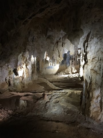
Donna Cave, Chillagoe
Donna Cave is one of the 3 caves in Chillagoe managed by the NPWS. Access is only by guided tour with a NPWS Ranger who provides a commentary on the formation and history of the cave.
The cave is well lit and has steel walkways and stairs (approx. 300) throughout.
The stalactites and stalagmites are awesome and the whole experience is well worth the effort.
 5
km
return
2
hrs
5
km
return
2
hrs
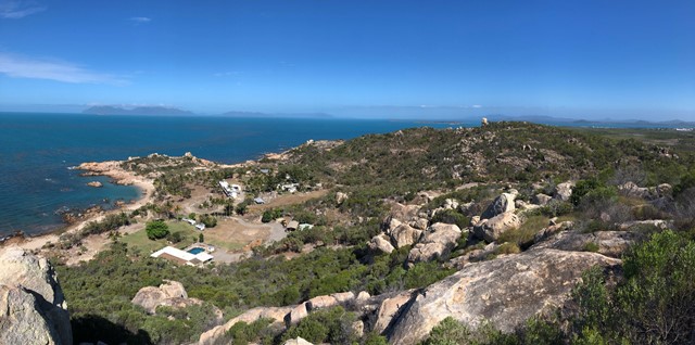
Edgecumbe Heights Recreational Reserve
Edgecumbe Heights Recreational Reserve, Bowen, Queensland
 1.2
km
return
30
mins
1.2
km
return
30
mins
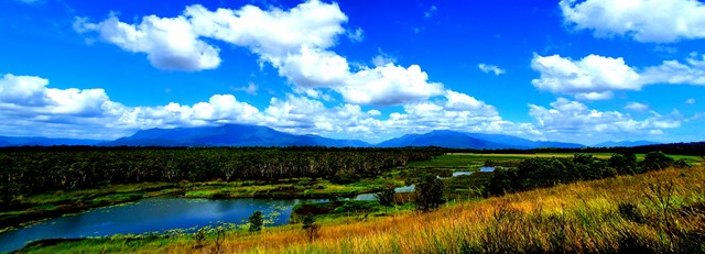
Eubenangee Swamp
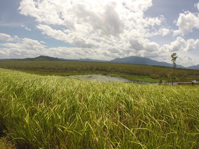
Well maintained track following the river then opens into farmland where you will climb a hill to the wetland lookout. High grass on both sides of the farmland track.
Good for viewing wetland birds and crocs if you're lucky (or unlucky).
 6
km
return
2
hrs
6
km
return
2
hrs
Flinders River Walk
An enjoyable walk along the banks of Station Creek and Flinders River (Queensland's longest river), with various historic attractions along the way. This is dinosaur country, so keep your eyes peeled!
 500
m
return
30
mins
500
m
return
30
mins
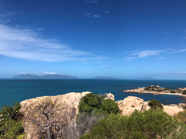
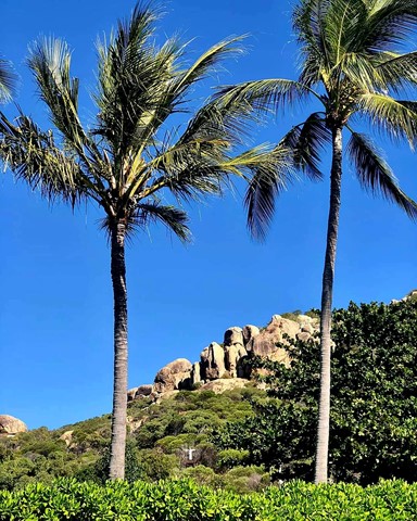
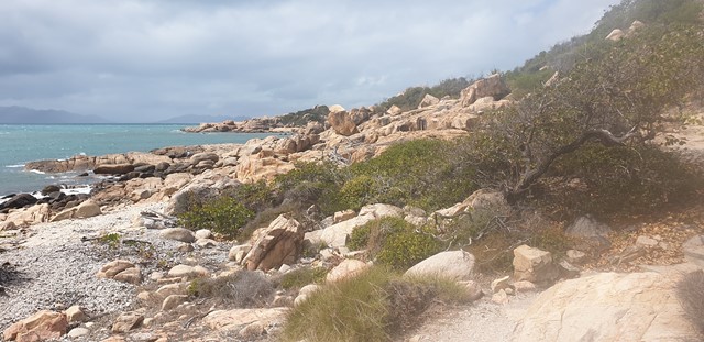
Horseshoe Bay - Rotary Lookout
A short 10min pathed walk through some light vegetation, past some really beautiful rocks and up to a viewing platform over Horseshoe Bay
 800
m
return
20
mins
800
m
return
20
mins
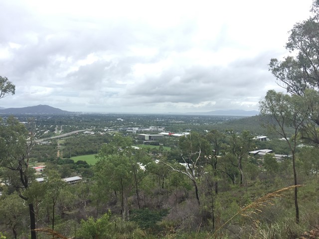
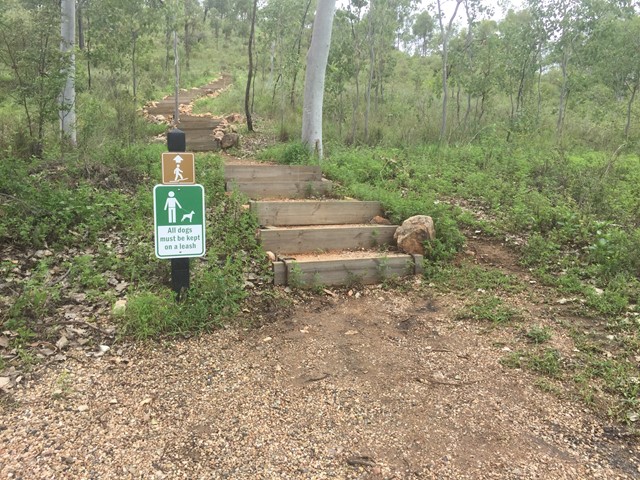
JCU Walking Track
The JCU Walking Track is a joint project of TropEco and JCU Discovery Rise. 493 well-maintained steps through beautiful bushland up to a gorgeous view of Townsville out to the ocean and James Cook University. Kangaroos, crickets and other critters are common along this enjoyable walk.
 3
km
return
1
hr
3
km
return
1
hr
Julia Creek Nature Trail
Located behind the caravan park, the nature trail offers a chance to see some of the local birds and wildlife, especially if you do the walk either in the early morning or late afternoon.
 5
km
return
1
hr
5
km
return
1
hr
Lake Ross Walk
There is a Gravel track directly next to Lake Ross where you can walk along as far as you like.
Good view over Lake Ross and the Mountains in the Background.
 3.5
km
return
1
hr
3.5
km
return
1
hr
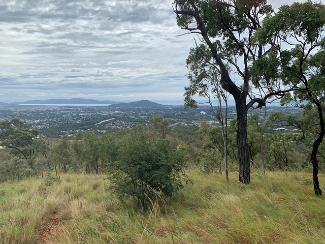
Mount Louisa Bush Walking Track
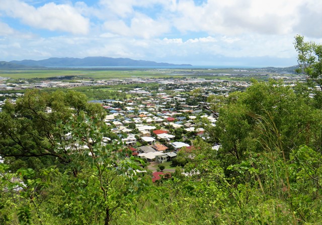
Popular walking track for fitness enthusiasts, 3.5km circuit track contains many stair climbs along the way to reach the summit and enjoy sweeping views to the north-east across Townsville and Cleveland Bay out to Magnetic Island, as well as views from the ridgeline and summit extending south-west from Mount Stuart to Kirwan.
 5.2
km
return
6
hrs
5.2
km
return
6
hrs
Mount Robert
Standing about 1000m high, Mt Robert, in the Boyne Valley is the highest mountain between the Gold Coast and Townsville. The Boyne Valley is a rural locality in Gladstone Region, Queensland, Australia. Mt Robert is situated on private property therefore can only be climbed when the family allows access usually once a year around July.