The Cream Track

Springbrook National Park

The Cream Track is the name given to a track from the Tallebudgera Valley, up to the Springbrook Plateau, following a route that early dairy farmers used to get their product down to the coast. It is a challenging track, because of its gradient, and especially challenging after rain.

Waterfalls
Lookouts
Swimming
Bird Watching
Picnic Facilities
BBQ
Toilets
Rainforest
828m
Maximum Elevation
708m
Total Climb

Getting there

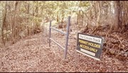
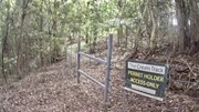
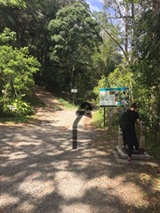
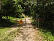
The track begins at the end of Tallebudgera Creek Road (sealed all the way), where there is a carpark and Gold Coast City Council signage describing the track. Notably, the sign describes going to a website in order to obtain a permit to cross some private property on the Springbrook end of the track, but the website no longer exists. There are now no signs prohibiting access on the way up the mountain, and the old signs a walker encounters on the way back down are, like the GCCC signage, clearly out of date. Walkers should keep to the path (which is, on the whole, quite well-formed), and respect the multiple "private property" notices that are passed. 

Walk Details

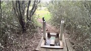
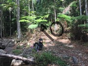
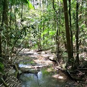
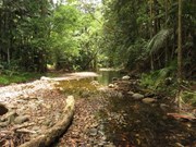
Cross through a gate at the start of the track and travel about 800m following the creek. There are three creek crossings which may require getting your feet wet, depending on whether there's been recent rain. Soon after the third crossing the track diverges, with the right hand track clearly signed as the Cream Track (the left follows the creek to various swimming holes; handy for the end of your walk).

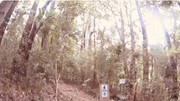
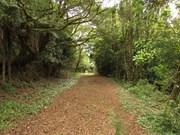
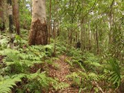
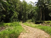
From this point, the next few kilometres are almost relentlessly upward, with some sections being quite steep. At times you walk on a clear footpad, and at other times you walk along the old 4WD track. The GCCC trail markers are pretty clear, especially around the bottom half of the walk.

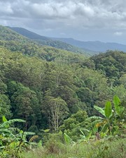
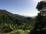
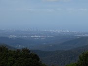
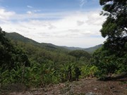
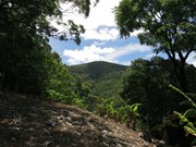
About 2km in, you'll come across a viewpoint, near a banana plantation, with views north towards Mt Gannon and Tallebudgera Mountain. The next 2km or so are the steepest part of the track, though there are still a few short inclines to negotiate towards the top. There aren't any significant navigational difficulties.

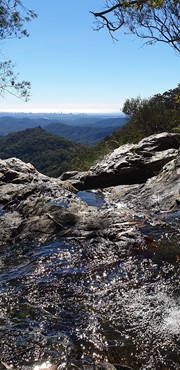
Towards the end of the track, it opens out onto a gravel road that leads to the Goomoolahra Picnic Area and Lookout, with good views towards the coast and a waterfall (weather dependent). Retrace your steps to return to the start, and keep your eye out for views of the Cougals on your way back down.

Maps

QTopo: Mount Cougal 9541-132 and Springbrook 9541-133


Comments

Nice and dry today, but also quite hot for September. The track doesn't seem to cross the paddocks of Serenity Farm anymore (as seen in one of the photos). All of the track is in forest. Perhaps the route has been changed, and this is why permits aren't necessary?

Michael D on 27 Sep, 2023

Very Good 3.5hrs just cruising. Was dry, no leeches, B. E. A. Utiful.

MP__Ultra on 18 Sep, 2022

Conquered the Cream Track today starting at Tally trailhead up to Springbrook. Need an Advanced level of fitness as it is a really really steep ascent for most of the hike going up to Springbrook. It took us 2.45hrs to get to the top and 2hrs to get back down due to the steepness, the number of breaks needed to catch our breath and de-leech the numerous little blood suckers we kept picking up every few hundred meters as we faced intermittent rain all the way. Was 12.3kms return according to AllTrails. There are 4 creek crossings which need some agile rock hopping abilities so as not to end up wet on your butt looking up from in the creek. Well signed track, lush rainforest canopy the whole way up and one good scenic view across to Surfers Paradise on a fine day once you reach the banana plantation half way up. Sadly the Tea House at the top was closed but will be driving up to that one next time to enjoy those scones, jam and cream. It’s a one time only walk for us and glad we can now tick it off the list.

Paul on 31 Dec, 2021

Finally completed the cream track. Gotta say if you’re thinking of taking on this track on a wet day - don’t. I know you’re all tough as nails but avoid yourself the pain of having to pick off dozens and dozens of leeches every 5 minutes. Yes the walk was lush and on a rainy day very misty and fairytale-esque but it’s just not worth the leeches. I would definitely attempt this on a DRY wintery day. Lots of flora and interesting changes in scenery with rainforest, Ferny fields and waterfalls.

Warlock Bride on 31 Dec, 2021

Started at Tally, goes up and up and up and up. The views and teahouse at the top are worth it. It's well signed and even has stairs at the bottom. It's a fun hill to run back down, with a float in the creek at the bottom as a rewards. Don't forget to visit Gorge falls too, which is at the bottom of the hill.

asherbasher on 22 May, 2021

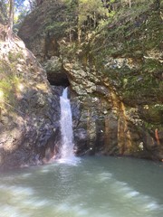
Loved this walk although we missed the fact that u need to go left at the bottom of the steps and ended up halfway to Springbrook! Saw an echidna and an eel and had a dip in the waterfall pool, lovely and serene and there’s ropes if you are game enough for a jump!!

Tania Kinsey on 8 May, 2021

This is now one of our favourite hikes in the local GC area.
We went on a sunny dry morning, so no fear of slipping, although could definitely see it getting that way on a wet day.
Definitely recommend parking and starting in Tallebudgera so that you start the hike walking up then returning on the way down.
The track is clearly marked with signage to the top, so you don’t need any kind of GPS tracking to navigate this one.
It’s a beautiful trek, challenging at times due to it taking around 1.5-2 hour to ascend (took us 1:40) and that is all uphill. But what a reward at the top!
Be sure to walk through into the Springbrook ends car park, as there you will find a gorgeous English Tea House, where we enjoyed a tea and scones!! (Much deserved)
We then went and enjoyed the views of Goolmoolahra Falls and its picnic area! Which as amazing views out to the valley.
Not sure what people are talking about when they say there is nothing to see, we found this a gorgeous hike, with brilliant views at the top!
It then took us about 1.15 to get back down.
Highly recommended!!!!

Emma + Kyle on 25 Apr, 2021

This is a good day out on the mountain!

Starting from Springbrook, we made it down in 1 hr 45min at a reasonable pace and without stops. Lunch at the bottom and 2 hours back up with a couple of breaks. Going down is tough on the body - and I'm 30!

This track is for people who hike often. It isn't the most scenic, but is a lovely journey all the same. There are better hikes in the area for beginners.

Comment from Dec, 2020 sums the walk up well. It is easy to follow and with good signage.

ct__ on 18 Apr, 2021

Fun but steep track. No views but I found scenery beautiful. Started out a warm day but was cold and drizzly up the top at Springbrook.

Jimcar on 8 Nov, 2020

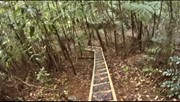
This is an easy track to follow, now that National Parks have erected convenient signposts. It starts off nice and flat with 4 creek crossings then it's uphill all the way. You start with some new steps, and after the steps, the track just keeps heading up, past the banana plantations, and then into more rainforest. There was only one spot near the top that could have done with a sign. The track seems to keep going uphill but actually, you have to turn right and cross a small stream. Once you reach the top there is a park and some lookouts. The day we went, It was freezing cold at the top. The thermometer on the tea house read 12^C, so a hot chocolate was more than welcome. I was surprised It only took us about 2 hours 10 mins to get there, and that's with 5 or 6 stops to wait for slower walkers.

Jeff on 8 Nov, 2020

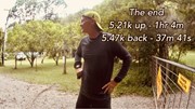
Up and back in In 1 hour 41, I did some research on this track and decided to go both ways. I went at 11 am on 27 Oct 2020. It’s about 5.2 each way. I started on the steep side at the end of Tallebudgera Creek Road, If you start the Springbrook Road end it’s all down hill. A permit is needed as you will be crossing into private property. It’s free for the permit and got it on line. It took me about an hour to get to the top and 40 mins to get back, don’t go during or before heavy rain, the clay hills are too slippery and steep. I went by myself but if your inexperienced then suggest you go with a friend. If your looking for views, this is not the track, it’s heavy rainforest and bush, The council is making efforts to better improve the track with sign post and steps on the Tallebudgera side. It’s a good sharp slog but rewarding with a few creek crossings. I made a video if you would like to see the conditions. https://youtu.be/fBncIa6RBRs

miike2000 on 27 Oct, 2020

Awful awful awful. I don’t understand why this track to so popular, there is very little scenery and the entire hike is a steep ascent. I almost couldn’t complete it, and as it is one-way you have to walk all the way back again! I strongly discourage any inexperienced hikers from this track. There are many tracks in springbrook that are much more scenic and not so difficult. This track could only be good if you are very keen on a workout.

maggie on 6 Sep, 2020

Great hike. Startec at the bottom and went to the top, then stopped at the tea house for a cuppa. Great day. Good cardio.

Mon86 on 11 Jul, 2020

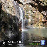
We followed Google Maps location to 'The Cream Track' without checking and found ourselves at the top of the mountain which in hindsight is not ideal. We went down for about 1h 30m until we reached the creek. It was a very steep descent, you have to hold onto trees in certain areas and easy to slip. At the bottom of the track we excitedly veered off to check out the waterfalls (definitely recommend) which took us about 1h return back to the creek. Being now at the bottom of the track we had to climb up the Cream Track where we parked the car. It was very challenging! It took us about 3h to go back up. I would not recommend going down the track and then up unless you like this kind of challenge. Check map before going. Great walk tho, not very busy/popular and great views. We didn't print the permit form but had it on our phones.

Katya on 25 May, 2020

Good steep climb starting from Tallebudgera. Easy track to follow and easy to find starting points. Didn't have time to check out the waterfalls but that can be next time.

WogHiker on 24 May, 2020

Wonderful! Did it in reverse. Down and then back up. Had no problem with finding the way - the comments were enough to get us started. Will do again soon.

Rod Hewins on 13 Feb, 2020

From Talle up to Springbrook and return.
Long constant slog upwards, but heaps of places to stop and take photos of the forest and one section of the surrounding Mountains. No phone signal at the start or parts of the track so if you are planning on using your phone to track and guide you, make sure to down load the map before you leaved home, i didn't :(
3 hrs 20 mins return, 2 hrs up and 1 hr 20 mins down (in a hurry down)

Rock Wallaby on 3 Nov, 2019

Good walk. Nothing technically challenging just hard constant uphill slog. There’s a section in the middle where you can walk off track a bit along a razorback ridge which was probably my highlight of the whole walk.

Juiced Pixels on 27 Oct, 2019

There was very little information about how to get to the actual beginning of the track. So here it is: Park, clean your feet and take the track RIGHT. Cross up to FOUR river beds (do not follow them up stream, but if you do, the 4th leads to a waterfall), follow the 4WD track up until it spilts with a PRIVATE property sign and the Cream Track is on the right, marked by a wooden sign. Its more of a narrow path now that goes up and up. Keep an eye out for pink tape, there is minimal as other reviews say. It is steep and a bit of bush bashing allow the way. We didn’t quite make it to the top as we ran out of time after following the 4th riverbed up in the wrong direction for 30mins! We had planned to get to the summit and walk down, but will have to wait until our next trip!

Ashley on 18 Oct, 2019

Never made it quite to the summit.

First trip was to explore the waterfalls along the river bed and second was to tackle the track. Started later than we hoped fue to getting lost on the drive over and missing the entrance to the track and die to heat had to turn back not too far up fromthe banana plantation clearing

Korina Meagher on Oct, 2019

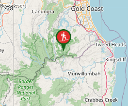
Where

Click here to load this map.

Nearby Walks

Done this walk?

This walk has been ticked 60 times

Aussie Bushwalking can keep track of your bushwalks.

Login/signup to tick this walk off.

Tick walks to keep track of where you've been. You must Login to tick walks. Accounts are 100% free so sign up if you don't have one.