Pages Pinnacle

South East Queensland

PLEASE DO NOT THROW ROCKS OR ANYTHING OFF THE RIDGE LINE!!!!!!! PLEASE WATCH YOUR CHILDREN AND TEENS ALSO AND STOP THEM FROM THROWING ANY OBJECTS OFF OF THE RIDGE. ROCK CLIMBERS ARE FREQUENTLY CLIMBING BELOW AND MANY CLOSE CALLS OF CATASTROPHIC DAMAGE HAVE BEEN ENCOUNTERED LATELY FROM HIKERS THROWING ROCKS!!!

PLEASE DO NOT MAKE MARKINGS ALONG THIS TRAIL, THIS INCLUDES CARVING TREES AND PAINTING ROCKS

PLEASE RESPECT THE OUTDOORS AND LEAVE NO TRACE.

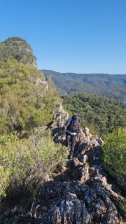
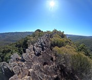
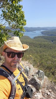
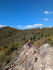
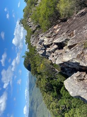
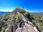
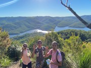
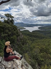
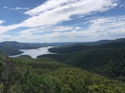
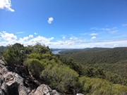
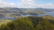
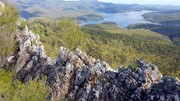
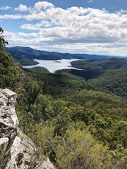
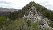
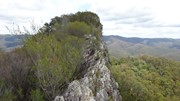
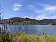
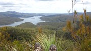
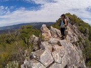
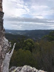
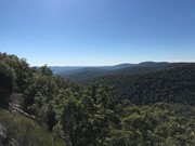
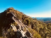
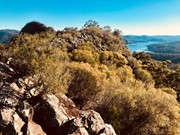
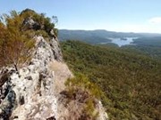
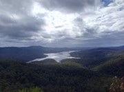
Pages Pinnacle is a 400m high tertiary rhyolite volcanic plug on a ridge between Springbrook and the Numinbah Valley. It is located above the Nerang River within the Numinbah State Forest. The Yugambeh people called the pinnacle kundohikulli meaning rock shaped boat. The pinnacle, similar to other ancient volcanic landmarks in the Gold Coast and northern New South Wales hinterlands, is an acid volcanic rock containing at least 66% silica. The view at the top of the Pages Pinnacle overlooks Hinze Dam.

Lookouts
Scrambling or Climbing
Eucalypt Forest
410m
Maximum Elevation
350m
Total Climb

Getting there

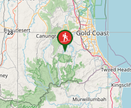
From the Gold Coast, follow Nerang Murwillumbah road and turn left onto Pine Creek Road. Approximately 2-3 kilometres after the turn-off, there will be a car park which is next to the Scouts Numinbah Camp Site.

Maps

Wikiloc

Route/Trail notes

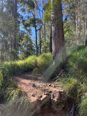
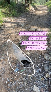
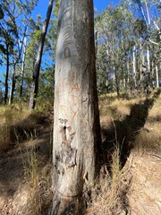
From the carpark, walk around the gate on the right and follow the fire trail. When you come to the first junction turn right. Then turn right again at the next junction, then left. You should be walking uphill for quite some time. When you see the pinnacle on your left, look for a small cairn near a large gum tree. The gum tree has 'PP' carved into it (DO NOT MAKE ANY MORE MARKINGS IN THE TREE) (ALSO NOTE there is a tree earlier on that goes to the base of the ridge, do not take this track). This is where you turn left to follow the track up to the ridge all the way to the pinnacle. The walk is quite steep and you my be walking with your head down so it is quite easy to walk past the tree so remember to look up occasionally.

Permits/Costs

N/A

Comments

Quite easy to take the wrong turn. Look for pink ribbons at the intersections. There are often a few people on the trail if you get stuck. Strong climb but along a fire trail and not too lengthy. Hopping along the ridge is fun :)

ct__ on 17 May, 2020

Adding to the chorus... it's very easy to go the wrong way if you are following the wrong map on Wikiloc! We went the right way, then backtracked to the wrong way because of the Wikiloc map my friend chose. Ended up at the base of the ridge, and had to go back up. Stay on the fire trail until you see the Pinnacle tree. It's also very easy to miss, I happened to be looking around at that point and saw it, it's quite a steep section so easy to miss. We got to the pinnacle with an hour until sunset, and then it started to rain so didn't attempt the scramble. Will need to come back and finish it. We met some people who were coming back and they reiterated you can't see much from the second pinnacle because it's all overgrown.

sarasvati on 16 May, 2020

Good steep initial walk. Views from pinnacle are great but views from second pinnacle not worth the extra walk. Scramble was easy if careful and dry.

WogHiker on 9 May, 2020

Absolutely loved this one as not many people seem to know about it so we almost had the whole experience without seeing another soul.

Korina Meagher on 30 Dec, 2019

Did it today for the first time, solo. Steep walk to get to the rocky section that had me huffing and puffing. It was windy and semi cloudy which kept the temps down but made it slightly harder to scramble but still not too scary. I loved it. Total moving time was 1 hr 43 mins with a look at the water on my return and over shooting the engraved tree sign.

Rock Wallaby on 31 Oct, 2019

Great fun scrambling up the top, didn’t make it to the second peak but definitely doable if you take care and have some climbing experience

Karla on 29 Oct, 2019

Great hike with a easy scramble across the pinnacle.

Ryan Ramsay on 27 Oct, 2019

Step walk to for the first 2 thirds took my breath away and I almost missed the tree marked with the pinnacle turn off point.

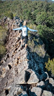
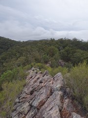
The walk across the ridge was fun but quite nerve racking. Luckily the surface of the rock is quite abrasive so I never felt like I was going to slip even in sneakers.

I didn't make it across to the second peak (it was very sunny and I was starting to feel sun burnt, it's very exposed on the ridge, I don think it would be pleasant on a windy day), hopefully I will get a chance to go back and complete the walk.

samkramer on 4 Oct, 2019

Absolutely no idea how anyone could do this hike plus the scramble, scratch that straight up climb, to the very end in anywhere under 4 hours on first attempt. Don't turn off the fire trail until you reach the tree with PINNACLE scraped into it in the photos, any other trails are rock climbers trails and you'll waste you time and energy (like us ahah) if you are looking for the pinnacle. The scramble along the razorback took myself and my friend 2 hours but was exhilarating and pant-wetting and I'd definitely do it again. Do not do this climb/scramble unless you have proper hiking boots you are temping death on sheer cliffs and slippery rocks. Fantastic all round, reminded me what it feels like to be alive.

Sasha Thiedeke on 2 Oct, 2019

3h30m walk, would have been shorter but I got lost. The instructions on this (AB) site are good, although seem to take you away from the peak at first. I thought I knew better and walked a couple of km I didn't need to. Please don't make my mistake!
When you're on the right track, it just seems to go uphill for ever. Turnoff to left clearly marked The Pinnacle on a tree. Excellent scramble over razorback at top; bad place to fall off; but outstanding views when you get there. Might as well do both peaks, but second one is a bit overgrown, limits photo options. Definitely a good walk!

John F on 9 Aug, 2019

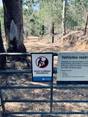
Signs up stating ROCK CLIMBING PROHIBITED

Juiced Pixels on 6 Aug, 2019

Been wanting to get out and get this hike done for a while. Finally had some time spare to get it done. Awesome hike, just wish I had of worn my trail shoes instead of sneakers for the scramble up top. Will be back in better shoes to reach the very end of the scramble in the future

AT165 on 27 Jul, 2019

Amazing views. Ridges very fun, but be careful.

Mkos on 3 Jul, 2019

Amazing views, keep left and head down to reach the main peak.

Garth on 1 Jul, 2019

Awesome walk

Jenny on 15 Jun, 2019

This is my first proper climb in the Gold Coast area, definitely one to remember. We took the first turn off and went as far as the base of the ridge before turning back; I'd like to explore that area one day, does anyone know if it leads to anything worthwhile? Anyway, we continued on the fire trail, but missed the PP tree shortcut. We continued another 200m or so and took the footpad instead. The views on the ridge and the first peak are pretty breath-taking; scrambling along the ridge is definitely not for the faint-hearted, but is really not as difficult as it looks. We down-climbed directly from the first peak to the saddle (north-face of the first peak), but we're both pretty confident in our climbing, so I'd suggest you follow the GPX Kingi uploaded if you aren't as crazy as we are. The vegetation on the second peak is currently more overgrown than at the first peak, so the views weren't as good.

K38 on 31 Mar, 2019

The rating on this is fairly accurate - a good amount of fitness is required due to the length and elevation, but it's definitely doable. It would be easy to miss the turnoff to the ridge, but it is marked by the rocks as described in the other comments. The ridge itself is a lot of fun to scramble over and you can continue on through to the peak, however this portion of the path is a bit overgrown - be prepared for some spiderwebs and scratches! The additional exploration will add to the time needed, so expect to spend 3-3.5 hours on the overall walk. Although a lot of the trail has shade, there is little shade along the ridge so be prepared for that. The trail itself also did not get much of a breeze despite it being a blustery day in general on the coast, so we were warm the whole way - I'd suggest starting early in the day. Overall, an interesting and worthwhile hike.

Rhi on 12 Jan, 2019

Great walk with awesome views. Trail head was easy to find but we missed the best turnoff for Pages Pinnacle. The four cairns that you may see pictured were simply a pile of rocks when we did the trail although there is a tree with PP carved into it that will also mark the way to the climb. Otherwise you'll get a little higher and see the trail fork. Take the hard left to get to the razorback.
There is a little exposure but should be comfortable for those with a little hiking experience. Don't forget to hit the second summit which is slightly higher (~30m odd). Find that in the GPX file I've uploaded. Essentially you're heading back along the ridgeline and downclimbing off the western side or backtracking enough that you hit a bath. Then you hug the bottom of the west side of the ridgeline where you'll head north to get to another peak with views over the dam. Less exposure this way and fantastic views. Well worth adding to the trip.

Kingi on 28 Oct, 2018

Father’s Day walk to the top. You can walk past the summit and do a bit more exploring north. Great views over the dam.

Juiced Pixels on 2 Sep, 2018

It’s an easy walk up to Pages Pinnacle but it’s also very easy to get lost. I used the wikiloc website for directions and that helped me keep on track. When I arrived at the razorback ridge I realised I may have bitten off a bit more than I could chew...there were steep drops on either side and I wasn’t game enough to scramble across the rocks. So unfortunately I didn’t get to see the stunning views from the top of Page’s Pinnacle but it was a lovely walk nonetheless. Pages Pinnacle is not for the faint hearted (or those scared of heights)!

K8 on 15 Jul, 2018

Where
Click here to load this map.
Nearby Walks

Done this walk?

This walk has been ticked 210 times

Aussie Bushwalking can keep track of your bushwalks.

Login/signup to tick this walk off.

Tick walks to keep track of where you've been. You must Login to tick walks. Accounts are 100% free so sign up if you don't have one.