Pages Pinnacle

South East Queensland

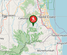
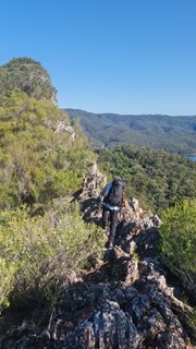
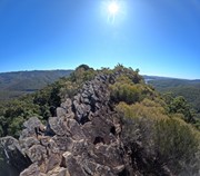
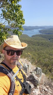
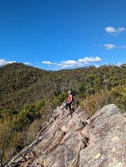
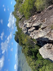
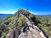
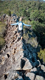
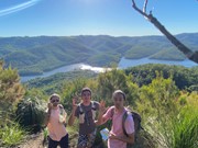
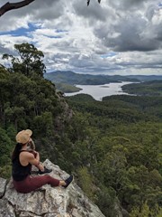
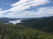
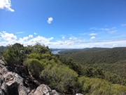
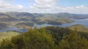
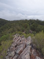
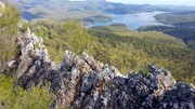
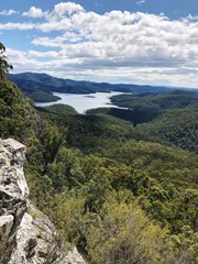
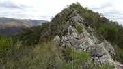
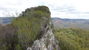
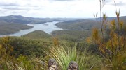
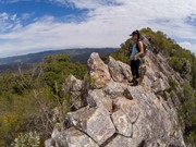
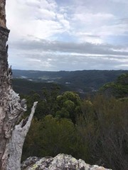
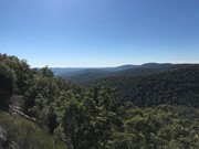
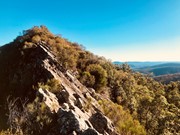
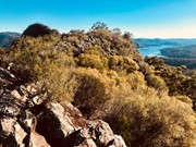
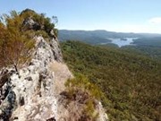
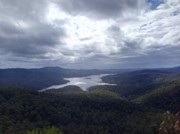
Pages Pinnacle is a 400m high volcanic plug on a ridge between Springbrook and the Numinbah Valley. It offers views towards the coast, as well as the Numinbah Valley and Lamington National Park. There is a challenging ridge line to scramble over, including a heart pumping (optional) razorback section.

Lookouts
Scrambling or Climbing
Eucalypt Forest
396m
Maximum Elevation
350m
Total Climb

Getting there

From the Gold Coast, follow Nerang Murwillumbah road and turn left onto Pine Creek Road. Approximately 2 kilometres after the turn-off, there is a car park on a right-hand uphill bend, with two gates. This is where the track starts.

Maps

QTopo and All Trails

Route/Trail notes

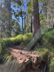
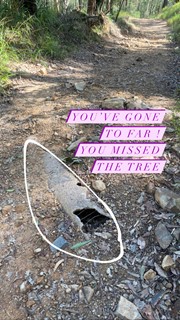
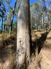
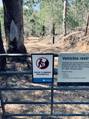
From the carpark, walk around the gate on the right and follow the fire trail. When you come to the first junction turn right. Then cross the creek and turn right again at the next junction, then left. You should then walk uphill for about a kilometre. Ignore the path on your left with a "Danger" sign warning about rock climbing (this is a path climbers use to get to the base of the Pinnacle's cliffs). Look for a small cairn next to a gum tree that has 'PP' carved into it; this is where you turn left to follow the track up to the ridge all the way to the Pinnacle (don't panic if you miss this track, because about 100 metres further up the fire trail, it turns a hard right and there is a track on the left that joins the ridge track after a short distance. Once you're on the ridge track, after a relatively short distance you'll climb over a large log across the track, and then a bit further on you'll have to do some scrambling, before reaching the infamous razorback section. You have two options here: If you're not afraid of heights, cross the razorback (very carefully, as there are long drops both right and left) and then keep following the ridge line, eventually scrambling down onto a saddle. On the other hand, if the razorback looks a little too challenging, after you've admired the view and taken your photos, backtrack down the scrambling section towards the log across the track and you should see a track to your right (West), which allows you to follow the base of the cliffs of the razorback section through some very pleasant fern understory, and then climb up to the aforementioned saddle. From the saddle, keep following the ridgeline, up towards the actual summit. There is some more scrambling and some mild exposure, but nothing like the razorback section. The summit itself is covered in casurainas, so there isn't much of a view, but there are some great views before you reach the top. Retrace your steps to return.

Permits/Costs

N/A

Comments

Amazing views, keep left and head down to reach the main peak.

Garth on 1 Jul, 2019

Awesome walk

Jenny on 15 Jun, 2019

This is my first proper climb in the Gold Coast area, definitely one to remember. We took the first turn off and went as far as the base of the ridge before turning back; I'd like to explore that area one day, does anyone know if it leads to anything worthwhile? Anyway, we continued on the fire trail, but missed the PP tree shortcut. We continued another 200m or so and took the footpad instead. The views on the ridge and the first peak are pretty breath-taking; scrambling along the ridge is definitely not for the faint-hearted, but is really not as difficult as it looks. We down-climbed directly from the first peak to the saddle (north-face of the first peak), but we're both pretty confident in our climbing, so I'd suggest you follow the GPX Kingi uploaded if you aren't as crazy as we are. The vegetation on the second peak is currently more overgrown than at the first peak, so the views weren't as good.

K38 on 31 Mar, 2019

The rating on this is fairly accurate - a good amount of fitness is required due to the length and elevation, but it's definitely doable. It would be easy to miss the turnoff to the ridge, but it is marked by the rocks as described in the other comments. The ridge itself is a lot of fun to scramble over and you can continue on through to the peak, however this portion of the path is a bit overgrown - be prepared for some spiderwebs and scratches! The additional exploration will add to the time needed, so expect to spend 3-3.5 hours on the overall walk. Although a lot of the trail has shade, there is little shade along the ridge so be prepared for that. The trail itself also did not get much of a breeze despite it being a blustery day in general on the coast, so we were warm the whole way - I'd suggest starting early in the day. Overall, an interesting and worthwhile hike.

Rhi on 12 Jan, 2019

Great walk with awesome views. Trail head was easy to find but we missed the best turnoff for Pages Pinnacle. The four cairns that you may see pictured were simply a pile of rocks when we did the trail although there is a tree with PP carved into it that will also mark the way to the climb. Otherwise you'll get a little higher and see the trail fork. Take the hard left to get to the razorback.
There is a little exposure but should be comfortable for those with a little hiking experience. Don't forget to hit the second summit which is slightly higher (~30m odd). Find that in the GPX file I've uploaded. Essentially you're heading back along the ridgeline and downclimbing off the western side or backtracking enough that you hit a bath. Then you hug the bottom of the west side of the ridgeline where you'll head north to get to another peak with views over the dam. Less exposure this way and fantastic views. Well worth adding to the trip.

Kingi on 28 Oct, 2018

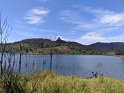
Father’s Day walk to the top. You can walk past the summit and do a bit more exploring north. Great views over the dam.

Juiced Pixels on 2 Sep, 2018

It’s an easy walk up to Pages Pinnacle but it’s also very easy to get lost. I used the wikiloc website for directions and that helped me keep on track. When I arrived at the razorback ridge I realised I may have bitten off a bit more than I could chew...there were steep drops on either side and I wasn’t game enough to scramble across the rocks. So unfortunately I didn’t get to see the stunning views from the top of Page’s Pinnacle but it was a lovely walk nonetheless. Pages Pinnacle is not for the faint hearted (or those scared of heights)!

K8 on 15 Jul, 2018

Loads of fun. Easy to miss the turn off from the fire trail but use Wikiloc app. I’d rate this more difficult than it is due to ridge line which could make lots of people scared, and there’s a bit of scrambling down and back up from the saddle. Great views all along the riddgeline - no views from summit as overgrown.

Juiced Pixels on 13 Jul, 2018

Great fun walk with a bit of scrambling. A lot of the walk is fire trail, but worth the walk.

Karin on 24 Jun, 2018

Great hike

Em on Sometime...

Where
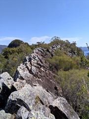
Click here to load this map.
Nearby Walks

Done this walk?

This walk has been ticked 238 times

Aussie Bushwalking can keep track of your bushwalks.

Login/signup to tick this walk off.

Tick walks to keep track of where you've been. You must Login to tick walks. Accounts are 100% free so sign up if you don't have one.