


 Pages Pinnacle (GPX)
 6.7
6.7 2.5
2.5- Pages Pinnacle Eastern Approach via Neranwood Break (Springbrook National Park)
- Neranwood Multi Use Trail (South East Queensland)
- Panorama Multi Use Trail (South East Queensland)
- Waterfall Creek Trail (Springbrook National Park)
- Apple Tree Park to Little Nerang Creek Falls (Springbrook National Park)
Pages Pinnacle
South East Queensland
Menu
GPS Tracks
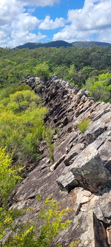
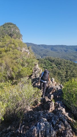
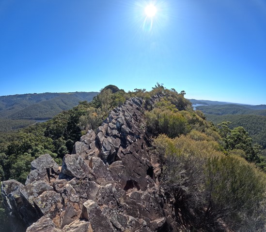

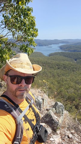
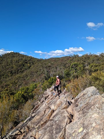

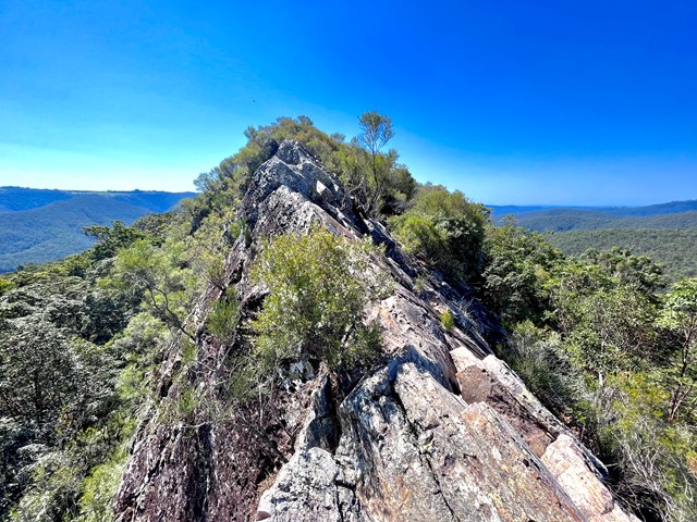

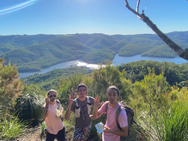

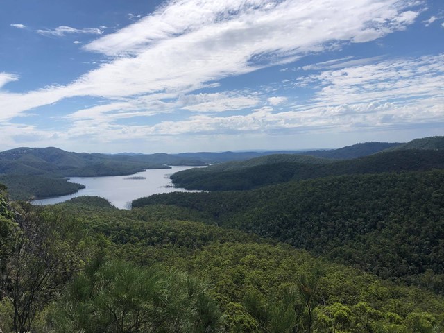
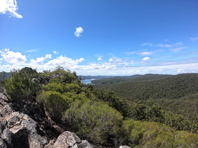
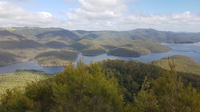
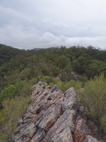
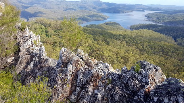
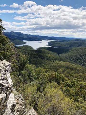
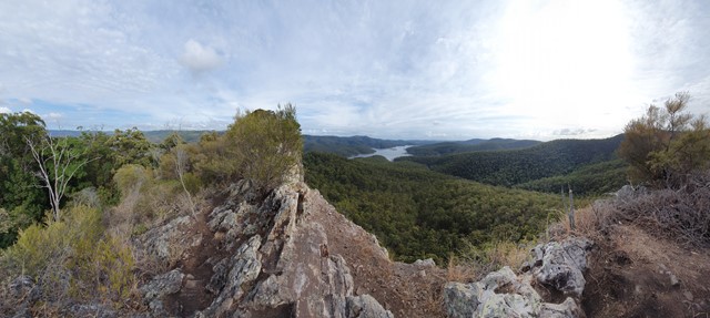


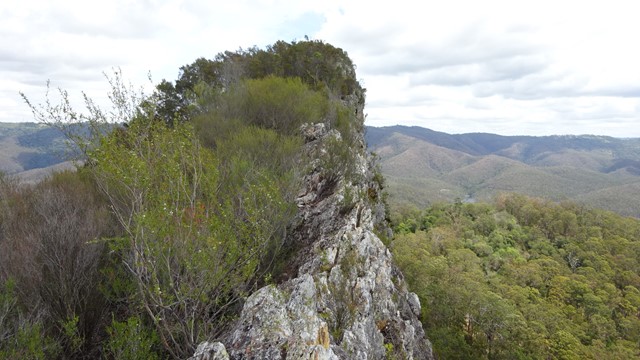
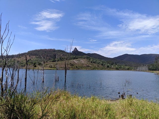
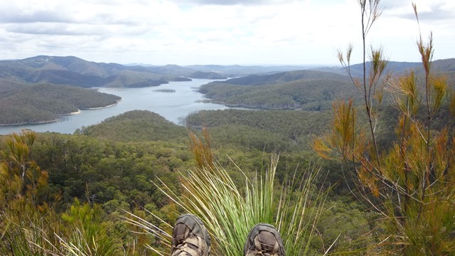
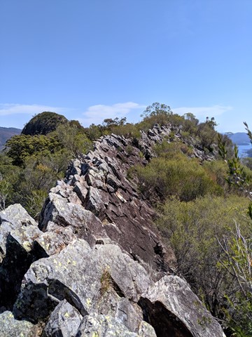
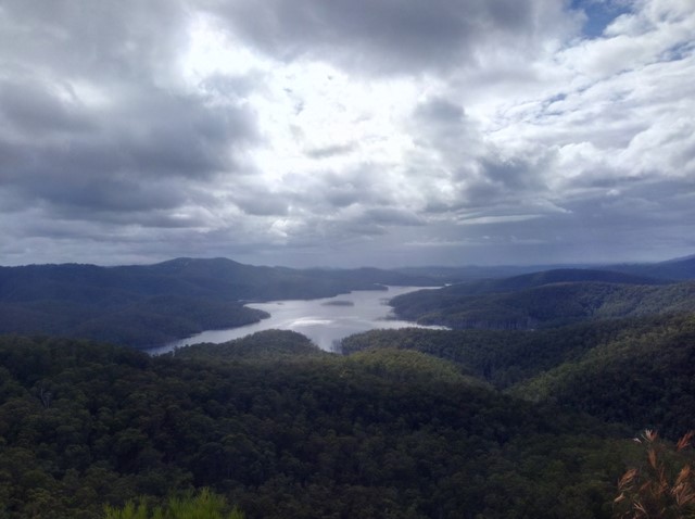

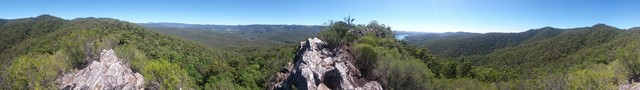
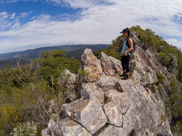
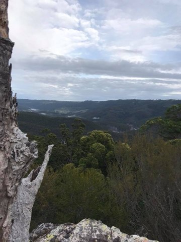
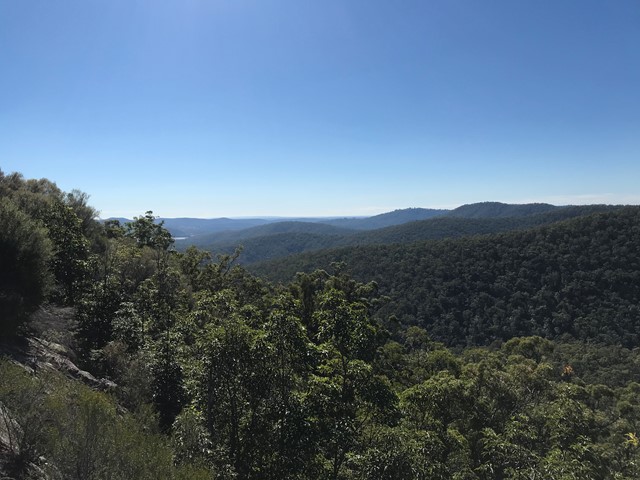

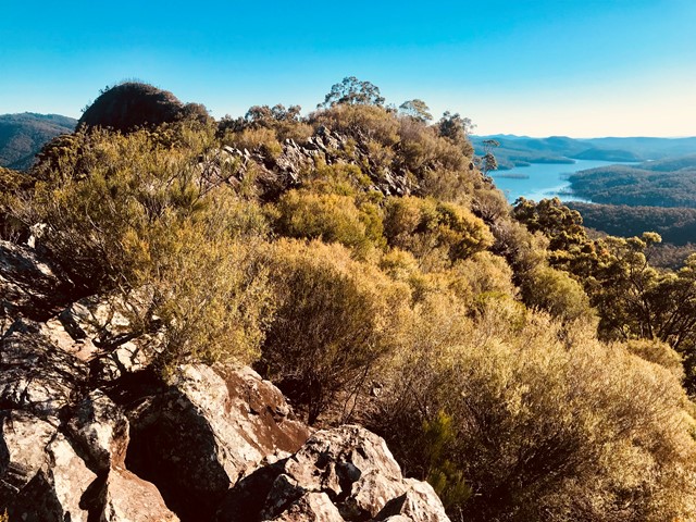
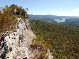
Pages Pinnacle is a 400m high volcanic plug on a ridge between Springbrook and the Numinbah Valley. It offers views towards the coast, as well as the Numinbah Valley and Lamington National Park. There is a challenging ridge line to scramble over, including a heart pumping (optional) razorback section.
Lookouts
Scrambling or Climbing
Eucalypt Forest
396m
Maximum Elevation
350m
Total Climb
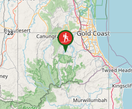
Getting there
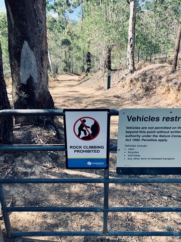
From the Gold Coast, follow Nerang Murwillumbah road and turn left onto Pine Creek Road. Approximately 2 kilometres after the turn-off, there is a car park on a right-hand uphill bend, with two gates. This is where the track starts.
Maps
QTopo and All Trails
Route/Trail notes
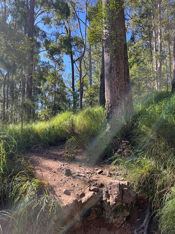
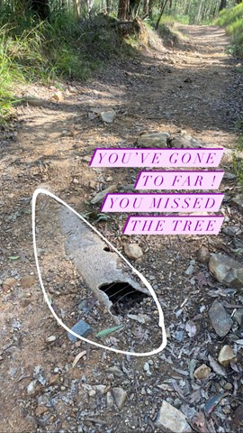
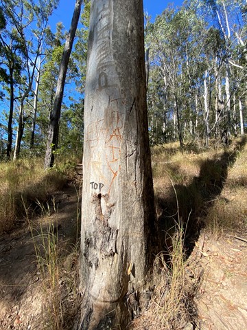
From the carpark, walk around the gate on the right and follow the fire trail. When you come to the first junction turn right. Then cross the creek and turn right again at the next junction, then left. You should then walk uphill for about a kilometre. Ignore the path on your left with a "Danger" sign warning about rock climbing (this is a path climbers use to get to the base of the Pinnacle's cliffs). Look for a small cairn next to a gum tree that has 'PP' carved into it; this is where you turn left to follow the track up to the ridge all the way to the Pinnacle (don't panic if you miss this track, because about 100 metres further up the fire trail, it turns a hard right and there is a track on the left that joins the ridge track after a short distance. Once you're on the ridge track, after a relatively short distance you'll climb over a large log across the track, and then a bit further on you'll have to do some scrambling, before reaching the infamous razorback section. You have two options here: If you're not afraid of heights, cross the razorback (very carefully, as there are long drops both right and left) and then keep following the ridge line, eventually scrambling down onto a saddle. On the other hand, if the razorback looks a little too challenging, after you've admired the view and taken your photos, backtrack down the scrambling section towards the log across the track and you should see a track to your right (West), which allows you to follow the base of the cliffs of the razorback section through some very pleasant fern understory, and then climb up to the aforementioned saddle. From the saddle, keep following the ridgeline, up towards the actual summit. There is some more scrambling and some mild exposure, but nothing like the razorback section. The summit itself is covered in casurainas, so there isn't much of a view, but there are some great views before you reach the top. Retrace your steps to return.
Permits/Costs
N/A
GPS Tracks
Where
Click here to load this map.
Comments