
Menu
Popular Walks
-
Mt Ngungun
(1156 ticks) -
Mount Coolum
(872 ticks) -
Mt Cordeaux
(668 ticks) -
Twin Falls Circuit
(636 ticks) -
Purling Brook Falls Circuit
(611 ticks)
Summary
The Sunshine State
Queensland has a wealth of bushwalking opportunities including multiple World Heritage Listed rainforests such as the Daintree and Lamington National Park, great coastal and island parks like Fraser Island and Hinchinbrook Island.
Popular Walks
-
Mt Ngungun
(1156 ticks) -
Mount Coolum
(872 ticks) -
Mt Cordeaux
(668 ticks) -
Twin Falls Circuit
(636 ticks) -
Purling Brook Falls Circuit
(611 ticks)
Sub-Regions
Other Information
World Heritage Areas
- Fraser Island
- Gondwana Rainforests of Australia (Lamington NP, Springbrook NP, Mount Chinghee NP, Mount Barney NP, Main Range NP)
- Great Barrier Reef
- Riversleigh
- Wet Tropics (Daintree NP, Barron Gorge NP, Cedar Bay NP, Girringun NP, Wooroonooran NP)
Contact details
Queensland Parks and Forest:
https://parks.des.qld.gov.au/
Regions
The link below provides a region map of QLD as a reference to what council zones are included in the 7 geographic regions of QLD.
https://en.wikipedia.org/wiki/Regions_of_Queensland#/media/File:Qld-regions-map.gif
- Far North Queensland
- North Queesnland
- Central Queensland
- Mackay, Isaac and Whitsunday
- Wide Bay Burnett
- Darling Downs South West
- South East Queensland
Walks in Sunshine Coast
(South East Queensland)
 5.4
km
one-way
5.4
km
one-way
 2
hrs
2
hrs
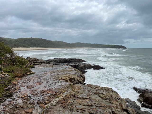
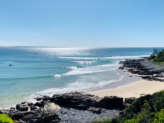
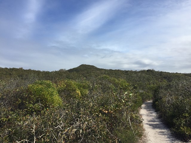
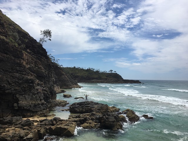
Noosa to Sunshine Beach - Coastal Track
A beautiful coastal track from Noosa National Park H.Q. to Sunshine Beach Surf Club. Via Hells Gates and Alexandria Bay nudie beach!
It was very windy but the view was just so beautiful !
 1
km
return
30
mins
1
km
return
30
mins
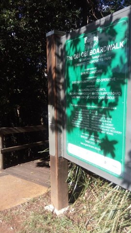
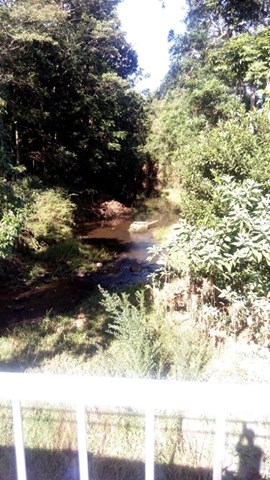
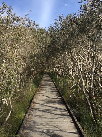
Obi Boardwalk
A short boardwalk beside Obi Obi Creek, that connects the town with the showground.
 1
km
return
30
mins
1
km
return
30
mins
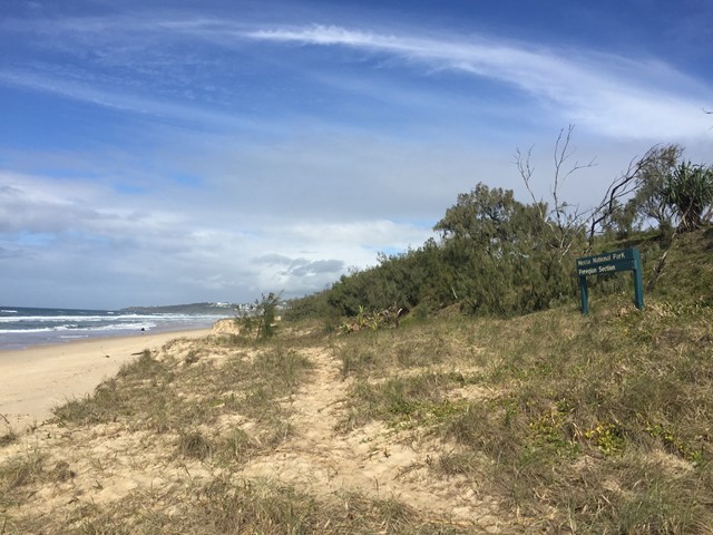
Ocean Beach Walk (Peregian Beach)
From boardwalk to beach, this short walk leads through forest to a peaceful stretch of beach away from the nearby towns.
 1.1
km
return
15
mins
1.1
km
return
15
mins
Palm Grove Walk
On a hot day, escape the sun for the densely-shaded rainforest on the Palm Grove Walk. Stroll along this short walk beneath the shade of elegant hoop pines and piccabeen palms. This circuit starts from the day-use area, near the toilet block.
 3
km
return
2
hrs
3
km
return
2
hrs
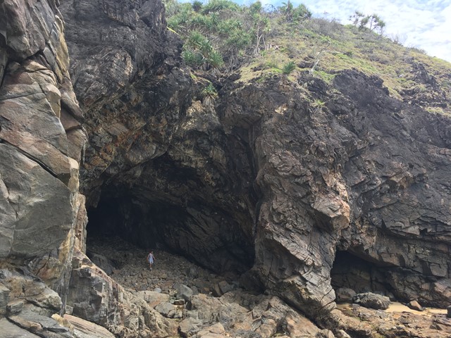
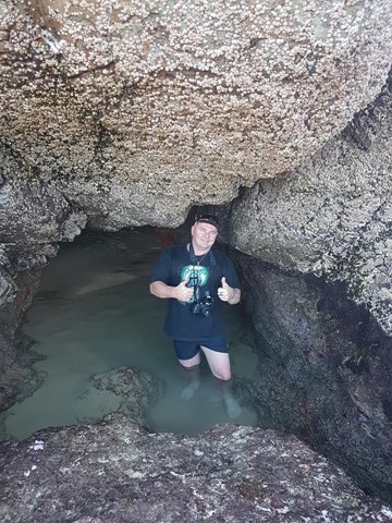
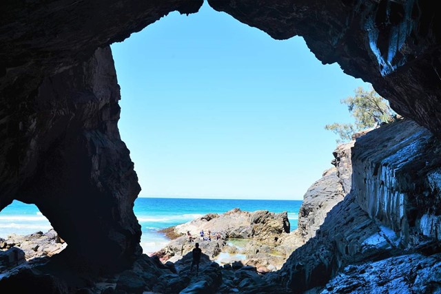
Paradise Cave
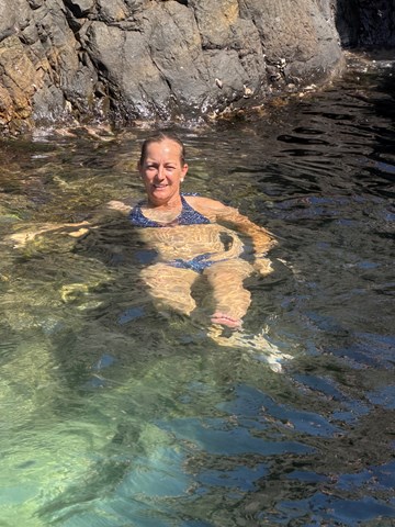
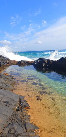
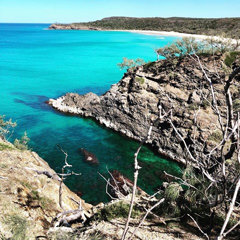
Fantastic little adventure to this secluded beach cave, only accessible at low tide
 4
km
return
1
hr
4
km
return
1
hr
Pelican Waters to Golden Beach (SCCP 1)
This is currently the southernmost start of the Sunshine Coast Coastal Pathway (SCCP) as it winds its way along the shoreline on the inside of Bribie Island. This section is very popular with visitors enjoying various water sports and with great views across Punicestone Passage.
 7.7
km
return
2
hrs
7.7
km
return
2
hrs
Sunshine Beach to Hell's Gate
From Sunshine Beach Surf Club to Alexandria Bay and back through the bush track at the first emergency phone beacon.
3.5
km
return
1
hr
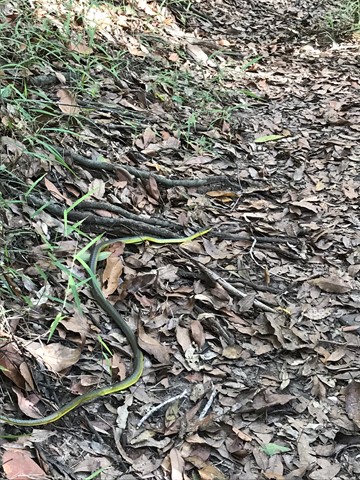
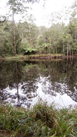
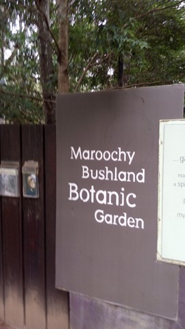
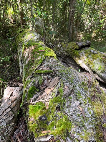
Upland Bushwalk
A circular walk in the southern end of Maroochy Botanic Garden, on a natural rough track with creek crossings that passes through a range of ecosystems including eucalypt open forest and riparian rainforest.
 2
km
one-way
30
mins
2
km
one-way
30
mins
Xanthorrhoea Track (Maroochy River Conservation Area)
A peaceful and shady trail through the remnant bushland of the area.
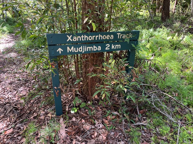
Walks in Tamborine National Park
(South East Queensland)
1
km
return
30
mins
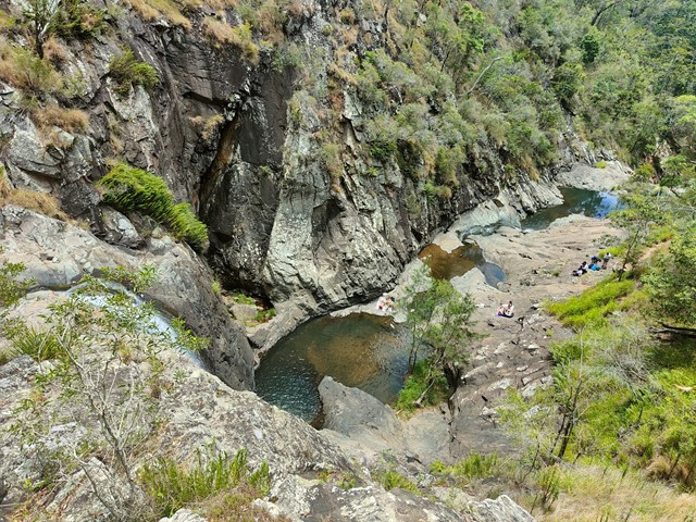
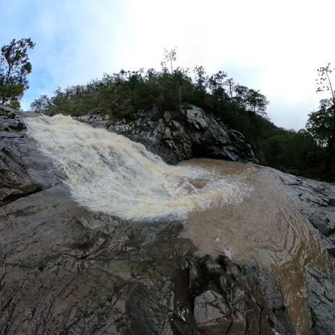
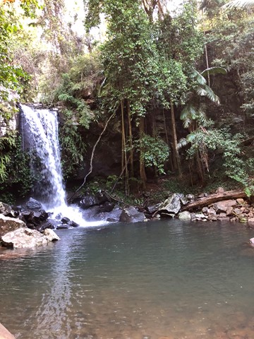
Cedar Creek Falls
From Cedar Creek Falls lookout, descend through eucalypt forest and dry rainforest to the rock pools below. Take your swimmers and immerse yourself in the cold cleat water of any of the three pool.
If you are swimming, please be aware that there are many hazards in natural waterways. Do not dive or jump into the pools.