
Menu
Popular Walks
-
Mt Ngungun
(1155 ticks) -
Mount Coolum
(872 ticks) -
Mt Cordeaux
(668 ticks) -
Twin Falls Circuit
(636 ticks) -
Purling Brook Falls Circuit
(611 ticks)
Summary
The Sunshine State
Queensland has a wealth of bushwalking opportunities including multiple World Heritage Listed rainforests such as the Daintree and Lamington National Park, great coastal and island parks like Fraser Island and Hinchinbrook Island.
Popular Walks
-
Mt Ngungun
(1155 ticks) -
Mount Coolum
(872 ticks) -
Mt Cordeaux
(668 ticks) -
Twin Falls Circuit
(636 ticks) -
Purling Brook Falls Circuit
(611 ticks)
Sub-Regions
Other Information
World Heritage Areas
- Fraser Island
- Gondwana Rainforests of Australia (Lamington NP, Springbrook NP, Mount Chinghee NP, Mount Barney NP, Main Range NP)
- Great Barrier Reef
- Riversleigh
- Wet Tropics (Daintree NP, Barron Gorge NP, Cedar Bay NP, Girringun NP, Wooroonooran NP)
Contact details
Queensland Parks and Forest:
https://parks.des.qld.gov.au/
Regions
The link below provides a region map of QLD as a reference to what council zones are included in the 7 geographic regions of QLD.
https://en.wikipedia.org/wiki/Regions_of_Queensland#/media/File:Qld-regions-map.gif
- Far North Queensland
- North Queesnland
- Central Queensland
- Mackay, Isaac and Whitsunday
- Wide Bay Burnett
- Darling Downs South West
- South East Queensland
Walks in Darling Downs South West

 4
km
return
4
km
return
 1
hr
1
hr
Tumble Downs Desert Walks and Gallery
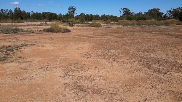
The Yelarbon Desert is a magnificent desert wilderness made from elevated, eroded level silty plains, these landforms are isolated to areas around Yelarbon near the State border. Grassland is scattered with shrubs and trees of Bull Oak, Tea tree, Belah Mallee Box and Poplar Box.
Much of the land type in this region consists of eroded soil, salinity scald, bleached sandy loam and light clay with intermittent Pitted Bluegrass, spinifex and Windmill (Inquisitive) grass and Roly Poly.
Our guided walk will take you into some of the most Eastern Desert in Australia at Yelarbon in South West Queensland. We do not rush... but take our time to experience the country’s beauty.
Enjoy a chat and a relaxing cup of Billy Tea & Anzac biscuits with your guide Julie Boyce on your return.
 1.2
km
return
30
mins
1.2
km
return
30
mins
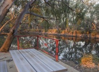
Wallam Creek
Located in the small town of Bollon between St George and Cunnamulla. Follow a concrete path ( suitable for wheelchairs) along the creek and spot some koalas and echidnas
 3.4
km
return
1
hr
3.4
km
return
1
hr
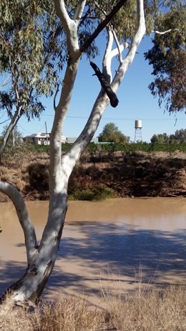
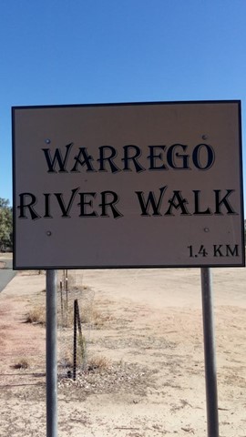
Warrego River Walk
The Warrego River, a northern tributary of the Darling River, flows through Charleville where this short walk follows its northern bank.
Walks in Crows Nest National Park
(Darling Downs South West) 4.5
km
return
2
hrs
4.5
km
return
2
hrs
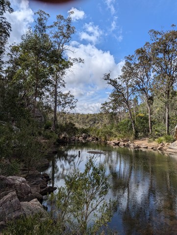
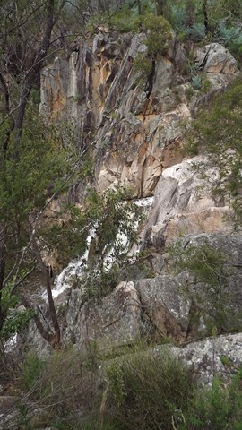
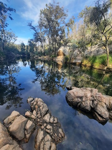
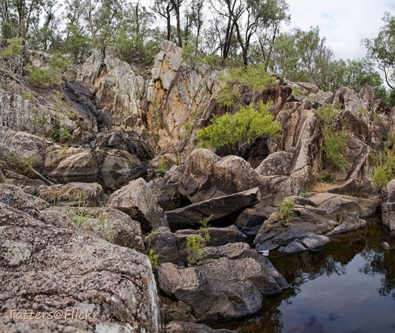
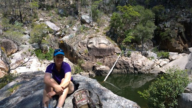
Crows Nest Falls Circuit
Crows Nest Falls via Kauyoo Loop (including The Cascades, Kauyoo Pool and Bottlebrush Pool).
Explore the creek on your way to Crows Nest Falls. Steep crevices and slippery rocks lead to the Cascades, where you can hear the ‘tock tock’ calls of striped marsh frogs echoing around the boulders in summer. A short scramble over low boulders brings you to Kauyoo Pool, where a sandy beach allows easy access to the normally shallow water - a perfect swimming spot for families with small children. Further along the trail, a long staircase leads you down to Bottlebrush Pool, which is an ideal place to enjoy a swim and relax. Keep an eye out for brush-tailed rock wallabies as they move quietly around the surrounding granite hills and boulders.
Caution: Take care on the steps leading down to the creek and when rock-hopping across the creek, as these surfaces can be slippery when wet.
Note: BYO drinking water. Water from the picnic/camping areas must be boiled before use.
 12
km
return
7
hrs
12
km
return
7
hrs
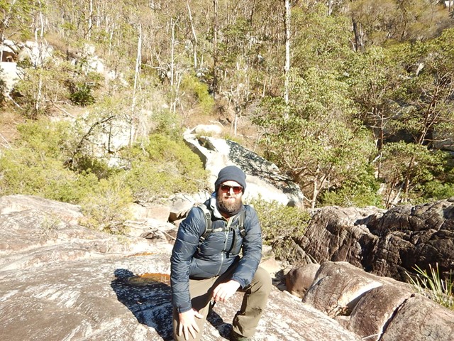
Crows Nest NP to Perserverance Dam
First 1/4 easy then 1/2 moderate then 1/4 hard. Try to get started early to avoid the heat. We took 7 hours to complete which had us doing the hardest part in the heat of the day.
At this date the creek portions were heavily overgrown and the rock hopping was hard since the floods of previous hears have washed out sand and small rocks leaving the entire Valley of Diamonds a hard slog criss-crossing the creek to find a navigable route. The bush has been badly degraded in recent years by drought and fires.
13
km
return
5
hrs
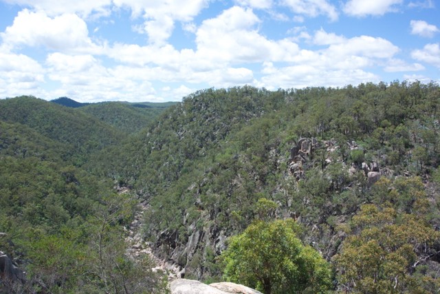
Valley of Diamonds
Starting from the same location as the normal day walks, it goes all the way to Perseverance Dam and then boulder-hopping all of the way up the gorge before a quick scramble up to Koonin Lookout
Walks in Currawinya National Park
(Darling Downs South West)
360
m
return
10
mins
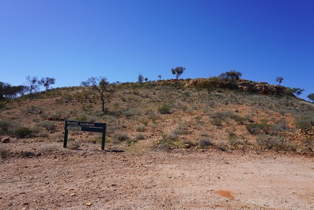
Budjiti Lookout
Budjiti Lookout
Grade 4
Distance: 360m return
Time: Allow 10 minutes
Take a short 180m walk up a rocky slope to the Budjiti Lookout and watch the sunset over an endless horizon. Located 44km north-west of the park office on the Boorara Road.
Remember to take water with you and walk carefully as the uneven track and rocks may be slippery.
 1.5
km
return
40
mins
1.5
km
return
40
mins
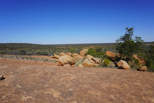
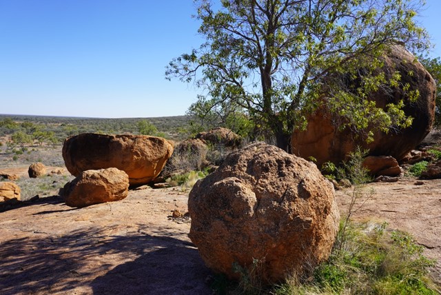
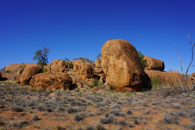
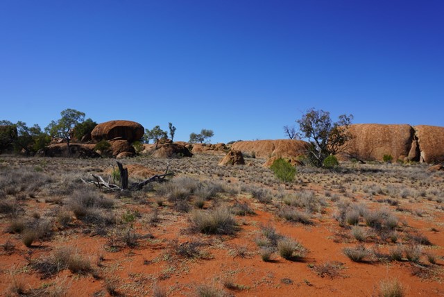
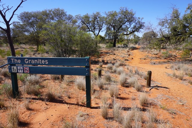
The Granites
The Granites
Grade 4
Distance: 1.5km return
Time: Allow 40 minutes
Visit The Granites, 10km north-west of Ten Mile Bore (pt 15km from ranger base) on the Boorara Road. Walk the 1.5km to a small outcrop of granite rocks, a unique feature of the park. Please respect the cultural significance of the area by not climbing on the granite rocks.
Walks in Girraween National Park
(Darling Downs South West)
5
km
return
3
hrs
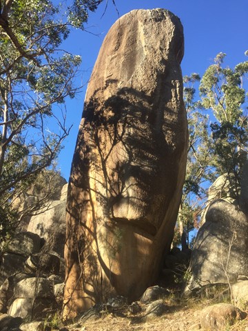
Aztec Temple
An off track walk from the end of the Underground Creek Trail containing a field of fascinating large stone pillars of various sizes, some of which (Main Pillar) can only be scales with ropes and shackles.
 4
km
return
1
hr
4
km
return
1
hr
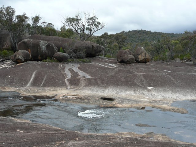
Bald Rock Creek Circuit
This circuit is ideal for a sample of Girraween’s finest features, with ample opportunity to see some of Giraween’s feathered, furred or scaly residents.
Cross Bald Rock Creek and follow it downstream along The Junction Track until it meets the track from the camping area. Use the stepping stones to cross the creek again and return to the day-use area via the camping area.