
Crows Nest NP to Perserverance Dam
Crows Nest National Park


Menu
First 1/4 easy then 1/2 moderate then 1/4 hard. Try to get started early to avoid the heat. We took 7 hours to complete which had us doing the hardest part in the heat of the day.
At this date the creek portions were heavily overgrown and the rock hopping was hard since the floods of previous hears have washed out sand and small rocks leaving the entire Valley of Diamonds a hard slog criss-crossing the creek to find a navigable route. The bush has been badly degraded in recent years by drought and fires.

Getting there
Stop at the Crows Nest National Park Day Use Area
Follow the signs to 'The Cascades'. Cross at the little concrete causeway. Small sign 'Stop - take map, water etc' at start of path.
Maps
QTOPO grid ref 412000, 6985000 it about the start of the walk
Route/Trail notes
Follow the well marked, grade 2, track from start for about 40 minutes to well defined old fire road. Turn left. Follow that road then trail markers till you reach perserverance creek at about 1.5 hours. Cross the creek and turn right then follow the creek to perserverance dam. Track is marked but very hard to find on left bank. Occasionally you will need to rock hop in the creek as the banks encroach steep and rocky. When you come to a well used dirt road on left bank you are near to bottom of dam wall. Follow the road steeply up hill, veering left, till you find the Perserverance Dam rest area and road over the dam wall.
Retrace your steps back to the initial crossing of Perserverance Creek. But do not re-cross the creek and continue down the right bank along a dirt driving track to a water. When the track expires navigate via creek crossings and rock hopping/climbing. Look for the confluence of Crows Nest Creek and Perserverance Creek marked by huge boulders and a narrow gorge to the right. Continue past the confluence another few hundred meters and look for Koonin Lookout. 200 meters before Koonin Bluff leave the creek and climb steeply up a rock defile. The start of the defile at this time was marked by small rock cairns and highlight tape. The defile is heavily over grown in places but try to stick to the defile all the way to the top. Then turn left back toward Koonin Lookout. The path from the defile was not visible when we did it but any left turn near the top should get you to the path to Koonin Lookout. The brush at the top of the defile is heavily overgrown and requires some scrub bashing. Then return to Crows Nest NP Day Use area via the path.
Permits/Costs
Do you need any permits? What's the cost?
Other References
How can I find more info? Any guide books?
GPS Tracks
- No GPS available for this walk yet.
 12
12 7
7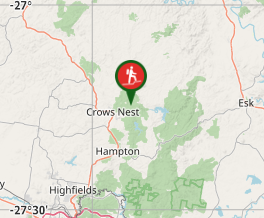
Comments
Nobody has commented on this walk yet. If you've done it then tick it off and add a comment.