
Menu
Popular Walks
-
Mt Ngungun
(1156 ticks) -
Mount Coolum
(872 ticks) -
Mt Cordeaux
(668 ticks) -
Twin Falls Circuit
(636 ticks) -
Purling Brook Falls Circuit
(611 ticks)
Summary
The Sunshine State
Queensland has a wealth of bushwalking opportunities including multiple World Heritage Listed rainforests such as the Daintree and Lamington National Park, great coastal and island parks like Fraser Island and Hinchinbrook Island.
Popular Walks
-
Mt Ngungun
(1156 ticks) -
Mount Coolum
(872 ticks) -
Mt Cordeaux
(668 ticks) -
Twin Falls Circuit
(636 ticks) -
Purling Brook Falls Circuit
(611 ticks)
Sub-Regions
Other Information
World Heritage Areas
- Fraser Island
- Gondwana Rainforests of Australia (Lamington NP, Springbrook NP, Mount Chinghee NP, Mount Barney NP, Main Range NP)
- Great Barrier Reef
- Riversleigh
- Wet Tropics (Daintree NP, Barron Gorge NP, Cedar Bay NP, Girringun NP, Wooroonooran NP)
Contact details
Queensland Parks and Forest:
https://parks.des.qld.gov.au/
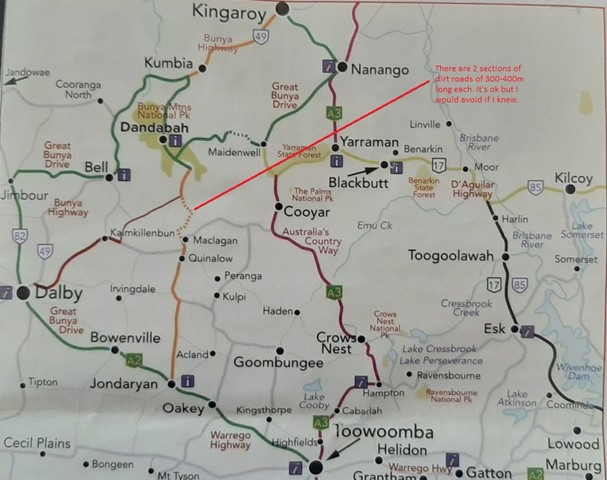
Regions
The link below provides a region map of QLD as a reference to what council zones are included in the 7 geographic regions of QLD.
https://en.wikipedia.org/wiki/Regions_of_Queensland#/media/File:Qld-regions-map.gif
- Far North Queensland
- North Queesnland
- Central Queensland
- Mackay, Isaac and Whitsunday
- Wide Bay Burnett
- Darling Downs South West
- South East Queensland
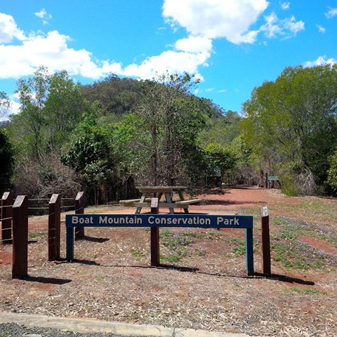
Walks in Boat Mountain Conservation Park
(Wide Bay Burnett)
 432
m
return
432
m
return
 30
mins
30
mins
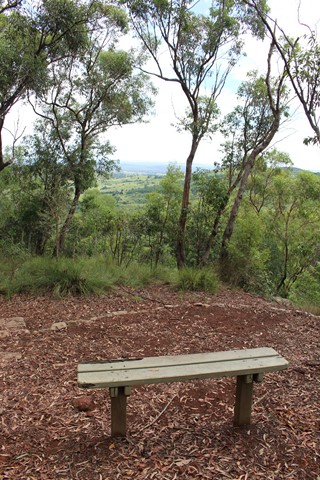
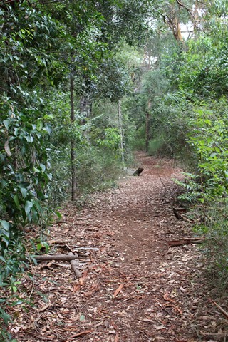
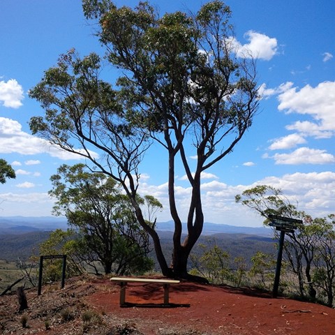
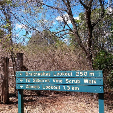
Braithwaites Lookout
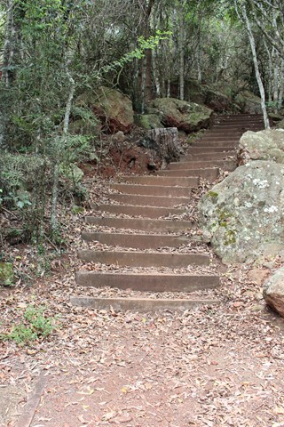
A walk up to Boat Mountain's first lookout with views towards Murgon, through healthy, partly-shaded bushland.
While this is a short and easy to follow track, the walk begins with a long staircase of 180 steps.
 2.6
km
return
1
hr
2.6
km
return
1
hr
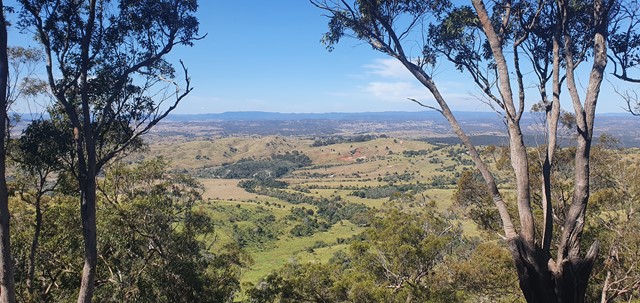
Daniels Lookout
This track winds up Boat Mountain then follows along the ridge at the top to offer sweeping views to the north.
There is a long man-made staircase of 180 steps at the beginning of this walk, but the upper section of the track is mostly flat and very easy to follow, with views that are well worth the effort.
 1.9
km
return
1
hr
1.9
km
return
1
hr
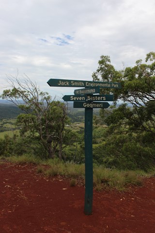
Silburns Vine Scrub Walk
Boat Mountain is named for it's shape, which looks like an overturned Viking ship. Silburns Vine Scrub Walk is a side track off the main trail. It winds through a shady section of dry rainforest that contains many interesting vines and plants and the odd Padymelon if you are lucky.
Walks in Brooyar State Forest
(Wide Bay Burnett) 100
m
return
15
mins
100
m
return
15
mins
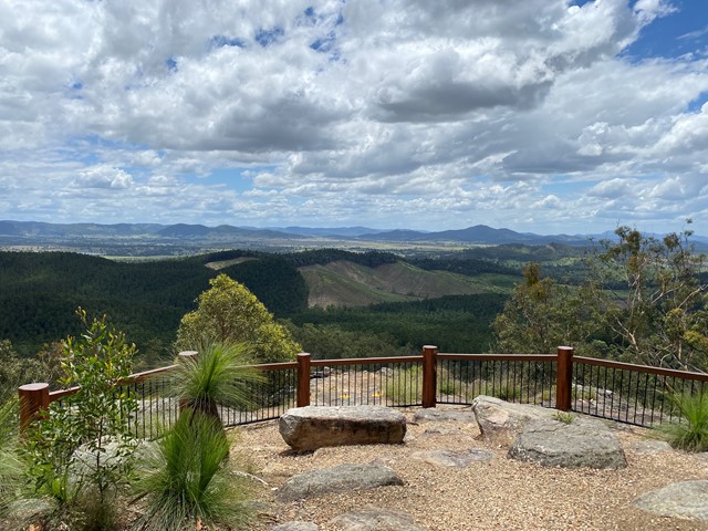
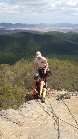
Eagles Nest
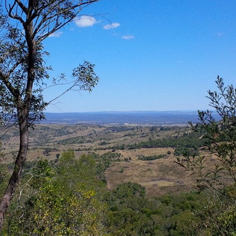
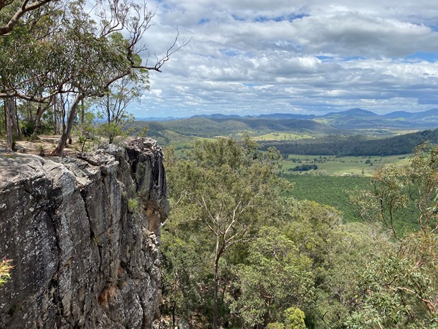
A short walk to a similar lookout to Point Pure, with its sandstone cliffs and views over hoop pine plantations and mature rainforest with emergent hoop pines.
Also a good place for some rock climbing and abseiling, if you're into that, or just watch the fun.
 2.2
km
return
1
hr
2.2
km
return
1
hr
Glastonbury Creek Loop
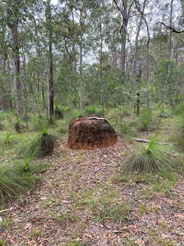
A looping walk up to the top of the ridge above the camp site, through the eucalypt forest and abundant grass trees, before returning downhill to Glastonbury Creek.
 8.6
km
return
2.5
hrs
8.6
km
return
2.5
hrs
Glastonbury Creek to Point Pure
A 4.3km(one way) walk along the road to point pure lookout from the camp ground. Very uphill on the way to the lookout.
It travels along the 4WD track so the path is quite smooth to walk, although a bit steep. It is a bit exposed in places so sun protection is a must.
410
m
return
15
mins
Point Pure
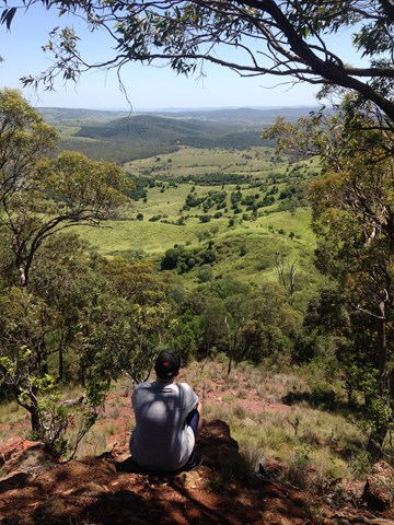
A short walk leads to the lookout at the top of sandstone cliffs. The lookout offers views over hoop pine plantations and mature rainforest with emergent hoop pines. Beyond the plantations, Glastonbury Creek can be seen winding through grazing country.
Also a good place for some rock climbing and abseiling, if you're into that, or just watch the fun.
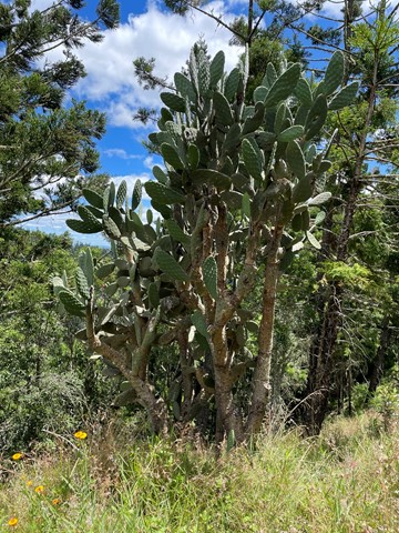
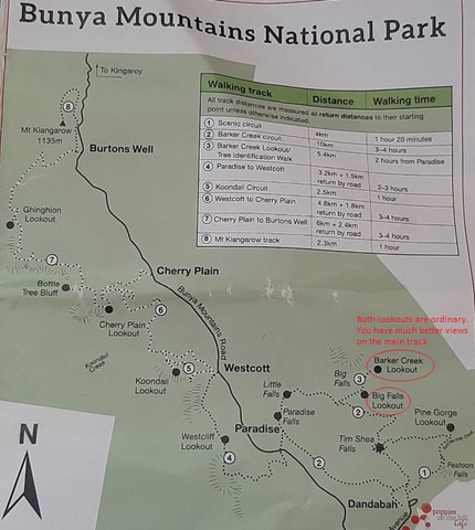
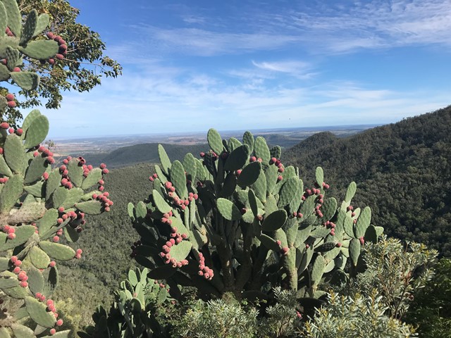
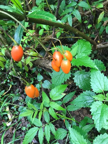
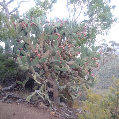
Walks in Bunya Mountains
(Wide Bay Burnett)
10
km
return
3
hrs
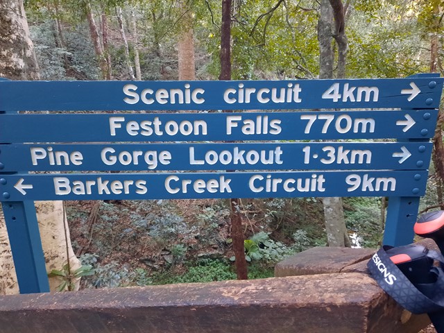
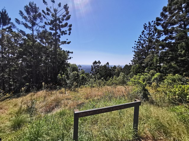
Barker Creek Circuit
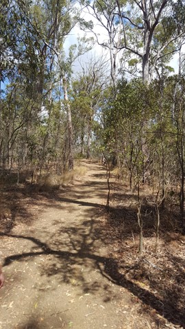
A very scenic walk leaving from the Dandabah Camping area, Bunya Avenue. The walk joins up with the shorter Tim Shea Falls walk. Best walked in an anti-clockwise direction for the views and less incline. A couple of side tracks to lookout points. Rainforest, grassy knoll and woodlands
 6
km
return
90
mins
6
km
return
90
mins
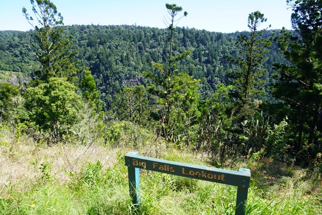
Big Falls & Barker Creek Lookout
6.09km Return from the Paradise Carpark (Along the Barker Creek Circuit track)
 6
km
one-way
2
hrs
6
km
one-way
2
hrs
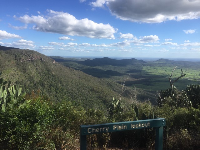
Cherry Plain to Burtons Well
This walk takes you along the Western Side of Bunya Mountains, passing three lookouts with views over the plains. Vegetation is dryer towards the the cliffs, with vine forests closer to the road. The path gradually ascends as you follow it in this direction. An easier walk may be to start sat Burtons Well.