
Menu
Popular Walks
-
Mt Warning Summit Trail
(760 ticks) -
Minyon Falls Loop
(119 ticks) -
Bald Rock Summit
(113 ticks) -
Fingal Head Lighthouse Walk
(73 ticks) -
Grand Canyon Track
(55 ticks)
Sub-Regions
- Bald Rock National Park
- Barren Grounds Nature Reserve
- Barrington Tops National Park
- Basket Swamp National Park
- Blue Mountains National Park
- Boonoo Boonoo National Park
- Border Ranges National Park
- Cathedral Rock National Park
- Dorrigo National Park
- Gibraltar Range National Park
- Greater Sydney
- Gundabooka National Park
- Guy Fawkes River National Park
- Hat Head National Park
- Koreelah National Park
- Kosciuszko National Park
- Ku-ring-gai Chase National Park
- Kwiambal National Park
- Lord Howe Island
- Morton National Park
- Mount Kaputar National Park
- Mt Jerusalem National Park
- Mt Kosciusko
- Mt Warning National Park
- Mutawintji National Park
- New England National Park
- Nightcap National Park
- Oxley Wild Rivers National Park
- Pilliga Nature Reserve
- Royal National Park
- Warrumbungle National Park
- Wollumbin National Park
Summary
New South Wales (NSW), is a state found on the east coast of Australia.
Popular Walks
-
Mt Warning Summit Trail
(760 ticks) -
Minyon Falls Loop
(119 ticks) -
Bald Rock Summit
(113 ticks) -
Fingal Head Lighthouse Walk
(73 ticks) -
Grand Canyon Track
(55 ticks)
Sub-Regions
- Bald Rock National Park
- Barren Grounds Nature Reserve
- Barrington Tops National Park
- Basket Swamp National Park
- Blue Mountains National Park
- Boonoo Boonoo National Park
- Border Ranges National Park
- Cathedral Rock National Park
- Dorrigo National Park
- Gibraltar Range National Park
- Greater Sydney
- Gundabooka National Park
- Guy Fawkes River National Park
- Hat Head National Park
- Koreelah National Park
- Kosciuszko National Park
- Ku-ring-gai Chase National Park
- Kwiambal National Park
- Lord Howe Island
- Morton National Park
- Mount Kaputar National Park
- Mt Jerusalem National Park
- Mt Kosciusko
- Mt Warning National Park
- Mutawintji National Park
- New England National Park
- Nightcap National Park
- Oxley Wild Rivers National Park
- Pilliga Nature Reserve
- Royal National Park
- Warrumbungle National Park
- Wollumbin National Park
Other Information
...
Contact details
NSW National Parks and Wildlife Service
https://www.nationalparks.nsw.gov.au/
Regions
...
Walks in New South Wales

 900
m
return
900
m
return
 45
mins
45
mins
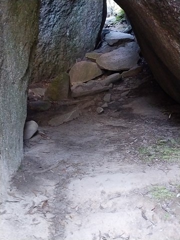
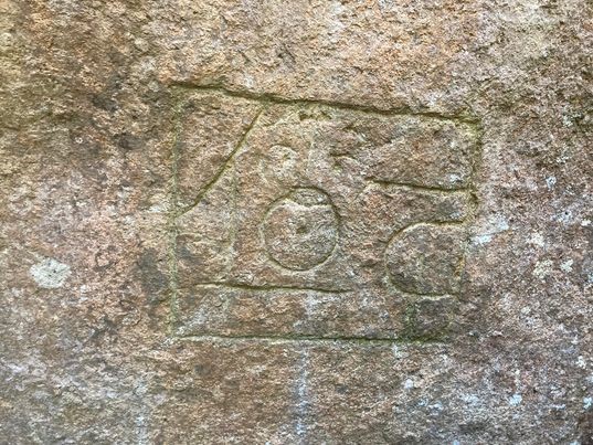
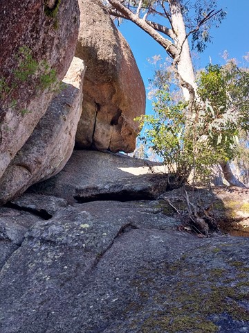
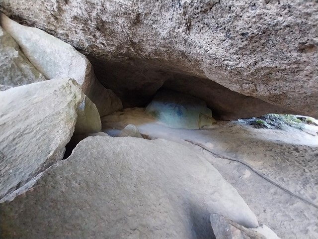
Thunderbolts Hideout
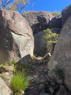
Fred Ward (1835 - 1870), better known as Captain Thunderbolt, was the longest roaming bushranger in Australia’s history. He was very familiar with the Tenterfield region, using it as both a hideout and hunting ground for his hold-ups. The large area between the rocks was used to stable horses and the small shelter under the large rock was a great place to camp. The top of the rock made an ideal lookout, as this was the main road to Warwick during the gold-mining days.
 2
km
return
1
hr
2
km
return
1
hr
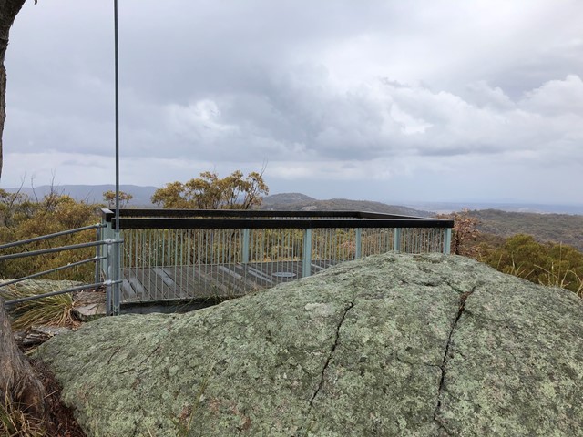
Thunderbolts Lookout Walking Track
Thunderbolts Lookout Walking Track provides spectacular 360° panoramic views of Torrington State Conservation Area
 500
m
return
20
mins
500
m
return
20
mins
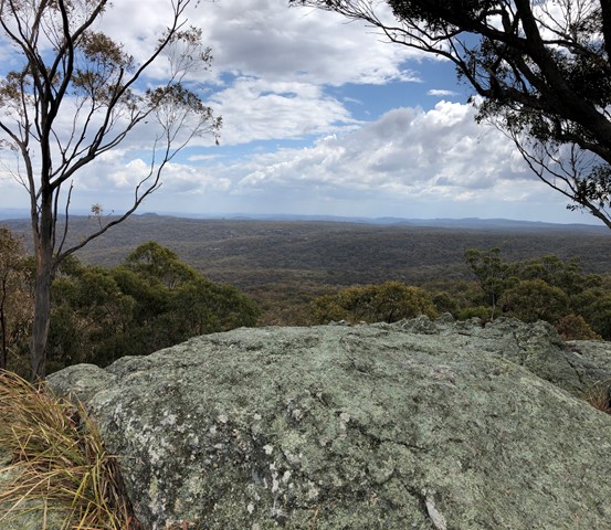
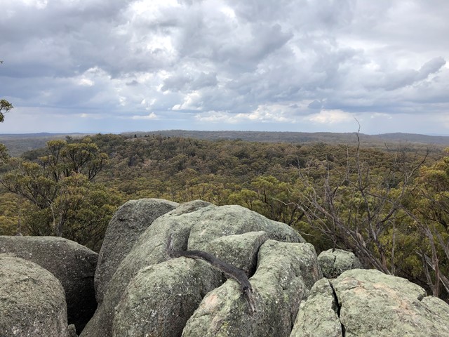
Tom Beatson Lookout Razorback Hill
A short stroll up the walkway to and around the Joongurranahreean Plateau which offers great views to the coast and inland.
 400
m
return
15
mins
400
m
return
15
mins
Tooloom Lookout
Short walk through rainforest from the Tooloom picnic area to the lookout.
 1
km
return
30
mins
1
km
return
30
mins
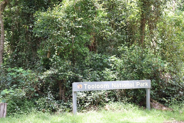
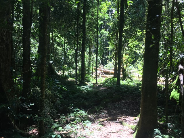
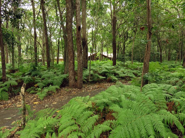
Tooloom Walking Track
Tooloom walking track is a short, easy stroll through World Heritage rainforest of Tooloom National Park, with plenty of opportunities for birdwatching and picnicking during your hike.
 8.2
km
return
2
hrs
8.2
km
return
2
hrs
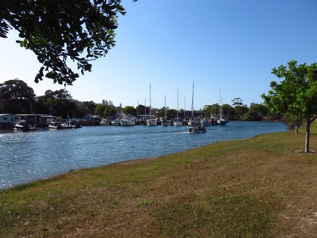
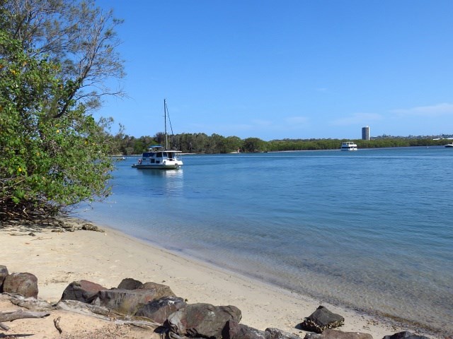
Tweed River Walk
This walk explores the Tweed/Coolangatta area with beach and Tweed River views.
 7
km
one-way
4
hrs
7
km
one-way
4
hrs
Tyagarah Fire Trail
Long, flat walk parallel to beach. It starts at Brunswick Heads, and ends a short distance from Byron Bay.
 1
km
return
15
mins
1
km
return
15
mins
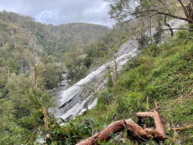
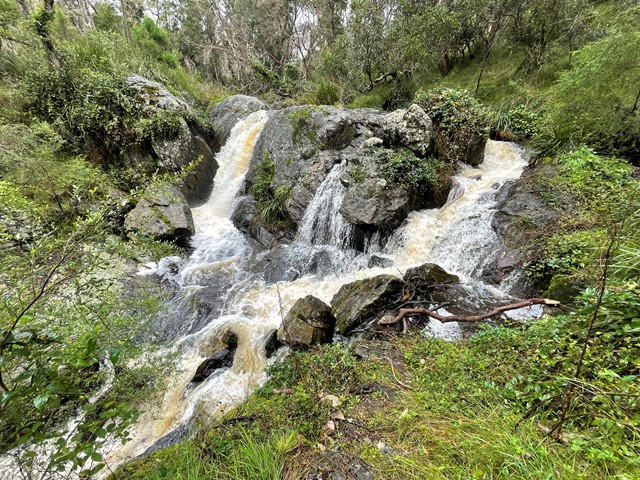
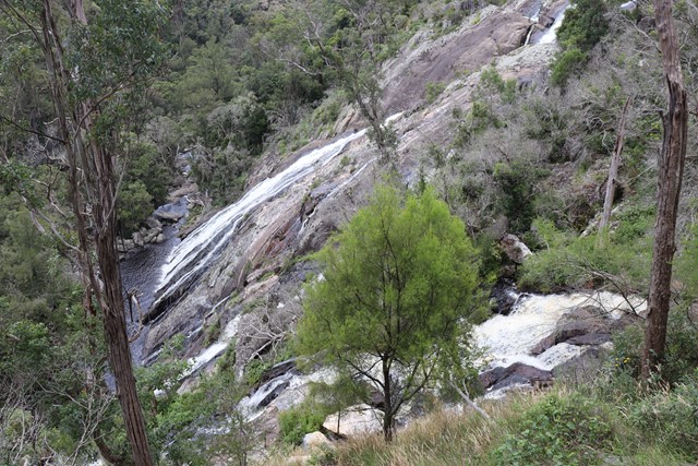
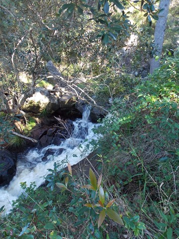
Undercliffe Falls
Undercliffe Falls is a waterfall located on the Bookookoorara Creek in northeast New South Wales.
Undercliffe Falls is estimated between 140m and 160m high. This estimate is based on analysis of the topographic profile around the waterfall and may not be an accurate figure for the total fall of water seen if viewing the falls.
The nearest populated town of Stanthorpe, with shops, wineries, accommodation etc etc is 23km away, via Amosfield Road. The nearest sealed road to Undercliffe Falls is the Mount Lindesay Highway (7.59km away). The turnoff, to Rivertree Road is located in the small village of Liston. The entrance to Undercliffe Falls is from Rivertree Rd and is signposted. You travel through farmland. Camping & coffee etc is available at Aloomba Lavender on the northern side of Liston. Liston has holiday accommodation and Liston hall (with bar) is often open on Fridays and some public holidays.
Care should be taken near the top of the waterfall, as a fall would be easy.
Mobile phone reception is patchy. Telstra is best so far. A public phone is available in Liston.
Public toilets are also in Liston (cleaned by local volunteers).
 1
km
return
45
mins
1
km
return
45
mins
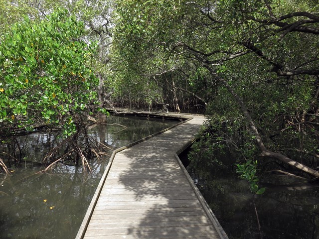
Walk on Water Track
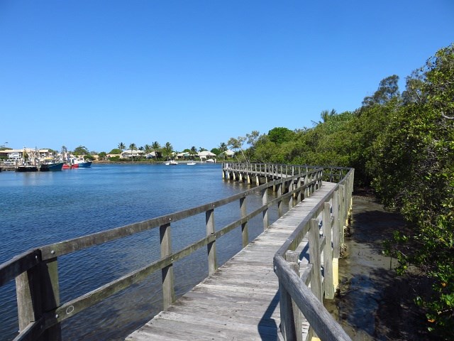
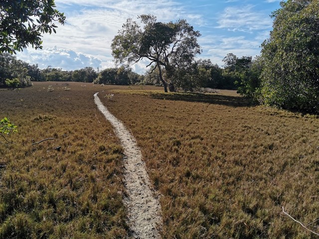
This short walk invites you to see beautiful bushland and mangroves while experiencing the Aboriginal cultural heritage that makes this area so special.
Starting from Minjungbal Aboriginal Cultural Centre, you’ll follow a wheelchair-accessible boardwalk and walking track through eucalypt forest, woodlands and swamp forests, before emerging among the diverse mangrove communities along Tweed River.
Read about the plants, animals, bush tucker and culture of the Minjungbal people from interpretive signage along the way. For a fascinating local perspective, why not take a guided tour from Minjungbal Aboriginal Cultural Centre?
See Bora Ring, a sacred Aboriginal site traditionally used for men’s initiation ceremonies. Today, it continues to be an important place for Minjungbal people, providing a spiritual link with their ancestors.
This easy walk also offers great birdwatching opportunities. Keep your binoculars handy to see shorebirds and waders like the greater egret and royal spoonbill.
 2
km
return
45
mins
2
km
return
45
mins
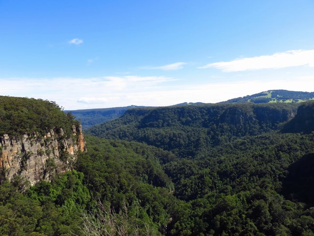
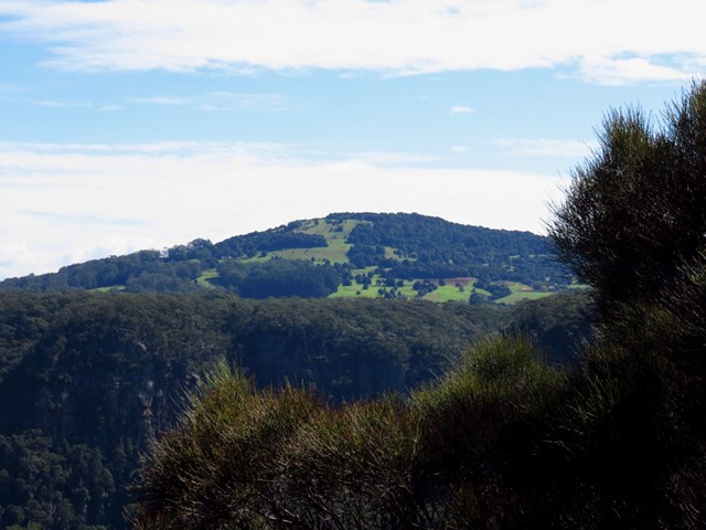
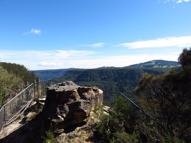
Warris Chair Lookout Track
If you like to feel on top of the world without the effort, you can’t go past Warris Chair lookout. From the heathlands, on the western edge of Kangaroo Valley, gaze across the last remaining pocket of rainforest protected by Budderoo National Park.
This easy walk through woodlands of swamp banksia offers fabulous birdwatching. The honey eaters, flame robins and beautiful firetails are attracted to the heath in spring, when it erupts in colours and fragrance. Nearby Carrington Falls will give a spectacular display after heavy rain.
If all that fresh air stirs up an appetite, head back to Carrington Falls or Nellies Glen picnic area or head to Lyrebird Café for a tasty snack. There are plenty of places to stay in the nearby southern highlands, making for a perfect weekend away.