
Menu
Popular Walks
-
Minyon Falls Loop
(119 ticks) -
Minyon Grass to Base of Minyon Falls
(48 ticks) -
Protesters Falls walking track
(34 ticks) -
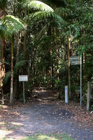
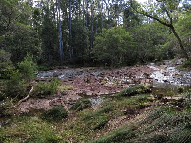
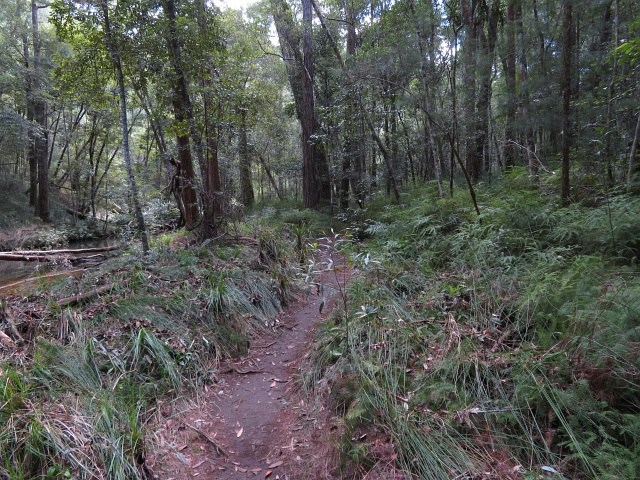
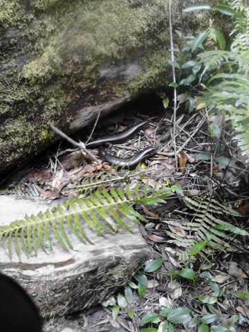
Boggy Creek Trail
(16 ticks) -
Pholis Gap (from Mt Nardi)
(11 ticks)
Parent Regions
Popular Walks
-
Minyon Falls Loop
(119 ticks) -
Minyon Grass to Base of Minyon Falls
(48 ticks) -
Protesters Falls walking track
(34 ticks) -
Boggy Creek Trail
(16 ticks) -
Pholis Gap (from Mt Nardi)
(11 ticks)
Parent Regions
Walks in Nightcap National Park

 4.8
km
return
4.8
km
return
 90
mins
90
mins
Boggy Creek Trail
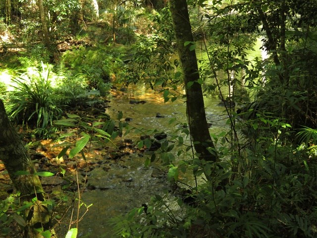
An easy walk along the side of Boggy Creek. A few tree roots and narrow path at times, with plenty of opportunities to cool your feet in the waters as it cascades over the boulders. Some rather large Land Mullet can be seen along the way.
 36
km
return
1
days
36
km
return
1
days
Historic Nightcap Walking Track
Historic Nightcap walking track leads through World Heritage-listed rainforest, offering scenic views across Nightcap National Park and Whian Whian State Conservation Area, near Byron Bay.
 6.8
km
return
3
hrs
6.8
km
return
3
hrs
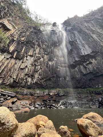
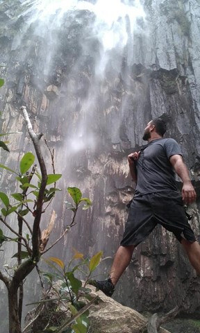
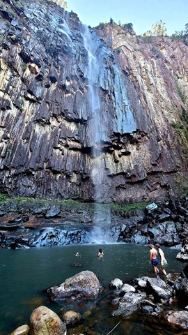
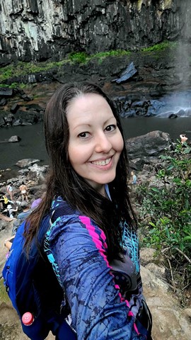
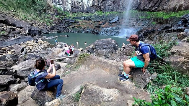
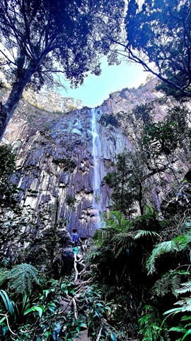
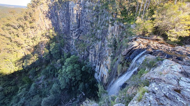
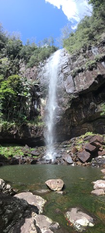
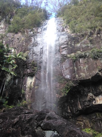
Minyon Falls Loop
The Minyon Falls is a plunge waterfall on the Repentance Creek in the Northern Rivers region of New South Wales, Australia. The waterfall descends more than 100 metres over the huge rhyolite cliffs which were once part of the Tweed Volcano.
Walk down to the base of the falls; a very pretty interesting walk. After the rain the water gushes past you.
 4
km
return
2
hrs
4
km
return
2
hrs
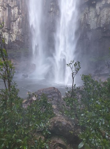
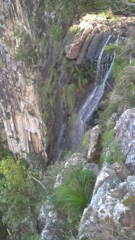
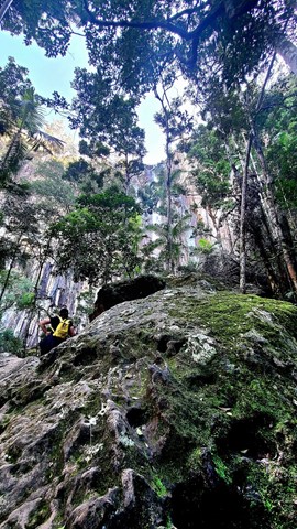
Minyon Grass to Base of Minyon Falls
This walk is the shorter alternative to the Minyon Loop (4 - 5 hr). It follows the Minyon Loop track from the Minyon Grass picnic grounds down along Repentance Creek to the base of the falls. The last 100m of the walk (to get to the waterfall base and pool) is scrambling up large boulders. Be careful when it's wet as the rocks can be very slippery. The majority of this walk is of medium difficultly however the scramble at the end lifts the difficulty to hard.
 3
km
return
90
mins
3
km
return
90
mins
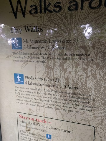
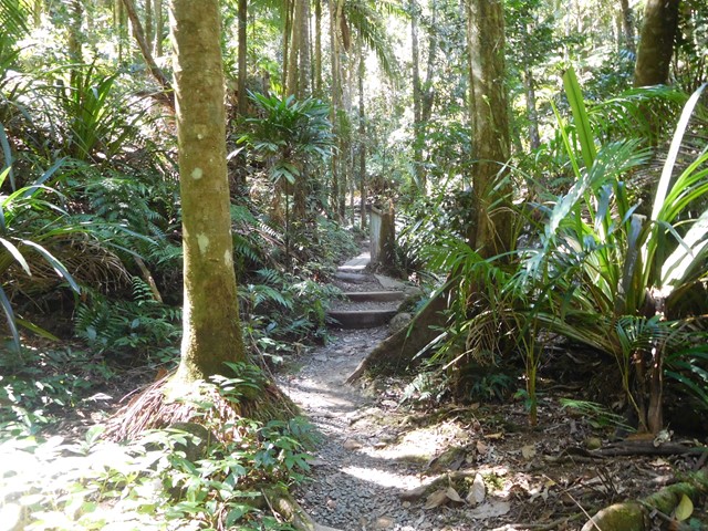
Mt Matheson Loop Walk (from Mt Nardi)
Starting at Mount Nardi picnic area, the Mount Matheson loop takes you on a short walk through rainforest. You can combine this hike with other tracks for a longer day walk.
 11.6
km
return
4
hrs
11.6
km
return
4
hrs
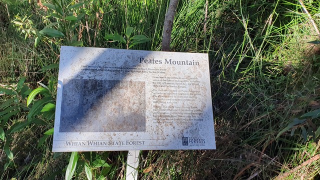
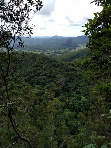
Peates Mountain
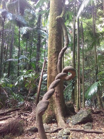
An interesting walk through the semi-tropical forest of the Whian Whian Conservation Area (Nightcap NP). Remnants of red cedar logging exist with the stumps showing the cut marks from the cutters planks, as well as an old cedar trunk bridge across one of the creeks.
Peates Mountain (once known as Peach Mountain) once had a fire lookout tower, that provided extensive views of the area from Lismore in the west to the eastern coast. Sadly this no longer exists and we are left with a ordinance obelisk.
 4
km
return
90
mins
4
km
return
90
mins
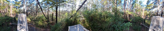
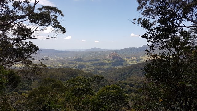
Pholis Gap (from Mt Nardi)
Sets out from the Mt Nardi carpark and follows the Mt Matheson walk till the track branches to the left at the 1.5km mark. There are alot of steps to get to the Pholis Gap lookout, however when you arrive there a plaque explains the Gap look out. The lookout is virtually over grown and all that can be seen is a distant view.
 1.4
km
return
90
mins
1.4
km
return
90
mins
Protesters Falls walking track
Protesters Falls walking track leads through superb World Heritage rainforest before arriving at spectacular waterfalls in Nightcap National Park, near Lismore.