
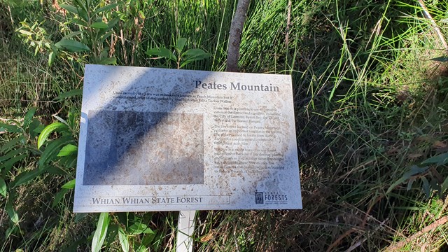
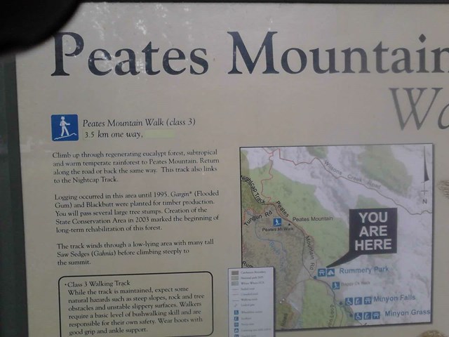
Peates Mountain
Nightcap National Park


Menu
GPS Tracks
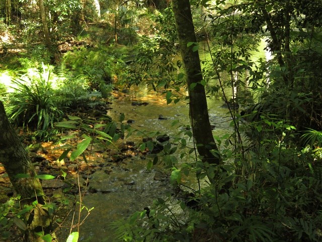


An interesting walk through the semi-tropical forest of the Whian Whian Conservation Area (Nightcap NP). Remnants of red cedar logging exist with the stumps showing the cut marks from the cutters planks, as well as an old cedar trunk bridge across one of the creeks.
Peates Mountain (once known as Peach Mountain) once had a fire lookout tower, that provided extensive views of the area from Lismore in the west to the eastern coast. Sadly this no longer exists and we are left with a ordinance obelisk.

Getting there:
From Mullumbimby, take the Coolamon Scenic Drive south then turn right into Repentance Creek Road and right again into Minyon Falls Road.
From the south, turn off the Lismore Bangalow Road into Eureka Road onto Federal Road before turning left onto Repentance Creek Road and right again into Minyon Falls Road.
The last two kilometres are gravel road. Minyon Falls is well signposted.
Maps:
None found, although this trail does form part of the much longer Historic Nightcap Track from Rummery Park to Mt Nardi (36km return).
Route/Trail notes:
From Minyon Falls car park, leave by the right hand track as if you were doing the Minyon Falls Loop anticlockwise. Where that walk turns left over the creek's stepping stones, carry straight on following the course of the creek.
After 600m, the track crosses the gravel road and continues along the creek side to Rummery Park Camp Ground. This part of the walk is known as the 'Boggy Creek Walk', so 'tick' that one off.
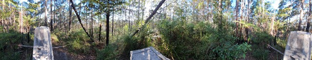
Cross to the north eastern corner of the camp ground and you will see the sign and track for Peates Mountain. The track is well defined and maintained by N.Ps. Other trails do cross your path, but carry straight on. For the first 1.8km from Rummery Park, the walk is pretty flat and it is only at this point that you start to climb from 400m to the top at 600m.
Return by the same route, or continue 500m beyond the peak and turn RIGHT back down Peates Mountain Road to Rummery Park.
Permits/Costs:
There is no camping permitted except at Rummery Park, where you need to pre-book and pay online at:
Other References/Comments:
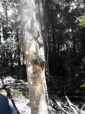
Watch out for the Goannas just beyond Rummery Park. They use the track as a runway and sunbathing area!
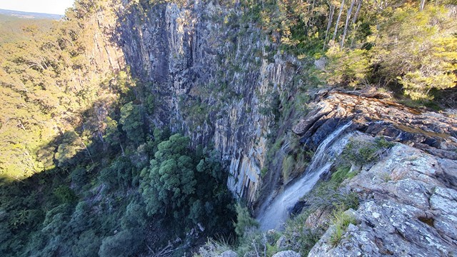
Minyon Falls can be a very busy area on weekends and holidays, so parking can be a problem. Parking, toilets, BBQs and picnic areas are located here and at Rummery Park.
You can of course cut the walk short by 5km, by driving to Rummery Park and starting from there.
 Peates Mountain (KML)
 11.6
11.6 4
4
Comments