
Menu

 17
km
return
17
km
return
 5
hrs
5
hrs
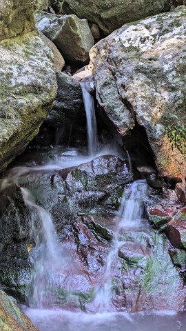
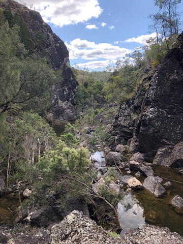
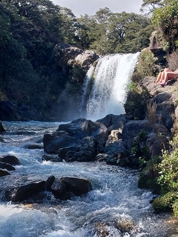
Warrie Circuit
Beautiful walk through the valley. Pass and go through lots of waterfalls and rainforest.
Stop at Apple Tree Park for toilet stop on way. Circuit is another 5-10min drive from there.
Public toilets are also located at Tallanbana Picnic Area approximately 300m on the right before Canyon Lookout where Warrie Circuit begins - toilets are set back off the road and can't be seen from the road, but, they're there just behind the picnic tables.
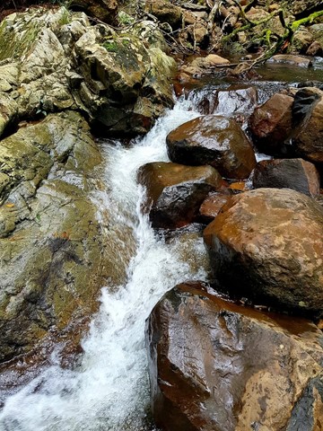
Cuts across the Ngarri-dhum Falls a few times in one half, and the Little Nerang Creek in the other half. The half way point is the Meeting of the Waters where (as the name suggests) the two creeks meet.
 450
m
return
30
mins
450
m
return
30
mins
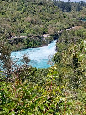
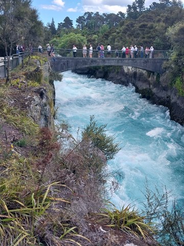
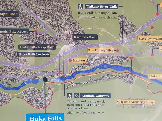
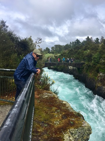
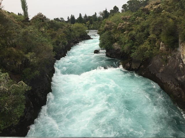
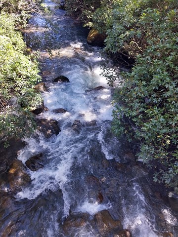
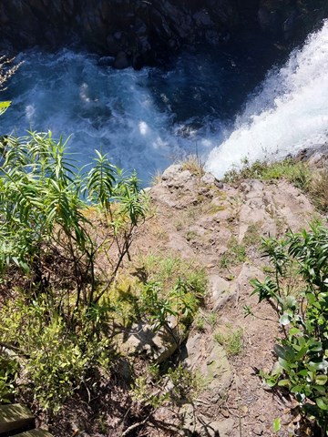
Huka Falls Lookouts
A short walk to views of the powerful thundering water flow through a natural 15m wide gorge before spilling over Huka Falls, which could fill 5 Olympic swimming pools a minute with its flow. The falls vary from 7m to 9.5m and are situated on the Waikato River which is the longest river in New Zealand and the only river to drain Lake Taupo.
 6.1
km
return
2
hrs
6.1
km
return
2
hrs
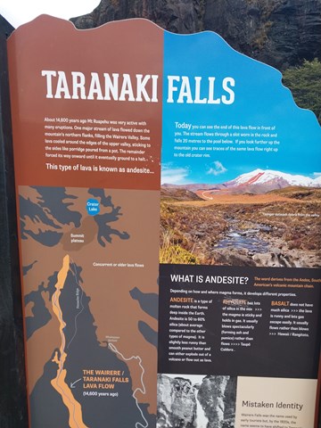
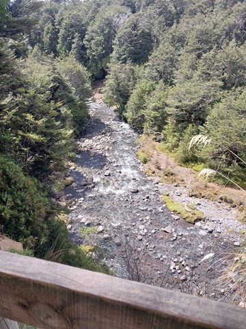
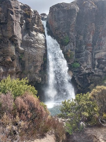
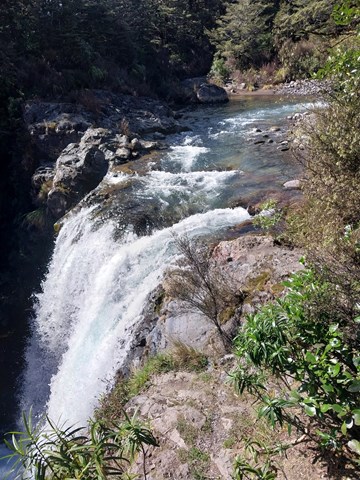
Taranaki Falls Circuit
Walk to spectacular 20m high Taranaki Falls and enjoy excellent mountain views and a range of land forms on a loop track which is part of Te Araroa Trail.
 3.2
km
return
90
mins
3.2
km
return
90
mins
Upper Silica Rapids Track
Experience a range of vegetation types as well as the creamy-white Silica Rapid terraces.
The boardwalks makes walking over swampy ground more comfortable and reduces the impact of foot traffic on delicate vegetation. This is a great place to enjoy mountain views particularly Mt. Ruapehu.
2.9
km
return
1
hr
Lookout Archerfield Wetland
The wetland offers a nice long walking path, perfect for a peaceful stroll or bicycle ride. However, there's little to no shade, making it a bit challenging during sunny summers. The area has a lot of potential but could use some improvements to make it more engaging. Despite being somewhat secluded, it's still a pleasant spot for outdoor activities, but it could benefit from a bit of enhancement to make the experience more enjoyable.
1.1
km
return
1
hr
Kinbombi Falls
Located next to a camping area with picnic and toilet facilities, the Kinbombi Falls walks are a network of 3 short tracks that descend into a deep gully containing a seasonally flowing creek/waterfall. The combined walks could be done in under an hour, but it is worth setting aside more time to enjoy and explore the gully.
Tracks 1 and 3 both have an unstable, unpaved section towards the bottom of the gully.
 3.8
km
one-way
90
mins
3.8
km
one-way
90
mins
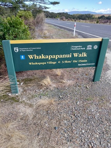
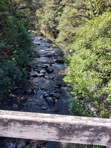
Whakapapanui Track
Follow Whakapapanui Stream and enjoy the shelter of the forest.
Water-logged clearings are passed as the track follows Whakapapanui Stream. Here, storm damaged beech forest is slowly regenerating. Keep a look out along the river for the endangered whio/blue duck. They are the same colour as the rocks so can be very difficult to spot, but you may hear the male’s whistling call.
 263
m
return
15
mins
263
m
return
15
mins
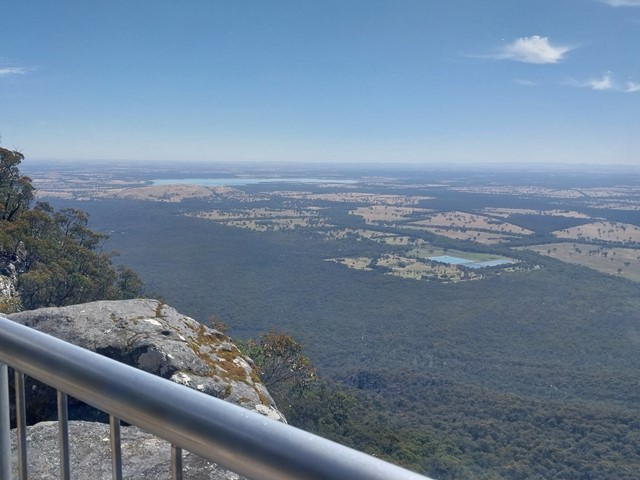
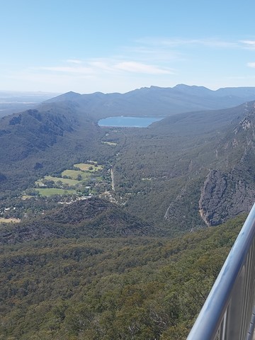
Boroka Lookout
Boroka Lookout provides panoramic views over Halls Gap and the east of the Grampians.
The sunrise here is especially stunning and the views towards Halls Gap and Lake Bellfield are amazing with both the Wonderland and Mt William mountain ranges in view.
 340
m
return
15
mins
340
m
return
15
mins
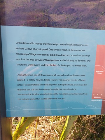
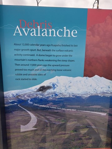
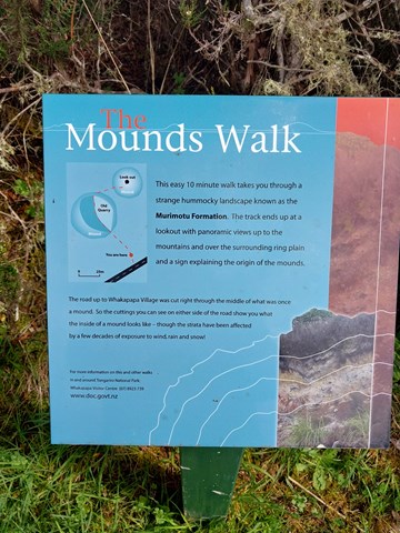
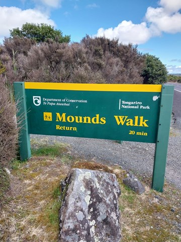
Mounds Walk
Debris avalanches during Ruapehu’s periods of volcanic activity are believed to have formed these mounds thousands of years ago. The top of the track offers good views of the volcanoes and surrounding area.
 900
m
return
45
mins
900
m
return
45
mins
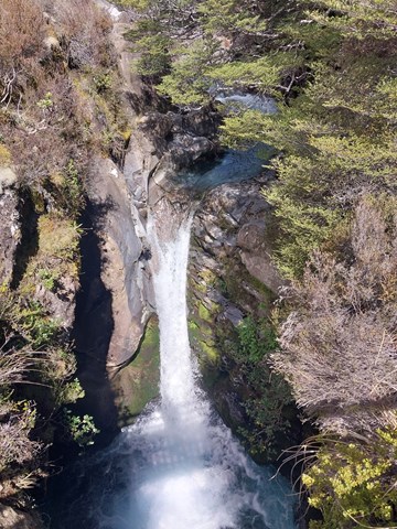
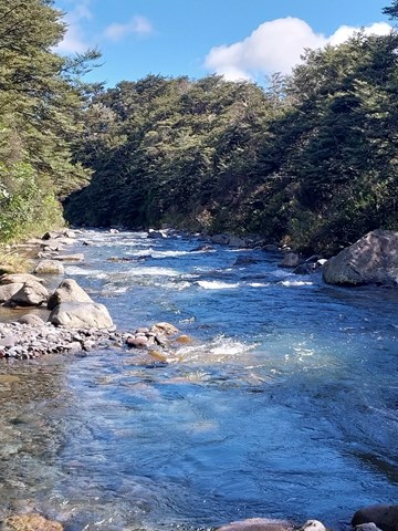
Tawhai Falls
The track leads down to a viewing point near the top of Tawhai Falls, where you can watch the river tumble over the edge of an ancient lava flow.
There is then the option to continue down more steps to the river’s edge, where there is a view of the river and a more distant view of the falls. The river is fast-flowing and the rocks on the riverbank can be slippery.
 1.2
km
return
30
mins
1.2
km
return
30
mins
Fitzgibbon Bushland Walk
Remnant bushland pocket in suburb of Fitzgibbon. Accessible by public transport.
4.5
km
one-way
90
mins
Cabbage Tree Creek Walk (upper creek section)
Follow the Cabbage Tree Creek Bikeway through parks and reserves. Includes parts of Bunyaville, Everton Hills, Arana Hills, Ferny Hills. Accessible by public transport.
1.9
km
return
45
mins
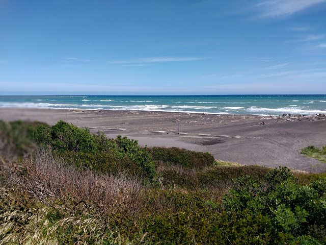
Castlecliff Dune Walk
A short walk through the pretty dune flora, with plenty of bird life and flowering plants and flowers.
 4.2
km
return
90
mins
4.2
km
return
90
mins
Davis Hill
A short walk which climbs gradually along fire trail to the summit of Davis Hill (298m). Views from the summit are limited, and there is a communications mast at the top.
4.8
km
return
5
hrs
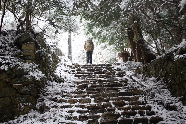
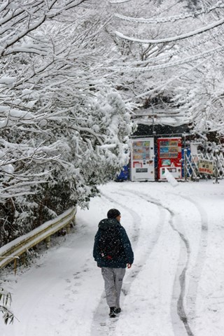
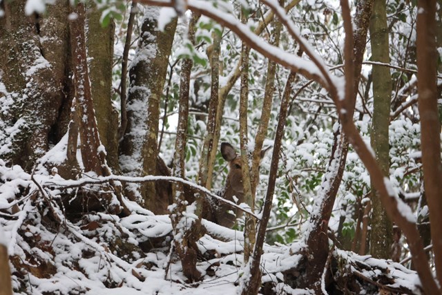
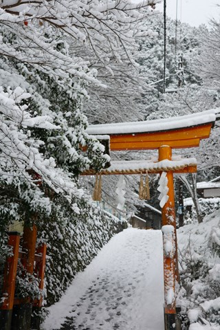
Mt. Atago 愛宕山 (Kyoto Prefecture)
Mt. Atago is the tallest mountain in Kyoto city. It is the best proper hike near Kyoto city within easy access of Arashiyama.
 4
km
return
2
hrs
4
km
return
2
hrs
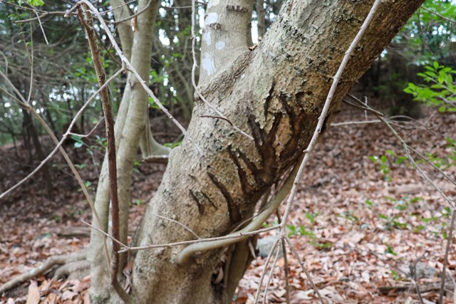
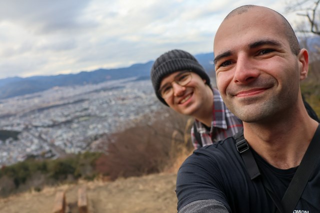
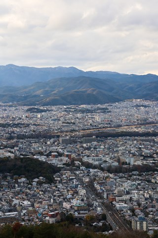
Mt. Daimonji 大文字山 (Kyoto Prefecture)
Easy hike in central Kyoto. Can see Kyoto and Osaka off into the distance, keen eyed hikers may also spot bear claw marks.
 1.5
km
return
30
mins
1.5
km
return
30
mins
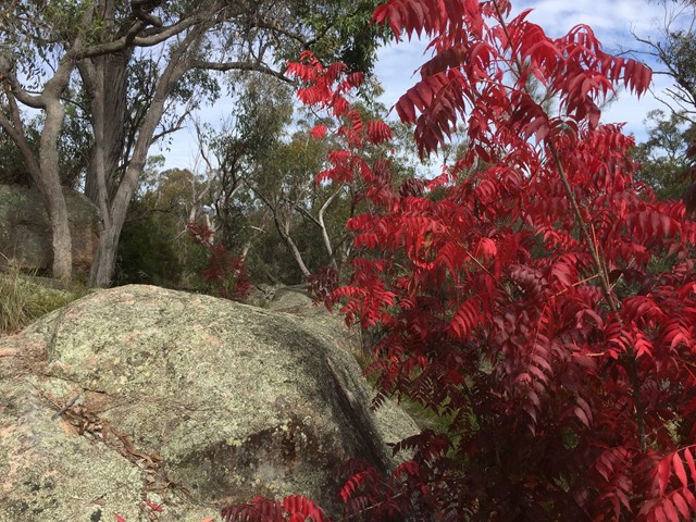
Sentimental Rocks
A little patch of bushland in Stanthorpe that offers a taste of the granite boulders the granite belt is known for.
A mini Girraween National Park for those who run short of time to make it out there.
 3
km
return
1
hr
3
km
return
1
hr
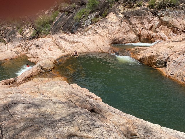
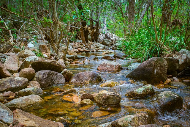
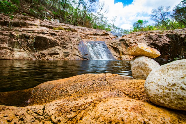
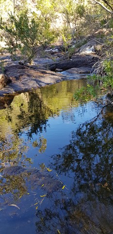
Mt Walsh Waterfall Creek (Utopia Falls)
This pleasant moderate grade walk to the rock pool area—a nice place to picnic, cool off in the shade beside the rock pools or just enjoy nature.
The walk begins in hoop pine dominated dry rainforest and vine thickets fringing a moist gully. Further on, open forests and grassy woodlands feature and merge into shrubby heath along Waterfall Creek.
The creek cascades through a series of rock pools that have potholed into the granite by years of water erosion. Cabbage palms, (Livistona decora), growing near the rock pools occur here at their most western limit. Further along Waterfall Creek, impressive water gums, (Tristaniopsis laurina), grow to over 25m high and wrap buttressed roots around rocks.
Look for wildlife as you walk. You might see wonga pigeons in the dark shaded understorey of the rainforest or catch a glimpse of white-throated treecreepers in the open forest and woodland. Swamp wallabies also use the track and red-necked wallabies often feed around the rainforest fringes.
Caution is required when accessing the creek as rocks may be slippery and unstable.
 6
km
2
hrs
6
km
2
hrs
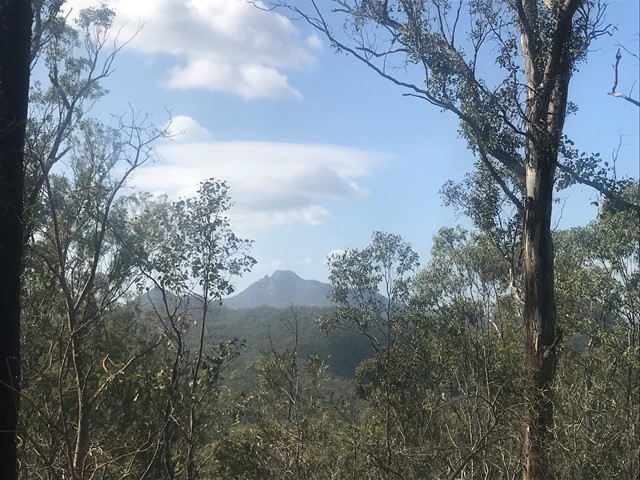
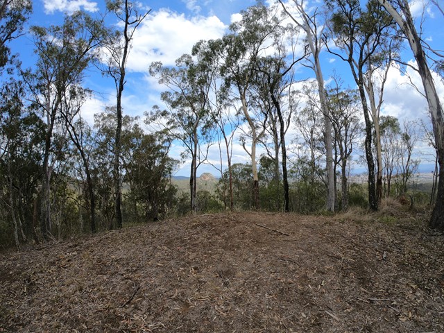
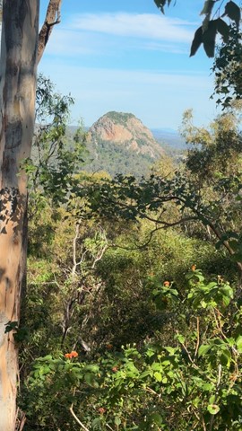
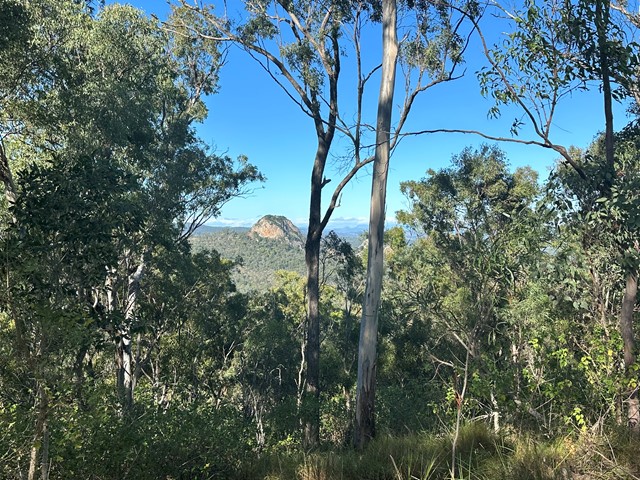
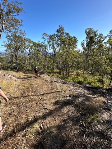
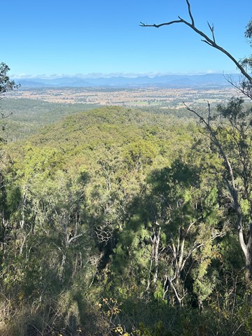
Goolman Lookout
Entry is from Hardings Paddock Picnic Area
Forming part of the Boonah to Ipswich Trail this multi-user trail winds its way to Goolman Lookout where you enjoy spectacular views of Mt Goolman and Ivory’s Rock, Scenic Rim and Brisbane. On a clear day it is possible to see the
Pacific Ocean.
 7.4
km
2
hrs
7.4
km
2
hrs
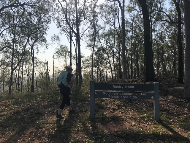
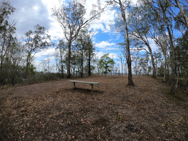
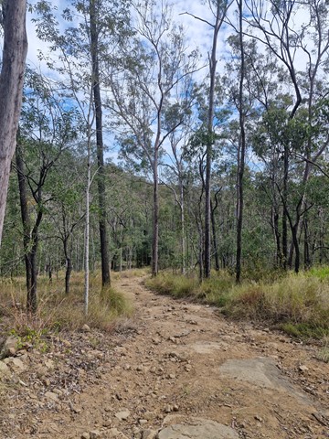
Goolman Lookout via Rocky Knoll
Entry is from Hardings Paddock Picnic Area
An alternative and slightly longer route to Goolman Lookout
skirting around the base of the Rocky Knoll. Be weary that this has some steep sections. To avoid slipping down the slope It is better to go via the Goolman Lookout track then return via Rocky Knoll.