
Taranaki Falls Circuit
North Island NZ


Menu
GPS Tracks
Walk to spectacular 20m high Taranaki Falls and enjoy excellent mountain views and a range of land forms on a loop track which is part of Te Araroa Trail.

Getting there:
The track is in Whakapapa Village. It starts 100m below the Visitor Centre on Ngauruhoe Place.
Maps:
Walks in and around Tongariro National Park
Route/Trail notes:
From Ngauruhoe Place take the left hand side entrance to the walk that takes you clockwise around the circuit.
The lower track (more sheltered on windy days) passes through tussock and alpine shrublands before entering beech forest. On a clear day Ngauruhoe’s symmetrical cone and the older, eroded mountains of Tongariro and Pukekaikiore are visible.
Once in the forest, the track descends to Wairere Stream then climbs alongside it, passing Cascade Falls. The forest consists mainly of large mountain beech trees, shiny broadleaf, mountain five-finger, umbrella ferns and mountain toatoa. Small native birds such as whiteheads, grey warbler and rifleman are commonly seen.
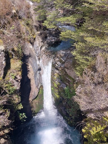
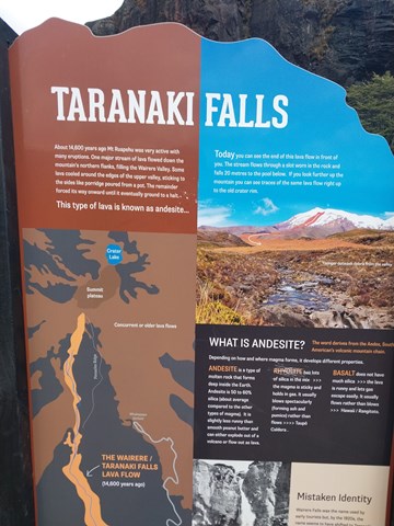
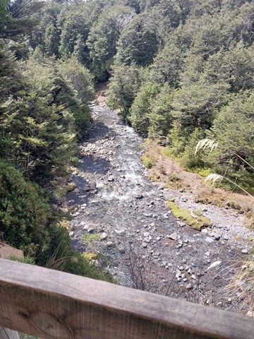
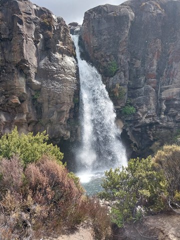
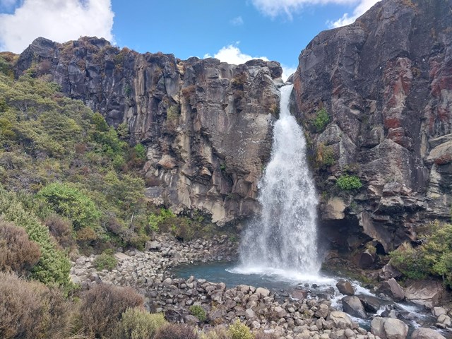
From the forest edge the track passes over the Wairere Stream with impressive views of a small narrow gorge. Continuing on up the track, Taranaki Falls comes into view tumbling 20 metres over the edge of a large andesite lava flow which erupted from Mt Ruapehu 15,000 years ago.
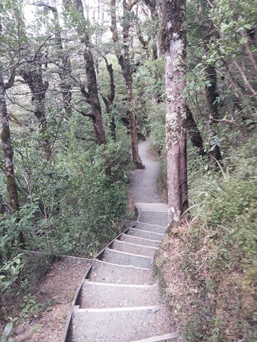
The trail from the falls climbs up a flight of 100 steps to a forest of mountain toatoa before joining the Tama Lakes Track. Turn right to return to Whakapapa, cross Wairere Stream and climb the shoulder of the lava flow, now covered with red tussock. Native birds likely to be heard in this area include pipits, fernbirds and occasionally skylarks.
The return track crosses a series of eroded gullies formed by wind, rain and frost action on volcanic soils. As the trail begins to sidle around the slopes of Mount Ruapehu, it merges with the wider old Waihohonu horse trail. Here, layers of pumice and ash from previous eruptions are exposed. After passing through the last patch of bush, the track emerges again into red tussock and manuka, leading easily back to the village.
If you are looking for a shorter walk to the falls and back then at the end of Ngauruhoe Place you can walk directly down to the falls and back.
Permits/Costs:
None.
Other References/Comments:
Disappointing was the fact that the Information Centre did not have a paper version of the numerous walks available in and around the township and I had to take a photo of a wall map in the Centre to see where I could go. Plan ahead by downloading the ‘walks’ link above.
 473 Taranaki Falls Circuit (GPX)
 6.1
6.1 2
2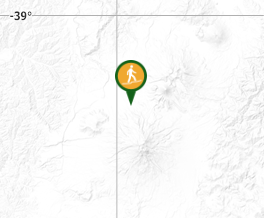
Comments