
Menu

 332
m
return
332
m
return
 30
mins
30
mins
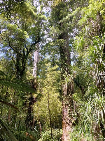
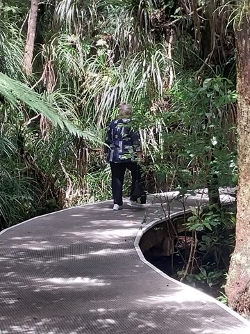
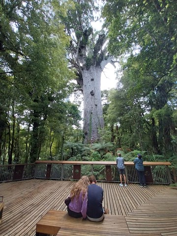
Tane Mahuta Walkway
This short walk leads you under cooling shade of the forest canopy to the majestic Tāne Mahuta, New Zealand's largest living kauri tree. Tāne Mahuta, also called "God of the Forest", is a giant kauri tree in the Waipoua Forest. Its age is unknown but is estimated to be between 1,250 and 2,500 years. It is named after Tāne, the Māori god of forests and birds.
 700
m
return
30
mins
700
m
return
30
mins
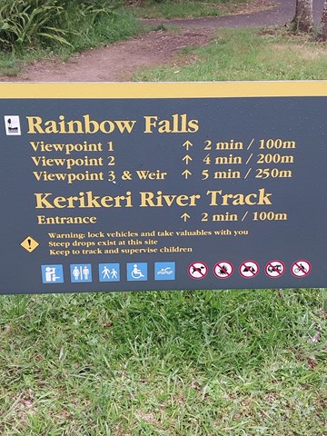
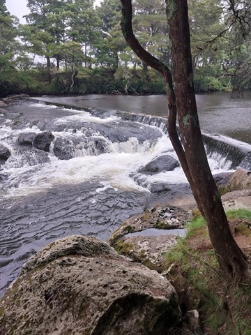
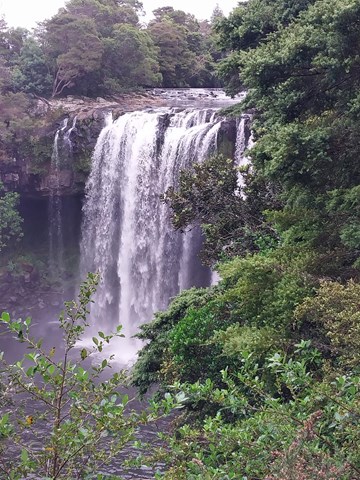
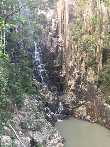
Rainbow Falls
The Rainbow Falls is a single-drop (27m) waterfall located on the Kerikeri River near Kerikeri. Unlike most New Zealand waterfalls which are created by the erosion of soft rock, the Rainbow Falls are sited on a hard basalt layer of rock beside softer mudstone.
 7
km
return
6
hrs
7
km
return
6
hrs
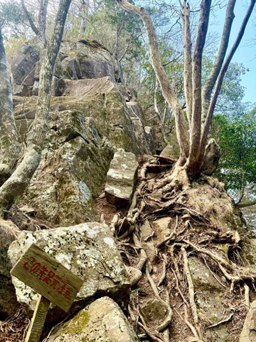
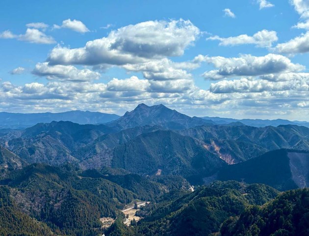
Mt. Hiramyoujin Loop 平明神山周回コース (Aichi Prefecture)
A challenging walk out in the sticks of Aichi with hardly any views to speak of.
 100
m
return
15
mins
100
m
return
15
mins
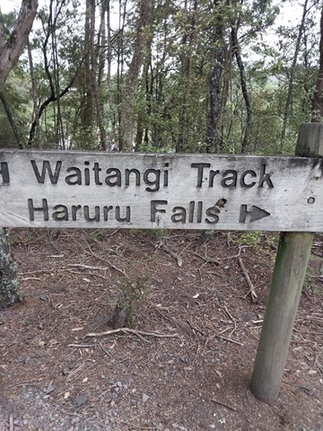
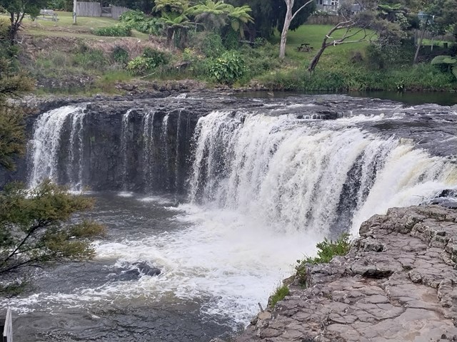
Haruru Falls
Haruru Falls is a five metre high waterfall on the Waitangi River near the settlement of Haruru three kilometres west of Paihia. In the Māori language, the word haruru means 'continuous noise or roar'.
 10.5
km
return
4
hrs
10.5
km
return
4
hrs
Little Nerang Creek, Purlingbrook Falls, Road return
This walk incorporates parts of the Gold Coast Hinterland Great Walk and the Purlingbrook Falls circuit to see spectacular waterfalls and beautiful rainforest, and it has some great waterholes if it's a hot day!
12
km
one-way
3
hrs
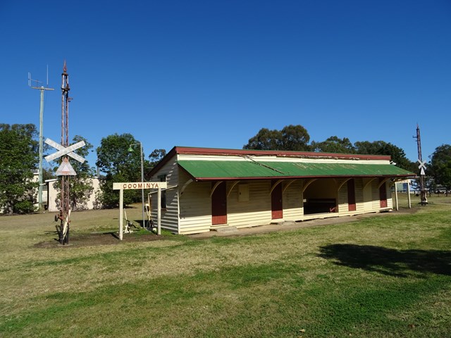
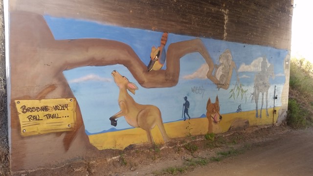
Lowood to Coominya Rail Trail
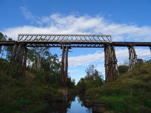
This walk is part of the Brisbane Valley Rail Trail, starts and finishes at the railway station. Coominya is a small town but has all services. A large and impressive rail bridge along the track but not accessible, a lower river crossing. The walk passes through farm lands so plenty of gates to open and shut but not a walk to complete in Summer months. The trail is well marked so maps are not required. Lowood is accessible after a turnoff at Fernvale which is situated on the Brisbane Valley Highway. Public amenities and car parking at both ends of the walk. No permits or costs for the walk.
 9
km
one-way
2.5
hrs
9
km
one-way
2.5
hrs
Diamantina Boulevard to Borallon Station Road - Part of BVRT
10kms easy walking along the old Brisbane Valley Rail Trail. Passing old stations (or where they used to be, signs have been erected) of Muirlea, Pine Mountain and Borallon. Great for birdwatching. I would recommend for a winter walk - dappled shade, but would get very hot very quickly in summer.
10
km
one-way
2.5
hrs
Borallon Station Road to Fernvale - Part of BVRT
This is a nice part of the BVRT, the scenery changes quite a bit along the walk, bush track to farm land to open pasture looking out to the mountains. You'll need to do a quick crossing of the Brisbane Valley Highway, easy, but just keep your wits about you. Along the way you'll pass Wanora and Fairney View stations. Just after Fairney View is a lovely little creek where a bridge once crossed, a nice spot for a break. After this there is the slightest of inclines, but that incline continues all the way to Fernvale. But once there you've got a great excuse for a pie!
4
km
one-way
1
hr
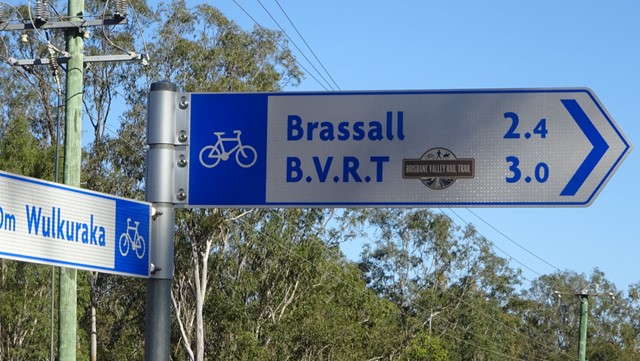
Wulkuraka Station to Diamantina Boulevard - Part of BVRT
This first part of the BVRT (Brisbane Valley Rail Trail) is only 3.8kms of very easy walking along paved pathways between residential and bushland. As the name suggests this is along the old Brisbane Valley Railway, the whole trail is approximately 161kms finishing in Yarraman.
23
km
one-way
6
hrs
Wulkaraka to Fernvale - Part of BVRT
I rode this but you are certainly allowed to walk it. A fun and enjoyable ride from Wulkaraka station to Fernvale. Look forward to a delicious thick shake and a pie at the renowned Fernvale bakery! The track is mostly flat and easy to follow. A couple of road crossings.
 1.2
km
30
mins
1.2
km
30
mins
Willy Wagtail Circuit
Haig Street Quarry Bushland Reserve is located only five
minutes drive from Ipswich Central, yet offers spectacular
views of the Scenic Rim. From Ipswich Central travel
northwest along Burnett Road toward Brassall. Burnett Road
will become Hunter Street. Turn left from Hunter Street onto
Haig Street (travelling west) and drive directly into the main
parking area.
This park has a beautiful display of wildflowers in spring and
has many water birds that live in and around the pond.
Visitors are advised to contact Ipswich City Council on
(07) 3810 6666 for access requirements if they wish to:
• Venture away from the designated picnic area or
graded track system
• Undertake organised group activities
• Undertake activities of a commercial nature
Under Council’s Local Laws, conducting or engaging in the
following activities is prohibited:
800
m
one-way
20
mins
Bearded Dragon Circuit
Haig Street Quarry Bushland Reserve is located only five
minutes drive from Ipswich Central, yet offers spectacular
views of the Scenic Rim. From Ipswich Central travel
northwest along Burnett Road toward Brassall. Burnett Road
will become Hunter Street. Turn left from Hunter Street onto
Haig Street (travelling west) and drive directly into the main
parking area.
This park has a beautiful display of wildflowers in spring and
has many water birds that live in and around the pond.
Visitors are advised to contact Ipswich City Council on
(07) 3810 6666 for access requirements if they wish to:
• Venture away from the designated picnic area or
graded track system
• Undertake organised group activities
• Undertake activities of a commercial nature
Under Council’s Local Laws, conducting or engaging in the
following activities is prohibited:
7.4
km
return
3
hrs
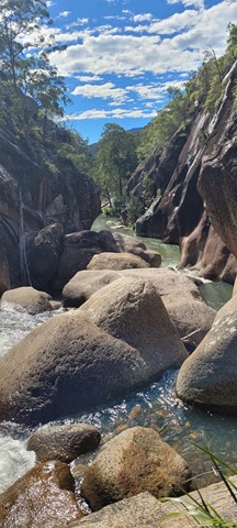
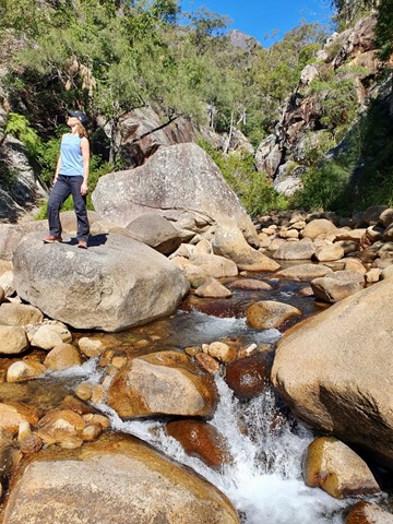
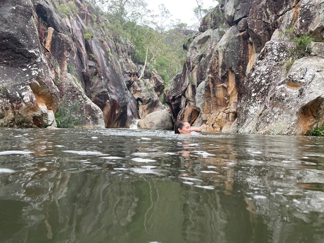
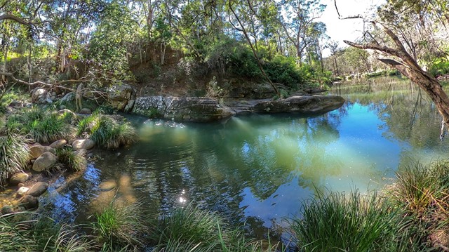
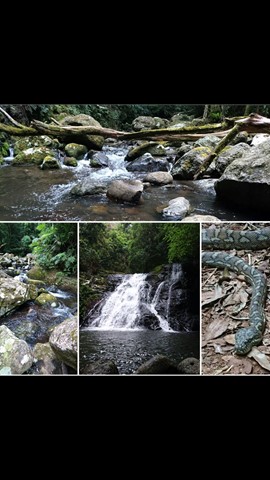
Lower Portals
This was my first overnight hike. It was challenging, but not ridiculous. A good beginners walk.
I highly recommend going for a dip in the creek even in Winter. It was like an ice bath for my tired muscles.
 9.4
km
return
4
hrs
9.4
km
return
4
hrs
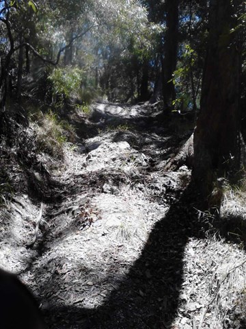
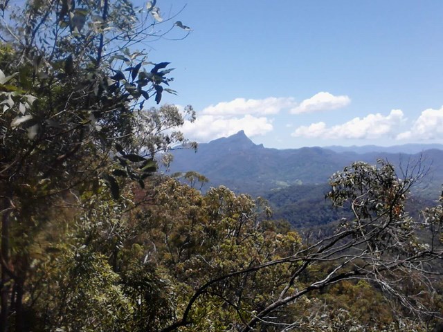
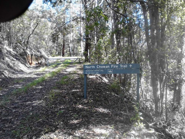
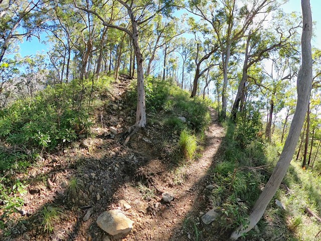
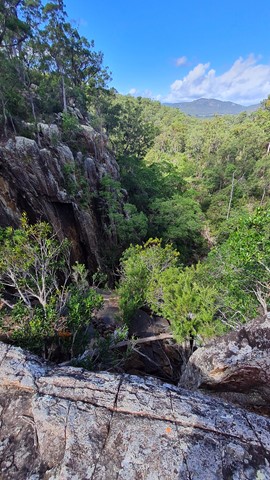
Mt Chowan
Reaching the top of Mt Chowan is a challenge, but a worthy challenge. Mt Chowan sits in the north-eastern corner of Mt Jerusalem National Park at a height of 523m. A fire trail and a track lead up along the side of the mountain until the final steep ascent.
 2.5
km
return
1
hr
2.5
km
return
1
hr
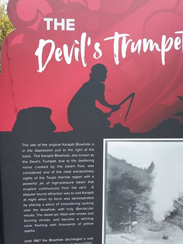
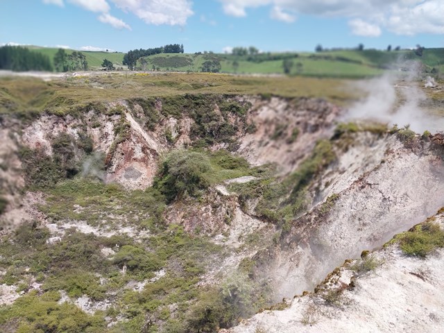
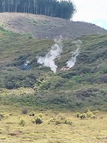
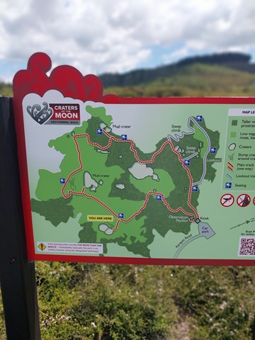
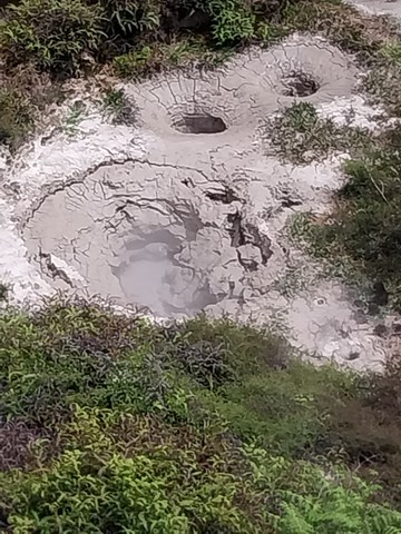
Craters of the Moon
Craters of the Moon lies within the Taupo volcanic zone and its landscape can be traced back over 700 years.
Underground geothermal activity along the belt shows itself on the surface as fumaroles, geysers, mud pools and hot springs.
 2.1
km
return
1
hr
2.1
km
return
1
hr
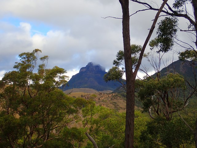
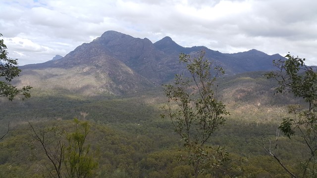
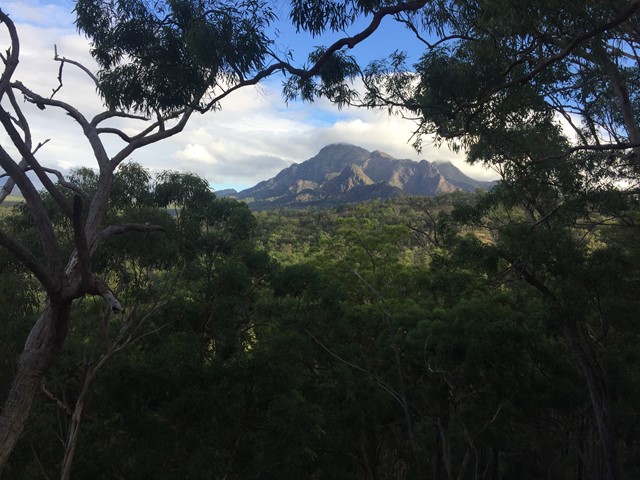
Yellow Pinch Summit
Follow a trail all the way to the summit where you will find great views of Mount Barney. Recommend early morning walk. Great walk for those camping for a few days in the National Park or surrounding camping sites and resorts.
 8
km
return
3.5
hrs
8
km
return
3.5
hrs
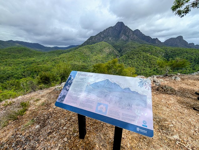
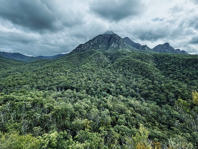
Paddy's Peak
A reasonably straight forward walk up a lesser known peak nestled between Mt Barney, Mt Maroon and Mt May.
 4.8
km
return
3
hrs
4.8
km
return
3
hrs
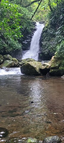
Paddy's Falls
Also known as Golden Staircase Falls for the so named nearby fire trail. Follows the fire trail before a rock hop up the creek to the falls then you can return the way you came or scramble out of the gully up to the fire trail and use it to go all the way back.
 1.2
km
return
75
mins
1.2
km
return
75
mins
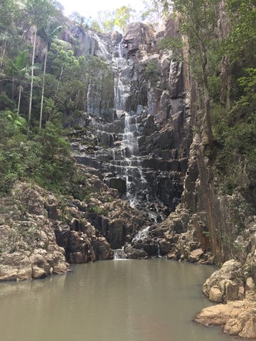
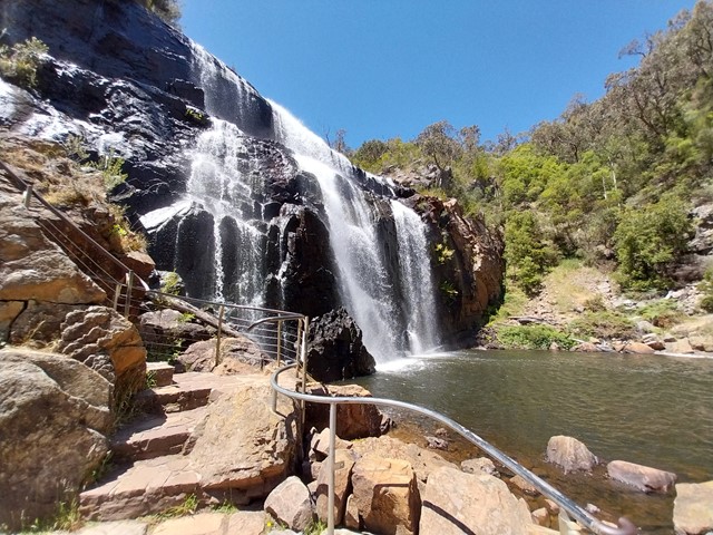
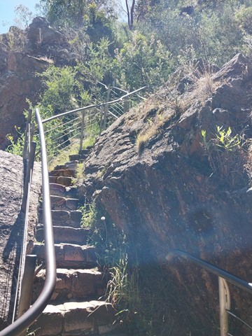
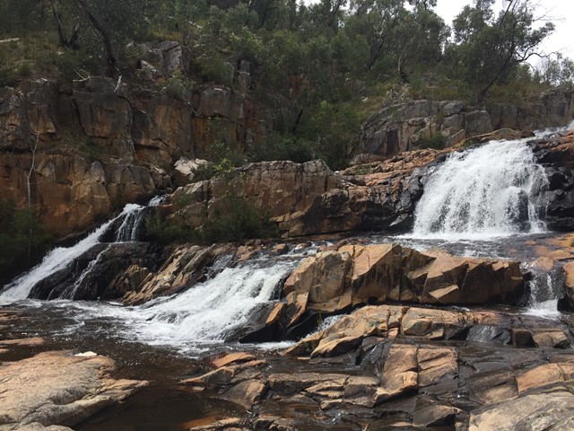
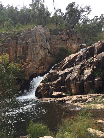
MacKenzie Falls Walk
Entrance is currently from Zumsteins carpark & picnic area as Parks Victoria is doing work to the path from near Smith Mill Road. Probably a nicer walk as it follows the Mackenzie river passing Fish Falls & onto the base of Mackenzie Falls. Easy walk with around 85 metre climb over the full length.
 17.4
km
7
hrs
17.4
km
7
hrs
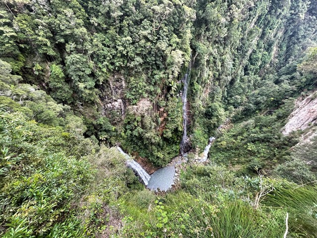
Coomera Circuit
This track showsoff some of Binna Burra's best assets and is one of the prettiest walks in this section of the park. The waterfalls are at their best after rain. The track does cross over the Coomera River several times and crossings can become tricky if water levels are high.