
Menu
Popular Walks
-
Mt Ngungun
(1145 ticks) -
Mount Coolum
(864 ticks) -
Mt Warning Summit Trail
(759 ticks) -
Mt Cordeaux
(659 ticks) -
Twin Falls Circuit
(630 ticks)
Popular Walks
-
Mt Ngungun
(1145 ticks) -
Mount Coolum
(864 ticks) -
Mt Warning Summit Trail
(759 ticks) -
Mt Cordeaux
(659 ticks) -
Twin Falls Circuit
(630 ticks)
Sub-Regions

 7
km
return
7
km
return
 2
hrs
2
hrs
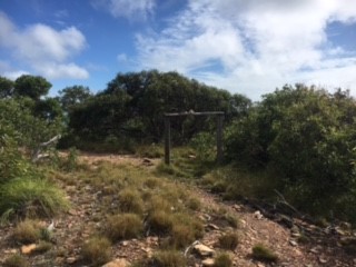
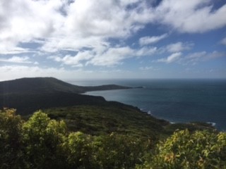
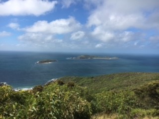
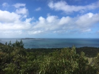
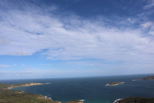
Mount Wyndham Loop
A short walk to the highest point on Great Keppel Island. Has dramatic views of the stunning coast line.
 17
km
return
1
days
17
km
return
1
days
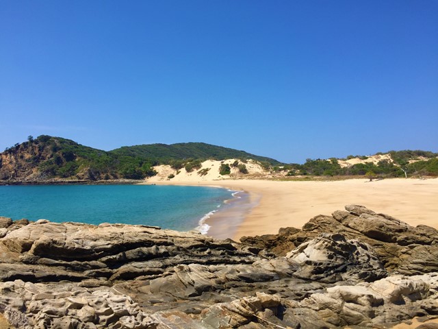
Northern Beaches
Start point the Western end of Putney Beach head over the headland to Leekes Beach continue along it till the tidal lagoon. If low tide continue straight across to Second Beach if high tide circumnavigate the lagoon then continue onto to Svendsens Beach and around Little Peninsular to Butterfish Bay then cut across the sand hills to Wreck Beach then back across the dunes to svendsens and follow your way back.
Look out for the wildlife, Peacocks, snakes, goats e.c.t.
An amalgamation of walks to provide a day treck.
Walks in North Queensland
(Queensland) 17
km
return
5.5
hrs
17
km
return
5.5
hrs
Alligator Creek Falls - Bowling Green Bay National Park
A longish walk (17 kilometres return) with a spectacular destination at the base of Alligator Creek Falls. The walk commences at the Picnic and Camping area, and is mostly gentle in grade, traversing up the Alligator Creek Valley through grassy open tropical woodlands, riparian forest and patches of rainforest. The walk involves 4 creek crossings, one at Cockatoo Creek, and 3 crossings of Alligator Creek itself. You will need to ford or boulder-hop at these crossings, depending on the water levels. Usually it is an easy boulder-hop, except for after flooding in the wet season. There are a couple sections in the middle of the walk which follow a power-line easement and access road. These sections can be hot and exposed in the middle of the day. This walk is best suited to the cooler months. Swimming is possible at the base of the Falls year round.
The 4 kilometre return walk to Cockatoo Creek provides a pleasant shorter option.
 1.3
km
return
30
mins
1.3
km
return
30
mins
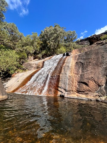
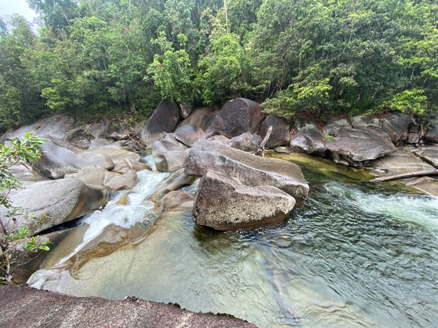
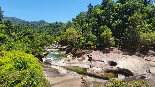
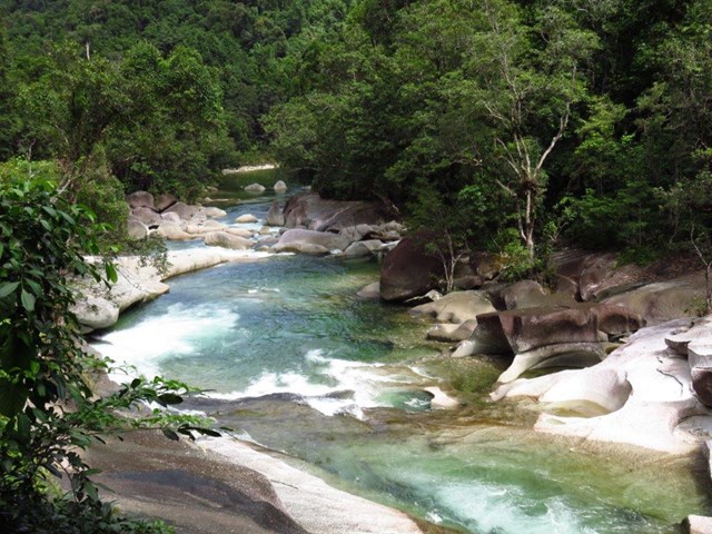
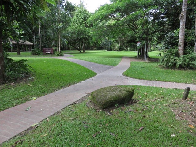
Babinda Boulders
The Devil's Pool Walk is a 1.3 kilometre return walk along Babinda Creek downstream from the picnic area. Slightly undulating along a rough bitumen track, the walk leads through the rainforest to two viewing platforms where the creek cascades down a series of spectacular waterfalls, granite boulders and washpools.
The Wonga Track Rainforest Circuit is an 850 metre loop walk which begins by crossing the creek on the suspension bridge from the picnic area. Read the information signs along the flat, dirt track about the wide variety of rainforest plants along the walk. There are also some secluded swimming holes along the walk, slightly away from the main swimming area at the picnic ground.
 440
m
return
20
mins
440
m
return
20
mins
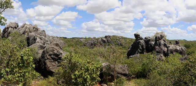
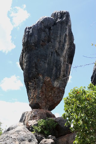
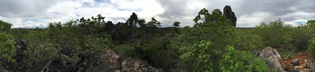
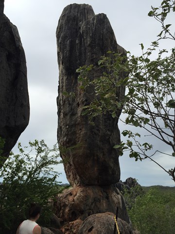
Balancing Rock
From the Balancing Rock car park a rough track climbs up a rock formation, providing views of Balancing Rock—a spectacular limestone outcrop. Take a moment to enjoy the view and photograph the surrounding open woodlands. The Wullumba art site is located to the right of the car park.
 600
m
return
30
mins
600
m
return
30
mins
Bauhinia Cave
This is a fun walk for something different. You'll wind your way down through cave passages and will have to duck or crawl to get through certain sections.
It's not very long distance or time-wise but I found I was more hesitant when it came to keeping a good pace in the dark.
 2.5
km
return
1
hr
2.5
km
return
1
hr
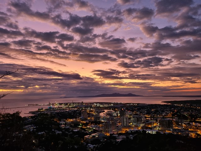
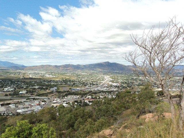
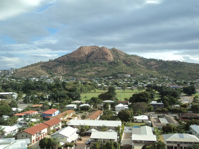
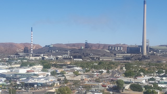
Castle Hill
Castle Hill is both a heritage-listed isolated pink granite monolith standing in the heart of the north Queensland city of Townsville and a suburb of Townsville. It rises to a height of 286 metres and dominates the city skyline and provides magnificent 360° views.
 900
m
return
30
mins
900
m
return
30
mins
City Lookout
This short walk to the City Lookout gives you an elevated 360° view over Mt Isa and the surrounding area.
 3.2
km
return
2
hrs
3.2
km
return
2
hrs
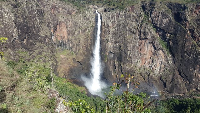
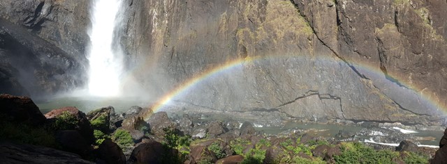
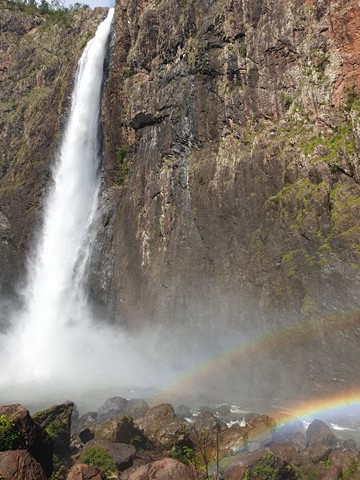
Djyinda Walk
Walk to the base of Wallaman Falls, the highest permanent single drop waterfall in Australia at 268 meters. It’s not so much the distance that makes this trail a challenge, but rather the 228 metre descent (and more importantly, ascent back to the top!). But it’s worth every step. The track wanders through open forest, along the escarpment overlooking the Herbert River Valley, into the gorge and through thick rainforest. Take care and go slow - not just because the trail warrants it, but because there are few times in your life when you’ll get to experience untouched nature like this all to yourself.
 45
mins
45
mins
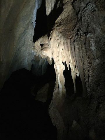
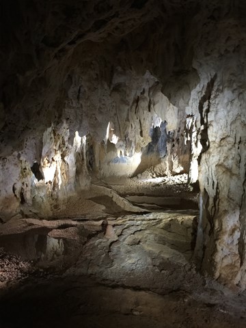
Donna Cave, Chillagoe
Donna Cave is one of the 3 caves in Chillagoe managed by the NPWS. Access is only by guided tour with a NPWS Ranger who provides a commentary on the formation and history of the cave.
The cave is well lit and has steel walkways and stairs (approx. 300) throughout.
The stalactites and stalagmites are awesome and the whole experience is well worth the effort.