Mt Barney - East Peak - South Ridge

Mt Barney National Park

South Ridge is the easiest track up Mt Barney (but it's NOT easy!). Sometimes referred to as Peasants' Ridge (a dig that only Peasants would take such a boring route up the mountain), South Ridge is an excellent choice for a first ascent of Barney. The track has triangular trail markers but there are still opportunities for navigational difficulties if you're inexperienced.

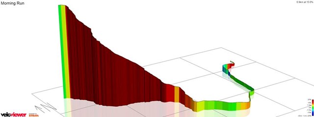
You MUST start early in the day. Expected time is 8-10 hours with almost 1200m of climbing from the carpark. Make sure to leave early to allow time for any mishaps and be prepared to turn back if necessary.

Lookouts
Scrambling or Climbing
Navigation Required
No Dogs Permitted
Eucalypt Forest

Getting there

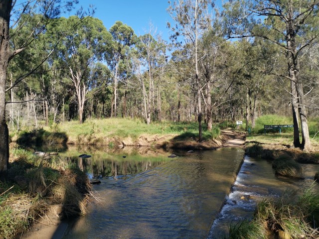
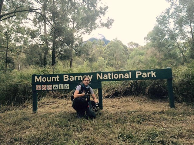
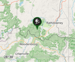
The walk starts from the Yellow Pinch carpark. From the Mount Lindesay Highway travel through Rathdowney and turn right on to the Boonah-Rathdowney Road. Turn left 8km later onto Barney View-Upper Logan Road. Follow the signs past Bigriggen, Flanagans Reserve and the Lower Portals turn off to Yellow Pinch at the end of this road.
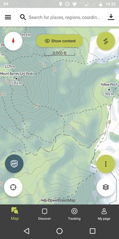
Maps

Topographical maps can be generated from the government's QTopo website: http://qtopo.dnrm.qld.gov.au/Mobile/

Route/Trail notes

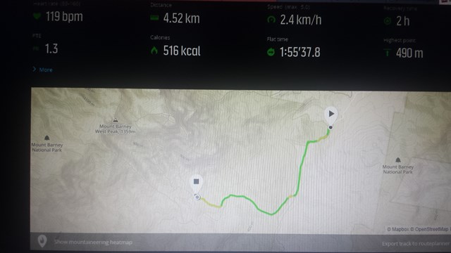
Start on the track up and over Yellow Pinch from the end of the carpark. This short but steep climb will give you a bit of a taste of what is to come. Halfway up Yellow Pinch there is a gate on your left. Follow the fire trail through this gate.

After approximately an hour's walk along this trail you will reach a signed fork. This is the start of the South Ridge. Take note of the picture of the triangular trail markers you will follow later on the track. Follow the right fork to begin your climb.

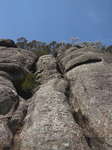
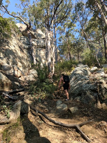
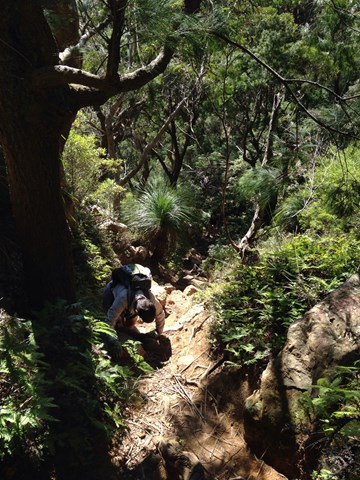
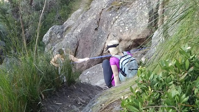
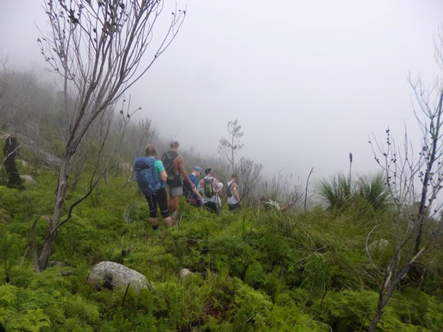
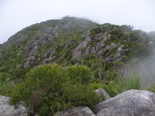
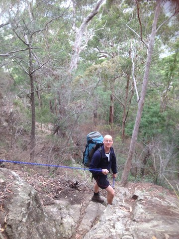
The track is well defined for quite a way past this fork. Eventually you'll reach some scrambling areas. Keep an eye out for the triangular route markers and make sure to look back regularly to help with the return navigation. There are two rock sections that stand out: one a large slightly exposed slab with a crack running through it, and the other, a narrow staircase.

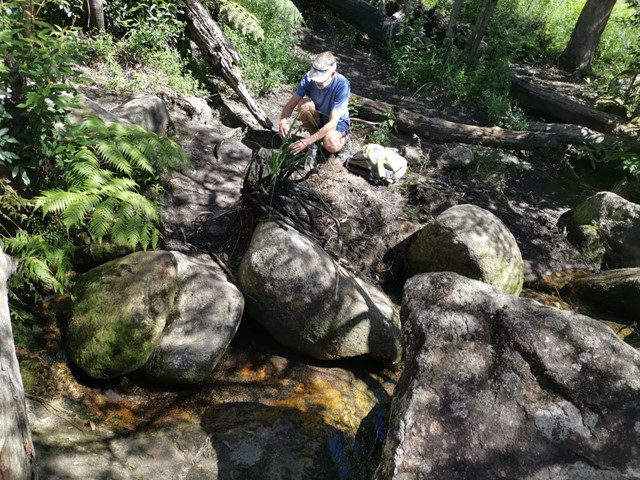
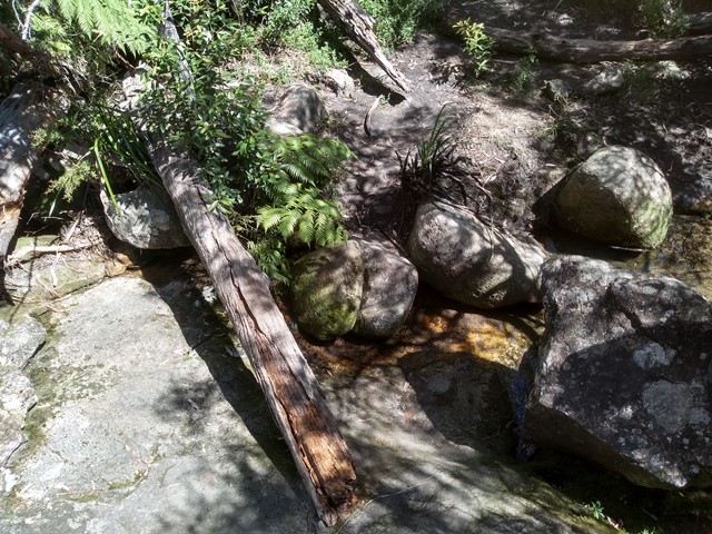
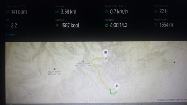
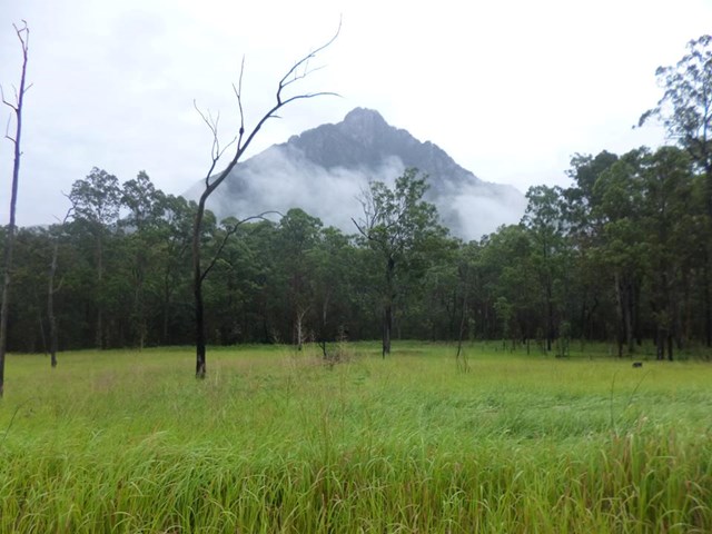
The South Ridge ends at a knoll, which means you'll actually descend into the saddle between the East and West Peaks. After traversing this knoll you'll enter the Rum Jungle. Depending on speed, the climb so far will take 3-4 hours. This is a great place for a rest, or continue on a few minutes to the Old Hut campground (just over the creek). You can top up your water in the creek if it is running.

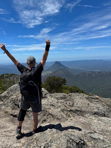
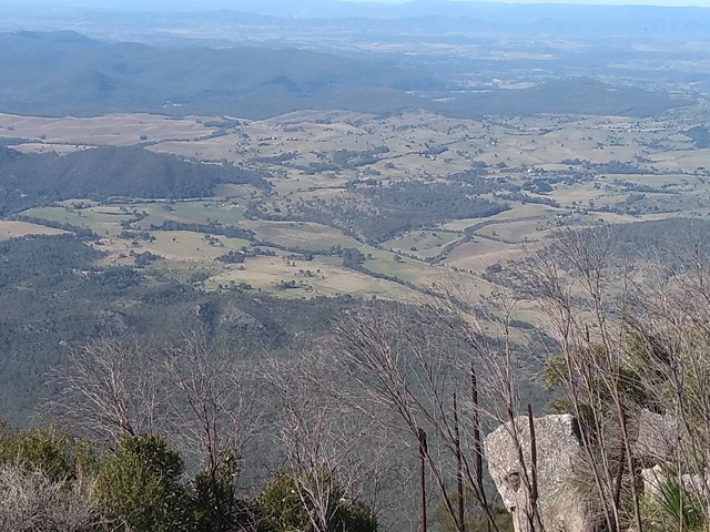
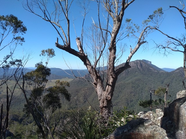
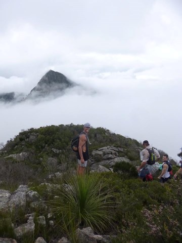
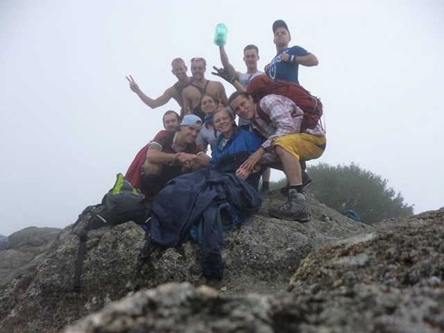
There are no distinct tracks up to the East Peak, general advice is to go up! Make sure to look back early in your climb to identify the Old Hut site. You'll want to aim for this on your return journey. After a few false summits you'll reach the peak. Expect this to take 5-6 hours from leaving the carpark.

During the return be careful to retrace your steps. Remember when you come out of the Rum Jungle you need to climb over a knoll before starting your descent. A fork at the start of this knoll heads immediately downhill but this track will take you via Egan Creek, a much tougher route. Keep an eye our for the route markers to confirm you're on track.

Permits/Costs

Climbing the mountain is free. There are costs for using either of the campgrounds in the East-West saddle.

Other References

TODO: List some guidebooks

Comments

3.5 hours up, 3 hours down to/from yellowpinch carpark plus 1 hour of sidetrack through the ferns at the base of the peak north along the creek and back up the creek to find the crossing to rum jungle.

Chris on 25 Apr, 2017

A great overnighter at either rum jungle or old hut. Be prepared: If there is a white out you can become lost easily. Good knowledge of the mountain or a topo map and compass will save you.

dalehikes on 19 Apr, 2017

Hiked up with full overnight packs in a group of six. Two of us had done the trip before but the rest hadn't. Took us aprox. 7 hrs each way. This is the most challenging walk I have done so far, love the views from the top and its never too hard. Some parts are pretty intimidating and it is almost essential to take track notes as some parts are not obvious where to go. Not much wildlife to see, a few bugs and some lizards at the top, but the real beauty is the landscape and that really you have to earn it.

Lawdaddy on Aug, 2016

We found our limit for 1 day, 12.5 hrs total, 7hrs up with a 6.15am start and down in 5 hrs by 6.45pm. We took the peasants ridge to the east summit (by 1pm). My 5 year old was just a tad slow, he never complained or struggled, just dawdled from rum jungle down. We never got lost and made it to the road width graded path before dark which guaranteed an easy walk without stressing. We had 4 layers on the top, pants, gloves, and beanies, 1.5 days of food, 8 litres of water, 2 headlamps and 2x200 lumen torches, GPS, GPS watch, a mobile phone, and a UHF. Everything but a tent which we will use for any mountaineering over this distance again - 14km round trip, and 1352mtrs high.
Gorgeous view and it made our previous trip up Mount Maroon look small.

father&son on 2 Jul, 2016

Up Logan's Ridge, Down South East. 3.5 hours up including a tea break and enjoying the views. Make sure you up to this one, heading back down it is likely more risky than topping out with some reasonably exposed scrambling sections. Fantastic day out though!!!

B_T on Jun, 2016

This climb is epic, perhaps I shouldn't have done it as I'm over 60 and not very fit (though I am fitter now because of it). I climbed with 3 others, a strong, fit couple around 30 and a 50 yo woman also fairly fit. This was their second attempt. (On the first, they'd taken a wrong turn, spent a lot of time bush bashing and returned the same way broken and defeated.) It was a beautiful sunny day.

We left the carpark just before 9 which was a couple of hours too late and didn't all take jackets, another mistake (there was an icy wind blowing at the top) About a 3rd of the way up I was tired and struggling and by halfway I knew I'd made a stupid, stupid mistake. But we kept going with almost no breaks. The 50yo, with her shorter legs, sometimes needed help up the rock slabs (we had a rope) and the young guy was struggling with his fear of heights next to the high cliffs and narrow ledges.

We'd picked 1pm as our turnaround time, but as we didn't want to go back down the SE Ridge as it was so hard, we kept going and reached the summit at 2:30. We'd been meeting 2 families with their young kids as they stopped for a snack and break and as they continued up past us, the parents would yell, slow down, come back, stop running. We last saw them going down to the saddle, still running.

We were at the saddle by 3:30 and knew we'd be finishing in the dark. I'd borrowed a vest which kept me warm enough, but my legs were in a lot of pain and going downhill was very slow. My dilemma; if I bent my legs, I'd fall down but I had to bend my legs to climb down and it was still a long way down. It is also very easy to lose the track; we lost the track 5 times on the way down but I'd plotted the tracks on the app View Ranger. What a saviour!

Just before dusk we took a wrong turn (which I didn't check on the app) and ended up at a cliff which we finally got down with the rope only to find no track. I checked the app and in the fading light we could see the Peasant's Ridge silhouette, then found a faint path back to it. Now it was very dark, we had one headlamp and a phone touch to light our way and my tracking app to guide us.

I didn't know how my legs were holding me up. The slightest decline was really painful and I had to hold on to someone or use a stick to stop from falling. Needless to say it was a slow decent but we were below the big rocks and once we hit the open country again, we could stride out.

Despite everything, we returned safely, 2 and a half hours in the dark and 11 hours after we set out. Please don't underestimate this climb, prepare well (warm clothes, head lamps and a rope, battery packs for your phone). We were careful, stuck together and helped each other out.

The views were fabulous, we could see all the way to Mt Warning, with gullies and great cliffs at every turn. It's the hardest thing I've ever down (it's heaps easier if you're young and fit), but I'm really glad I did it. Would I do it again?. Probably not. I'll stick to the smaller mountains.


Nichola Wallace on 28 May, 2016

An unmarked trail up Mt Barney. Supposed to be the easiest but still a little bit of a challenge. It was the second Mountain i had ever climbed. I have now summited Mt Barney twice and it is still my favorite hike so far. It has what i believe the best view ever! I have camped in Rum Jungle at the top, woke in the night in the clouds! It was amazing! Have also done it in one full day but im not the fittest person and did struggle a little bit.

Annalise Burton on 20 May, 2016

Well, this was quiet the hike. Might I say, take loads of water as 4Litres was still not enough even on a day where we could have been rained on. The east peak is steep and dangerous rock ledges all around but a quicker way up to the summit.

I hiked with a group of about 8 in varying fitness levels but we all made it together. The ascend had my legs burning at times and tests muscular endurance but as always the descend although quicker made my knee joints ache from the constant time under tension.

We got thrown off with trying to find the south ridge track as we lost sight of the West peak which is crucial in navigating this trail. We bush bashed a little but could tell from the vegetation that we veered to far left. 30minutes later we found the track to everyones relief. It could have been a hike gone bad as the weather was threatening to rain but we all pushed on and succeeded in a joint team effort.

The hike is as it states, 9 hours if you don't allow for much stopping and resting time and are able to navigate without getting lost. Do have your wits about you, as people do get caught out on this mountain, take plenty of water, ration your food incase and be cautious with both climbing and descending as its forest areas are slippery.

I would not advise to do on a hot day as water is essential although you can fill up in the streams at the top and around Rum Jungle. Be sure to pack a space blanket incase you get stuck out for the night!

What a challenge it was, physically it was demanding, mentally I felt totally fine. But better preparation next time will make for more comfort.

The next time I attempt this, I will go with people of the same fitness level, as the constant stopping/starting does wear down on your muscles and mentally makes you think of the aches and thats when it becomes tolling.

moniqueunique on 27 Mar, 2016

We decided to do this as a two day walk. We got to car park later than expected and decided to overnight at Rum Jungle which is the in the saddle between the peaks. We left early the next day and went up the East Peak. Awesome 360 views. There were three pairs of Wedge tail Eagles soaring above the peaks and we spent a few hours watching them and taking in the views. We then descended and packed up our gear and walked out. We both picked up a few paralysis ticks on the way that needed removing by a Doctor followed by antibiotics for a week. Despite this we will do the walk again. The walk up took us 6 hours with very heavy packs. We had 6 liters of water each, but still ran out. Luckily we found a clear stream flowing just before the climb up the East peak so after returning to camp to pack up we refilled three bottles each, treated the water and had enough to get us back to the car park.

Brian on Mar, 2016

Up Logans and down Peasant's. Crowded, long and uninspiring route for most parts IMO. Even if not tricky by any means would be challenging due length.

Anonymous on 12 Aug, 2015

9hrs to climb up Logans Ridge and then down South Ridge. Worth being prepared for this trip as things could turn pear-shaped in a hurry. Had difficulty finding track off East Peak to Barney Saddle and then accessing South Ridge trail start. Logans Ridge a great scramble with a few challenges. Worth doubling back sometimes if you run out of acheivable track. Done river-crossing near base during high waters to add to the fun! Will do this again with palns to stay overnight and climb West Peak.

John on 4 May, 2015

Walked up peasant's ridge for my first walk in camp! Very excited but exhausted. The track was easy to find up to rum jungle, the track to east peak a little more difficult and I would imagine so when the regular cloud comes in. Camped at rum jungle and then walked down the next morning. Tough walk for someone approaching 50 with good fitness. Whetted my appetite though!

Susan cramb on 8 Jun, 2014

walked up in the afternoon, camped the night in the rum jungle, did the east peak the next morning and descended the mountain. quite a challenging walk, mostly well marked but were some confusing areas, probably not necessary to camp overnight - would prefer to do it again with a lighter pack and in 1 day. took about 6 hrs up and 7 hrs up to the summit and back down to the car park. descent was wet and slippery on some of the rock faces (we used ropes). difficult but amazing walk, well worth the effort.

gabemma on 11 Jun, 2013

Walked up via peasents ridge and spent the night in rum jungle after summiting and walked out the next morning. Quite challenging with a heavy pack.

WorldWalker on 8 Dec, 2012

Walked up via peasents ridge and spent the night in rum jungle after summiting the views from the summit were spectacular today as a storm was brewing and swirls of black cloud was coming up from below us.......walked out the next morning. Quite challenging with a heavy pack and it was hot dam hot! the humdity was up a little too...

Walkinghawk on 8 Dec, 2012

A challenging yet interesting walk. The terrain changed regularly and is spectacular. I would suggest not climbing following rain, using a compass and definitely not for novice climbers. The summit has amazing views of Mt Ernest, Mt Lindsay and of course the West Peak. The Logan River begins near the summit and the water is drinkable (we filled our bottles with no ill effects). It is definitely worth the effort!

Petrina on Jun, 2011

Was an exhausting walk and one of my groups very early treks. A couple of guys only brought a regular water bottle and ran out fairly quickly. Luckily one of us had heard about a natural spring near the top which after a bit of searching we managed to find. Definitely one of the best walks in Queensland, although quite a monotonous steady uphill walk for most of it, the scrambling sections closer to the top are more fun and the 360 degree views at the peak are spectacular.

Tim on 22 Oct, 2004

Very epic and beautiful walk. We somewhat naively took our friend who is legally blind but leads a very active lifestyle. Thankfully we had park ranger friends to guide us or we may have needed rescuing!

jocelyn on Aug, 2004

Where

Click here to load this map.

Nearby Walks

Done this walk?

This walk has been ticked 90 times

Aussie Bushwalking can keep track of your bushwalks.

Login/signup to tick this walk off.

Tick walks to keep track of where you've been. You must Login to tick walks. Accounts are 100% free so sign up if you don't have one.