
Menu
Popular Walks
-
Mt. Coot-tha Summit Track
(339 ticks) -
Somerset Trail
(302 ticks) -
Greenes Falls via Rainforest Circuit + Cypress Grove Circuit
(238 ticks) -
The Northbrook River Trail (Northbrook Gorges)
(217 ticks) -
Enoggera Reservoir Circuit
(161 ticks)
Summary
Declared a national park in 1977 approx size 28 500 hectares second largest park in south east queensland. Originally settled by timber cutters approx 1870. Gold was discovered in mid 1800's there are many mines scattered throughout Cedar creek areas. The area is made up of D'Aguilar National Park, Jollys Lookout National Park, Maiala National Park, Boombana and Manorina National Parks. On Brisbanes door steep.
Popular Walks
-
Mt. Coot-tha Summit Track
(339 ticks) -
Somerset Trail
(302 ticks) -
Greenes Falls via Rainforest Circuit + Cypress Grove Circuit
(238 ticks) -
The Northbrook River Trail (Northbrook Gorges)
(217 ticks) -
Enoggera Reservoir Circuit
(161 ticks)
Parent Regions
Sub-Regions
History
The area has a history of Timber cutting, gold mining, farming, housing and eventually National Parks.
Features
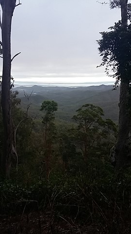
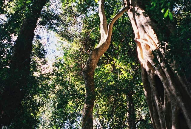
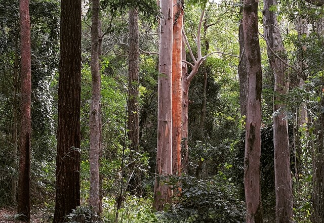
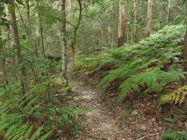
So many diverse areas ranging from rainforest to open eucalypt forest.
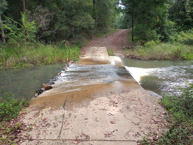
WARNING{ As at 13'1/11 there are many washouts of the fire trails. Lawnton Rd.and Eng;and Creek Road are cut in at least two places before the camp grounds!!
Access
Go along to 60 Waterworks Road. The Brisbane Forest Park information Centre is there. Also a Brisbane City Council bus goes right to the door of the Information Centre.
Maps
Maps are available from Brisbane Forest Park. D'Aguilar Range.
Accommodation
Bed & Breakfast on MT. Glorious, plus so close to Brisbane
Camping
Check with Brisbane Forest Park for further details
Contact details
Brisbane Forest Park 1300 130 372
Brisbane City Council 07 3403 8888
https://parks.des.qld.gov.au/parks/daguilar/

 15.4
km
one-way
15.4
km
one-way
 4
hrs
4
hrs
Mt Glorious to Dundas Road
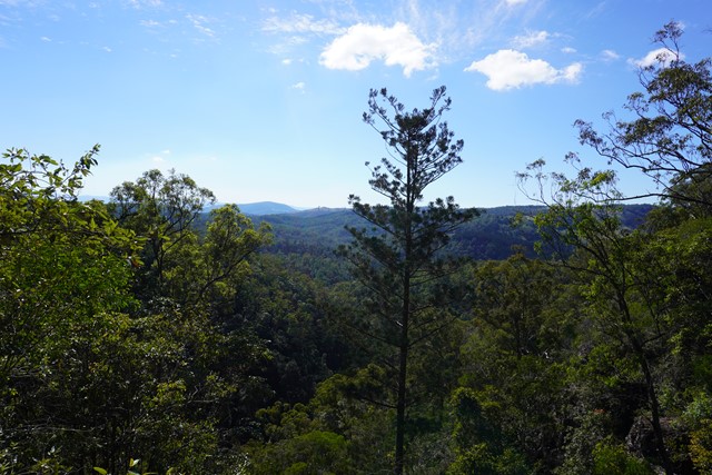
This is a fantastic walk which is actually the first leg of the annual Oxfam Walk. You do need two cars for this walk - park one car at Mt Nebo Road transfer station, Dundas Road and another at Miala picnic Grounds, Mt Glorious. We started from Miala and enjoyed spectacular views out towards Lockyear Valley before we gently wound our way down to the bottom of the valley. Make sure you enjoy a rest at the creek because ahead of you is a VERY steep walk out of the valley. This is the steepest hill I have ever walked and the trail was very slippery - it was actually easier to walk beside the trail, then we could use the trees to hold onto! The hill goes on FOREVER, but when you eventually reach the top you will have a real sense of achievement - and more sensational views!
More detailed information about this walk can b e found here: https://trailwalker.oxfam.org.au/wp-content/uploads/2014/12/BNE_map1.pdf
 1
km
return
30
mins
1
km
return
30
mins
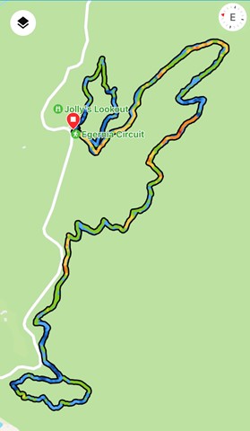
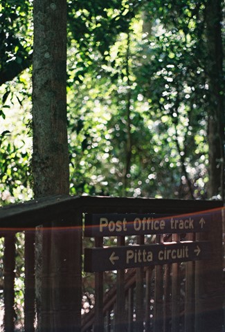
Pitta Circuit
Lovely walk through a Eucalyptus forest before entering a lovely cool rainforest. The track winds around onto a boardwalk which totally surrounds a strangler fig where the host has totally rotted away. A number of educational signs give some great information for the younger members of the family.
 6
km
3
hrs
6
km
3
hrs
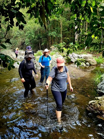
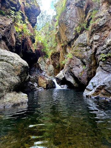
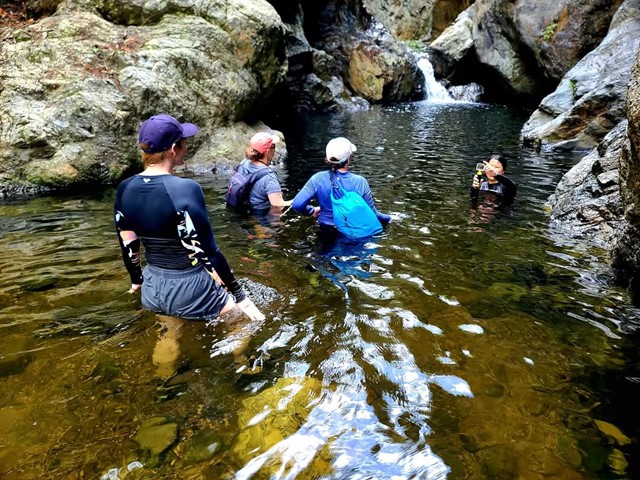
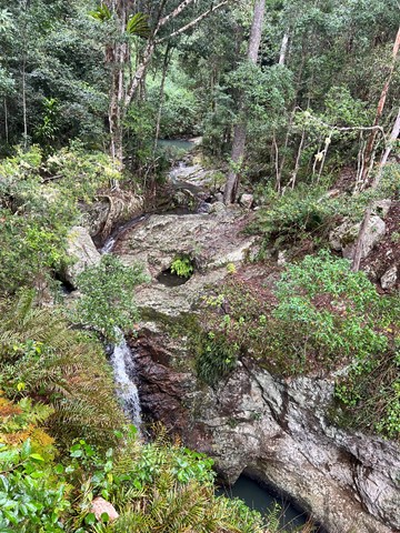
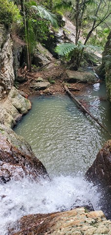
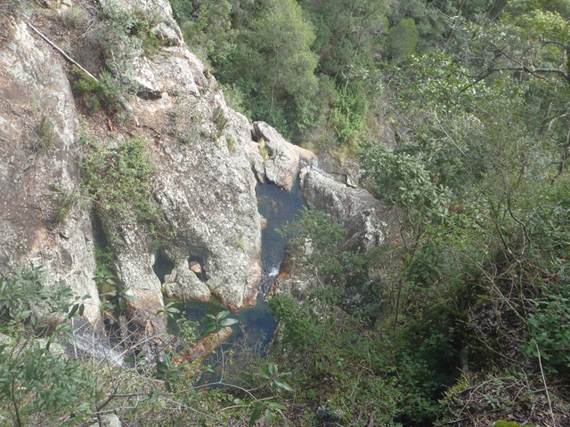
The Northbrook River Trail (Northbrook Gorges)
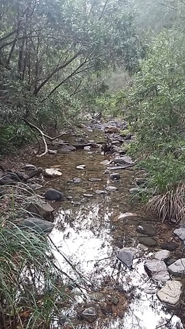
Northbrook Gorge walking and swimming. Beautiful scenery and vegetation. Make sure you pick a nice warm day and bring sturdy shoes your are willing to get wet. the gorges at the end are "gorge-ous", first one you can wade (keep right), second one you definetely in for a swim if you want to cross it.
Walks in D'Aguilar National Park
 21
km
2
days
21
km
2
days
Aquila Loop
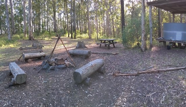
Remote bush camping in the remote middle section of the park, alongside picturesque England Creek at the England Creek bush camp. There are several waterholes along England Creek Road, 10 minutes south of the campsite. Look out for native daisies along the road edge flowering spring to summer. Pink rock orchids and tongue orchids can be seen growing on rock cuttings on Joyners Ridge Road in spring.
This trail can also be done as a day hike (6-10 hours).
 800
m
1
hr
800
m
1
hr
Atrax Circuit
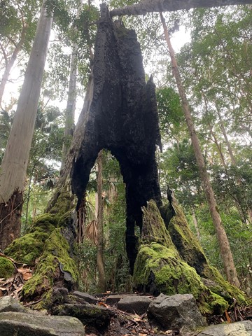
Take a short walk through a wet eucalypt forest. Look closely at the forest floor and notice the ferns, mosses and fungi that thrive in the moist environment. Glimpse inside the trunk of a brush box Lophostemon confertus, a former giant of this species-rich ecosystem.
 1
km
one-way
15
mins
1
km
one-way
15
mins
Bellbird Grove Access Trail
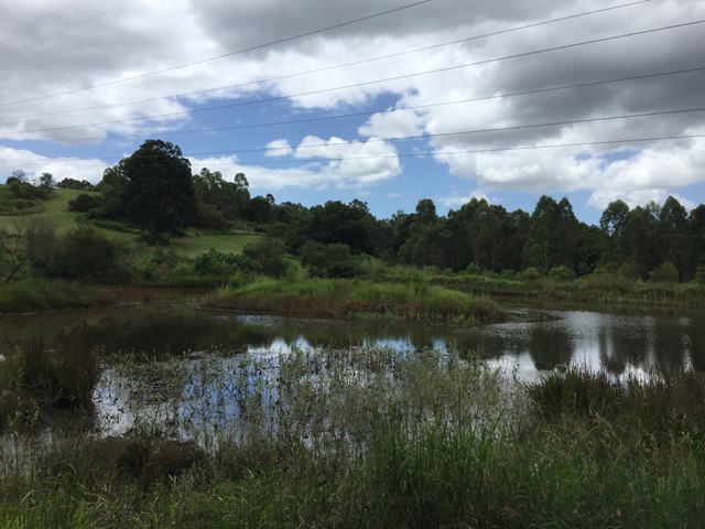
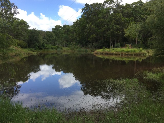
Trail leads from Ross Road, Upper Kedron into D'Aguilar National Park's Bellbird Grove Picnic Area following Cedar Creek and passing a pond.
Blue Gum Flat bush camp
As the name suggests, magnificent blue gums tower over this bush camp, a short walk from the scenic shores of Lake Manchester.
5.7
km
one-way
80
mins
Bullocky’s Dam to Scrub Road Bush Camp
The long way to Scrub Road Remote Bush Camp. Follows South Boundary Road the whole way. Some ups but overall mostly downhill but not too hectic.
1.1
km
return
30
mins
Bulls Falls
Part of the Mt Mee section of the park this is an easy walk which from the viewing platform includes the beauty of the Neurum Valley with its sheltered rainforest pools and rocky crags. The pathway then continues on down to the falls themselves.
 17
km
return
5
hrs
17
km
return
5
hrs
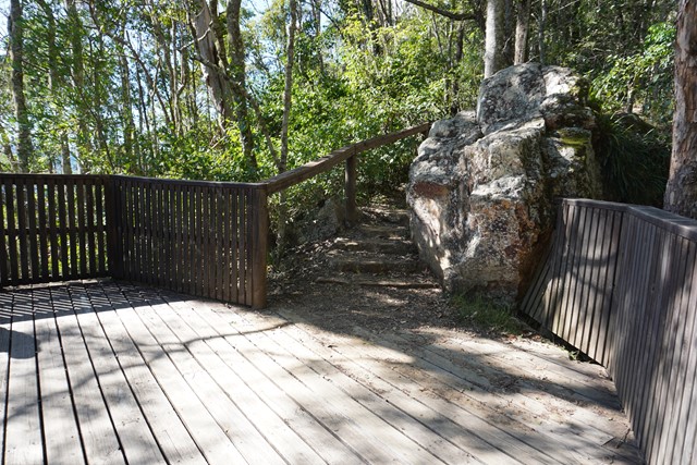
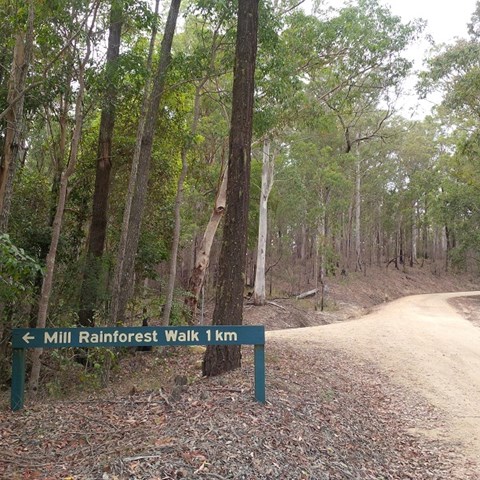
Bulls Falls and Mill Rainforest Walk Circuit
Starting from Gantry Day Use Area, the walk follows Neurum Creek Road to the Falls Lookout. Walk to the car park (200m) and out on the track (1.1 km return) to the escarpment lookout and the lookout over the falls. Return to Neurum Creek Road and continue to the left then turn right to Mill Rainforest Walk. Follow the road to the car park and then follow the Mil Rainforest Circuit (1 km), including the boardwalk around the base of a large fig tree.
Return to Neurum Creek Road and continue on over Neurum Creek and then ascend to a hairpin bend sign. Turn left onto a trail used by grail bikes and ascend steeply to Lovedays Road. Turn left and after about 100m turn left onto the Somerset Trail. Follow the Somerset Trail back to the Gantry Day Use Area.